Brownwood, Texas

Last updated

Brownwood, Texas
City
Brown County Courthouse (1 of 1).jpg
Brown County Courthouse
TXMap-doton-Brownwood.PNG
Location within the state of Texas
Brown County Brownwood.svg
Coordinates: 31°42′34″N98°59′28″W / 31.70944°N 98.99111°W / 31.70944; -98.99111
CountryUnited States
StateTexas
County Brown
Government
  Type Council-Manager
   City Council Mayor Stephen Haynes
H. D. Jones
Ed McMillian
Melody Nowowiejski
Draco Miller Jr.
Walker Willey
   City Manager Emily Crawford
Area
[1]
  Total14.99 sq mi (38.83 km2)
  Land14.97 sq mi (38.76 km2)
  Water0.03 sq mi (0.07 km2)
Elevation
[2]
1,365 ft (416 m)
Population
 (2020)
  Total18,862
  Density1,233.13/sq mi (476.11/km2)
Time zone UTC-6 (CST)
  Summer (DST) UTC-6 (CDT)
ZIP Codes
76801-76804
Area code 325
FIPS code 48-10780 [3]
GNIS feature ID1372753 [2]
Website brownwoodtexas.gov

Brownwood is a city in and the county seat of Brown County, Texas, United States. [4] The population was 18,862 as of the 2020 census. [5] Brownwood is located in the Northern Texas Hill Country[ clarification needed ] and is home to Howard Payne University, which was founded in 1889. [6]

Contents

History

Brownwood in 1937 Texas - Brownwood through Chisos Mountains - NARA - 68149091 (cropped).jpg
Brownwood in 1937

The original site of the Brown County seat of Brownwood was east of Pecan Bayou. A dispute arose over land and water rights, and the settlers were forced to find a new location. Greenleaf Fisk donated 60 acres (24 ha) to relocate the county seat to the west side of the bayou, on what is now the current site of Brownwood, [7] and 100 additional acres for county use. The town was incorporated in 1884. [8]

During the Second World War, Brownwood was the location of U.S. Army Camp Bowie, which had a peak complement of over 80,000 soldiers. Camp Bowie serves as a training camp today at the intersection Farm-to-Market Roads 45 and 2126.

On April 19, 1976, an F5 tornado struck near Brownwood, causing extensive damage, with 11 reported injuries, but no fatalities. [9]

Brownwood's census figures were re-evaluated after the 2000 census from 18,813 to reflect more accurate figures of 20,407. [10] The city was categorized in 2003 as a micropolitan statistical area. The federal Office of Management and Budget has issued a definition of micropolitan statistical areas as "an urban cluster of at least 10,000, but less than 50,000 population, plus adjacent territory that has a high degree of social and economic integration with the core, as measured by commuting ties."

A dispute over water rights created the adjacent city of Early. The two cities are separated by the Pecan Bayou, one of five major tributaries of the Colorado River of Texas.
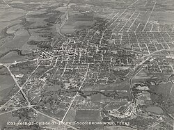
Geography

Brownwood is located south of the center of Brown County, west of the Pecan Bayou. It is bordered to the east by the city of Early. Several U.S. Highways pass through the city. Routes 84 and 67 lead west towards Bangs and Santa Anna. U.S. Route 377 leads southwest towards Brady. All three highways head east into Early, where 67 and 377 continue northeast towards Comanche, while 84 leads southeast towards Goldthwaite. Just over the city line in Early, U.S. Route 183 leads north 46 miles (74 km) to Cisco and Interstate 20, the closest Interstate highway.

According to the United States Census Bureau, Brownwood has a total area of 14.9 square miles (38.5 km2), of which 14.8 square miles (38.4 km2) are land and 0.04 sq mi (0.1 km2), or 0.17%, is water. [5]

Water bodies

Lake Brownwood is located 7 miles (11 km) north of the city. The lake is a 7,300-acre (30 km2) reservoir created by damming the Pecan Bayou. A wide variety of fish occurs in the lake: largemouth bass, smallmouth bass, white bass, striped bass, white crappie, yellow and flathead catfish, sunfish (perch), and alligator gar. Camping, water skiing, jet skiing, and boating are available. It is home of Lake Brownwood State Park, a 538-acre (2.18 km2) area that opened in 1938.

Pecan Bayou is a major tributary of the Colorado River. Due to the damming of the area to form Lake Brownwood, the bayou has a shallow depth and little flow downstream from Brownwood. During heavy rains, the bayou often floods. It runs northwest to southeast and serves as a boundary between the cities of Brownwood and Early.

Demographics

Historical population
CensusPop.Note
1880 725
1890 2,176200.1%
1900 3,96582.2%
1910 6,96775.7%
1920 8,22318.0%
1930 12,78955.5%
1940 13,3984.8%
1950 20,18150.6%
1960 16,974−15.9%
1970 17,3682.3%
1980 19,39611.7%
1990 18,387−5.2%
2000 18,8132.3%
2010 19,2882.5%
2020 18,862−2.2%
U.S. Decennial Census [11]

2020 census

Brownwood racial composition [12]
(NH = Non-Hispanic) [lower-alpha 1]
RaceNumberPercentage
White (NH)11,61161.56%
Black or African American (NH)9485.03%
Native American or Alaska Native (NH)350.19%
Asian (NH)1460.77%
Pacific Islander (NH)270.14%
Some Other Race (NH)660.35%
Mixed/Multi-Racial (NH)6283.33%
Hispanic or Latino 5,40128.63%
Total18,862

As of the 2020 United States census, there were 18,862 people, 7,167 households, and 4,367 families residing in the city.

2000 census

As of the census [3] of 2000, 18,813 people, 7,110 households, and 4,664 families resided in the city. The population density was 1,493.2 inhabitants per square mile (576.5/km2). The 8,169 housing units averaged 648.4 per square mile (250.3/km2). The racial makeup of the city was 82.74% White, 5.51% African American, 0.61% Native American, 0.60% Asian, 8.47% from other races, and 2.07% from two or more races. Hispanics or Latinos of any race were 21.34% of the population.

Of the 7,110 households, 32.2% had children under the age of 18 living with them, 48.5% were married couples living together, 13.7% had a female householder with no husband present, and 34.4% were not families. About 30.1% of all households were made up of individuals, and 13.8% had someone living alone who was 65 years of age or older. The average household size was 2.46 and the average family size was 3.05.

In the city, the population was distributed as 27.5% under the age of 18, 12.8% from 18 to 24, 24.3% from 25 to 44, 19.2% from 45 to 64, and 16.2% who were 65 years of age or older. The median age was 33 years. For every 100 females, there were 90.6 males. For every 100 females age 18 and over, there were 84.1 males.

The median income for a household in the city was $27,325, and for a family was $33,991. Males had a median income of $29,090 versus $18,905 for females. The per capita income for the city was $14,158. About 18.2% of families and 21.4% of the population were below the poverty line, including 28.9% of those under age 18 and 12.8% of those age 65 or over.

Government and infrastructure

The Texas Juvenile Justice Department operates the Ron Jackson State Juvenile Correctional Complex in Brownwood. [15]

The Texas Department of Criminal Justice operates the Brownwood District Parole Office in the city. [16]

The United States Postal Service operates the Brownwood Post Office. [17]

Education

Almost all of the city limits is in the Brownwood Independent School District. The portion around Brownwood Regional Airport is in the Early Independent School District. [18]

Brownwood High School has a strong tradition of nonsports UIL participation, including academic competitions and drama (one-act plays). Other opportunities for student participation include band, DECA, FFA, drill team (the Lionettes), Key Club, student council, Students Against Destructive Decisions, and National Honor Society.

The BHS mascot is the lion, with school colors of maroon and white. The school was tied for most state championships in high school football, with seven, the last coming in 1981, until Celina won their eighth state championship in 2007. Gordon Wood, who coached at Brownwood High for a quarter-century, retired in 1985 as one of the greatest coaches in Texas history, with 396 wins. He was recently surpassed by former Celina and Pilot Point coach G. A. Moore. Many athletes from surrounding communities move to Brownwood to play for the maroon and white.

Brownwood is home to Howard Payne University. The university's teams achieved national championship status in 1957 and 1964 in NAIA Cross Country, and in 2008 with NCAA Division III Women's Basketball. The Douglas MacArthur Academy of Freedom, a museum with recreations of famous rooms in American history, such as Independence Hall, and a 32-foot-high (9.8 m) mural depicting Biblical history, is located on the Howard Payne campus.

Brownwood is also the home of a West Texas campus of the Texas State Technical College System. Computer-aided drafting and design, digital imaging and design, software and business accounting, associate degree nursing, chemical dependency counseling, health information technology, computer network systems and administration, computer science database and web programming technology, emergency medical technology (paramedics), mechatronics, and welding technology are some of the courses offered at the TSTC campus.

Transportation

Brownwood is served by the following highways: US 67, US 84, US 183, US 377, and Texas State Highway 279. The Burlington Northern Santa Fe Railroad, Fort Worth and Western Railroad and Texas Rock Crusher Railway also serve the Brownwood area.

Brownwood is served by Brownwood Regional Airport. The airport currently has two runways: 17/35, a 5599 × 150-ft (1707 × 46-m) asphalt runway (30,000 lb per wheel), and 13/31, a 4596 × 100-ft (1401 × 30-m) asphalt runway (25,000 lb per wheel). Mostly cargo and private air operations take place at the airport, although in the past, Mesa Airlines offered regional connections.

Notable people

Climate

The climate in this area is characterized by hot, humid summers and generally mild to cool winters. According to the Köppen climate classification, Brownwood has a humid subtropical climate, Cfa on climate maps. [19]

Climate data for Brownwood, Texas, 1991–2020 normals, extremes 1893–present
MonthJanFebMarAprMayJunJulAugSepOctNovDecYear
Record high °F (°C)91
(33)
100
(38)
99
(37)
104
(40)
108
(42)
111
(44)
113
(45)
111
(44)
109
(43)
103
(39)
94
(34)
92
(33)
113
(45)
Mean maximum °F (°C)80.6
(27.0)
83.9
(28.8)
88.8
(31.6)
94.1
(34.5)
97.5
(36.4)
100.8
(38.2)
103.4
(39.7)
104.1
(40.1)
99.5
(37.5)
94.2
(34.6)
85.6
(29.8)
79.9
(26.6)
105.7
(40.9)
Mean daily maximum °F (°C)59.5
(15.3)
63.5
(17.5)
70.9
(21.6)
78.8
(26.0)
85.3
(29.6)
92.7
(33.7)
96.5
(35.8)
96.9
(36.1)
89.6
(32.0)
80.3
(26.8)
68.7
(20.4)
60.8
(16.0)
78.6
(25.9)
Daily mean °F (°C)45.6
(7.6)
49.8
(9.9)
57.3
(14.1)
65.1
(18.4)
73.5
(23.1)
80.9
(27.2)
84.3
(29.1)
84.3
(29.1)
77.0
(25.0)
66.7
(19.3)
55.4
(13.0)
47.4
(8.6)
65.6
(18.7)
Mean daily minimum °F (°C)31.7
(−0.2)
36.0
(2.2)
43.7
(6.5)
51.4
(10.8)
61.6
(16.4)
69.1
(20.6)
72.2
(22.3)
71.7
(22.1)
64.5
(18.1)
53.1
(11.7)
42.2
(5.7)
34.0
(1.1)
52.6
(11.4)
Mean minimum °F (°C)17.9
(−7.8)
21.0
(−6.1)
25.9
(−3.4)
35.0
(1.7)
45.8
(7.7)
60.1
(15.6)
66.0
(18.9)
64.0
(17.8)
50.4
(10.2)
35.4
(1.9)
25.3
(−3.7)
19.8
(−6.8)
14.9
(−9.5)
Record low °F (°C)−2
(−19)
0
(−18)
10
(−12)
26
(−3)
34
(1)
46
(8)
53
(12)
48
(9)
37
(3)
19
(−7)
12
(−11)
−6
(−21)
−6
(−21)
Average precipitation inches (mm)1.60
(41)
2.20
(56)
2.39
(61)
2.38
(60)
4.25
(108)
3.75
(95)
2.04
(52)
2.63
(67)
2.88
(73)
3.43
(87)
1.72
(44)
1.37
(35)
30.64
(779)
Average snowfall inches (cm)0.2
(0.51)
0.3
(0.76)
0.0
(0.0)
0.2
(0.51)
0.0
(0.0)
0.0
(0.0)
0.0
(0.0)
0.0
(0.0)
0.0
(0.0)
0.0
(0.0)
0.2
(0.51)
0.4
(1.0)
1.3
(3.29)
Average precipitation days (≥ 0.01 in)4.34.65.04.57.26.03.84.64.74.74.44.157.9
Average snowy days (≥ 0.1 in)0.10.20.00.00.00.00.00.00.00.00.10.20.6
Source 1: NOAA [20]
Source 2: National Weather Service [21]

Related Research Articles

<span class="mw-page-title-main">Brown County, Texas</span> County in Texas, United States

Brown County is a county in west-central Texas. As of the 2020 census, the population was 38,095. Its county seat is Brownwood. The county was founded in 1856 and organized in 1858. It is named for Henry Stevenson Brown, a commander at the Battle of Velasco, an early conflict between Texians and Mexicans.

<span class="mw-page-title-main">Batesville, Arkansas</span> City in Arkansas, United States

Batesville is the county seat and largest city of Independence County, Arkansas, United States, 80 miles (183 km) northeast of Little Rock, the state capital. According to the 2010 Census, the population of the city was 10,268. The city serves as a regional manufacturing and distribution hub for the Ozark Mountain region and Northeast Arkansas.

<span class="mw-page-title-main">Angleton, Texas</span> City in Texas, United States

Angleton is a city in and the county seat of Brazoria County, Texas, United States, within the Houston–The Woodlands–Sugar Land metropolitan area. Angleton lies at the intersection of State Highway 288, State Highway 35, and the Union Pacific Railroad. The population was 19,429 at the 2020 census. Angleton is in the 14th congressional district, and is represented by Republican Congressman Randy Weber.

<span class="mw-page-title-main">Liverpool, Texas</span> City in Texas, United States

Liverpool is a city in Brazoria County, Texas, United States, named after the city of Liverpool in England. It is located along the Union Pacific Railroad and County Road 171, northeast of Angleton and south of Alvin. The population was 482 at the 2010 census.

<span class="mw-page-title-main">Early, Texas</span> City in Texas, United States

Early is a city located in Brown County in west-central Texas, United States. It is a suburb of Brownwood, and the population was 2,762 at the 2010 census. It is named for Walter U. Early, who donated land for the local schools. It is home to the Early Independent School District and the Heartland Mall.

<span class="mw-page-title-main">Lake Brownwood, Texas</span> Census-designated place in Texas, United States

Lake Brownwood is a census-designated place (CDP) located in Brown County in central Texas, United States. The population was 1,532 at the 2010 census.

<span class="mw-page-title-main">Atlanta, Texas</span> City in Texas, United States

Atlanta is a city in Cass County, northeastern Texas, United States. According to the 2010 U.S. census, the city had a population of 5,675, which decreased to 5,433 as of 2020.

<span class="mw-page-title-main">Coleman, Texas</span> City in Texas, United States

Coleman is a town in and the county seat of Coleman County, Texas, United States. As of the 2010 census, its population was 4,709.

<span class="mw-page-title-main">Tornillo, Texas</span> Place in Texas, United States

Tornillo is a border town in El Paso County, Texas, United States. The population was 1,568 at the 2010 census. For statistical purposes, the United States Census Bureau has defined this unincorporated community as a census-designated place (CDP). It is part of the El Paso Metropolitan Statistical Area. The Tornillo and Guadalupe, Chihuahua, area is connected by the Tornillo–Guadalupe International Bridge.

<span class="mw-page-title-main">Pecan Grove, Texas</span> Census-designated place in Texas, United States

Pecan Grove is a census-designated place and master-planned community within the extraterritorial jurisdictions of Houston and Richmond in Fort Bend County, Texas, United States. The population was 22,782 at the 2020 census.

<span class="mw-page-title-main">Bayou Vista, Texas</span> City in Texas, United States

Bayou Vista is a city in Galveston County, Texas, United States. The population was 1,537 at the 2010 census. It received severe damage from Hurricane Ike on September 13, 2008.

<span class="mw-page-title-main">Granbury, Texas</span> City in Texas, United States

Granbury is a city in and the county seat of Hood County, Texas, United States. As of the 2020 census, the city's population was 10,958, and it is the principal city of the Granbury micropolitan statistical area. Granbury is named after Confederate General Hiram B. Granbury.

<span class="mw-page-title-main">Brady, Texas</span> City in Texas, United States

Brady is a city in McCulloch County, Texas, United States. Brady refers to itself as the "Heart of Texas", as it is the city closest to the geographical center of the state, which is about 15 miles northeast of Brady. Its population was 5,118 at the 2020 census. It is the county seat of McCulloch County.

<span class="mw-page-title-main">Goldthwaite, Texas</span> City in Texas, United States

Goldthwaite is a town and the county seat of Mills County, Texas, United States. The population was 1,878 at the 2010 census.

<span class="mw-page-title-main">Ballinger, Texas</span> City in the United States

Ballinger is a city in Runnels County, Texas, United States. The population was 3,619 at the 2020 census. It is the county seat of Runnels County. Downtown Ballinger features historic 1800s buildings with shops and restaurants.

<span class="mw-page-title-main">San Saba, Texas</span> City in Texas, United States

San Saba is a city located in, and the county seat of, San Saba County, Texas, United States. It was settled in 1854 and named for its location on the San Saba River. Its population was 3,099 at the 2010 census.

<span class="mw-page-title-main">Breckenridge, Texas</span> City in Texas, United States

Breckenridge is a city and county seat of Stephens County, Texas, Texas, United States. The estimated population was 5,349 as of February 2021. The mayor is Bob Sims.

<span class="mw-page-title-main">Aransas Pass, Texas</span> City in Texas, United States

Aransas Pass is a city in Aransas, Nueces, and San Patricio Counties in the U.S. state of Texas. The population was 8,011 at the 2021 Census.

<span class="mw-page-title-main">Pecan Gap, Texas</span> City in Texas, United States

Pecan Gap is a city in Delta and Fannin counties within the U.S. state of Texas. It is sometimes informally referred to as "The Gap" by area residents. The population was 178 at the time of the 2020 census. It is named for the gap between two pecan trees, but unfortunately one of the two pecan trees was destroyed by a tornado in 1963.

Thunderbird Bay is a census-designated place (CDP) in Brown County in central Texas, United States. The population was 663 at the 2010 census.

References

  1. "2019 U.S. Gazetteer Files". United States Census Bureau. Retrieved August 7, 2020.
  2. 1 2 U.S. Geological Survey Geographic Names Information System: Brownwood, Texas
  3. 1 2 "U.S. Census website". United States Census Bureau . Retrieved January 31, 2008.
  4. "Find a County". National Association of Counties. Archived from the original on May 31, 2011. Retrieved June 7, 2011.
  5. 1 2 "Geographic Identifiers: 2010 Demographic Profile Data (G001): Brownwood city, Texas". U.S. Census Bureau, American Factfinder. Archived from the original on February 12, 2020. Retrieved April 22, 2014.
  6. "History".
  7. Aston, B.W; Taylor, Ira Donathon (1997). Along the Texas Forts Trail. University of North Texas Press. p. 120. ISBN   978-1-57441-035-8.
  8. Odintz, Mark. "Brownwood, Texas". Handbook of Texas Online. Texas State Historical Association. Retrieved February 18, 2011.
  9. A Severe Weather and Flood Climatology of West Central Texas. Retrieved July 16, 2010.
  10. "Brownwood TX 76803 (Brown County)". www.allplaces.us. Retrieved January 15, 2022.
  11. "Census of Population and Housing". Census.gov. Retrieved June 4, 2015.
  12. "Explore Census Data". data.census.gov. Retrieved May 20, 2022.
  13. "Census.gov". Census.gov.
  14. "About the Hispanic Population and its Origin". www.census.gov. Retrieved May 18, 2022.
  15. "Facility Address List Archived 2010-07-25 at the Wayback Machine ." Texas Youth Commission. Retrieved May 22, 2010.
  16. "Parole Division Region V Archived September 26, 2011, at the Wayback Machine ." Texas Department of Criminal Justice. Retrieved May 22, 2010.
  17. "Post Office Location – BROWNWOOD Archived June 12, 2012, at the Wayback Machine ." United States Postal Service. Retrieved May 22, 2010.
  18. "2020 CENSUS - SCHOOL DISTRICT REFERENCE MAP: Brown County, TX" (PDF). U.S. Census Bureau . Retrieved November 18, 2023.
    Compare to: "2020 CENSUS - CENSUS BLOCK MAP: Brownwood city, TX" (PDF). U.S. Census Bureau . Retrieved November 18, 2023. Brownwood Regional Arprt
  19. Climate Summary for Brownwood, Texas
  20. "U.S. Climate Normals Quick Access – Station: Brownwood 2ENE, TX". National Oceanic and Atmospheric Administration. Retrieved April 30, 2023.
  21. "NOAA Online Weather Data – NWS San Angelo". National Weather Service. Retrieved April 30, 2023.
  1. Note: the US Census treats Hispanic/Latino as an ethnic category. This table excludes Latinos from the racial categories and assigns them to a separate category. Hispanics/Latinos can be of any race. [13] [14]