Coleman County is a county located in the U.S. state of Texas. As of the 2020 census, its population was 7,684. The county seat is Coleman. The county was founded in 1858 and organized in 1864. It is named for Robert M. Coleman, a signer of the Texas Declaration of Independence and soldier at the Battle of San Jacinto.

Brown County is a county in west-central Texas. As of the 2020 census, the population was 38,095. Its county seat is Brownwood. The county was founded in 1856 and organized in 1858. It is named for Henry Stevenson Brown, a commander at the Battle of Velasco, an early conflict between Texians and Mexicans.

Round Mountain is a town in Blanco County, Texas, United States. The population was 101 at the 2020 census.

Brazoria is a city in the U.S. state of Texas, in the Houston–The Woodlands–Sugar Land metropolitan area and Brazoria County. As of the 2020 census, the city population was 2,866.
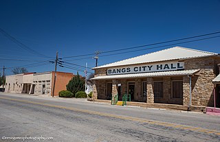
Bangs is a city located in Brown County in west-central Texas, United States. The population was 1,540 at the 2020 census.
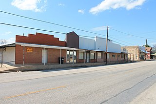
Blanket is a town located in Brown County in west-central Texas, United States. The population was 369 at the 2020 census.
Brownwood is a city in and the county seat of Brown County, Texas, United States. The population was 18,862 as of the 2020 census. Brownwood is located in the Northern Texas Hill Country and is home to Howard Payne University, which was founded in 1889.

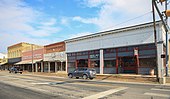
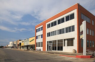
Early is a city located in Brown County in west-central Texas, United States. It is a suburb of Brownwood, and the population was 3,087 at the 2020 census. It is named for Walter U. Early, who donated land for the local schools. It is home to the Early Independent School District and the Heartland Mall.
Santa Rosa is a town in Cameron County, Texas, United States. The population was 2,450 at the 2020 census. It is part of the Brownsville–Harlingen–Raymondville and the Matamoros–Brownsville metropolitan areas.

Panhandle is the county seat of Carson County, Texas, United States. The population of the town was 2,452 at the 2010 census. Panhandle is part of the Amarillo metropolitan statistical area.
Coleman is a town in and the county seat of Coleman County, Texas, United States. As of the 2020 census, its population was 3,912.
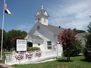
Weston is a town in Collin County, Texas, United States. The population was 563 at the 2010 census, and 283 at the 2020 census. As of 2023, Collin County estimates Weston's population at 1,050.

Comanche is a city located in Comanche County in the U.S. state of Texas. The population was 4,211 at the 2020 census. It is the county seat of Comanche County.

Petersburg is a city in Hale County, Texas, United States. As of the 2020 census, it had a population of 1,014.

Spearman is a city in and the county seat of Hansford County, Texas, United States. As of the 2010 census, the city population was 3,368. It is known for its collection of windmills from the J.B. Buchanan windmill collection.

Chillicothe is a city in Hardeman County, Texas, United States. The population was 549 at the 2020 census.

Shallowater is a city in Lubbock County, Texas, United States. Shallowater is on U.S. Route 84 and the Burlington Northern Santa Fe line, 12 miles (19 km) northwest of Lubbock. Its population was 2,964 at the 2020 census. It is part of the Lubbock metropolitan statistical area.

Brady is a city in McCulloch County, Texas, United States. Brady refers to itself as the "Heart of Texas", as it is the city closest to the geographical center of the state, which is about 15 miles northeast of Brady. Its population was 5,118 at the 2020 census. It is the county seat of McCulloch County.

Goldthwaite is a town and the county seat of Mills County, Texas, United States. The population was 1,738 at the 2020 census, down from 1,878 at the 2010 census.

Kerens is a city in Navarro County, Texas, United States. The population was 1,505 at the 2020 census.