Stratford, Texas | |
|---|---|
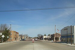 Stratford, 2006 | |
 Location of Stratford, Texas | |
 | |
| Coordinates: 36°20′15″N102°04′34″W / 36.33750°N 102.07611°W | |
| Country | United States |
| State | Texas |
| County | Sherman |
| Settled | c. 1885 |
| Named after | Stratford Hall |
| Area | |
• Total | 2.31 sq mi (5.98 km2) |
| • Land | 2.31 sq mi (5.98 km2) |
| • Water | 0 sq mi (0.00 km2) |
| Elevation | 3,694 ft (1,126 m) |
| Population (2020) | |
• Total | 1,939 |
| • Density | 840/sq mi (324/km2) |
| Time zone | UTC−6 (Central (CST)) |
| • Summer (DST) | UTC−5 (CDT) |
| ZIP code | 79084 |
| Area code | 806 |
| FIPS code | 48-70544 [3] |
| GNIS feature ID | 2411988 [2] |
| Website | www |
Stratford is a small city and county seat of Sherman County, Texas, United States. Its population was 1,939 at the 2020 Census, [4] down from 2,017 in 2010. [5]