Snyder, Texas

Last updated

Snyder, Texas
Downtown Snyder, TX IMG 4585.JPG
Downtown Snyder
Scurry County Snyder.svg
Location of Snyder, Texas
Coordinates: 32°42′56″N100°54′52″W / 32.71556°N 100.91444°W / 32.71556; -100.91444
CountryUnited States
State Texas
County Scurry
Area
[1]
  Total8.97 sq mi (23.23 km2)
  Land8.94 sq mi (23.15 km2)
  Water0.03 sq mi (0.08 km2)
Elevation
2,320 ft (707 m)
Population
 (2020)
  Total11,438
  Estimate 
(2022) [2]
11,230
  Density1,300/sq mi (490/km2)
Time zone UTC−6 (Central (CST))
  Summer (DST) UTC−5 (CDT)
ZIP codes
79549-79550
Area code 325
FIPS code 48-68624 [3]
GNIS feature ID1347340 [4]
Website http://ci.snyder.tx.us/

Snyder is a city in, and the county seat of Scurry County, Texas, United States. [5] The population was 11,438 at the 2020 census. [6] The city is located in the lower part of the Southwestern Tablelands ecological region. In 2023, Snyder was ranked as the 16th Worst place to live and 2nd Most dangerous according to KQVT and Norada Real Estate Investments. [7] [8] [9] [10]

Contents

History

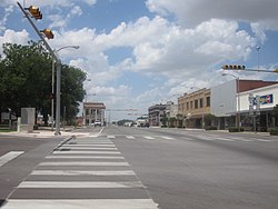
Snyder is named for merchant and buffalo hunter William Henry (Pete) Snyder, who built a trading post on Deep Creek in 1878. It soon drew fellow hunters, and a small settlement grew up around the post. The nature of those early dwellings, mostly constructed of buffalo hide and tree branches, led to the community's first, if unofficial, name of "Hide Town". Another early name, "Robber's Roost", is said to owe its beginnings to the sometimes nefarious nature of a few residents and a lack of law enforcement. [11] A statue of an albino buffalo on the grounds of the Scurry County Courthouse in Snyder pays homage to the town's beginnings as a buffalo-trading post.

Snyder antedates Scurry County by two years, with a town plan being drawn up in 1882, while the county was not organized until 1884. A population of 600 was reported in 1892, with a school, two churches, a grist mill, steam gin, two banks, and two weekly newspapers being part of the community. Significant change happened in 1907 when Snyder was granted a city charter, and construction began on the Roscoe, Snyder and Pacific Railway. The 1910 census indicated Snyder had grown to a population of 2,514. The Atchison, Topeka & Santa Fe Railway tracks reached Snyder in 1911, spurring further growth. Ranching and farming were the primary economic backbone of Snyder through the first half of the 20th century.

This changed in 1948, when oil was discovered in the Canyon Reef area north of town. Snyder became a boomtown, as the population jumped to about 12,000 in just a year's time. By the time the boom ended in 1951, an estimated peak population of 16,000 had been reached. This soon decreased to the 10,000 to 11,000 level and stabilized. Although the boom was over, oil still remained a vital part of the local economy, with the Snyder area being one of the leading oil-producing areas in Texas. In 1973, the one-billionth barrel of oil was pumped from the nearby oil fields.

An industrial base was established in the 1960s and early 1970s, diversifying the town's economy and making it less susceptible to cycles of boom and bust. Higher education came to Snyder in 1971 with the founding of Western Texas College.

The Scurry County Coliseum in Snyder, operated by Western Texas College since 2008, is a large arena which hosts area events. Outside the coliseum is a locomotive engine and a small restored historic village. Also located in Snyder is the Diamond M Museum. Established by local oilman and rancher Clarence T. McLaughlin, the museum houses over 80 bronze works and 200 paintings. Among the collection are works by Peter Hurd and Andrew Wyeth.
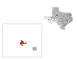
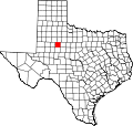
Geography

Snyder is located on Deep Creek, a minor tributary of the Colorado River of Texas.

Snyder is about 90 miles (140 km) southeast of Lubbock, 80 miles (130 km) northwest of Abilene, 90 miles (140 km) northeast of Midland, and 100 miles (160 km) north of San Angelo.

Climate

Climate data for Snyder, Texas (1991–2020 normals, extremes 1911–present)
MonthJanFebMarAprMayJunJulAugSepOctNovDecYear
Record high °F (°C)86
(30)
92
(33)
99
(37)
104
(40)
110
(43)
114
(46)
114
(46)
115
(46)
108
(42)
102
(39)
91
(33)
87
(31)
115
(46)
Mean maximum °F (°C)77.2
(25.1)
81.3
(27.4)
88.1
(31.2)
93.6
(34.2)
99.7
(37.6)
101.8
(38.8)
102.7
(39.3)
101.6
(38.7)
97.7
(36.5)
92.5
(33.6)
82.9
(28.3)
76.7
(24.8)
105.0
(40.6)
Mean daily maximum °F (°C)57.0
(13.9)
61.5
(16.4)
69.7
(20.9)
78.3
(25.7)
85.7
(29.8)
92.4
(33.6)
95.6
(35.3)
94.4
(34.7)
87.0
(30.6)
78.0
(25.6)
66.0
(18.9)
57.7
(14.3)
76.9
(24.9)
Daily mean °F (°C)43.0
(6.1)
46.8
(8.2)
55.0
(12.8)
63.2
(17.3)
72.1
(22.3)
79.7
(26.5)
82.9
(28.3)
82.0
(27.8)
74.5
(23.6)
64.4
(18.0)
52.2
(11.2)
44.1
(6.7)
63.3
(17.4)
Mean daily minimum °F (°C)28.3
(−2.1)
31.9
(−0.1)
39.2
(4.0)
47.4
(8.6)
58.3
(14.6)
66.3
(19.1)
69.6
(20.9)
68.7
(20.4)
61.3
(16.3)
50.5
(10.3)
38.2
(3.4)
28.8
(−1.8)
49.0
(9.4)
Mean minimum °F (°C)16.2
(−8.8)
19.3
(−7.1)
25.2
(−3.8)
34.0
(1.1)
44.9
(7.2)
58.9
(14.9)
64.7
(18.2)
63.2
(17.3)
49.0
(9.4)
35.5
(1.9)
23.9
(−4.5)
17.1
(−8.3)
12.4
(−10.9)
Record low °F (°C)−10
(−23)
−11
(−24)
5
(−15)
20
(−7)
29
(−2)
40
(4)
52
(11)
46
(8)
35
(2)
19
(−7)
4
(−16)
−3
(−19)
−11
(−24)
Average precipitation inches (mm)0.77
(20)
1.05
(27)
1.56
(40)
1.40
(36)
2.68
(68)
3.14
(80)
1.91
(49)
2.09
(53)
2.75
(70)
2.17
(55)
1.19
(30)
1.06
(27)
21.77
(553)
Average snowfall inches (cm)0.1
(0.25)
0.5
(1.3)
0.0
(0.0)
0.0
(0.0)
0.0
(0.0)
0.0
(0.0)
0.0
(0.0)
0.0
(0.0)
0.0
(0.0)
0.0
(0.0)
0.4
(1.0)
0.8
(2.0)
1.8
(4.6)
Average precipitation days (≥ 0.01 in)3.54.45.34.06.86.24.65.45.65.33.74.058.8
Average snowy days (≥ 0.1 in)0.00.20.00.00.00.00.00.00.00.00.00.30.5
Source: NOAA [12] [13]

Demographics

Historical population
CensusPop.Note
1890 500
1910 2,514
1920 2,179−13.3%
1930 3,00838.0%
1940 3,81526.8%
1950 12,010214.8%
1960 13,85015.3%
1970 11,171−19.3%
1980 12,70513.7%
1990 12,195−4.0%
2000 10,783−11.6%
2010 11,2023.9%
2020 11,4382.1%
2022 (est.)11,230 [2] −1.8%
U.S. Decennial Census

2020 census

Snyder racial composition [14]
(NH = Non-Hispanic) [lower-alpha 1]
RaceNumberPercentage
White (NH)5,01443.84%
Black or African American (NH)3753.28%
Native American or Alaska Native (NH)450.39%
Asian (NH)740.65%
Pacific Islander (NH)40.03%
Some Other Race (NH)240.21%
Mixed/Multi-Racial (NH)2572.25%
Hispanic or Latino 5,64549.35%
Total11,438

As of the 2020 United States census, there were 11,438 people, 4,360 households, and 2,843 families residing in the city.

2010 census

As of the census [3] of 2010, 11,202 people, 4,128 households, and 2,880 families resided in the city. The population density was 1,256.8 people/sq mi (485.2/km2). The 5,013 housing units averaged 584.3/sq mi (225.6/km2). The racial makeup of the city was 79.00% White, 4.69% African American, 0.57% Native American, 0.25% Asian, 13.68% from other races, and 1.81% from two or more races. Hispanics or Latinos of any race were 31.8% of the population.

Of the 4,068 households, 34.9% had children under 18 living with them, 55.3% were married couples living together, 11.8% had a female householder with no husband present, and 29.2% were not families. About 26.5% of all households were made up of individuals, and 14.2% had someone living alone who was 65 or older. The average household size was 2.56, and the average family size was 3.10.

In the city, the age distribution was 27.8% under 18, 10.5% from 18 to 24, 24.0% from 25 to 44, 20.8% from 45 to 64, and 16.9% who were 65 or older. The median age was 36 years. For every 100 females, there were 87.3 males. For every 100 females age 18 and over, there were 83.9 males.

The median income for a household in the city was $42,077, and for a family was $55,567. Males had a median income of $30,033 versus $17,609 for females. The per capita income for the city was $23,296. About 13.7% of families and 17.0% of the population were below the poverty line, including 22.4% of those under age 18 and 10.8% of those age 65 or over.

Economy

Snyder's economy is based on oil, gas, and wind industries. In 2012, 994 jobs were created in Snyder, leading to 20% job growth in the community, according to the Development Corporation of Snyder. [17]

The nearby Scurry Area Canyon Reef Operators oilfield is among the largest and most productive in the United States.[ citation needed ] Snyder is also located within the footprint of the recently-discovered Cline Shale. [18] Two of the largest wind farms in the United States are located in Snyder area. Other industries in Snyder include manufacturing and cotton.[ citation needed ]

The Texas Department of Criminal Justice operates the Snyder Distribution Center. [19]

Education

The Snyder Independent School District serves Snyder. The schools are Snyder Primary, Snyder Intermediate, Snyder Junior High School, Snyder Academy, Snyder Christian School, and Snyder High School.

Western Texas College, a two-year community college, is located in Snyder. In addition to traditional academic courses, Western Texas College offers several career/technical programs, including communication design, early childhood education, electrical distribution systems, information technology, business management, petroleum technology, radio broadcasting, solar energy technology, turfgrass and landscape management, vocational nursing, and welding. [20]

Notable people

See also

Related Research Articles

<span class="mw-page-title-main">Yoakum County, Texas</span> County in Texas, United States

Yoakum County is a county located in the far western portion of the U.S. state of Texas. As of the 2020 census, the population was 7,694. Its county seat is Plains. The county was created in 1876 and later organized in 1907. It is named for Henderson King Yoakum, a Texas historian.

<span class="mw-page-title-main">Upton County, Texas</span> County in Texas, United States

Upton County is a county located on the Edwards Plateau in the U.S. state of Texas. As of the 2020 census, its population was 3,308. Its county seat is Rankin. The county was created in 1887 and later organized in 1910. It is named for two brothers: John C. and William F. Upton, both colonels in the Confederate Army.

<span class="mw-page-title-main">Scurry County, Texas</span> County in Texas, United States

Scurry County is a county located in the U.S. state of Texas. As of the 2020 census, its population was 16,932. Its county seat is Snyder, which is the home for Western Texas College. Scurry County is named for Confederate General William Scurry. The county was created in 1876 and organized in 1884. Scurry County was one of 46 prohibition, or entirely dry, counties in the state of Texas, until a 2006 election approved the sale of beer and wine in Snyder, and a 2008 election approved the sale of liquor by the drink throughout the county.

<span class="mw-page-title-main">Motley County, Texas</span> County in Texas, United States

Motley County is a county located in the U.S. state of Texas. As of the 2020 census, its population was 1,063, making it the 10th-least populous county in Texas. Its county seat is Matador. The county was created in 1876 and organized in 1891. It is named for Junius William Mottley, a signer of the Texas Declaration of Independence. Mottley's name is spelled incorrectly because the bill establishing the county misspelled his name. Motley County was one of 30 prohibition, or entirely dry, counties in Texas, but is now a wet county.

<span class="mw-page-title-main">Lubbock County, Texas</span> County in Texas, United States

Lubbock County is a county located in the U.S. state of Texas. The 2020 census placed the population at 310,639. Its county seat and largest city is Lubbock. The county was created in 1876 and organized in 1891. It is named for Thomas Saltus Lubbock, a Confederate colonel and Texas Ranger.

<span class="mw-page-title-main">Karnes County, Texas</span> County in Texas, United States

Karnes County is a county in the U.S. state of Texas. As of the 2020 census, the population was 14,710. Its county seat is Karnes City. The county is named for Henry Karnes, a soldier in the Texas Revolution. The former San Antonio and Aransas Pass Railway passed through Karnes County in its connection linking San Antonio with Corpus Christi.

<span class="mw-page-title-main">Hemphill County, Texas</span> County in Texas, United States

Hemphill County is a county located in the U.S. state of Texas. As of the 2020 census, its population was 3,382. The county seat and only incorporated community in the county is the city of Canadian. The county was created in 1876 and organized in 1887. It is named for John Hemphill, a judge and Confederate congressman. Hemphill County is the most recent Texas county to permit alcohol sales.

<span class="mw-page-title-main">Garza County, Texas</span> County in Texas, United States

Garza County is a county located in the U.S. state of Texas. As of the 2020 census, its population was 5,816, of which most of the population were residing in its county seat, and only incorporated municipality, Post. The county was created in 1876 and later organized in 1907. Garza is named for a pioneer Bexar County family, as it was once a part of that county.

<span class="mw-page-title-main">Claude, Texas</span> City in Texas, United States

Claude is a city in and the county seat of Armstrong County, Texas, United States. The population was 1,196 at the 2010 census. It is located east of Amarillo in the south Texas Panhandle. Claude is part of the Amarillo Metropolitan Statistical Area but is some thirty miles east of Amarillo.

<span class="mw-page-title-main">Lamesa, Texas</span> City in Texas, United States

Lamesa is a city in and the county seat of Dawson County, Texas, United States. The population was 8,674 at the 2020 census, down from 9,952 at the 2000 census. Located south of Lubbock on the Llano Estacado, Lamesa was founded in 1903. Most of its economy is based on cotton farming. The Preston E. Smith prison unit, named for the former governor of Texas, is located just outside Lamesa.

<span class="mw-page-title-main">Ranger, Texas</span> City in Texas, United States

Ranger is a city in Eastland County, Texas, United States. Its population was 2,468 at the 2010 census. Ranger College, a community college, is the second-largest employer in the community.

<span class="mw-page-title-main">Colorado City, Texas</span> City in the United States

Colorado City is a city in and the county seat of Mitchell County, Texas, United States. Its population was 3,991 at the 2020 census.

<span class="mw-page-title-main">Roscoe, Texas</span> City in Texas, United States

Roscoe is a city in Nolan County in the U.S. state of Texas near the intersection of Interstate 20 and US Highway 84. The Union Pacific Railroad passes through the center of the city.

<span class="mw-page-title-main">Rankin, Texas</span> City in Texas, United States

Rankin is a city in Upton County, Texas, United States. Its population was 778 at the 2010 census. It is named after F.E. Rankin, a local rancher. It is the county seat of the thinly populated county; in 2010, only 3,355 people lived in the entire county, and McCamey was the only larger town. During the early 20th century, the town grew due to the discovery of oil in the nearby Yates Oil Field. However, following a second oil boom in the '80s the town saw a decline in its economy and population.

<span class="mw-page-title-main">Kermit, Texas</span> City in Texas, United States

Kermit is a city in and the county seat of Winkler County, Texas, United States. The population was 6,267 at the 2020 census. The city was named after Kermit Roosevelt following a visit by his father, President Theodore Roosevelt, to the county.

<span class="mw-page-title-main">Southlake, Texas</span> City in Texas, U.S.

Southlake is a city located predominantly in Tarrant County with minor areas extending into Denton County in the U.S. state of Texas. Southlake is a suburb of Dallas/Fort Worth. As of the 2019 census estimate it had a population of 32,376.

<span class="mw-page-title-main">Odessa, Texas</span> City in Texas

Odessa is a city in the U.S. state of Texas and the seat of Ector County with portions extending into Midland County.

<span class="mw-page-title-main">Hamlin, Texas</span> City in Texas, United States

Hamlin is a city in Jones and Fisher Counties in the U.S. state of Texas. The population was 2,124 at the 2010 census, and in 2018, the estimated population was 1,997. The Jones County portion of Hamlin is part of the Abilene, Texas metropolitan area.

<span class="mw-page-title-main">Gladewater, Texas</span> City in Texas, United States

Gladewater is a city in Gregg and Upshur counties in the U.S. state of Texas with a 2020 census population of 6,134.

<span class="mw-page-title-main">Longview, Texas</span> City in Texas, United States

Longview is a city in and county seat of Gregg County, Texas, United States. Longview is located in East Texas, where Interstate 20 and U.S. highways 80 and 259 converge just north of the Sabine River. According to the 2020 U.S. census, the city had a population of 81,638. Longview is the principal city of the Longview metropolitan statistical area, comprising Gregg, Upshur, and Rusk counties. The population of the metropolitan area as of 2021 census estimates was 287,858.

References

  1. "2019 U.S. Gazetteer Files". United States Census Bureau. Retrieved August 7, 2020.
  2. 1 2 "Population and Housing Unit Estimates". United States Census Bureau. May 24, 2020. Retrieved February 29, 2024.
  3. 1 2 "U.S. Census website". United States Census Bureau . Retrieved January 31, 2008.
  4. "US Board on Geographic Names". United States Geological Survey. October 25, 2007. Retrieved January 31, 2008.
  5. "Find a County". National Association of Counties. Retrieved June 7, 2011.
  6. "U.S. Census Bureau QuickFacts" . Retrieved February 29, 2024.
  7. pookspooks (January 5, 2022). "The Top 10 Most Dangerous Cities To Live in Texas". KQVT- Q92 The Beat. Retrieved December 21, 2023.
  8. Santarelli, Marco (December 20, 2023). "Worst Places to Live in Texas in 2023 & 2024". Norada Real Estate Investments. Retrieved December 21, 2023.
  9. "Snyder, TX Crime Rates: Stats & Map". www.areavibes.com. Retrieved February 29, 2024.
  10. "Snyder, TX | Crime Statistics | Neighborhoods | Gangs". www.insideprison.com. Retrieved February 29, 2024.
  11. Wiggins, Noel. "Snyder, Texas. Handbook of Texas Online". Texas State Historical Association. Retrieved June 14, 2012.
  12. "NOWData – NOAA Online Weather Data". National Oceanic and Atmospheric Administration . Retrieved May 6, 2013.
  13. "Summary of Monthly Normals 1991–2020". National Oceanic and Atmospheric Administration. Retrieved April 26, 2023.
  14. "Explore Census Data". data.census.gov. Retrieved May 20, 2022.
  15. https://www.census.gov/ [ not specific enough to verify ]
  16. "About the Hispanic Population and its Origin". www.census.gov. Retrieved May 18, 2022.
  17. "$1 Billion Reasons to Look at Snyder, TX" (PDF). Development Corporation of Snyder. Retrieved June 5, 2013.
  18. Eady, Ashley. "Exploration continues to fuel expectations for Cline Shale oil boom". Lubbock Avalanche-Journal. Retrieved June 5, 2013.
  19. "Snyder Distribution Center." Texas Department of Criminal Justice. Retrieved on May 22, 2010.
  20. "Western Texas College - Degrees". www.wtc.edu. Retrieved December 21, 2023.
  1. Note: the US Census treats Hispanic/Latino as an ethnic category. This table excludes Latinos from the racial categories and assigns them to a separate category. Hispanics/Latinos can be of any race. [15] [16]

12 and 14 have bad links