Elmendorf is a city in Bexar County, Texas, United States. It is part of the San Antonio—New Braunfels metropolitan statistical area. Its population was 1,862 at the 2020 census. It was founded in 1885, and named after Henry Elmendorf, a former mayor of San Antonio, and a German-Texan. For a long time, the biggest employer was Star Clay Products.
Walnut Springs is a city in Bosque County. Texas, United States. The population was 795 at the 2020 census.

Baird is a city and the county seat of Callahan County, Texas, United States. Its population was 1,479 at the 2020 census. The city is named after Matthew Baird, the owner and director of the Texas and Pacific Railway. The railway depot is now operated as the visitor center and a transportation museum.

Eastland is a city in Eastland County, Texas, United States. The population was 3,609 at the 2020 census. It is the county seat of Eastland County.

Dilley is a town in Frio County, Texas, United States. The population was 3,274 at the 2020 census. It is located off Interstate 35, south of the county seat in Pearsall.

Hamilton is a city in and the county seat of Hamilton County, Texas, United States, located in the state's central region. Its population was 2,895 at the 2020 census.

Gruver is a city in Hansford County, Texas, United States. The population was 1,130 at the 2020 census. Farwell, in the center of Hansford County, approximately three miles east of what became Gruver, was established in 1880 by the Canott family of Illinois, and was the first town in the county. Gruver was established shortly after, and Farwell rapidly fell into oblivion after 1889, when it lost a county seat election to Hansford.
Grapeland is a city in Houston County, Texas, United States. Its population was 1,465 as of the 2020 census.

Stinnett is a city in and the county seat of Hutchinson County, Texas, United States. The population was 1,650 at the 2020 census.

Benjamin is a city in and the county seat of Knox County, Texas, United States. Its population was 196 at the 2020 census, making it the least-populated county seat in Texas.

Lometa is a city in Lampasas County, Texas, United States. The population was 753 at the 2020 census. It is part of the Killeen–Temple–Fort Hood metropolitan statistical area.

Centerville is a city in Leon County, in the U.S. state of Texas. The population was 905 at the 2020 census. It is the county seat of Leon County. Centerville was so named as it is near the geographic center of Leon County.
Hardin is a city in Liberty County, Texas, United States. Its population was 768 at the 2020 census.

Shallowater is a city in Lubbock County, Texas, United States. Shallowater is on U.S. Route 84 and the Burlington Northern Santa Fe line, 12 miles (19 km) northwest of Lubbock. Its population was 2,964 at the 2020 census. It is part of the Lubbock metropolitan statistical area.

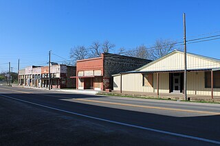
Corrigan is a town in north central Polk County, Texas, United States. It is located along U.S. Highway 59 and is approximately 100 miles from Houston. Its population was 1,477 in the 2020 census.
San Saba is a city located in, and the county seat of, San Saba County, Texas, United States. It was settled in 1854 and named for its location on the San Saba River and for Sabbas the Sanctified. Its population was 3,099 at the 2010 census.

Aspermont is a town and the county seat of Stonewall County, Texas, United States. The population was 789 at the 2020 census.

Woodville is a town in and the county seat of Tyler County, Texas, United States. The town is intersected by three U.S. Numbered Highways: U.S. Route 69, U.S. Route 190, and U.S. Route 287. The population was 2,403 at the 2020 census. It is the county seat of Tyler County. The town was named after George Tyler Wood, governor of Texas from 1847 to 1849.

Stockdale is a city in Wilson County, Texas, United States. The population was 1,413 at the 2020 census. It is part of the San Antonio Metropolitan Statistical Area.

Winnsboro is a city in Franklin and Wood counties in northeastern Texas, United States, north of Tyler. The population was 3,455 at the 2020 census. Settlement of Winnsboro began in the 1850s with a post office established between 1854 and 1855.