Caldwell, Texas

Last updated

Caldwell, Texas
Caldwell downtown1 (1 of 1).jpg
Downtown Caldwell
Nicknames: 
The Kolache Capital of Texas
The Big Grape
Motto: 
"Preparing for the Future with Respect for the Past"
Caldwell, Texas
Caldwell, Texas
Caldwell, Texas
Caldwell, Texas
Coordinates: 30°31′53″N96°41′58″W / 30.53139°N 96.69944°W / 30.53139; -96.69944
Country United States
State Texas
County Burleson
Area
[1]
  Total
3.92 sq mi (10.16 km2)
  Land3.90 sq mi (10.10 km2)
  Water0.03 sq mi (0.07 km2)
Elevation
[2]
387 ft (118 m)
Population
 (2020)
  Total
3,993
  Density1,121.86/sq mi (433.18/km2)
Time zone UTC-6 (CST)
  Summer (DST) UTC-5 (CDT)
ZIP code
77836
Area code 979
FIPS code 48-11836 [3]
GNIS feature ID2409957 [2]
Website www.caldwelltx.gov

Caldwell is a city in and the county seat of Burleson County, Texas, United States. [4] The population was 3,993 at the 2020 census. [5] It is part of the Bryan-College Station metropolitan area.

Contents

Geography

Caldwell is located northwest of the center of Burleson County. Texas State Highway 21 passes through the center of the city, leading northeast 23 miles (37 km) to Bryan and southwest 50 miles (80 km) to Bastrop. Texas State Highway 36 bypasses the center of the city to the northeast, leading northwest 16 miles (26 km) to Milano and southeast 32 miles (51 km) to Brenham.

According to the United States Census Bureau, Caldwell has a total area of 3.9 square miles (10.2 km2), of which 0.03 square miles (0.07 km2), or 0.66%, is water. [5]

Demographics

Historical population
CensusPop.Note
1880 301
1890 1,250315.3%
1900 1,58526.8%
1910 1,476−6.9%
1920 1,68914.4%
1930 1,7242.1%
1940 2,16525.6%
1950 2,109−2.6%
1960 2,2044.5%
1970 2,3084.7%
1980 2,95327.9%
1990 3,1817.7%
2000 3,4498.4%
2010 4,10419.0%
2020 3,993−2.7%
U.S. Decennial Census [6]
1850–1900 [7] 1910 [8]
1920 [9] 1930 [10] 1940 [11]
1950 [12] 1960 [13] 1970 [14]
1980 [15] 1990 [16] 2000 [17]
2010 [18]


Caldwell racial composition as of 2020 [19]
(NH = Non-Hispanic) [a]
RaceNumberPercentage
White (NH)2,08652.24%
Black or African American (NH)50712.7%
Native American or Alaska Native (NH)110.28%
Asian (NH)250.63%
Some Other Race (NH)60.15%
Mixed/Multi-Racial (NH)1062.65%
Hispanic or Latino 1,25231.35%
Total3,993

As of the 2020 United States census, there were 3,993 people, 1,694 households, and 896 families residing in the city.

As of the census [3] of 2000, there were 3,449 people, 1,322 households, and 938 families residing in the city. The population density was 1,021.4 inhabitants per square mile (394.4/km2). There were 1,485 housing units at an average density of 439.8 per square mile (169.8/km2). The racial makeup of the city was 71.24% White, 12.64% African American, 0.17% Native American, 0.09% Asian, 13.71% from other races, and 2.15% from two or more races. Hispanic or Latino of any race were 22.96% of the population.

There were 1,322 households, out of which 36.5% had children under the age of 18 living with them, 52.5% were married couples living together, 14.1% had a female householder with no husband present, and 29.0% were non-families. 26.3% of all households were made up of individuals, and 15.8% had someone living alone who was 65 years of age or older. The average household size was 2.61 and the average family size was 3.16.

In the city, the population was spread out, with 28.8% under the age of 18, 9.5% from 18 to 24, 26.7% from 25 to 44, 20.5% from 45 to 64, and 14.5% who were 65 years of age or older. The median age was 34 years. For every 100 females, there were 87.0 males. For every 100 females age 18 and over, there were 83.2 males.

The median income for a household in the city was $29,936, and the median income for a family was $37,658. Males had a median income of $25,745 versus $20,306 for females. The per capita income for the city was $14,141. About 14.2% of families and 17.9% of the population were below the poverty line, including 21.0% of those under age 18 and 12.2% of those age 65 or over.

Climate

The climate in this area is characterized by hot, humid summers and generally mild to cool winters. According to the Köppen Climate Classification system, Caldwell has a humid subtropical climate, abbreviated "Cfa" on climate maps. [21]

Education

Caldwell is served by the Caldwell Independent School District.

Notable people

Related Research Articles

<span class="mw-page-title-main">Burleson County, Texas</span> County in Texas, United States

Burleson County is a county located in the U.S. state of Texas. As of the 2020 census, the population was 17,642. Its county seat is Caldwell. The county is named for Edward Burleson, a general and statesman of the Texas Revolution.

<span class="mw-page-title-main">Normanna, Texas</span> Census-designated place in Bee County, Texas, United States

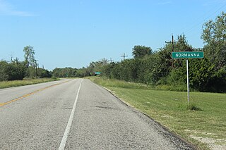
Normanna is a census-designated place (CDP) in Bee County, Texas, United States. The population was 98 at the 2020 census.

<span class="mw-page-title-main">De Kalb, Texas</span> City in Texas, United States

De Kalb is a city in Bowie County, Texas, United States; it is part of the Texarkana metropolitan statistical area. Its two area codes are 430 and 903. Its ZIP code is 75559. It is in the Central Time Zone, and its population was 1,527 at the 2020 United States census.

<span class="mw-page-title-main">Snook, Texas</span> City in Texas, United States

Snook is a city in Burleson County, Texas, United States. The population was 506 at the 2020 census.

<span class="mw-page-title-main">Somerville, Texas</span> City in Texas, United States

Somerville is a city in Burleson County, Texas, United States. The population was 1,312 at the 2020 census. Somerville is named for Albert Somerville the first president of the Gulf, Colorado and Santa Fe Railway.

<span class="mw-page-title-main">La Feria, Texas</span> City in Texas, United States

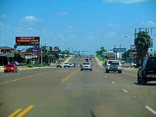
La Feria is a city in Cameron County, Texas, United States. Its population was 6,817 at the time of the 2020 census. It is part of the Brownsville–Harlingen–Raymondville, the Matamoros–Brownsville, and the McAllen–Edinburg–Mission metropolitan areas.

<span class="mw-page-title-main">Olmito, Texas</span> Census-designated place in Texas, United States

Olmito is a census-designated place (CDP) in Cameron County, Texas, United States. Olmito is Spanish for "little elm". The population was 1,021 at the 2020 census. It is part of the Brownsville–Harlingen Metropolitan Statistical Area. Olmito is the self-described "mesquite capital of the world."

<span class="mw-page-title-main">Canyon Lake, Texas</span> CDP in Texas, United States

Canyon Lake is a census-designated place (CDP) in Comal County, Texas, United States. The population was 31,124 at the 2020 census. It is part of the San Antonio Metropolitan Statistical Area.

<span class="mw-page-title-main">Hartley, Texas</span> CDP in Texas, United States

Hartley is a census-designated place (CDP) in Hartley County, Texas, United States. The population was 540 at the 2010 census.

<span class="mw-page-title-main">Linn, Texas</span> Census-designated place in Hidalgo County, Texas, United States

Linn, formerly San Manuel-Linn, is a census-designated place (CDP) in Hidalgo County, Texas, United States. The population was 801 at the 2010 census, down from 958 at the 2000 census. It is part of the McAllen–Edinburg–Mission Metropolitan Statistical Area.

<span class="mw-page-title-main">Evadale, Texas</span> Census-designated place in Texas, United States

Evadale is an unincorporated community and census-designated place (CDP) in Jasper County, Texas, United States. The population was 1,246 at the 2020 census.

<span class="mw-page-title-main">Central Gardens, Texas</span> Census-designated place in Texas, United States

Central Gardens is an unincorporated community and census-designated place (CDP) in Jefferson County, Texas, United States. The population was 4,373 at the 2020 census. It is part of the Beaumont–Port Arthur metropolitan area.

Briaroaks is a city in Johnson County, Texas, United States. The population was 507 at the 2020 census.

<span class="mw-page-title-main">Lampasas, Texas</span> City in Texas, United States

Lampasas is a city in Lampasas County, Texas, United States. Its population was 7,291 at the 2020 census. It is the seat of Lampasas County.

<span class="mw-page-title-main">Lipscomb, Texas</span> Census-designated place in Texas, United States

Lipscomb is an unincorporated community and census-designated place (CDP) in Lipscomb County, Texas, United States. It is the Lipscomb county seat. The population was 66 at the 2020 census.

<span class="mw-page-title-main">Deweyville, Texas</span> CDP in Texas, United States

Deweyville is a census-designated place (CDP) in Newton County, on the central eastern border of Texas, United States. The population was 571 at the 2020 census, down from 1,023 at the 2010 census.

<span class="mw-page-title-main">Milam, Texas</span> CDP in Texas, United States

Milam is a census-designated place (CDP) in Sabine County, Texas, United States. It is located along the Sabine River at the junction of Highway 87 and Highway 21. The population was 1,355 at the 2020 census. Milam is the largest city in Sabine County.

<span class="mw-page-title-main">Raymondville, Texas</span> City in and county seat of Willacy County, Texas, United States

Raymondville is a city in and the county seat of Willacy County, Texas, United States. The population was 10,236 at the 2020 census. It may be included as part of the Brownsville–Harlingen–Raymondville and the Matamoros–Brownsville metropolitan areas.

<span class="mw-page-title-main">Zapata, Texas</span> CDP in Texas, United States

Zapata is a census-designated place (CDP) in and the county seat of Zapata County, Texas, United States. The population was 5,383 at the 2020 census. As an unincorporated community, Zapata has no municipal government, but like all 254 Texas counties has four elected county commissioners chosen by single-member districts and a countywide elected administrative judge.

<span class="mw-page-title-main">Horseshoe Bay, Texas</span> City in Texas, United States

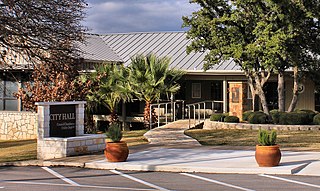
Horseshoe Bay is a city in Llano and Burnet counties in the U.S. state of Texas.

References

  1. "2019 U.S. Gazetteer Files". United States Census Bureau. Retrieved August 7, 2020.
  2. 1 2 U.S. Geological Survey Geographic Names Information System: Caldwell, Texas
  3. 1 2 "U.S. Census website". United States Census Bureau . Retrieved January 31, 2008.
  4. "Find a County". National Association of Counties. Archived from the original on May 31, 2011. Retrieved June 7, 2011.
  5. 1 2 "Geographic Identifiers: 2010 Demographic Profile Data (G001): Caldwell city, Texas". U.S. Census Bureau, American Factfinder. Archived from the original on February 12, 2020. Retrieved April 22, 2014.
  6. "Decennial Census by Decade". United States Census Bureau .
  7. "1900 Census of Population - Population of Texas By Counties And Minor Civil Divisions" (PDF). United States Census Bureau .
  8. "1910 Census of Population - Supplement for Texas" (PDF). United States Census Bureau .
  9. "1920 Census of Population - Number of Inhabitants - Texas" (PDF). United States Census Bureau .
  10. "1930 Census of Population - Number of Inhabitants - Texas" (PDF). United States Census Bureau .
  11. "1940 Census of Population - Number of Inhabitants - Texas" (PDF). United States Census Bureau .
  12. "1950 Census of Population - Number of Inhabitants - Texas" (PDF). United States Census Bureau .
  13. "1960 Census of Population - Number of Inhabitants - Texas" (PDF). United States Census Bureau .
  14. "1970 Census of Population - Number of Inhabitants - Texas" (PDF). United States Census Bureau .
  15. "1980 Census of Population - Number of Inhabitants - Texas" (PDF). United States Census Bureau .
  16. "1990 Census of Population - Population and Housing Unit Counts - Texas" (PDF). United States Census Bureau .
  17. "2000 Census of Population - Population and Housing Unit Counts - Texas" (PDF). United States Census Bureau .
  18. "2010 Census of Population - Population and Housing Unit Counts - Texas" (PDF). United States Census Bureau .
  19. "Explore Census Data". data.census.gov. Retrieved May 25, 2022.
  20. "About the Hispanic Population and its Origin". www.census.gov. Retrieved May 18, 2022.
  21. Climate Summary for Caldwell, Texas
  1. Note: the US Census treats Hispanic/Latino as an ethnic category. This table excludes Latinos from the racial categories and assigns them to a separate category. Hispanics/Latinos can be of any race. [20]