Clay, Texas | |
|---|---|
 Clay  Clay | |
| Coordinates: 30°22′52″N96°20′41″W / 30.38111°N 96.34472°W | |
| Country | United States |
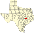
| State | Texas |
| County | Burleson |
| Area | |
• Total | 4.47 sq mi (11.6 km2) |
| • Land | 4.45 sq mi (11.5 km2) |
| • Water | 0.02 sq mi (0.052 km2) |
| Elevation | 207 ft (63 m) |
| Population (2020) | 139 [3] |
| Time zone | UTC-6 (Central (CST)) |
| • Summer (DST) | UTC-5 (CDT) |
| ZIP Code | 77879 (Somerville) |
| Area code | 979 |
| FIPS code | 48-15232 |
| GNIS feature ID | 2805746 [2] |
Clay is an unincorporated community and census-designated place (CDP) in Burleson County, Texas, United States. It was first listed as a CDP prior to the 2020 census [2] and has a population of 139. [3]
Contents
The community is located along Farm to Market Road 50 (FM 50) in southeastern Burleson County, approximately 8 miles (13 km) southeast of Snook, 5 miles (8 km) north of Independence, and 17 miles (27 km) miles north of Brenham. [4]
The Snook Independent School District has served Clay since 1949. [5] [6]