Lyons, Texas | |
|---|---|
 Lyons, Texas  Lyons, Texas | |
| Coordinates: 30°23′54″N96°33′00″W / 30.39833°N 96.55000°W | |
| Country | United States |
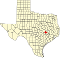
| State | Texas |
| County | Burleson |
| Elevation | 292 ft (89 m) |
| Population (2020) | |
• Total | 236 |
| Time zone | UTC-6 (Central (CST)) |
| • Summer (DST) | UTC-5 (CDT) |
| ZIP code | 77863 |
| GNIS feature ID | 2805748 [1] |
Lyons is an unincorporated community and census-designated place (CDP) in Burleson County, Texas, United States. It was first listed as a CDP in the 2020 census, with a population of 236. [2] Lyons has a post office, with the ZIP code 77863. [3]