Rita, Texas | |
|---|---|
 Rita  Rita | |
| Coordinates: 30°41′13″N96°36′32″W / 30.68694°N 96.60889°W | |
| Country | United States |
| State | Texas |
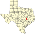
| County | Burleson |
| Elevation | 299 ft (91 m) |
| Time zone | UTC-6 (Central (CST)) |
| • Summer (DST) | UTC-5 (CDT) |
| Area code | 979 |
| GNIS feature ID | 1380441 [1] |
Rita is an unincorporated community in Burleson County, Texas, United States. [1] According to the Handbook of Texas, the community had a population of 50 in 2000. It is located within the Bryan-College Station metropolitan area.