State Highway 21 (SH 21) runs from the Texas-Louisiana boundary east of San Augustine to San Marcos in east and central Texas. SH 21 mostly follows the alignment of the Old San Antonio Road and the El Camino Real, except for the portion between Midway and Bryan, where the Old San Antonio Road took a more northerly route, and SH 21 follows a more direct route. That section of the Old San Antonio Road is served by Texas State Highway OSR.
SH 21 was one of the original 25 routes proposed in Texas on June 21, 1917, along a route from the Louisiana state line east of St. Augustine to Gonzales, overlaid on top of the Gonzales-St. Augustine Highway.[2] There was proposed extension southward to Karnes City on February 18, 1918.[3] On July 16, 1923, the terminus was shortened to Giddings, with the section south of there being cancelled.[4] A spur, SH 21 Spur, was designated on March 19, 1930, from Milam to Hemphill. On August 1, 1930, this spur became part of SH 87. On September 29, 1933, SH 21 was extended to Lockhart. On July 15, 1935, the section from Giddings to Lockhart was cancelled, and SH 21 was rerouted though Lincoln, replacing part of SH OSR, and followed SH 44 to Giddings.[5] On October 21, 1936, SH 21 Spur to Chireno was added.[6] On May 18, 1937, the spur in Chireno became a loop, SH 21 Loop.[7] On February 21, 1938, another SH 21 Spur to McMahan's Chapel was added.[8] On April 19, 1938, the section of SH 21 from Lincoln to Giddings was cancelled, and SH 21 was extended to Bastrop, replacing part of SH OSR. On September 26, 1939, the section from Paige to Bastrop was cancelled, as it was already part of US 290. The spur and loop became Loop 34 (Chireno) and Spur 35 (McMahan's Chapel). On August 2, 1943, the western terminus had been extended to end in San Marcos, along its current route, replacing part of SH OSR.
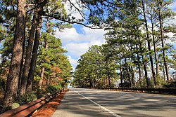
Westbound Highway 21 through the "Lost Pines" north of Bastrop.
On June 24, 2010, the SH 21 designation was extended along SH 80 and SH142 to end at I-35.[9][10]
Business State Highway 21-H (Bus.SH21-H) is a 1.362-mile (2.192km) long business route that runs through Kurten in central Texas. The route was formed from an old section of SH21 on February 28, 2002, when SH21 proper was moved onto a new bypass around Kurten.[12]
Business State Highway 21-P (Bus.SH21-P) is a 4.170-mile (6.711km) long business route that runs through Nacogdoches in eastern Texas.[13] The route was formed from an old section of SH21, when the main highway was re-routed onto Loop 224 and US59 on October 25, 2018.[14]
This page is based on this Wikipedia article Text is available under the CC BY-SA 4.0 license; additional terms may apply. Images, videos and audio are available under their respective licenses.