List of Interstate Highways in Texas

Last updated

Dwight D. Eisenhower National System of Interstate and Defense Highways
I-10 (TX).svg
I-410 (TX).svg
Business Loop 20.svg
Highway markers for Interstate 10, Interstate 410, and Interstate 20 Business loop
List of Interstate Highways in Texas
Interstate Highways highlighted in red
System information
Maintained by TxDOT
Length3,274.7 mi (5,270.1 km)
FormedJune 29, 1956 (1956-06-29) [1]
Highway names
Interstates Interstate X (I-X)
Interstate Highway X (IH X)
US Highways U.S. Highway X (US X)
State State Highway X (SH X)
Loops:Loop X
Spurs:Spur X
Recreational:Recreational Road X (RE X)
Farm or Ranch
to Market Roads:
Farm to Market Road X (FM X)
Ranch to Market Road X (RM X)
Park Roads:Park Road X (PR X)
System links

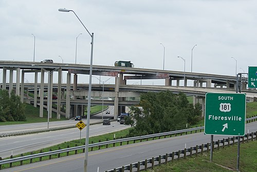
The Interstate Highways in Texas are all owned and maintained by the U.S. state of Texas. [2] The Texas Department of Transportation (TxDOT) is the agency responsible for the day-to-day maintenance and operations of the Interstate Highways in Texas. The Interstate Highway System in Texas covers 3,239.7 miles (5,213.8 km) and consists of twelve primary routes, seven auxiliary routes and Interstate 35 (I-35) which is split into two branches, I-35E and I-35W, that provide access to both Fort Worth and Dallas. The longest segment of Interstate Highway in Texas is I-10 at 878.6 miles (1,414.0 km); the shortest is I-110 at 0.9 miles (1.4 km).

Contents

The construction of the Interstate Highway System in Texas began well before these routes were designated as Interstate Highways. A 50-mile (80 km) stretch of I-45 between Galveston and Houston was opened in 1951, eight years before it was designated I-45. It was also the first urban expressway in Texas. In 1962, 43 miles (69 km) of I-35 opened in Bexar County, the first section of Interstate Highway to open from county line to county line in a large metropolitan area. [3] Portions of I-10 west of San Antonio took much longer to complete due to the vast open spaces and lack of nearby labor. The majority of the construction of this section of I-10 occurred in the 1970s and 1980s and was complete by the early 1990s. The section east of San Antonio was completed 20 years earlier in 1972. [4] The opening of a 6-mile (10 km) section of I-27 in 1992 completed the Interstate Highway System in Texas. [5]

Planning is ongoing for a proposed extension of I-69 southward from its original terminus in Indiana through Texas to the United States–Mexico border. [6] If complete as planned, I-69 will extend about 650 miles (1,050 km) across Texas, from the Louisiana state line in the TexarkanaShreveport area to South Texas. [7] The first 6.2-mile (10.0 km) portion was approved in 2011, with signage posted December 6, 2011.

Primary Interstate Highways

NumberLength (mi)Length (km)Southern or western terminusNorthern or eastern terminusFormedRemovedNotes
I-2.svg I-2 46.8 [8] 75.3 US 83/Bus. US 83 in Peñitas I-69E/US 77/US 83 in Harlingen 02013-05-302013 [8] currentLowest numbered route in the system; Intersects I-69C in Pharr [9] [10] [11]
I-10.svg I-10 877.455 [12] 1,412.127 I-10/US 85/US 180 at New Mexico state line in Anthony I-10/US 90 at Louisiana state line in Orange 01959-10-011959 [12] currentIntersects I-110 in El Paso; [13] I-20 between Kent and Balmorhea; [14] [15] I-35, I-37, and I-410 in San Antonio; [16] and I-45, I-69, and I-610 in Houston [17]
I-14.svg I-14 25.9041.68 US 190/SH 9 in Copperas Cove I-35/US 190 near Belton 02017-01-262017 [18] currentKnown as the Fourteenth Amendment Highway; [19] to be extended west along US 190 to I-10 and I-20 and east to Louisiana [20]
I-20.svg I-20 634.723 [21] 1,021.488 I-10 between Kent and Toyah I-20 at Louisiana state line east of Waskom 01959-10-011959 [21] currentIntersects I-30, I-35W, and I-820 in Fort Worth; [22] I-35E, I-45, and I-635 in Dallas; [23] and future I-369 in Marshall [24]
I-27.svg I-27 124.182 [25] 199.852 US 87/Loop 289 in Lubbock I‑40/US 60/US 87/US 287 in Amarillo 01968-12-241968 [25] currentExtensions to Laredo and New Mexico signed into law on March 15, 2022 [26]
I-30.svg I-30 223.404 [27] 359.534 I-20 in Fort Worth I-30/US 59/US 71 at Arkansas state line in Texarkana 01959-10-011959 [27] currentIntersects I-35W and I-820 in Fort Worth; [22] I-35E, I-45, I-345, and I-635 in Dallas; [23] and I-369 in Texarkana [28]
I-35.svg I-35 407.195 [29] 655.317 I-35E & I-35W in Denton (Northern section)
Fed. 85 at Juárez–Lincoln International Bridge in Laredo (Southern section)
I-35/US 77 at Oklahoma state line north of Gainesville (Northern section)
I-35E & I-35W in Hillsboro (Southern section)
01959-10-011959 [29] currentIntersects I-69W in Laredo [30] then I-10, I-37, and I-410 in San Antonio [16] [31] before branching at Hillsboro into I-35E and I-35W [32] through Dallas and Fort Worth reuniting in Denton [33]
I-35E.svg I-35E 96.657 [34] 155.554 I-35 & I-35W in Hillsboro I-35 & I-35W in Denton 01959-10-011959 [34] currentEastern branch of I-35 through Dallas where it intersects I-20, I-30, and I-635 [23] [35]
I-35W.svg I-35W 85.283 [36] 137.250 I-35 & I-35E in Hillsboro I-35 & I-35E in Denton 01959-10-011959 [36] currentWestern branch of I-35 through Fort Worth where it intersects I-20, I-30, and I-820 [22]
I-37.svg I-37 142.787 [37] 229.793 US 181/SH 35 in Corpus Christi I-35/US 281 in San Antonio 01959-10-011959 [37] currentIntersects I-69E in Corpus Christi; [38] future I-69W east of George West; and both I-10 and I-410 in San Antonio [16] [31]
I-40.svg I-40 177.139 [39] 285.078 I-40 at New Mexico state line in Glenrio I-40 at Oklahoma state line east of Shamrock 01959-10-011959 [39] currentIntersects I-27 in Amarillo [40]
I-44.svg I-44 15.398 [41] 24.781 US 277/US 281/US 287 in Wichita Falls I-44/US 277/US 281 at Oklahoma state line north of Burkburnett 01982-06-291982 [41] current
I-45.svg I-45 284.913 [42] 458.523 SH 87 in Galveston I-30, I-345, US 67 in Dallas 01959-10-011959 [42] currentIntersects I-10, I-69, and I-610 in Houston; [17] and I-20 in Dallas [23]
I-49.svg I-49 23.2 I-49/US 59/US 71 at Arkansas state line north of Texarkana I-49 at Arkansas state line north of TexarkanaproposedLinks two Arkansas I-49 segments [43]
I-69.svg I-69 74.9 [44] 120.5 US 59/Spur 529 in Rosenberg US 59 near Cleveland 02011-10-272011 [44] [45] currentIntersects I-10, I-45, and I-610 in Houston; The future I-69 will extend from I-69E/I-69W merger south of Victoria along US 59 to Tenaha intersecting I-369 before following US 84 to I-69 at Louisiana state line east of Joaquin [46]
I-69C.svg I-69C 18 [47] 29 I-2/US 83/US 281 in Pharr US 281/FM 490 in Edinburg 02013-05-302013 [47] currentThe future I-69C will follow US 281 ending at I-69W in George West [46]
I-69E.svg I-69E 81 [48] 130 Fed. 101/Fed. 180 at Veterans International Bridge in Brownsville
US 77 in Kingsville
US 77 north of Raymondville
I-37/US 77 in Corpus Christi
02013-05-302013 [48] currentIntersects I-169 in Olmito and I-2 in Harlingen; The future I-69E will follow US 77 to I-69/I-69W south of Victoria [46]
I-69W.svg I-69W 1.4 [49] 2.3 Fed. 85D at World Trade International Bridge in Laredo I-35/US 59/US 83/Loop 20 in Laredo02014-06-262014 [49] currentThe future I-69W will follow US 59 to I-69/I-69E south of Victoria intersecting I-69C in George West and I-37 east of George West [46]
  •       Proposed and unbuilt

Auxiliary Interstate Highways

NumberLength (mi)Length (km)Southern or western terminusNorthern or eastern terminusFormedRemovedNotes
I-110.svg I-110 0.891 [50] 1.434 Fed. 45 at Bridge of the Americas in El Paso I-10/US 54/US 180 in El Paso01967-03-281967 [50] currentPartially along US 54 [13]
I-169.svg I-169 1.52.4 Port of Brownsville I-69E/US 77/US 83 in Olmito 02015-05-152015currentFrontage roads opened and signed as SH 550 from I-69E/US 77/US 83 to FM 3248 in 2011 and from FM 3248 to the Port of Brownsville in 2013; main lanes opened and co-signed with SH 550 from I-69E/US 77/US 83 to Old Alice Road in 2015, main lanes currently under construction from Old Alice Road to the Port of Brownsville and should be completed by 2016, it will be a toll route once fully completed
I-345.svg I-345 1.400 [51] 2.253 I-30/I-45/US 67 in Dallas US 75/Spur 366 in Dallas01964-10-151964 [51] currentUnsigned
I-369.svg I-369 3.5 [52] 5.6 US 59/SH 93/Loop 151 in Texarkana I-30/US 59 in Texarkana02013-05-302013 [52] currentProposed extension along US 59 to I-69 in Tenaha; intersects I-20 [24]
I-410.svg I-410 49.488 [53] 79.643 Beltway around San Antonio 01959-10-011959 [53] currentIntersects I-10, I-35, and I-37 [16] [31]
I-610.svg I-610 37.972 [54] 61.110 Beltway around Houston 01959-10-011959 [54] currentIntersects I-10, I-45, and I-69 [17]
I-635.svg I-635 36.999 [55] 59.544 I-20 in Balch Springs SH 121 in Grapevine 01959-10-011959 [55] currentPartial Dallas beltway; intersects I-30, and I-35E [23] [35]
I-820.svg I-820 35.173 [56] 56.605 I-20 in Fort Worth I-20/US 287 in Fort Worth01959-10-011959 [56] currentPartial Fort Worth beltway; intersects I-30 and I-35W [22]

Business Interstate Highways

NumberLength (mi) [a] Length (km)Southern or western terminusNorthern or eastern terminusFormedRemovedNotes
Business Loop 10.svg I-10 BL 2.747 [57] 4.421 I-10 in Sierra Blanca I-10 in Sierra Blanca01990-06-211990 [57] currentFormerly Loop 416 signed as Bus. US 80 [58]
Business Loop 10.svg I-10 BL 2.881 [59] 4.637 I-10 in Van Horn I-10 in Van Horn01990-06-211990 [59] currentFormerly Loop 519 signed as Bus. US 80 [60]
Business Loop 10.svg I-10 BL 2.000 [61] 3.219 I-10/FM 2903 north of Balmorhea I-10/SH 17 east of Balmorhea01991-11-211991 [61] currentFormerly part of US 290 and FM 2903 [61]
Business Loop 10.svg I-10 BL 1.398 [62] 2.250 I-10/US 67 in Fort Stockton I-10/US 67/US 385 in Fort Stockton01991-01-211991 [62] currentFormerly part of US 290 [62]
Business Loop 20.svg I-20 BL 14.042 [63] 22.598 I-20 west of Pecos I-20 east of Barstow 01991-08-281991 [63] currentFormerly part of US 80 [63]
Business Loop 20.svg I-20 BL 8.223 [64] 13.234 I-20 west of Monahans I-20 in Monahans01991-08-281991 [64] currentFormerly part of US 80 [64]
Business Loop 20.svg I-20 BL 31.761 [65] 51.114 I-20 in West Odessa I-20 east of Midland 01991-08-281991 [65] currentFormerly part of US 80 [65]
Business Loop 20.svg I-20 BL 4.687 [66] 7.543 I-20 west of Stanton I-20 east of Stanton01995-03-301995 [66] currentFormerly Loop 214 preceded by US 80 [67]
Business Loop 20.svg I-20 BL 5.609 [68] 9.027 I-20 west of Big Spring I-20 in Big Spring01990-06-211990 [68] currentFormerly Loop 402 signed as Bus. US 80 [69]
Business Loop 20.svg I-20 BL 1.069 [70] 1.720 I-20/FM 670 west of Westbrook I-20 in Westbrook01990-06-211990 [70] currentFormerly Loop 333 preceded by US 80 [71]
Business Loop 20.svg I-20 BL 5.926 [72] 9.537 I-20 west of Colorado City I-20 east of Colorado City01990-06-211990 [72] currentFormerly Loop 377 signed as Bus. US 80 [73]
Business Loop 20.svg I-20 BL 1.633 [74] 2.628 I-20 west of Loraine I-20 in Loraine01990-06-211990 [74] currentFormerly Loop 316 preceded by US 80 [75]
Business Spur 20.svg I-20 BS 1.644 [76] 2.646 I-20 west of Roscoe Bus. US 84/FM 608 in Roscoe01990-06-211990 [76] currentFormerly Loop 237 preceded by US 80 [77]
Business Loop 20.svg I-20 BL 6.448 [78] 10.377 I-20/US 84 west of Sweetwater I-20/US 84/SH 70 in Sweetwater01990-06-211990 [78] currentFormerly Loop 432 signed as Bus. US 80 [79]
Business Loop 20.svg I-20 BL 2.076 [80] 3.341 I-20/US 84 west of Trent I-20/US 84 east of Trent01990-06-211990 [80] currentFormerly Loop 319 preceded by US 80 [81]
Business Loop 20.svg I-20 BL 2.786 [82] 4.484 I-20/US 84 west of Merkel I-20/US 84/FM 1235 east of Merkel01990-06-211990 [82] currentFormerly Loop 39 preceded by US 80 [83]
Business Loop 20.svg I-20 BL 1.661 [84] 2.673 I-20/US 84 in Tye I-20/US 84 in Tye01990-06-211990 [84] currentFormerly Loop 320 preceded by US 80 [85]
Business Loop 20.svg I-20 BL 8.466 [86] 13.625 I-20/US 84 in Tye I-20 in Abilene 01990-06-211990 [86] currentFormerly Loop 355 signed as Bus. US 80 [87]
Business Loop 20.svg I-20 BL 2.826 [88] 4.548 I-20/FM 2047 west of Baird I-20 east of Baird01990-06-211990 [88] currentFormerly Loop 425 preceded by US 80 [89]
Business Loop 27.svg I-27 BL 1.168 [90] 1.880 I-27/US 87 in Hale Center I-27/US 87 in Hale Center02002-02-282002 [90] current
Business Loop 27.svg I-27 BL 9.282 [91] 14.938 I-27/US 87 south of Plainview I-27/US 87 in Plainview01990-06-211990 [91] currentFormerly Loop 445 signed as Bus. US 87 [92]
Business Loop 35.svg I-35 BL 3.400 [93] 5.472 Fed. 85 at Gateway to the Americas International Bridge in Laredo I-35/US 83 in Laredo01991-03-261991 [93] currentSegment formerly Bus. US 83 and Loop 420 preceded by US 81/US 83 [94] [95]
Business Loop 35.svg I-35 BL 1.222 [96] 1.967 I-35 south of Encinal I-35/SH 44 north of Encinal01990-06-211990 [96] currentFormerly Loop 532 signed as Bus. US 81 [97]
Business Loop 35.svg I-35 BL 2.872 [98] 4.622 I-35 south of Cotulla I-35 in Cotulla01991-03-261991 [98] currentFormerly part of US 81 [98]
Business Loop 35.svg I-35 BL 4.147 [99] 6.674 I-35 south of Dilley I-35 north of Dilley01991-03-261991 [99] currentFormerly part of US 81 [99]
Business Loop 35.svg I-35 BL 5.449 [100] 8.769 I-35/FM 1581 in Pearsall I-35 north of Pearsall01991-03-261991 [100] currentSegment formerly part of US 81 [100]
Business Loop 35.svg I-35 BL 4.488 [101] 7.223 I-35 in New Braunfels I-35 in New Braunfels01991-03-261991 [101] currentFormerly part of US 81 [101]
Business Loop 35.svg I-35 BL 1.461 [102] 2.351 I-35 in Kyle I-35 in Kyle01990-06-211990 [102] currentFormerly part of US 81 [102]
Business Loop 35.svg I-35 BL 3.648 [103] 5.871 I-35 in Round Rock I-35/FM 3406 in Round Rock01990-06-211990 [103] 02013-02-282013 [103] Formerly Loop 384 signed as Bus. US 81; [104] segment now Spur 379 [105]
Business Loop 35.svg I-35 BL 5.1 [106] 8.2 I-35 in Georgetown I-35 in Georgetown01990-06-211990 [106] 02006-05-252006 [106] Formerly Loop 418 signed as Bus. US 81; [107] segments now Spur 26 and Spur 158 [106]
Business Loop 35.svg I-35 BL 2.288 [108] 3.682 I-35W in Alvarado I-35W in Alvarado01990-10-251990 [108] currentFormerly Loop 392 signed as Bus. US 81 [109]
Business Loop 35.svg I-35 BL 1.883 [110] 3.030 I-35 in Sanger I-35 in Sanger01991-12-191991 [110] currentFormerly Spur 138; a portion preceded by part of US 77 [111]
Business Loop 40.svg I-40 BL 0.779 [112] 1.254 Historic US 66 at New Mexico state line in Glenrio I-40 east of Glenrio01990-06-211990 [112] currentFormerly Spur 504; segment preceded by part of US 66 [113]
Business Loop 40.svg I-40 BL 2.369 [114] 3.813 I-40 west of Adrian I-40 east of Adrian01990-06-211990 [114] currentFormerly Loop 550 [115] preceded by part of US 66 [116]
Business Loop 40.svg I-40 BL 3.395 [117] 5.464 I-40 west of Vega I-40 east of Vega01990-06-211990 [117] currentFormerly Loop 551 [118] preceded by part of US 66 [119]
Business Loop 40.svg I-40 BL 14.125 [120] 22.732 I-40 west of Amarillo I-40 east of Amarillo01990-10-251990 [120] currentFormerly Loop 552 preceded by part of US 66 [121]
Business Loop 40.svg I-40 BL 3.533 [122] 5.686 I-40 west of Groom I-40 east of Groom01990-06-211990 [122] currentFormerly Loop 554 preceded by part of US 66 [123]
Business Loop 40.svg I-40 BL 3.796 [124] 6.109 I-40 west of McLean I-40 east of McLean01990-06-211990 [124] currentFormerly Loop 555 preceded by part of US 66 [125]
Business Loop 40.svg I-40 BL 2.770 [126] 4.458 I-40 west of Shamrock I-40 east of Shamrock01993-03-241993 [126] currentFormerly Loop 556 preceded by part of US 66 [127]
Business Loop 45.svg I-45 BL 6.367 [128] 10.247 I-45 in Corsicana I-45/US 287 north of Corsicana01990-06-211990 [128] currentFormerly Loop 564 preceded by part of US 75 [129]
Business Loop 45.svg I-45 BL 4.512 [130] 7.261 I-45 in Ennis I-45 in Ennis01990-06-211990 [130] currentFormerly Loop 563 preceded by part of US 75 [131]
Business Loop 45.svg I-45 BL 2.330 [132] 3.750 I-45 in Palmer I-45 north of Palmer01990-06-211990 [132] currentFormerly Loop 562 preceded by part of US 75 [133]
Business Loop 45.svg I-45 BL 3.367 [134] 5.419 I-45 south of Ferris I-45 north of Ferris01990-06-211990 [134] currentFormerly Loop 560 preceded by part of US 75 [135]
  •       Former

See also

Notes

  1. Official route lengths do not include segments that run concurrently with other highways of greater hierarchy

References

  1. McNichol, Dan (2006). The Roads that Built America. New York: Sterling. p. 106. ISBN   1-4027-3468-9.
  2. Staff. "Interstate Frequently Asked Questions". Federal Highway Administration. Archived from the original on February 28, 2006. Retrieved February 25, 2008.
  3. Staff. "TxDOT History: 1970 to 1951". Texas Department of Transportation. Archived from the original on April 14, 2021. Retrieved February 25, 2008.
  4. Beaumont, Penny; Brinkmann, Rhonda; Ellis, David; Pourteau, Chris; Webb, Brandon V. "From Anywhere to Everywhere: The Development of the Interstate Highway System in Texas" (PDF). Texas Transportation Institute. p. 30. Archived from the original (PDF) on May 6, 2008. Retrieved February 25, 2008.
  5. Staff. "TxDOT History: 2000 to 1971". Texas Department of Transportation. Archived from the original on August 5, 2012. Retrieved February 25, 2008.
  6. Staff. "I-69/TTC (Northeast Texas to Mexico)". Texas Department of Transportation. Archived from the original on July 20, 2008. Retrieved February 24, 2008.
  7. Staff (February 9, 2008). TTC Tier 1 EIS Meeting Handout. Texas Department of Transportation.
  8. 1 2 Transportation Planning and Programming Division (n.d.). "Interstate Highway No. 2". Highway Designation Files. Texas Department of Transportation. Retrieved December 3, 2014.
  9. Transportation Planning and Programming Division (2014). Texas County Mapbook (PDF) (Map) (2014 ed.). 1:120,000. Texas Department of Transportation. p. 351. Retrieved December 2, 2014.[ needs update ]
  10. Transportation Planning and Programming Division (2014). Texas County Mapbook (PDF) (Map) (2014 ed.). 1:120,000. Texas Department of Transportation. p. 381. Retrieved December 2, 2014.[ needs update ]
  11. Transportation Planning and Programming Division (2014). Texas County Mapbook (PDF) (Map) (2014 ed.). 1:120,000. Texas Department of Transportation. p. 411. Retrieved December 2, 2014.[ needs update ]
  12. 1 2 Transportation Planning and Programming Division (n.d.). "Interstate Highway No. 10". Highway Designation Files. Texas Department of Transportation. Retrieved December 3, 2014.
  13. 1 2 Transportation Planning and Programming Division (2014). Texas County Mapbook (PDF) (Map) (2014 ed.). 1:120,000. Texas Department of Transportation. p. 6. Retrieved December 2, 2014.[ needs update ]
  14. Transportation Planning and Programming Division (2014). Texas County Mapbook (PDF) (Map) (2014 ed.). 1:120,000. Texas Department of Transportation. p. 30. Retrieved December 2, 2014.[ needs update ]
  15. Transportation Planning and Programming Division (2014). Texas County Mapbook (PDF) (Map) (2014 ed.). 1:120,000. Texas Department of Transportation. p. 40. Retrieved December 2, 2014.[ needs update ]
  16. 1 2 3 4 Transportation Planning and Programming Division (2014). Texas County Mapbook (PDF) (Map) (2014 ed.). 1:120,000. Texas Department of Transportation. p. 339. Retrieved December 2, 2014.[ needs update ]
  17. 1 2 3 Transportation Planning and Programming Division (2014). Texas County Mapbook (PDF) (Map) (2014 ed.). 1:120,000. Texas Department of Transportation. p. 497. Retrieved December 2, 2014.[ needs update ]
  18. Texas Transportation Commission (January 26, 2017). "Minute Order" (PDF). Texas Department of Transportation. p. 1. Archived (PDF) from the original on February 2, 2017. Retrieved January 26, 2017.
  19. Office of Senator Johnny Isakson (April 28, 2005). "Chambliss, Isakson Seek to Include Study of Two Proposed New Interstates in National Highway Funding Bill" (Press release). Office of Senator Johnny Isakson. Archived from the original on September 27, 2011. Retrieved November 27, 2011.
  20. Bryant, David (January 26, 2017). "Highway 190 is officially Interstate Highway 14 from Cove to Belton". Killeen Daily Herald. Archived from the original on January 28, 2017. Retrieved January 28, 2017.
  21. 1 2 Transportation Planning and Programming Division (n.d.). "Interstate Highway No. 20". Highway Designation Files. Texas Department of Transportation. Retrieved December 3, 2014.
  22. 1 2 3 4 Transportation Planning and Programming Division (2014). Texas County Mapbook (PDF) (Map) (2014 ed.). 1:120,000. Texas Department of Transportation. p. 387. Retrieved December 2, 2014.[ needs update ]
  23. 1 2 3 4 5 Transportation Planning and Programming Division (2014). Texas County Mapbook (PDF) (Map) (2014 ed.). 1:120,000. Texas Department of Transportation. p. 417. Retrieved December 2, 2014.[ needs update ]
  24. 1 2 Staff (May 30, 2013). "Interstate 69 Comes to Texarkana and the Valley" (Press release). Alliance for I-69 Texas. Archived from the original on October 19, 2013. Retrieved May 31, 2013.
  25. 1 2 Transportation Planning and Programming Division (n.d.). "Interstate Highway No. 27". Highway Designation Files. Texas Department of Transportation. Retrieved December 3, 2014.
  26. "Interstate 27 expansion signed into law". NewsWest 9. Midland, Texas: KWES-TV. March 17, 2022. Archived from the original on April 6, 2022. Retrieved March 30, 2022.
  27. 1 2 Transportation Planning and Programming Division (n.d.). "Interstate Highway No. 30". Highway Designation Files. Texas Department of Transportation. Retrieved December 3, 2014.
  28. Transportation Planning and Programming Division (2014). Texas County Mapbook (PDF) (Map) (2014 ed.). 1:120,000. Texas Department of Transportation. p. 521. Retrieved December 2, 2014.[ needs update ]
  29. 1 2 Transportation Planning and Programming Division (n.d.). "Interstate Highway No. 35". Highway Designation Files. Texas Department of Transportation. Retrieved December 3, 2014.
  30. Transportation Planning and Programming Division (2014). Texas County Mapbook (PDF) (Map) (2014 ed.). 1:120,000. Texas Department of Transportation. p. 287. Retrieved December 2, 2014.[ needs update ]
  31. 1 2 3 Transportation Planning and Programming Division (2014). Texas County Mapbook (PDF) (Map) (2014 ed.). 1:120,000. Texas Department of Transportation. p. 340. Retrieved December 2, 2014.[ needs update ]
  32. Transportation Planning and Programming Division (2014). Texas County Mapbook (PDF) (Map) (2014 ed.). 1:120,000. Texas Department of Transportation. p. 420. Retrieved December 2, 2014.[ needs update ]
  33. Transportation Planning and Programming Division (2014). Texas County Mapbook (PDF) (Map) (2014 ed.). 1:120,000. Texas Department of Transportation. p. 385. Retrieved December 2, 2014.[ needs update ]
  34. 1 2 Transportation Planning and Programming Division (n.d.). "Interstate Highway No. 35-E". Highway Designation Files. Texas Department of Transportation. Retrieved December 3, 2014.
  35. 1 2 Transportation Planning and Programming Division (2014). Texas County Mapbook (PDF) (Map) (2014 ed.). 1:120,000. Texas Department of Transportation. p. 416. Retrieved December 2, 2014.[ needs update ]
  36. 1 2 Transportation Planning and Programming Division (n.d.). "Interstate Highway No. 35-W". Highway Designation Files. Texas Department of Transportation. Retrieved December 3, 2014.
  37. 1 2 Transportation Planning and Programming Division (n.d.). "Interstate Highway No. 37". Highway Designation Files. Texas Department of Transportation. Retrieved December 3, 2014.
  38. Transportation Planning and Programming Division (2014). Texas County Mapbook (PDF) (Map) (2014 ed.). 1:120,000. Texas Department of Transportation. p. 405. Retrieved December 2, 2014.[ needs update ]
  39. 1 2 Transportation Planning and Programming Division (n.d.). "Interstate Highway No. 40". Highway Designation Files. Texas Department of Transportation. Retrieved December 3, 2014.
  40. Transportation Planning and Programming Division (2014). Texas County Mapbook (PDF) (Map) (2014 ed.). 1:120,000. Texas Department of Transportation. p. 119. Retrieved December 2, 2014.[ needs update ]
  41. 1 2 Transportation Planning and Programming Division (n.d.). "Interstate Highway No. 44". Highway Designation Files. Texas Department of Transportation. Retrieved December 3, 2014.
  42. 1 2 Transportation Planning and Programming Division (n.d.). "Interstate Highway No. 45". Highway Designation Files. Texas Department of Transportation. Retrieved December 3, 2014.
  43. Planning and Research Division (2012). 2012 Highway Map of Arkansas (PDF) (Map). Scale not given. Little Rock: Arkansas State Highway and Transportation Department. § H2. Archived from the original (PDF) on February 21, 2014. Retrieved December 3, 2014.
  44. 1 2 Transportation Planning and Programming Division (n.d.). "Interstate Highway No. 69". Highway Designation Files. Texas Department of Transportation. Retrieved December 3, 2014.
  45. Brezosky, Lynn (December 6, 2011). "Coastal Bend, Valley Unveil First Stretch of Interstate 69". San Antonio Express-News . Archived from the original on February 5, 2012. Retrieved December 10, 2011.
  46. 1 2 3 4 Texas Department of Transportation (March 1, 2013). Status of I-69 Designation in Texas (PDF) (Map). Scale not given. Austin: Texas Department of Transportation. Archived (PDF) from the original on December 25, 2014. Retrieved December 4, 2014.
  47. 1 2 Transportation Planning and Programming Division (n.d.). "Interstate Highway No. 69-C". Highway Designation Files. Texas Department of Transportation. Retrieved December 3, 2014.
  48. 1 2 Transportation Planning and Programming Division (n.d.). "Interstate Highway No. 69-E". Highway Designation Files. Texas Department of Transportation. Retrieved December 3, 2014.
  49. 1 2 "Minutes of the regular meeting of the Texas Transportation Commission" (PDF). Texas Department of Transportation. June 26, 2014. p. 4. Archived (PDF) from the original on December 27, 2014. Retrieved December 3, 2014.
  50. 1 2 Transportation Planning and Programming Division (n.d.). "Interstate Highway No. 110". Highway Designation Files. Texas Department of Transportation. Retrieved December 4, 2014.
  51. 1 2 Transportation Planning and Programming Division (n.d.). "Interstate Highway No. 345". Highway Designation Files. Texas Department of Transportation. Retrieved December 4, 2014.
  52. 1 2 Transportation Planning and Programming Division (n.d.). "Interstate Highway No. 369". Highway Designation Files. Texas Department of Transportation. Retrieved December 4, 2014.
  53. 1 2 Transportation Planning and Programming Division (n.d.). "Interstate Highway No. 410". Highway Designation Files. Texas Department of Transportation. Retrieved December 4, 2014.
  54. 1 2 Transportation Planning and Programming Division (n.d.). "Interstate Highway No. 610". Highway Designation Files. Texas Department of Transportation. Retrieved December 4, 2014.
  55. 1 2 Transportation Planning and Programming Division (n.d.). "Interstate Highway No. 635". Highway Designation Files. Texas Department of Transportation. Retrieved December 4, 2014.
  56. 1 2 Transportation Planning and Programming Division (n.d.). "Interstate Highway No. 820". Highway Designation Files. Texas Department of Transportation. Retrieved December 4, 2014.
  57. 1 2 Transportation Planning and Programming Division (n.d.). "Business Interstate Highway No. 10-C". Highway Designation Files. Texas Department of Transportation. Retrieved November 26, 2014.
  58. Transportation Planning and Programming Division (n.d.). "State Highway Loop No. 416". Highway Designation Files. Texas Department of Transportation. Retrieved November 26, 2014.
  59. 1 2 Transportation Planning and Programming Division (n.d.). "Business Interstate Highway No. 10-D". Highway Designation Files. Texas Department of Transportation. Retrieved November 26, 2014.
  60. Transportation Planning and Programming Division (n.d.). "State Highway Loop No. 519". Highway Designation Files. Texas Department of Transportation. Retrieved November 26, 2014.
  61. 1 2 3 Transportation Planning and Programming Division (n.d.). "Business Interstate Highway No. 10-F". Highway Designation Files. Texas Department of Transportation. Retrieved November 26, 2014.
  62. 1 2 3 Transportation Planning and Programming Division (n.d.). "Business Interstate Highway No. 10-G". Highway Designation Files. Texas Department of Transportation. Retrieved November 26, 2014.
  63. 1 2 3 Transportation Planning and Programming Division (n.d.). "Business Interstate Highway No. 20-B". Highway Designation Files. Texas Department of Transportation. Retrieved November 26, 2014.
  64. 1 2 3 Transportation Planning and Programming Division (n.d.). "Business Interstate Highway No. 20-D". Highway Designation Files. Texas Department of Transportation. Retrieved November 26, 2014.
  65. 1 2 3 Transportation Planning and Programming Division (n.d.). "Business Interstate Highway No. 20-E". Highway Designation Files. Texas Department of Transportation. Retrieved November 26, 2014.
  66. 1 2 Transportation Planning and Programming Division (n.d.). "Business Interstate Highway No. 20-F". Highway Designation Files. Texas Department of Transportation. Retrieved November 26, 2014.
  67. Transportation Planning and Programming Division (n.d.). "State Highway Loop No. 214". Highway Designation Files. Texas Department of Transportation. Retrieved November 27, 2014.
  68. 1 2 Transportation Planning and Programming Division (n.d.). "Business Interstate Highway No. 20-G". Highway Designation Files. Texas Department of Transportation. Retrieved November 26, 2014.
  69. Transportation Planning and Programming Division (n.d.). "State Highway Loop No. 402". Highway Designation Files. Texas Department of Transportation. Retrieved November 27, 2014.
  70. 1 2 Transportation Planning and Programming Division (n.d.). "Business Interstate Highway No. 20-H". Highway Designation Files. Texas Department of Transportation. Retrieved November 27, 2014.
  71. Transportation Planning and Programming Division (n.d.). "State Highway Loop No. 333". Highway Designation Files. Texas Department of Transportation. Retrieved November 27, 2014.
  72. 1 2 Transportation Planning and Programming Division (n.d.). "Business Interstate Highway No. 20-J". Highway Designation Files. Texas Department of Transportation. Retrieved November 27, 2014.
  73. Transportation Planning and Programming Division (n.d.). "State Highway Loop No. 377". Highway Designation Files. Texas Department of Transportation. Retrieved November 27, 2014.
  74. 1 2 Transportation Planning and Programming Division (n.d.). "Business Interstate Highway No. 20-K". Highway Designation Files. Texas Department of Transportation. Retrieved November 27, 2014.
  75. Transportation Planning and Programming Division (n.d.). "State Highway Loop No. 316". Highway Designation Files. Texas Department of Transportation. Retrieved November 27, 2014.
  76. 1 2 Transportation Planning and Programming Division (n.d.). "Business Interstate Highway No. 20-L". Highway Designation Files. Texas Department of Transportation. Retrieved November 27, 2014.
  77. Transportation Planning and Programming Division (n.d.). "State Highway Loop No. 237". Highway Designation Files. Texas Department of Transportation. Retrieved November 27, 2014.
  78. 1 2 Transportation Planning and Programming Division (n.d.). "Business Interstate Highway No. 20-M". Highway Designation Files. Texas Department of Transportation. Retrieved November 27, 2014.
  79. Transportation Planning and Programming Division (n.d.). "State Highway Loop No. 432". Highway Designation Files. Texas Department of Transportation. Retrieved November 27, 2014.
  80. 1 2 Transportation Planning and Programming Division (n.d.). "Business Interstate Highway No. 20-N". Highway Designation Files. Texas Department of Transportation. Retrieved November 27, 2014.
  81. Transportation Planning and Programming Division (n.d.). "State Highway Loop No. 319". Highway Designation Files. Texas Department of Transportation. Retrieved November 27, 2014.
  82. 1 2 Transportation Planning and Programming Division (n.d.). "Business Interstate Highway No. 20-P". Highway Designation Files. Texas Department of Transportation. Retrieved November 27, 2014.
  83. Transportation Planning and Programming Division (n.d.). "State Highway Loop No. 39". Highway Designation Files. Texas Department of Transportation. Retrieved November 27, 2014.
  84. 1 2 Transportation Planning and Programming Division (n.d.). "Business Interstate Highway No. 20-Q". Highway Designation Files. Texas Department of Transportation. Retrieved November 27, 2014.
  85. Transportation Planning and Programming Division (n.d.). "State Highway Loop No. 320". Highway Designation Files. Texas Department of Transportation. Retrieved November 27, 2014.
  86. 1 2 Transportation Planning and Programming Division (n.d.). "Business Interstate Highway No. 20-R". Highway Designation Files. Texas Department of Transportation. Retrieved November 27, 2014.
  87. Transportation Planning and Programming Division (n.d.). "State Highway Loop No. 355". Highway Designation Files. Texas Department of Transportation. Retrieved November 27, 2014.
  88. 1 2 Transportation Planning and Programming Division (n.d.). "Business Interstate Highway No. 20-T". Highway Designation Files. Texas Department of Transportation. Retrieved November 27, 2014.
  89. Transportation Planning and Programming Division (n.d.). "State Highway Loop No. 425". Highway Designation Files. Texas Department of Transportation. Retrieved November 27, 2014.
  90. 1 2 Transportation Planning and Programming Division (n.d.). "Business Interstate Highway No. 27-T". Highway Designation Files. Texas Department of Transportation. Retrieved November 27, 2014.
  91. 1 2 Transportation Planning and Programming Division (n.d.). "Business Interstate Highway No. 27-U". Highway Designation Files. Texas Department of Transportation. Retrieved November 27, 2014.
  92. Transportation Planning and Programming Division (n.d.). "State Highway Loop No. 445". Highway Designation Files. Texas Department of Transportation. Retrieved November 27, 2014.
  93. 1 2 Transportation Planning and Programming Division (n.d.). "Business Interstate Highway No. 35-A". Highway Designation Files. Texas Department of Transportation. Retrieved November 27, 2014.
  94. Transportation Planning and Programming Division (n.d.). "Business U.S. Highway No. 83-K". Highway Designation Files. Texas Department of Transportation. Retrieved November 27, 2014.
  95. Transportation Planning and Programming Division (n.d.). "State Highway Loop No. 420". Highway Designation Files. Texas Department of Transportation. Retrieved November 27, 2014.
  96. 1 2 Transportation Planning and Programming Division (n.d.). "Business Interstate Highway No. 35-B". Highway Designation Files. Texas Department of Transportation. Retrieved November 27, 2014.
  97. Transportation Planning and Programming Division (n.d.). "State Highway Loop No. 532". Highway Designation Files. Texas Department of Transportation. Retrieved November 27, 2014.
  98. 1 2 3 Transportation Planning and Programming Division (n.d.). "Business Interstate Highway No. 35-C". Highway Designation Files. Texas Department of Transportation. Retrieved November 27, 2014.
  99. 1 2 3 Transportation Planning and Programming Division (n.d.). "Business Interstate Highway No. 35-D". Highway Designation Files. Texas Department of Transportation. Retrieved November 27, 2014.
  100. 1 2 3 Transportation Planning and Programming Division (n.d.). "Business Interstate Highway No. 35-E". Highway Designation Files. Texas Department of Transportation. Retrieved November 27, 2014.
  101. 1 2 3 Transportation Planning and Programming Division (n.d.). "Business Interstate Highway No. 35-H". Highway Designation Files. Texas Department of Transportation. Retrieved November 27, 2014.
  102. 1 2 3 Transportation Planning and Programming Division (n.d.). "Business Interstate Highway No. 35-J". Highway Designation Files. Texas Department of Transportation. Retrieved November 27, 2014.
  103. 1 2 3 Transportation Planning and Programming Division (n.d.). "Business Interstate Highway No. 35-L". Highway Designation Files. Texas Department of Transportation. Retrieved November 27, 2014.
  104. Transportation Planning and Programming Division (n.d.). "State Highway Loop No. 384". Highway Designation Files. Texas Department of Transportation. Retrieved November 27, 2014.
  105. Transportation Planning and Programming Division (n.d.). "State Highway Spur No. 379". Highway Designation Files. Texas Department of Transportation. Retrieved November 27, 2014.
  106. 1 2 3 4 Transportation Planning and Programming Division (n.d.). "Business Interstate Highway No. 35-M". Highway Designation Files. Texas Department of Transportation. Retrieved November 27, 2014.
  107. Transportation Planning and Programming Division (n.d.). "State Highway Loop No. 418". Highway Designation Files. Texas Department of Transportation. Retrieved November 27, 2014.
  108. 1 2 Transportation Planning and Programming Division (n.d.). "Business Interstate Highway No. 35-V". Highway Designation Files. Texas Department of Transportation. Retrieved November 27, 2014.
  109. Transportation Planning and Programming Division (n.d.). "State Highway Loop No. 392". Highway Designation Files. Texas Department of Transportation. Retrieved November 27, 2014.
  110. 1 2 Transportation Planning and Programming Division (n.d.). "Business Interstate Highway No. 35-X". Highway Designation Files. Texas Department of Transportation. Retrieved November 27, 2014.
  111. Transportation Planning and Programming Division (n.d.). "State Highway Spur No. 138". Highway Designation Files. Texas Department of Transportation. Retrieved November 27, 2014.
  112. 1 2 Transportation Planning and Programming Division (n.d.). "Business Interstate Highway No. 40-A". Highway Designation Files. Texas Department of Transportation. Retrieved November 28, 2014.
  113. Transportation Planning and Programming Division (n.d.). "State Highway Spur No. 504". Highway Designation Files. Texas Department of Transportation. Retrieved November 28, 2014.
  114. 1 2 Transportation Planning and Programming Division (n.d.). "Business Interstate Highway No. 40-B". Highway Designation Files. Texas Department of Transportation. Retrieved November 28, 2014.
  115. Transportation Planning and Programming Division (n.d.). "State Highway Loop No. 550". Highway Designation Files. Texas Department of Transportation. Retrieved November 28, 2014.
  116. Texas State Highway Department (January 1, 1961). General Highway Map, Oldham County, Texas (Map). 1:126,720. Austin: Texas State Highway Department. p. 1. Archived from the original on December 20, 2014. Retrieved December 5, 2014.
  117. 1 2 Transportation Planning and Programming Division (n.d.). "Business Interstate Highway No. 40-C". Highway Designation Files. Texas Department of Transportation. Retrieved November 28, 2014.
  118. Transportation Planning and Programming Division (n.d.). "State Highway Loop No. 551". Highway Designation Files. Texas Department of Transportation. Retrieved November 28, 2014.
  119. Texas State Highway Department (January 1, 1961). General Highway Map, Oldham County, Texas (Map). 1:126,720. Austin: Texas State Highway Department. p. 2. Archived from the original on December 20, 2014. Retrieved December 5, 2014.
  120. 1 2 Transportation Planning and Programming Division (n.d.). "Business Interstate Highway No. 40-D". Highway Designation Files. Texas Department of Transportation. Retrieved November 28, 2014.
  121. Transportation Planning and Programming Division (n.d.). "State Highway Loop No. 552". Highway Designation Files. Texas Department of Transportation. Retrieved November 28, 2014.
  122. 1 2 Transportation Planning and Programming Division (n.d.). "Business Interstate Highway No. 40-F". Highway Designation Files. Texas Department of Transportation. Retrieved November 28, 2014.
  123. Transportation Planning and Programming Division (n.d.). "State Highway Loop No. 554". Highway Designation Files. Texas Department of Transportation. Retrieved November 28, 2014.
  124. 1 2 Transportation Planning and Programming Division (n.d.). "Business Interstate Highway No. 40-H". Highway Designation Files. Texas Department of Transportation. Retrieved November 28, 2014.
  125. Transportation Planning and Programming Division (n.d.). "State Highway Loop No. 555". Highway Designation Files. Texas Department of Transportation. Retrieved November 28, 2014.
  126. 1 2 Transportation Planning and Programming Division (n.d.). "Business Interstate Highway No. 40-J". Highway Designation Files. Texas Department of Transportation. Retrieved November 28, 2014.
  127. Transportation Planning and Programming Division (n.d.). "State Highway Loop No. 556". Highway Designation Files. Texas Department of Transportation. Retrieved November 28, 2014.
  128. 1 2 Transportation Planning and Programming Division (n.d.). "Business Interstate Highway No. 45-F". Highway Designation Files. Texas Department of Transportation. Retrieved November 28, 2014.
  129. Transportation Planning and Programming Division (n.d.). "State Highway Loop No. 564". Highway Designation Files. Texas Department of Transportation. Retrieved November 28, 2014.
  130. 1 2 Transportation Planning and Programming Division (n.d.). "Business Interstate Highway No. 45-G". Highway Designation Files. Texas Department of Transportation. Retrieved November 28, 2014.
  131. Transportation Planning and Programming Division (n.d.). "State Highway Loop No. 563". Highway Designation Files. Texas Department of Transportation. Retrieved November 28, 2014.
  132. 1 2 Transportation Planning and Programming Division (n.d.). "Business Interstate Highway No. 45-H". Highway Designation Files. Texas Department of Transportation. Retrieved November 28, 2014.
  133. Transportation Planning and Programming Division (n.d.). "State Highway Loop No. 562". Highway Designation Files. Texas Department of Transportation. Retrieved November 28, 2014.
  134. 1 2 Transportation Planning and Programming Division (n.d.). "Business Interstate Highway No. 45-J". Highway Designation Files. Texas Department of Transportation. Retrieved November 28, 2014.
  135. Transportation Planning and Programming Division (n.d.). "State Highway Loop No. 560". Highway Designation Files. Texas Department of Transportation. Retrieved November 28, 2014.