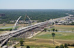
Tom Landry Freeway at Eastchase in Fort Worth, Texas
The western end and zero mile point of I-30 in Texas is at its interchange with I-20 in Parker County near Aledo. It then travels near Downtown Fort Worth on a new routing further south than the now removed Lancaster Elevated section of the freeway.[4] The section of I-30 between Dallas and Fort Worth is designated the Tom Landry Highway in honor of the longtime Dallas Cowboys coach. This section was previously known as the Dallas–Fort Worth Turnpike, which preceded the Interstate System.[citation needed] The section from Downtown Dallas to Arlington was widened to over 16lanes in some sections by 2010.
In Dallas, I-30 is known as East R.L. Thornton Freeway between Downtown Dallas and the eastern suburb of Mesquite. I-30 picks up the name from I-35E south at the Mixmaster interchange. The Mixmaster is scheduled to be reconstructed as part of the Horseshoe project,[5] derived from the larger Pegasus Project.[6][7] The section from Downtown Dallas to State Highway Loop12 (Loop12, Buckner Boulevard) is eight lanes plus an HOV lane. This section will be reconstructed under the East Corridor project to 12lanes by 2025–2030.[8] From Rockwall to a point past Sulphur Springs, I-30 runs concurrently with US67. Through Greenville, I-30 is known as Martin Luther King Jr. Freeway.[9] I-30 continues northeasterly through East Texas until a few miles from the Oklahoma state line, when the route turns east toward Arkansas.
Arkansas
I-30's eastern terminus at I-40 in North Little Rock, Arkansas
I-30 enters southwestern Arkansas at Texarkana.[10][self-published source] I-30 intersects I-49,[10] after which it travels northeast. I-30 then passes through Hope,[10]Prescott, Gurdon, Arkadelphia, and Malvern. At Malvern, drivers can use US70 or US270 to travel into historic Hot Springs or beyond into Ouachita National Forest. There, US70 and US67 join I-30 and stay with the interstate into the Little Rock city limits. Northeast of Malvern, I-30 passes through Benton before reaching the Little Rock city limits.[11] From Benton to its end at I-40, I-30 is a six-lane highway with up to 85,000vehicles per day.[citation needed] As I-30 enters Little Rock, I-430 leaves its parent route to create a western bypass of the city. Just south of downtown, I-30 meets the western terminus of I-440 and the northern terminus of another auxiliary route in I-530. I-530 travels 46 miles (74km) south to Pine Bluff. At this three-way junction of Interstates, I-30 turns due north for the final few miles of its route. Here, I-30 passes through the capitol district of Little Rock.[12] I-30 also creates one final auxiliary route in I-630, or the Wilbur D. Mills Freeway, which splits Downtown Little Rock in an east–west direction before coming to its other end at I-430 just west of downtown. After passing I-630, I-30 crosses the Arkansas River into North Little Rock and comes to its eastern terminus,[13] despite facing north, at I-40. At its end, I-30 is joined by US65, US67, and US167. US65 joins I-40 westbound, while US67 and US167 join I-40 eastbound from I-30's eastern terminus.
The very first fully controlled-access part of what is now I-30 was the Dallas–Fort Worth Turnpike, a 30-mile (48km) controlled-access tollway in the Dallas–Fort Worth area. Completed by 1957, it operated as a toll road between 1957 and 1977, afterward becoming a nondescript part of I-20 and then I-30. The road, three lanes in each direction but later widened, is the only direct connection between Downtown Fort Worth and Downtown Dallas. In October2001, the former turnpike was named the Tom Landry Highway, after the late Dallas Cowboys coach.[14]
The proposed expressway was studied as early as 1944 but was turned down by the state engineer due to the expense.[15][citation needed] However, in 1953, the state legislature created the Texas Turnpike Authority, which, in 1955, raised $58.5million (equivalent to $519.45million in 2023[16]) to build the project. Construction started later that year. On August27, 1957, the highway was open to traffic,[17] but the official opening came a week later on September5.[18] The turnpike's presence stimulated growth in Arlington and Grand Prairie and facilitated construction of Six Flags Over Texas. At the end of 1977, the bonds were paid off, and the freeway was handed over to the state Department of Transportation, toll collection ceased, and the tollbooths were removed in the first week of 1978.[19]
The existing US67 route was already in heavy use in the early 1950s, at which point it was twinned from just east of Dallas to Rockwall and also a rural section near Greenville and a few miles in Hopkins County. There were still a few at-grade crossings on these two sections into the 1980s. The twinned US67 routes were upgraded to Interstate Highway standards beginning in 1961, forming the R.L. Thornton Freeway. By the mid-1960s, much of I-30 was under construction outside the metroplex as well. The majority of the route was completed by 1965, but a 40-mile (64km) stretch through rural areas built on a new alignment well away from US67 between Mount Pleasant and New Boston remained unfinished. This remaining segment was finally built and opened to traffic in 1971, completing I-30.[20][self-published source]
Originally, the west end of I-30 was at the current intersection of I-30 and US80 near the border of Mesquite and Dallas. I-20 went into Downtown Dallas and across the former turnpike through Downtown Fort Worth and to points west. Later, I-20 took its current southerly route around Dallas and Fort Worth, and I-30 assumed the former I-20 route from US80 to Western Fort Worth, and later to the current interchange with I-20 near Aledo.[21] I-30 was proposed to be extended along the US67 freeway from Little Rock. However, this conflicted with the Missouri Department of Transportation's plan to extend I-57, which is also planned to use US67.[citation needed] In April2016, a provision designating US67 from North Little Rock to Walnut Ridge, as "Future I-57" was added to the federal fiscal year2017 Transportation, Housing and Urban Development funding bill. The provision would also give Arkansas the ability to request any segment of the road built to Interstate Highway standards be officially added to the Interstate Highway System as I-57.[22]
If I-30 had been extended, there were plans to upgrade AR226 to Interstate standards and designate it as I-730. This would eventually become part of US78 in 2023.[23][24]
I-130 was a proposed auxiliary route of I-30 that was planned to be concurrent with I-49. Once the eastern segment of the Texarkana Loop had been upgraded to Interstate standards, I-130 was to have been signed; however, it is now part of I-49.[25]
Future
The Texas Department of Transportation is currently upgrading a 16-mile-long (26km) section of I-30 between exit 62 in Garland to exit 77 at the Rockwall-Hunt county line. The work will widen the interstate from six to eight lanes, rebuild bridges, including the bridge over Lake Ray Hubbard, and reconstruct interchanges. Full completion of the project is expected by the end of 2027.[26]
Signed as exit 13 eastbound; access to Harris Methodist Hospital, Cook Children's Medical Center, Baylor All Saints Medical Center, and Plaza Medical Center of Fort Worth
Interstate30 Business (I-30 Bus.) was a business route in Benton, Arkansas. It ran from exit116 to exit118 on I-30 from approximately 1960 to 1975, concurrently with US70C.[28]
Interstate30 Business (I-30 Bus.) was a business route in Little Rock, Arkansas. The route started at exit132 on I-30 and followed US70B nearly its entire route. In North Little Rock, the route remained concurrent with US70 and terminated at exit141B on I-30.[29]
↑ Transportation Planning and Programming Division (n.d.). "Highway Designations Glossary". Texas Department of Transportation. Retrieved May 20, 2020.
↑ Staff (December 9, 1959). "Minute Order 3514"(PDF). Arkansas State Highway Commission. Archived from the original(PDF) on October 1, 2018. Retrieved February 5, 2015. (p. 1544 of PDF)
This page is based on this Wikipedia article Text is available under the CC BY-SA 4.0 license; additional terms may apply. Images, videos and audio are available under their respective licenses.


