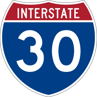
Interstate 30 (I-30) is a major Interstate Highway in the southern states of Texas and Arkansas in the United States. I-30 travels 366.76 miles from I-20 west of Fort Worth, Texas, northeast via Dallas, and Texarkana, Texas, to I-40 in North Little Rock, Arkansas. The highway parallels U.S. Route 67 (US 67) except for the portion west of downtown Dallas. Between the termini, I-30 has interchanges with I-35W, I-35E, and I-45. I-30 is known as the Tom Landry Freeway between I-35W and I-35E, within the core of the Dallas–Fort Worth metroplex.

Interstate 45 (I-45) is a major Interstate Highway located entirely within the U.S. state of Texas. While most Interstate routes which have numbers ending in "5" are cross-country north–south routes, I-45 is comparatively short, with the entire route located in Texas. Additionally, it has the shortest length of all the interstates that end in a "5". It connects the cities of Dallas and Houston, continuing southeast from Houston to Galveston over the Galveston Causeway to the Gulf of Mexico.
In Downtown Atlanta, the Downtown Connector or 75/85 is the concurrent section of Interstate 75 and Interstate 85 through the core of the city. Beginning at the I-85/Langford Parkway interchange, the Downtown Connector runs generally due north, meeting the west–east I-20 in the middle. Just north of this is the Grady Curve around Grady Memorial Hospital. Continuing north, the terminus of the Downtown Connector is the Brookwood Interchange or Brookwood Split in the Brookwood area of the city. The overall length of the Downtown Connector is approximately 7.5 miles (12 km). Since the 2000s, it has been officially named James Wendell George Parkway for most of its length, although it is still designated the Connector in the mainstream. It also has unsigned designations State Route 401 (I-75) and State Route 403 (I-85) along its length, due to I-75 and I-85 having 400-series reference numbers.
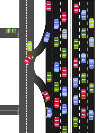
A frontage road is a local road running parallel to a higher-speed, limited-access road. A frontage road is often used to provide access to private driveways, shops, houses, industries or farms. Where parallel high-speed roads are provided as part of a major highway, these are also known as local lanes. Sometimes a similar arrangement is used for city roads; for example, the collector portion of Commonwealth Avenue in Boston, Massachusetts, is known as a carriage road.

The Arroyo Seco Parkway, also known as the Pasadena Freeway, is one of the oldest freeways built in the United States. The parkway connects Los Angeles with Pasadena alongside the Arroyo Seco seasonal river. It is notable not only for being an early freeway, mostly opened in 1940, but for representing the transitional phase between early parkways and later freeways. It conformed to modern standards when it was built, but is now regarded as a narrow, outdated roadway. A 1953 extension brought the south end to the Four Level Interchange in downtown Los Angeles and a connection with the rest of the freeway system.

State Highway 121 is a state highway angling from southwest to northeast through north central Texas. It runs from Cleburne, Texas at US 67 to SH 78 in Bonham, Texas, just north of a junction with US 82.

Interstate 375 (I-375) is a north–south auxiliary Interstate Highway in Detroit, Michigan, United States. It is the southernmost leg of the Walter P. Chrysler Freeway and a spur of I-75 into Downtown Detroit, ending at the unsigned Business Spur I-375, better known as Jefferson Avenue. The freeway opened on June 12, 1964. At only 1.062 miles (1.709 km) in length, it once had the distinction of being the shortest signed Interstate Highway in the country before I-110 in El Paso, Texas, was signed. The Michigan Department of Transportation (MDOT) announced in 2021 plans to convert the freeway to a boulevard. Details of that project were revealed in April 2023 with MDOT reaffirming that construction is scheduled to begin in 2025.
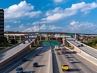
The High Five Interchange is one of the first five-level stack interchanges built in Dallas, Texas. Located at the junction of the Lyndon B. Johnson Freeway and the Central Expressway, it replaces an antiquated combination interchange constructed in the 1960s.

The Dallas North Tollway is a 30.2-mile (49 km) controlled-access toll road operated by the North Texas Tollway Authority (NTTA), which runs from Interstate 35E near downtown Dallas, Texas (USA), to U.S. Highway 380, in Frisco, Texas.

Interstate 635 (I-635) is a 36.999-mile-long (59.544 km) partial loop around Dallas, Texas, in the United States between I-20 in Balch Springs and State Highway 121 (SH 121) at the north entrance of the Dallas Fort Worth International Airport in Grapevine. It intersects I-35E at exits 27B and 27C but does not connect with I-35W. I-635 and a part of I-20 are collectively designated as the Lyndon B. Johnson Freeway; known locally as the LBJ Freeway, or simply LBJ. The roadway is named after Lyndon B. Johnson, the former U.S. senator from Texas and the 37th vice-president and 36th president of the U.S. Where I-635 ends at I-20, I-20 continues the LBJ Freeway designation heading west. Since the portion of I-20 between Spur 408 to I-635 retains the same names as I-635, the two highways are considered three-quarters of the beltway around Dallas. Together with Spur 408, a portion of Loop 12, and a portion of I-35E, I-635 and I-20 complete the beltway.
Spur 366, also named Woodall Rodgers Freeway, is a highway that connects Beckley Avenue and Singleton Boulevard in West Dallas to Interstate 35E and U.S. Highway 75 in central Dallas, Texas. The highway, as part of the downtown freeway loop, also serves as a dividing line between downtown Dallas on the south and the Uptown and Victory Park neighborhoods on the north.
A directional interchange, colloquially known as a stack interchange, is a type of grade-separated junction between two controlled-access highways that allows for free-flowing movement to and from all directions of traffic. These interchanges eliminate the problems of weaving, have the highest vehicle capacity, and vehicles travel shorter distances when compared to different types of interchanges.
Central Expressway is a north–south highway in the Dallas-Fort Worth Metroplex in Texas (USA) and surrounding areas. The best-known section is the North Central Expressway, a name for a freeway section of U.S. Highway 75 between downtown Dallas and Van Alstyne, Texas. The southern terminus is south of the Woodall Rodgers Freeway at exit 284C of "hidden" Interstate 345. From there, Central Expressway becomes the South Central Expressway, the northernmost portion of which was renamed César Chávez Boulevard on April 9, 2010.

Interstate 35E (I-35E), an Interstate Highway, is the eastern half of I-35, where it splits to serve the Dallas–Fort Worth metropolitan area. I-35 splits into two branch routes, I-35W and I-35E, at Hillsboro. I-35E travels north for 97 miles (156 km), maintaining I-35's sequence of exit numbers. It travels through Dallas before rejoining with I-35W to reform I-35 in Denton.

Interstate 35E (I-35E) is an Interstate Highway in the US state of Minnesota, passing through downtown Saint Paul. It is one of two through routes for I-35 through the Twin Cities of Minneapolis and Saint Paul, the other being I-35W through Minneapolis. Thus, both ends of I-35E are shared with I-35W and I-35.

Interstate 35W (I-35W), an Interstate Highway, is the western half of I-35 where it splits to serve the Dallas–Fort Worth metropolitan area. I-35 splits into two branch routes, I-35W and I-35E, at Hillsboro. I-35W runs north for 85.2 miles (137.1 km), carrying its own separate sequence of exit numbers. It runs through Fort Worth before rejoining with I-35E to reform I-35 in Denton. It is the more direct route for long-distance expressway traffic, as is noted on signs on I-35 leading into the I-35W/I-35E splits. During the 1970s, billboards existed on I-35 encouraging travelers to take the faster and shorter I-35W route.

Interstate 35W (I-35W) is an Interstate Highway in the US state of Minnesota, passing through downtown Minneapolis. It is one of two through routes for I-35 through the Twin Cities of Minneapolis and Saint Paul, the other being I-35E through downtown Saint Paul.
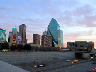
This article is about transportation systems in and around Dallas, Texas (USA).

Interstate 35 (I-35) is a major north–south Interstate Highway that runs from Laredo, Texas near the Mexican border to Duluth, Minnesota. In Texas, the highway begins in Laredo and runs north to the Red River north of Gainesville, where it crosses into Oklahoma. Along its route, it passes through the cities of San Antonio, Austin, and Waco before splitting into two branch routes just north of Hillsboro: I-35E heads northeast through Dallas, while I-35W turns northwest to run through Fort Worth. The two branches rejoin in Denton to again form I-35, which continues to the Oklahoma state line. The exit numbers for I-35E maintain the sequence of exit numbers from the southern segment of I-35, and the northern segment of I-35 follows on from the sequence of exit numbers from I-35E. I-35W maintains its own sequence of exit numbers.

Spur 482, known better as Storey Lane, is a short connector route located in the Dallas area. The route originates at the site of the former Texas Stadium and ends northwest of Love Field.


