
Arkansas Highway 5 is a designation for three state highways in Arkansas. The southern segment of 45.84 miles (73.77 km) runs from U.S. Route 70 east of Hot Springs north to Interstate 430 (I-430) in Little Rock.

Arkansas Highway 59 is a north–south state highway in Northwest Arkansas. The route runs 93.24 miles (150.06 km) from Arkansas Highway 22 in Barling north to the Missouri state line through Van Buren, the county seat of Crawford County. Highway 59 parallels US 59 between Siloam Springs and Fort Smith. Since US 59 goes through Arkansas, AR 59 is the only Arkansas state highway to share its numbering with a federal highway that goes through Arkansas.

Arkansas Highway 25 is a north–south state highway in north central Arkansas. The route runs 127.36 miles (204.97 km) from Interstate 40 (I-40) in Conway north to US 63/US 412 in Black Rock through Heber Springs, Batesville, and the foothills of The Ozarks.

Highway 139 is a designation for two north–south state highways in the Upper Arkansas Delta. One route of 17.65 miles (28.40 km) begins at Highway 158 in Caraway and runs north to Missouri Supplemental Route F at the Missouri state line. A second route of 34.86 miles (56.10 km) runs from US Highway 412 (US 412) to Missouri Route 51 at the Missouri state line. Both routes are maintained by the Arkansas State Highway and Transportation Department (AHTD).

Arkansas Highway 90 is an east–west state highway in northeast Arkansas. The route of 81.93 miles (131.85 km) runs from Main Street in Ravenden to Route 84 at the Missouri state line. The route is an entirely undivided surface highway that passes through rich cotton country.

Highway 89 is a highway in the central part of the U.S. state of Arkansas.

Arkansas Highway 113 is a north–south state highway in Central Arkansas. The route runs 29.48 miles (47.44 km) from Highway 10 south of Wye north to U.S. Route 64 east of Blackwell. This also gives access to some rural areas west of Morrilton. It runs through Pulaski, Perry, and Conway counties. It contains no spur of business routes.
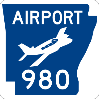
Highway 980 is a state highway designation for all state maintained airport roads in Arkansas.

Arkansas Highway 9 is a designation for three state highways in Arkansas. One segment of 51.44 miles (82.78 km) runs from U.S. Route 79 at Eagle Mills north to US 67 in Malvern. A second segment of 79.76 miles (128.36 km) runs from Highway 5 at Crows north to US 65 at Choctaw. A third segment of 94.41 miles (151.94 km) runs from US 65 in Clinton north to US 63 in Mammoth Spring. The route was created during the 1926 Arkansas state highway numbering, and has seen only minor extensions and realignments since. Pieces of all three routes are designated as Arkansas Heritage Trails for use during the Civil War and the Trail of Tears.

Arkansas Highway 4 is a designation for two state highways in Arkansas. One segment of 2.99 miles (4.81 km) runs from the Oklahoma state line east to US 59/US 71 at Cove. A second segment of 22.1 miles (35.6 km) runs from US 278 in McGehee east to Highway 1 at Rohwer. The two routes were formerly connected until a portion of approximately 230 miles (370 km) was redesignated US 278 in 1998. The eastern segment is part of the Great River Road.

Highway 118 is a designation for two state highways in the Upper Arkansas Delta. One route of 41.43 miles (66.68 km) begins at US Highway 64 (US 64) and Highway 149 east to Mississippi County Road 495 near the Mississippi River levee. A second route of 4.29 miles (6.90 km) runs from US 70/US 79 in West Memphis to US 64 in Marion. Both routes are maintained by the Arkansas State Highway and Transportation Department (AHTD).

Highway 110 is a designation for three east–west state highways in north central Arkansas. One segment of 16.71 miles (26.89 km) runs east from US Highway 65 (US 65) at Botkinburg to Highway 9/Highway 16 near Shirley. A second route of 3.15 miles (5.07 km) begins at Highway 16/Highway 92 in Greers Ferry and runs east to the lake shore of Greers Ferry Lake. A third segment of 20.43 miles (32.88 km) begins at the Sugar Maple Dr/Old Tr intersection outside Heber Springs and runs east to Highway 16 in Pangburn.

Arkansas Highway 18 is a designation for two state highways in northeast Arkansas. One segment of 0.93 miles (1.50 km) runs from Highway 69 east of Jacksonport east to Highway 17 in Diaz. A second segment of 92.83 miles (149.40 km) runs from Highway 17 in Diaz east to the Mississippi River.

Arkansas Highway 124 is a designation for two state highways in Central Arkansas. The western segment of 72.17 miles (116.15 km) runs from Russellville to Rose Bud. An eastern segment of 9.17 miles (14.76 km) runs east in White County from Pangburn to Highway 157.

Highway 92 is an east–west state highway in north-central Arkansas. The route of 60.7 miles (97.7 km) runs from US Highway 64 (US 64) in Plumerville to AR 5/AR 25 at Drasco. The route is maintained by the Arkansas Department of Transportation (ARDOT).

Highway 356 is an east–west state highway in north-central Arkansas. The route of 11.65 miles (18.75 km) runs from AR 92 near Bee Branch east to AR 25/AR 124 in Quitman. The route was created in 1957 and extended in 1960. It is maintained by the Arkansas Department of Transportation (ArDOT).
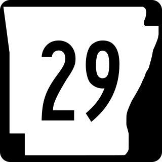
Arkansas Highway 29 is a designation for two state highways in South Arkansas. One segment of 67.6 miles (108.8 km) runs from the Louisiana state line north to Highway 19 north of Prescott. A second segment of 4.3 miles (6.9 km) runs from Highway 19 south of Antoine north to Highway 26 in Antoine.

Arkansas Highway 15 is a designation for three state highways in Arkansas. One segment of 21.2 miles (34.1 km) runs from the Louisiana state line north to U.S. Route 82 in El Dorado. A second segment of 18.12 miles (29.16 km) runs from US 79B west of Altheimer north to US 165 in England. A third segment of 16.33 miles (26.28 km) runs from US 165 in Keo north to Highway 89 in Furlow.
Three auxiliary routes of Arkansas Highway 25 currently exist. Two are spur routes, with one serving as a business route.
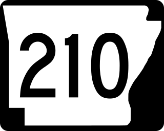
Arkansas Highway 210 is a designation for two east–west state highways in Cleburne County, Arkansas. One segment of 0.82 miles (1.32 km) runs in Heber Springs from Greers Ferry Lake east to Heber Springs Road as Case Ford Road. A second segment begins at Highway 110 and runs northeast as Industrial Park Rd.


