Rose Bud, Arkansas

Last updated

Rose Bud, Arkansas
Rose Bud High School in Rose Bud, Arkansas.jpg
Rose Bud, Arkansas town seal.png
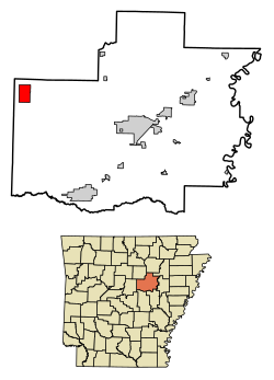
White County Arkansas Incorporated and Unincorporated areas Rose Bud Highlighted 0560770.svg
Location of Rose Bud in White County, Arkansas.
Coordinates: 35°19′30″N92°04′52″W / 35.32500°N 92.08111°W / 35.32500; -92.08111
Country United States
State Arkansas
County White
Area
[1]
  Total
6.07 sq mi (15.71 km2)
  Land6.04 sq mi (15.64 km2)
  Water0.03 sq mi (0.07 km2)
Elevation
[2]
745 ft (227 m)
Population
 (2020)
  Total
494
  Estimate 
(2024)
498 Increase2.svg
  Density81.80/sq mi (31.59/km2)
Time zone UTC-6 (Central (CST))
  Summer (DST) UTC-5 (CDT)
ZIP code
72137
Area code 501
FIPS code 05-60770
GNIS feature ID2407243 [2]

Rose Bud is a town in White County, Arkansas, United States. Rose Bud has its own school district with Pre-K through 12th grade.

Contents

Geography

According to the United States Census Bureau, the town has a total area of 15.2 km2 (5.9 mi2), of which 15.2 km2 (5.9 mi2) is land and 0.17% is water.

Rose Bud is the third largest town in the county by area. Composed of mainly wooded area and cattle land.

Demographics

Historical population
CensusPop.Note
1880 38
1970 157
1980 20228.7%
1990 156−22.8%
2000 429175.0%
2010 48212.4%
2020 4942.5%
2024 (est.)4980.8%
U.S. Decennial Census [3]

As of the 2010 census, the population was 482. The population density was 28.2/km2 (73.1/mi2). There were 191 housing units at an average density of 12.3/km2 (31.9/mi2). The population is racially composed of 89.7% White, 1.1% Hispanic, 0.8% Other, and 9.5% Two or More. There are about 105 boys for every 100 girls. Most of the population is between 50 and 54 years of age.

There were 191 households, out of which 12.9% had children under the age of 18 living with them, 29.5% were married couples living together, 4.1% had a female householder with no husband present, and 23.7% were non-families. 7.9% of all households were made up of individuals, and 7.9% had someone living alone who was 65 years of age or older. The average household size was 2.52 and the average family size was 3.02.

In the town, the population was spread out, with 22.6% under the age of 18, 17% from 18 to 24, 22.2% from 25 to 44, 28.4% from 45 to 64, and 16% who were 65 years of age or older. The median age was 41 years. For every 100 females, there were 105 males.

The median income for a household in the town was $34,732, and the median income for a family was $37,375. Males had a median income of $28,438 versus $27,750 for females. The per capita income for the town was $22,677. About 11.0% of families and 11.1% of the population were below the poverty line, including 23.3% of those under age 18 and 4.0% of those age 65 or over. [4] [5]

Arts and culture

The Darden-Gifford House was built in the late 1800s by J.W. Darden. it was added to the National Register of Historic Places in 1976. [6]

Education

Rose Bud School District headquarters Rose Bud School District Admin Building.jpg
Rose Bud School District headquarters

Public education from pre-kindergarten through grade 12 is provided by the Rose Bud School District, including Rose Bud High School and Rose Bud Elementary School.

Notable people

References

  1. "2020 U.S. Gazetteer Files". United States Census Bureau. Retrieved October 29, 2021.
  2. 1 2 U.S. Geological Survey Geographic Names Information System: Rose Bud, Arkansas
  3. "Census of Population and Housing". Census.gov. Retrieved June 4, 2015.
  4. suburbanstats.org. "Current Rose Bud, Arkansas Population, Demographics and stats in 2020, 2019". SuburbanStats.org. Retrieved April 5, 2020.
  5. "Rose Bud Population Demographics and Statistics | LiveStories". stories.livestories.com. Retrieved April 5, 2020.
  6. "Ghostly activity leads to paranormal investigation at historic Rose Bud home". Arkansas Online. October 26, 2014. Retrieved April 5, 2020.
  7. "Encyclopedia of Arkansas". Encyclopedia of Arkansas. Retrieved April 5, 2020.