Route information | ||||
---|---|---|---|---|
Maintained by TxDOT | ||||
Length | 188.4 mi [1] (303.2 km) | |||
Existed | April 4, 1917–present | |||
Major junctions | ||||
South end | ![]() | |||
![]() ![]() ![]() ![]() ![]() ![]() ![]() | ||||
North end | ![]() ![]() ![]() ![]() | |||
Location | ||||
Country | United States | |||
State | Texas | |||
Highway system | ||||
|
State Highway 19 (SH 19) is a state highway in Texas runs from Huntsville to Paris in east Texas.
SH 19 begins at an interchange with Interstate 45 in southeast Huntsville. The highway runs through the eastern edge of the town as an expressway running close to the Sam Houston National Forest. The expressway ends at an intersection with State Highway 30 and runs through rural areas before reaching the town of Trinity. SH 19 runs north towards Crockett where the highway begins a concurrency with US 287. The two highways leave each other just northwest of Palestine. SH 19 runs northwest to Athens, running around the town with US 175/State Highway 31. The highway next runs through Canton, where it intersects Interstate 20. SH 19 runs through more rural areas of East Texas until the highway comes to Emory. The highway turns more northeast before running through the western part of Sulphur Springs. State Highway 154 joins SH 19, before leaving just east of Cooper. State Highway 24 joins the highway, where the two highways run together before ending in Paris.
A widening project for SH 19 between Montalba, north of Palestine, and Athens began in 2013, providing passing lanes, left turn lanes, and a shoulder. The segment in Henderson County was completed in 2014, but the Anderson County portion was not completed until spring 2019.
SH 19 was one of the original 25 Texas state highways proposed on June 21, 1917, overlaid on top of the Paris-Houston Highway. [2] The original proposal was for it to run from the Texas/Oklahoma border north of Paris to Houston. On February 5, 1918, it was extended south to Freeport. [3] On August 21, 1923, SH 19 was pared back significantly, eliminating the section north of Grand Saline. On August 4, 1932, it had extended north to Alba. [4] On May 13, 1935, it was rerouted to end in Fruitvale. [5] On September 4, 1935, an eventual extension via Emory, Commerce, Ladonia, and Bonham to Oklahoma was proposed. [6] On August 1, 1936, the section from Canton to Grand Saline was restored as SH 19T. [7] SH 19T was cancelled when the rerouting of SH 19 from Canton to Fruitvale opened. On September 26, 1939, the sections south of Palestine which were cosigned with US 287 and US 75 were dropped. One section became part of SH 45 (now SH 30), and another was renumbered to SH 288. On April 15, 1940, SH 19 was extended north to Sulphur Springs, a modification of the much longer proposed extension that was not designated. On September 26, 1945, SH 19 was routed over FM 647 from 1 mile south of the Hopkins County line through Emory to Dunbar. On August 24, 1960, it was extended northward to its original starting point of Paris and again to the south to Huntsville, replacing a portion of SH 45. On May 21, 1979, SH 19 was extended over Loop 405 in Huntsville.
SH 19A was a spur route of SH 19 that was originally planned on February 18, 1919, splitting off at Angleton and traveling to Palacios. [8] On March 19, 1923, it was extended east to Galveston and west to Ganado, with the old route to Palacios being changed to SH 19B. [9] On August 21, 1923, the route had been renumbered as SH 58 (now SH 35). [10]
SH 19B was a spur route of SH 19 that was originally planned on March 19, 1923, from Midfield to Palacios replacing part of rerouted SH 19A. On August 21, 1923, the route had been renumbered as SH 59. [10]
County | Location | mi | km | Destinations | Notes |
---|---|---|---|---|---|
Walker | Huntsville | 0.0 | 0.0 | ![]() | Southern terminus; I-45 exit 113 |
1.4 | 2.3 | ![]() | Interchange | ||
1.6 | 2.6 | ![]() ![]() | No southbound access | ||
2.4 | 3.9 | ![]() | Interchange | ||
4.1 | 6.6 | ![]() | Interchange | ||
4.8 | 7.7 | ![]() | Interchange; north end of expressway | ||
6.0 | 9.7 | ![]() ![]() | |||
Riverside | 15.3 | 24.6 | ![]() ![]() | ||
15.8 | 25.4 | ![]() | |||
Trinity River | 16.3 | 26.2 | Unnamed bridge | ||
Trinity | | 19.3 | 31.1 | ![]() ![]() | |
Trinity | 20.5 | 33.0 | ![]() ![]() | ||
21.1 | 34.0 | ![]() ![]() | |||
21.7 | 34.9 | ![]() ![]() | |||
21.8 | 35.1 | ![]() ![]() ![]() ![]() | |||
Barnes Switch | 26.6 | 42.8 | ![]() ![]() | ||
Houston | Lovelady | 35.7 | 57.5 | ![]() ![]() ![]() | |
| 41.0 | 66.0 | ![]() ![]() | ||
Crockett | 48.2 | 77.6 | ![]() | ||
48.7 | 78.4 | ![]() ![]() | |||
49.7 | 80.0 | ![]() ![]() ![]() ![]() | South end of SH 7/SH 21 overlap | ||
49.76 | 80.08 | ![]() ![]() ![]() ![]() | North end of SH 7 overlap; south end of US 287 overlap | ||
49.82 | 80.18 | ![]() ![]() | North end of SH 21 overlap | ||
51.2 | 82.4 | ![]() | |||
| 53.0 | 85.3 | ![]() ![]() | ||
Latexo | 55.5 | 89.3 | ![]() ![]() | ||
Grapeland | 61.6 | 99.1 | ![]() ![]() ![]() | ||
62.2 | 100.1 | ![]() | |||
63.1 | 101.5 | ![]() | |||
63.5 | 102.2 | ![]() | |||
| 64.4 | 103.6 | ![]() ![]() ![]() | ||
Anderson | | 72.8 | 117.2 | ![]() ![]() | South end of SH 294 overlap |
Elkhart | 73.3 | 118.0 | ![]() ![]() | ||
73.7 | 118.6 | ![]() ![]() | North end of SH 294 overlap | ||
| 79.3 | 127.6 | ![]() ![]() | ||
Palestine | 81.6 | 131.3 | ![]() | ||
83.4 | 134.2 | ![]() ![]() | South end of US 84 overlap | ||
83.7 | 134.7 | ![]() ![]() ![]() ![]() | North end of US 84/ US 287 overlap | ||
83.9 | 135.0 | ![]() | |||
84.4 | 135.8 | ![]() ![]() | South end of US 79 overlap | ||
84.5 | 136.0 | ![]() ![]() | |||
85.7 | 137.9 | ![]() ![]() ![]() ![]() | North end of US 79 overlap; south end of US 287 overlap | ||
86.4 | 139.0 | ![]() | Interchange | ||
| 88.3 | 142.1 | ![]() ![]() ![]() | North end of US 287 overlap; access to Palestine Municipal Airport | |
Montalba | 95.1 | 153.0 | ![]() | ||
| 96.8 | 155.8 | ![]() ![]() | ||
Bois d'Arc | 100.9 | 162.4 | ![]() ![]() | ||
Bradford | 103.2 | 166.1 | ![]() | ||
Henderson | Athens | 115.7 | 186.2 | ![]() ![]() | |
115.8 | 186.4 | ![]() ![]() | |||
116.5 | 187.5 | ![]() ![]() ![]() ![]() ![]() | Interchange; south end of Loop 7 overlap | ||
118.9 | 191.4 | ![]() ![]() ![]() ![]() ![]() | Interchange; south end of US 175 overlap | ||
120.3 | 193.6 | ![]() | Interchange | ||
121.7 | 195.9 | ![]() ![]() ![]() ![]() ![]() | Interchange; south end of SH 31 overlap | ||
122.4 | 197.0 | ![]() | |||
124.1 | 199.7 | ![]() ![]() ![]() ![]() ![]() | Interchange; north end of US 175/SH 31/Loop 7 overlap | ||
| 127.1 | 204.5 | ![]() ![]() | ||
| 129.6 | 208.6 | ![]() ![]() | ||
Van Zandt | | 133.3 | 214.5 | ![]() | |
| 135.9 | 218.7 | ![]() ![]() ![]() ![]() | ||
| 137.3 | 221.0 | ![]() ![]() | ||
| 142.4 | 229.2 | ![]() ![]() | ||
| 145.2 | 233.7 | ![]() ![]() | ||
Canton | 146.1 | 235.1 | ![]() | ||
146.9 | 236.4 | ![]() | |||
148.4 | 238.8 | ![]() | I-20 exit 527. | ||
| 156.0 | 251.1 | ![]() | ||
| 161.2 | 259.4 | ![]() ![]() | ||
Sabine River | 161.8 | 260.4 | Unnamed bridge | ||
Rains | | 165.3 | 266.0 | ![]() ![]() | |
Emory | 167.9 | 270.2 | ![]() ![]() | ||
168.0 | 270.4 | ![]() | |||
168.1 | 270.5 | ![]() | |||
168.6 | 271.3 | ![]() ![]() | |||
| 173.9 | 279.9 | ![]() ![]() | South end of FM 514 overlap | |
| 174.4 | 280.7 | ![]() ![]() | North end of FM 514 overlap | |
Hopkins | | 179.0 | 288.1 | ![]() ![]() | South end of FM 1567 overlap |
| 179.3 | 288.6 | ![]() ![]() | North end of FM 1567 overlap | |
Sulphur Springs | 186.3 | 299.8 | ![]() ![]() | South end of SH 11 overlap | |
186.9 | 300.8 | ![]() | I-30 exit 122. | ||
187.8 | 302.2 | ![]() ![]() ![]() ![]() | |||
188.4 | 303.2 | ![]() ![]() | North end of SH 11 overlap | ||
189.9 | 305.6 | ![]() ![]() | Access to CHRISTUS Mother Frances Hospital - Sulphur Springs | ||
191.6 | 308.4 | ![]() ![]() ![]() ![]() | South end of SH 154 overlap | ||
| 193.1 | 310.8 | ![]() ![]() | ||
| 198.4 | 319.3 | ![]() | ||
Tira | 202.0 | 325.1 | ![]() ![]() | ||
South Sulphur River | 204.3 | 328.8 | Unnamed bridge | ||
Delta | | 205.2 | 330.2 | ![]() ![]() | North end of SH 154 overlap |
| 206.6 | 332.5 | ![]() ![]() | ||
| 207.8 | 334.4 | ![]() ![]() | ||
| 211.0 | 339.6 | ![]() ![]() | South end of SH 24 overlap | |
| 211.6 | 340.5 | ![]() | ||
| 212.2 | 341.5 | ![]() ![]() | ||
North Sulphur River | 213.3 | 343.3 | Unnamed bridge | ||
Lamar | | 215.6 | 347.0 | ![]() | |
| 219.1 | 352.6 | ![]() ![]() | ||
Paris | 223.4 | 359.5 | ![]() ![]() ![]() ![]() ![]() ![]() | Interchange; access to Paris Regional Medical Center | |
224.0 | 360.5 | ![]() ![]() | |||
224.4 | 361.1 | ![]() ![]() | |||
225.7 | 363.2 | ![]() ![]() ![]() ![]() ![]() ![]() ![]() ![]() ![]() ![]() ![]() | Northern terminus of SH 19/SH 24 | ||
1.000 mi = 1.609 km; 1.000 km = 0.621 mi
|
SH 19 has one business route.
Location | Athens |
---|---|
Length | 4.186 mi [11] (6.737 km) |
Existed | 2010–present |
Business State Highway 19-J (Bus. SH 19-J) is a 4.186 mi (6.737 km) long business route through Athens. The route was designated on May 27, 2004 after SH 19 proper was re-routed east onto the Jed Robinson Loop, also designated as US 175, SH 31 and Loop 7 (formerly FM 317). [11] Bus. SH 19-J begins at an interchange with the Jed Robinson Loop and SH 19, north of downtown Athens, heading south on North Palestine Street, while SH 19 heads east along the loop around the city. Bus. SH 19-J continues south through the town square, which is the location of the Henderson County Courthouse and also comprises the junction with Bus. SH 31-H (Tyler Street) and Bus. US 175-G (Corsicana Street). For a short distance, the business route is paralleled by FM 2494, which takes South Praireville Street, before cutting east, away from Bus. SH 19-J on Lakeside Drive. The business route curves southeast, still following Palestine Street, past the northern terminus of FM 59 at West Cayuga Drive, before reaching its southern terminus at the Jim Robinson Loop, where SH 19 splits from Loop 7 and serves as a continuation of the route. [12]
The entire route is in Athens, Henderson County.
mi | km | Destinations | Notes | ||
---|---|---|---|---|---|
0.000 | 0.000 | ![]() ![]() ![]() ![]() ![]() | Southern terminus; road continues south as SH 19 | ||
1.471 | 2.367 | ![]() ![]() | Northern terminus of FM 39 | ||
2.582 | 4.155 | ![]() ![]() | |||
2.658 | 4.278 | ![]() ![]() | |||
4.186 | 6.737 | ![]() ![]() ![]() ![]() ![]() ![]() ![]() | Northern terminus; road continues north as SH 19 | ||
1.000 mi = 1.609 km; 1.000 km = 0.621 mi |
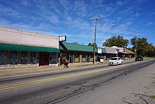
State Highway 30 runs from Business SH 6-R in College Station via Roans Prairie to SH 19 in Huntsville. It is known as Harvey Road between Business SH 6-R and FM 158 in College Station, as 11th Street between I-45 and US 190 in Huntsville, and as Riverside Drive east of US 190 in Huntsville.
State Highway 47 (SH 47) runs from FM 60 near Easterwood Airport and the West Campus of Texas A&M University in College Station to SH 21 at Texas A&M University-Riverside near Bryan. This highway was designated on January 28, 1987. Designed primarily to provide a shorter route between SH 21 west of Bryan and the Texas A&M main campus in College Station, SH 47 was completed in August 1996.
State Highway 8 is a north–south state highway in the U.S. state of Texas that runs from the Red River, which serves as the boundary between Texas and Arkansas, north of New Boston to SH 155 at Linden.
State Highway 11 is a highway that runs from US 59 in Linden to SH 56 in Sherman in northeast Texas.
State Highway 12 (SH 12) is a west–east state highway in the U.S. state of Texas that runs from Interstate 10 (I-10) in Vidor to the Louisiana state line at Deweyville. The route was designated on August 27, 1959, as a renumbering of SH 235 to match the numbering of Louisiana Highway 12 (LA 12), with which it connects.
State Highway 15 is a state highway in the U.S. state of Texas. It runs from the Oklahoma state line 6 miles (9.7 km) east of Follett to US 287 in Stratford.
State Highway 18 is a state highway in the U.S. state of Texas maintained by the Texas Department of Transportation (TxDOT) that runs from Fort Stockton in western Texas to the New Mexico state line between Kermit and Jal, New Mexico. This route was designated in 1958 over the northern half of what was previously SH 82.
State Highway 21 runs from the Texas-Louisiana boundary east of San Augustine to San Marcos in east and central Texas. SH 21 mostly follows the alignment of the Old San Antonio Road and the El Camino Real, except for the portion between Midway and Bryan, where the Old San Antonio Road took a more northerly route, and SH 21 follows a more direct route. That section of the Old San Antonio Road is served by Texas State Highway OSR.
State Highway 24 runs from Campbell to Paris in north Texas. It is a portion of the main route, along with Interstate 30, from Paris to the Dallas–Fort Worth metroplex.
State Highway 114 is a state highway that runs from the Dallas-Fort Worth Metroplex westward across Texas to the New Mexico state line, where it becomes New Mexico State Road 114, which eventually ends at Elida, New Mexico at US 70 / NM 330.
State Highway 78 is a state highway that follows surface roads in a predominantly southwest-to-northeast direction in the Dallas area before traveling 90 miles (145 km) north-northeast to the Oklahoma State border.
State Highway 29 runs from 3.0 miles (4.8 km) south of Menard, Texas, east to SH 95 in Circleville via Mason, Llano, Burnet, Liberty Hill, and Georgetown in central Texas, United States.
State Highway 64 is a Texas state highway that runs from Wills Point via Tyler to Henderson.
State Highway 33 is a route that runs from U.S. Highways 60 and 83 south of Canadian and travels east to the Oklahoma state line, where it becomes State Highway 33.
State Highway 36 runs from Freeport to Abilene. It was designated as the 36th Division Memorial Highway between Cameron and Sealy by the Texas Legislature in 1985.
State Highway 37 is a state highway that runs from the Oklahoma state line near Albion to Mineola in the northeast corner of the state.
State Highway 43 is a Texas state highway that runs from Henderson to Atlanta.
State Highway 44 (SH 44) is a Texas state highway that runs from west of Encinal to Corpus Christi, Texas. This highway is also known as the Cesar Chavez Memorial Highway outside the city limits of Robstown, Banquete, Agua Dulce, Alice, and Corpus Christi in Nueces and Jim Hogg counties.
State Highway 111 is a state highway that runs from Gonzales to Midfield in the southeastern region of the U.S. state of Texas.
State Highway 173 (SH 173) is a state highway that runs for 97.9 miles (157.6 km) from Jourdanton to Kerrville in south Texas, traversing through the Texas Hill Country.
Media related to Texas State Highway 19 at Wikimedia Commons