
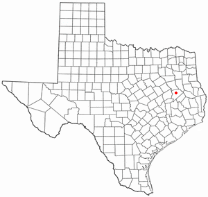
Houston County is a county located in the U.S. state of Texas. As of the 2020 census, its population was 22,066. Its county seat is Crockett. Houston County was one of 46 entirely dry counties in the state of Texas, until voters in a November 2007 special election legalized the sale of alcohol in the county.

Roby is a city in and the county seat of Fisher County, Texas, United States. The population was 591 at the 2020 census.
Kountze is a city in and the county seat of Hardin County, Texas, United States. The population was 1,981 at the 2020 census. The city is part of the Beaumont–Port Arthur Metropolitan Statistical Area.

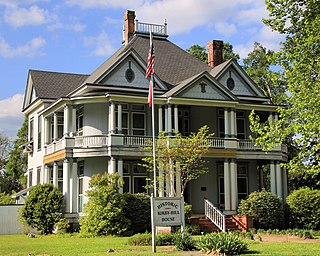
Crockett is a city and the county seat of Houston County, Texas, United States. As of the 2020 census, the city population was 6,332. Houston County is the oldest county and Crockett the fifth-oldest city in Texas.

Kennard is a city in Houston County, Texas, United States. Its population was 272 at the 2020 census. The main street is Texas State Highway 7.
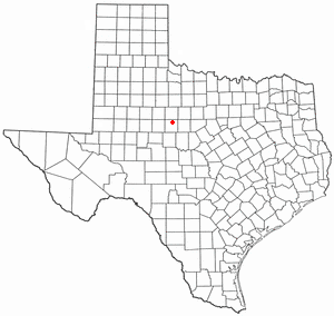
Latexo is a city in Houston County, Texas, United States. Its population was 232 at the 2020 census.

Lovelady is a town in Houston County, Texas, United States. The population was 570 at the 2020 census.

Buffalo is a city in Leon County, Texas, United States. The population was 1,767 at the 2020 census.

Liberty is a city in the U.S. state of Texas, within Liberty County. The population was 8,279 at the 2020 census. It serves as the seat of Liberty County.

Brady is a city in McCulloch County, Texas, United States. Brady refers to itself as the "Heart of Texas", as it is the city closest to the geographical center of the state, which is about 15 miles northeast of Brady. Its population was 5,118 at the 2020 census. It is the county seat of McCulloch County.
Bishop is a city in Nueces County, Texas, United States. The population was 3,174 as of the 2020 census, up from 3,134 in the 2010 census.

Strawn is a city in Palo Pinto County, Texas, United States. The population was 540 at the 2020 census. Strawn, on State Highway 16 and 108, Farm to Market Road 2372, and the Missouri Pacific Railroad in southwestern Palo Pinto County, was one of several towns developed about 1880 when the Texas and Pacific Railway began service. The site, known earlier as North Fork for its location on Palo Pinto Creek, was laid out on the land of two early ranchers, Stephen Bethel Strawn and James N. Stuart. Stuart built the area's first house in 1875. A community to the west, Russell's Pocket, and one to the east, Davidsonville, were merged to form Strawn.

Friona is a city in Parmer County, Texas, United States. The population was 4,171 at the 2020 census. Friona was established as a small community in 1898 by XIT Ranch, originally called Frio, which is also the word for "cold" in Spanish.
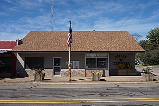
Emory is a city in Rains County, Texas, United States. The population was 1,239 at the 2010 census. It is the county seat of Rains County. Previously known as Springville, the city and county are named after Emory Rains, who was a legislator from the area. Rains was the author of the Homestead Law of Texas, which was later used as a model for the protection of homesteads throughout the United States. Special legislation passed to create Rains County called for the citizens to vote on the location of the county seat and for that selected town to be named Emory.
San Saba is a city located in, and the county seat of, San Saba County, Texas, United States. It was settled in 1854 and named for its location on the San Saba River and for Sabbas the Sanctified. Its population was 3,099 at the 2010 census.
Tye is a city in Taylor County, Texas, United States. The population was 1,176 at the 2020 census. It is part of the Abilene, Texas Metropolitan Statistical Area.

Woodville is a town in and the county seat of Tyler County, Texas, United States. The town is intersected by three U.S. Numbered Highways: U.S. Route 69, U.S. Route 190, and U.S. Route 287. The population was 2,403 at the 2020 census. It is the county seat of Tyler County. The town was named after George Tyler Wood, governor of Texas from 1847 to 1849.

Liberty Hill is a city in Williamson County, Texas, United States. The population was 3,646 at the 2020 census, and according to 2023 census estimates, the city is estimated to have a population of 10,428. Liberty Hill is part of the Greater Austin metropolitan area.

Bartlett is a city in Bell and Williamson counties in the U.S. state of Texas. The population was 1,633 at the 2020 census.

Ackerly is a city in Dawson and Martin Counties in the U.S. state of Texas. As of the 2020 Census, the population was 264. The Martin county portion of Ackerly is part of the Midland-Odessa metropolitan area.


