Cumby, Texas

Last updated

Cumby, Texas
Cumby November 2015 4 (Main Street).jpg
Main Street in Cumby
TXMap-doton-Cumby.PNG
Location of Cumby, Texas
Hopkins County Cumby.svg
Coordinates: 33°8′7″N95°50′25″W / 33.13528°N 95.84028°W / 33.13528; -95.84028
Country United States
State Texas
County Hopkins
Area
[1]
  Total0.96 sq mi (2.49 km2)
  Land0.96 sq mi (2.49 km2)
  Water0.00 sq mi (0.00 km2)
Elevation
[2]
646 ft (197 m)
Population
 (2010)
  Total777
  Estimate 
(2019) [3]
798
  Density830.39/sq mi (320.67/km2)
Time zone UTC-6 (Central (CST))
  Summer (DST) UTC-5 (CDT)
ZIP code
75433
Area code 903
FIPS code 48-18128 [4]
GNIS feature ID1333809 [2]
Website cumbytx.com

Cumby is a city in Hopkins County, Texas, United States. The population was 777 at the 2010 census, [5] up from 616 at the 2000 census. In 2020, its population was 679. [6]

Contents

History

Originally known as Black Jack Grove as early as 1848, from 1857 to 1858 the post office was renamed to Theodocias. It was renamed again to Black Jack Grove before being renamed a final time to Cumby in 1896. It was named for Confederate army veteran Robert H. Cumby (1825-1881).

Geography

Cumby is located in western Hopkins County at 33°8′7″N95°50′25″W / 33.13528°N 95.84028°W / 33.13528; -95.84028 (33.135235, –95.840141). [7] Interstate 30 runs through the south side of the city, with access from Exit 110. I-30 leads east 14 miles (23 km) to Sulphur Springs, the Hopkins county seat, and west 65 miles (105 km) to downtown Dallas.

According to the United States Census Bureau, the city has a total area of 1.0 square mile (2.6 km2), of which 0.004 square miles (0.01 km2), or 0.50%, are water. [5] The city sits on a watershed divide, with the north side draining towards the South Sulphur River, part of the Red River watershed, and the south side of the city draining towards Lake Fork Creek, part of the Sabine River watershed.

Climate

Cumby is part of the humid subtropical climate region.

Demographics

Historical population
CensusPop.Note
1920 945
1930 646−31.6%
1940 642−0.6%
1950 504−21.5%
1960 447−11.3%
1970 62840.5%
1980 6473.0%
1990 571−11.7%
2000 6167.9%
2010 77726.1%
2019 (est.)798 [3] 2.7%
U.S. Decennial Census [8]
Cumby racial composition as of 2020 [6]
(NH = Non-Hispanic) [lower-alpha 1]
RaceNumberPercentage
White (NH)60488.95%
Black or African American (NH)50.74%
Native American or Alaska Native (NH)111.62%
Asian (NH)10.15%
Mixed/Multi-Racial (NH)263.83%
Hispanic or Latino 324.71%
Total679

According to the 2020 United States census, there were 679 people, 321 households, and 222 families residing in the city. At the census [4] of 2000, there were 616 people, 262 households, and 178 families residing in the city. The population density was 708.1 inhabitants per square mile (273.4/km2). There were 292 housing units at an average density of 335.6 per square mile (129.6/km2). The racial makeup of the city was 97.56% White, 0.65% Native American, 0.97% from other races, and 0.81% from two or more races. Hispanic or Latino of any race were 2.60% of the population.

There were 262 households, out of which 26.7% had children under the age of 18 living with them, 52.7% were married couples living together, 10.3% had a female householder with no husband present, and 31.7% were non-families. 27.5% of all households were made up of individuals, and 16.4% had someone living alone who was 65 years of age or older. The average household size was 2.35 and the average family size was 2.87.

In the city, the population was spread out, with 22.9% under the age of 18, 7.6% from 18 to 24, 29.2% from 25 to 44, 21.6% from 45 to 64, and 18.7% who were 65 years of age or older. The median age was 39 years. For every 100 females, there were 98.1 males. For every 100 females age 18 and over, there were 91.5 males.

The median income for a household in the city was $30,547, and the median income for a family was $34,091. Males had a median income of $25,833 versus $19,643 for females. The per capita income for the city was $15,228. About 7.0% of families and 11.9% of the population were below the poverty line, including 9.6% of those under age 18 and 15.9% of those age 65 or over.

Education

The city is served by the Cumby Independent School District.

Related Research Articles

<span class="mw-page-title-main">Tallapoosa County, Alabama</span> County in Alabama, United States

Tallapoosa County is located in the east-central portion of the U.S. state of Alabama. As of the 2020 census, the population was 41,311. Its county seat is Dadeville. Its largest city is Alexander City.

<span class="mw-page-title-main">Hunt County, Texas</span> County in Texas, United States

Hunt County is a county in the U.S. state of Texas. As of the 2020 census, its population was 99,956. Its county seat is Greenville. The county is named for Memucan Hunt, Jr., the first Republic of Texas Minister to the United States from 1837 to 1838 and the third Texas Secretary of the Navy from 1838 to 1839. Hunt County is located on the eastern edge of the Dallas/Fort Worth Metroplex and the western edge of East Texas. Hunt County is part of the Dallas-Fort Worth-Arlington metropolitan statistical area.

<span class="mw-page-title-main">Hopkins County, Texas</span> County in Texas, United States

Hopkins County is a county located in the U.S. state of Texas. As of the 2020 census, its population was 36,787. Its county seat is Sulphur Springs. Hopkins County is named for the family of David Hopkins, an early settler in the area. Hopkins County comprises the Sulphur Springs, TX Micropolitan Statistical Area. Hopkins County was once known as the Dairy Capital of Texas. Although dairy farms declined in the area in the late 1990s there are still a number of these located there. The Southwest Dairy Museum is located in Sulphur Springs.

<span class="mw-page-title-main">Fruitland, Idaho</span> City in Payette County, Idaho, United States

Fruitland is a city along the Snake and Payette rivers in Payette County, Idaho, United States. It lies along U.S. Route 95 in the Treasure Valley of southwest Idaho, about 50 miles (80 km) west of Boise on the border with Oregon. It is part of the Ontario Micropolitan Area. Fruitland is named after apple orchards that surround the community, and its slogan is "The Big Apple of Idaho."

<span class="mw-page-title-main">Galatia, Illinois</span> Village in Illinois, United States

Galatia is a village in Saline County, Illinois, in the United States. As of the 2010 census, the village population was 933.

<span class="mw-page-title-main">Princeton, Kansas</span> City in Franklin County, Kansas

Princeton is a city in Franklin County, Kansas, United States. As of the 2020 census, the population of the city was 248.

<span class="mw-page-title-main">Ozawkie, Kansas</span> City in Kansas, United States

Ozawkie is a city in Jefferson County, Kansas, United States. As of the 2020 census, the population of the city was 638. Located adjacent to Perry Lake, Ozawkie formerly existed in a different location but was relocated without the aid of government funding prior to the reservoir's construction.

<span class="mw-page-title-main">Lyndon, Kansas</span> City in Osage County, Kansas

Lyndon is a city in, and the county seat of Osage County, Kansas, United States. As of the 2020 census, the population of the city was 1,037.

<span class="mw-page-title-main">Bonita, Louisiana</span> Village in Louisiana, United States

Bonita is a village in Morehouse Parish, Louisiana, United States. The population was 170 at the 2020 census, down from 284 in 2010.

<span class="mw-page-title-main">Effie, Minnesota</span> City in Minnesota, United States

Effie( EF-ee) is a city in Itasca County, Minnesota, United States. The population was 123 at the 2010 census.

<span class="mw-page-title-main">Mountain Top, Pennsylvania</span> Census-designated place in Pennsylvania, United States

Mountain Top is an unincorporated area and census-designated place (CDP) in Luzerne County, Pennsylvania, United States. As of the 2010 census, its population was 10,982.

<span class="mw-page-title-main">South Congaree, South Carolina</span> Town in South Carolina, United States

South Congaree is a town in Lexington County, South Carolina, United States. The population was 2,306 at the 2010 census. It is part of the Columbia, South Carolina Metropolitan Statistical Area.

<span class="mw-page-title-main">Lovelady, Texas</span> City in Texas, United States

Lovelady is a town in Houston County, Texas, United States. The population was 570 at the 2020 census.

<span class="mw-page-title-main">Mertzon, Texas</span> City in Texas, United States

Mertzon is a city in and the county seat of Irion County, Texas, United States. Its population was 781 according to the 2010 census. It is part of the San Angelo, Texas, metropolitan statistical area.

<span class="mw-page-title-main">North Cleveland, Texas</span> Community in Texas, United States

North Cleveland is a city within the Houston–The Woodlands–Sugar Land metropolitan area and Liberty County, Texas, United States. The population was 247 at the 2010 census.

<span class="mw-page-title-main">Cushing, Texas</span> City in Texas, United States

Cushing is a city in Nacogdoches County, Texas, United States. The population was 612 at the 2010 census.

<span class="mw-page-title-main">Coldspring, Texas</span> City in Texas, United States

Coldspring is a city in San Jacinto County, Texas, United States. It is the county seat of San Jacinto County which is named after the river that traverses it and shares its name with the battle which gave Texas its independence. The population was 819 at the 2020 census.

<span class="mw-page-title-main">Lawn, Texas</span> Town in Texas, United States

Lawn is a town in Taylor County, Texas, United States. As of the 2010 census, the town population was 314. It is part of the Abilene, Texas Metropolitan Statistical Area.

<span class="mw-page-title-main">Marathon, Wisconsin</span> Town in Wisconsin, United States

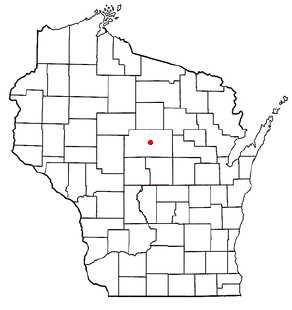
Marathon is a town in Marathon County, Wisconsin, United States. It is part of the Wausau, Wisconsin Metropolitan Statistical Area. The population was 1,048 at the 2010 census. The village of Marathon City was incorporated from a part of the town's original area.

<span class="mw-page-title-main">Winnsboro, Texas</span> City in Texas, United States

Winnsboro is a city in Franklin and Wood counties in northeastern Texas, United States, north of Tyler. The population was 3,434 at the 2010 census, down from 3,584 at the 2000 census. Settlement of Winnsboro began in the 1850s with a post office established between 1854 and 1855.

References

  1. "2019 U.S. Gazetteer Files". United States Census Bureau. Retrieved August 7, 2020.
  2. 1 2 U.S. Geological Survey Geographic Names Information System: Cumby, Texas
  3. 1 2 "Population and Housing Unit Estimates". United States Census Bureau. May 24, 2020. Retrieved May 27, 2020.
  4. 1 2 "U.S. Census website". United States Census Bureau . Retrieved January 31, 2008.
  5. 1 2 "Geographic Identifiers: 2010 Census Summary File 1 (G001): Cumby city, Texas". American Factfinder. U.S. Census Bureau. Archived from the original on February 13, 2020. Retrieved March 14, 2018.
  6. 1 2 "Explore Census Data". data.census.gov. Retrieved May 22, 2022.
  7. "US Gazetteer files: 2010, 2000, and 1990". United States Census Bureau. February 12, 2011. Retrieved April 23, 2011.
  8. "Census of Population and Housing". Census.gov. Retrieved June 4, 2015.
  9. "About the Hispanic Population and its Origin". www.census.gov. Retrieved May 18, 2022.
  1. Note: the US Census treats Hispanic/Latino as an ethnic category. This table excludes Latinos from the racial categories and assigns them to a separate category. Hispanics/Latinos can be of any race. [9]