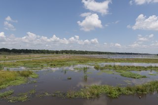
Lake Kickapoo is a reservoir located on the North Fork Little Wichita River in the Red River Basin of Archer County, Texas. It is neighbored by Archer City, Texas and Wichita Falls, Texas which reside within the Central Great Plains ecoregion.

Rowlett is a city in Dallas and Rockwall Counties in Texas, United States, and an eastern suburb of Dallas. It is a growing, upscale community with nearly $1.5 billion in development in the Dallas–Fort Worth metroplex, located on Lake Ray Hubbard.

The Trinity River is a 710-mile (1,140 km) river, the longest with a watershed entirely within the U.S. state of Texas. It rises in extreme northern Texas, a few miles south of the Red River. The headwaters are separated by the high bluffs on the southern side of the Red River.

Lake Houston is a reservoir on the San Jacinto River, 15 miles (24 km) northeast of downtown Houston, Texas, United States. The reservoir is the primary municipal water supply for the city of Houston.
Somerville Lake is a U.S. Army Corps of Engineers reservoir on Yegua Creek in the Brazos River basin, 10 miles (16 km) northwest of Brenham, Texas, United States. The town of Somerville in Burleson County is adjacent to the reservoir. The lake extends into portions of Burleson County, Washington County, and Lee County. The dam lies in Washington County. The dam and lake are managed by the Fort Worth District of the U.S. Army Corps of Engineers. The reservoir was officially impounded in 1967, and serves to provide flood control and water for irrigation for the communities downstream. Somerville Lake is a popular recreational destination.
Lake Fork Reservoir is a reservoir located in Wood, Rains, and Hopkins counties in the state of Texas, between the towns of Quitman, Alba, Emory, and Yantis, Texas.
The President George Bush Turnpike (PGBT) is a 52-mile (84 km) controlled-access toll road running through the northern, northeastern and western suburbs, forming a partial beltway around Dallas, Texas, United States. It is named for the late George H. W. Bush, the 41st president of the United States. At its west end near Belt Line Road in Irving, State Highway 161 continues southwest to I-20 in Grand Prairie. The discontinuous free frontage roads along the turnpike from I-35E in Carrollton east to its end at I-30 in Garland are assigned the State Highway 190 designation. SH 190 signage appears only along the Rowlett, Garland, Richardson, Plano, and Carrollton sections of the frontage road with the undersign "frontage road only". At intersections with city streets, only the Bush Turnpike signs are displayed, not the SH 190 signage. Prior to the construction of the main lanes as a tollway, SH 190 was used as the name of the planned main lanes too. Similarly, the part west of I-35E was planned as part of SH 161. Bush Turnpike is signed as a north–south road from I-20 to I-35E, an east–west road from I-35E to the Merritt Main Lane Gantry and as a north–south road from the Merritt Main Lane Gantry to I-30, as Bush Turnpike makes a nearly 90-degree curve in both places.

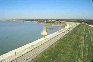
Joe Pool Lake is a fresh water impoundment (reservoir) located in the southern part of the Dallas/Fort Worth Metroplex in North Texas. The lake encompasses parts of Tarrant, Dallas and Ellis counties. The lake measures 7,740 acres (31.3 km2) with a conservation storage capacity of 176,900 acre-feet (218,200,000 m3). With a maximum depth of 75 feet (23 m) the lake drains an area of 232 square miles (601 km2).

Jim Chapman Lake is a 19,305-acre (78.12 km2) impoundment operated by the Army Corps of Engineers and is located 75 miles (121 km) east of the Dallas/Fort Worth Metroplex in the state of Texas.

Choke Canyon Reservoir is a reservoir in South Texas, United States. The lake and the dam that creates it are owned by the United States Bureau of Reclamation and managed by the City of Corpus Christi.

Brady Creek Reservoir is a reservoir on Brady Creek in McCulloch County, Texas in the United States. The lake is about 3 miles west of downtown Brady, Texas. The dam and lake are managed by the City of Brady. The reservoir was officially impounded in 1963. The reservoir is also sometimes called Brady Reservoir or Brady Lake. The dam for Brady Creek Reservoir is 8,400 ft. long and 104 ft. high and has a storage capacity of 30,430 acre-Ft.
Averhoff Reservoir is a 173-acre narrow, riverine-type reservoir located on the Nueces River 10 mi (16 km) north of the town of Crystal City in Zavala County, Texas, United States, and 100 miles from San Antonio, Texas.

Lake Granbury is a North Texas reservoir near Granbury, Texas. It was created in 1969 and is one of three lakes damming the Brazos River.

Cedar Creek Reservoir is a reservoir located in Henderson and Kaufman Counties, Texas (USA), 50 miles (80 km) southeast of Dallas. It is built on Cedar Creek, which flows into the Trinity River. Floodwaters are discharged through a gated spillway into a discharge channel that connects to the Trinity River.

Lake Pat Cleburne is the municipal water reservoir for the city of Cleburne, Texas, as well as a recreational lake for residents. It is formed by damming the Nolan River which continues below the lake's dam. The water is murky due to sediment. U.S. Highway 67 crosses over the extreme north end of the lake lending a panoramic view of the complete lake.
Grapevine Lake is a reservoir in North Texas about 20 mi (32 km) northwest of Dallas and northeast of Fort Worth. It was impounded in 1952 by the U.S. Army Corps of Engineers when they dammed Denton Creek, a tributary of Trinity River.

Aquilla Lake is an artificial lake (reservoir) in Hill County, Texas, USA. The dam was constructed by the U.S. Army Corps of Engineers. The dam is part of the overall flood control project in the Brazos River basin. The lake is located approximately 23 miles (37 km) north of Waco, Texas, and directly north of the town of Aquilla.
Alvarado Park Lake is a reservoir in Johnson County, Texas 2 miles (3.2 km) southwest of Alvarado, Texas. The county-owned reservoir was built in 1966 by Jack P. McKinney for floodwater retention, municipal water storage, and recreation. It is controlled by the City of Alvarado.
Richland-Chambers Reservoir is the third largest inland reservoir by surface area and the 8th largest reservoir by water volume in Texas formed by the impoundment of Richland Creek and Chambers Creek east-southeast of the town of Corsicana and south of Kerens, in Navarro County and Freestone County, Texas, USA. It has 330 miles (530 km) of shoreline and is Y-shaped with the dam on the eastern end of the lake.
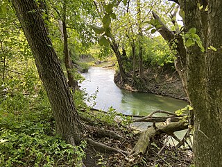
Rowlett Creek is a creek that flows through Collin, Dallas and Rockwall Counties in Texas.

