Brackish water, sometimes termed brack water, is water occurring in a natural environment that has more salinity than freshwater, but not as much as seawater. It may result from mixing seawater and fresh water together, as in estuaries, or it may occur in brackish fossil aquifers. The word comes from the Middle Dutch root brak. Certain human activities can produce brackish water, in particular civil engineering projects such as dikes and the flooding of coastal marshland to produce brackish water pools for freshwater prawn farming. Brackish water is also the primary waste product of the salinity gradient power process. Because brackish water is hostile to the growth of most terrestrial plant species, without appropriate management it is damaging to the environment.

An estuary is a partially enclosed coastal body of brackish water with one or more rivers or streams flowing into it, and with a free connection to the open sea. Estuaries form a transition zone between river environments and maritime environments and are an example of an ecotone. Estuaries are subject both to marine influences such as tides, waves, and the influx of saline water, and to fluvial influences such as flows of freshwater and sediment. The mixing of seawater and freshwater provides high levels of nutrients both in the water column and in sediment, making estuaries among the most productive natural habitats in the world.

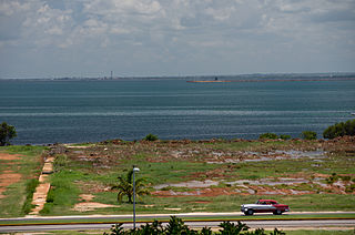
Villa Clara is one of the provinces of Cuba. It is located in the central region of the island bordering on the Atlantic Ocean to the north, Matanzas Province to the west, Sancti Spiritus Province to the east, and Cienfuegos Province to the South. Villa Clara shares with Cienfuegos and Sancti Spiritus on the south the Escambray Mountain Range. Its main cities are Santa Clara, Remedios, Sagua La Grande, Camajuani, Caibarién, Ranchuelo, Placetas, and Manicaragua.

Biscayne Bay is a lagoon with characteristics of an estuary located on the Atlantic coast of South Florida. The northern end of the lagoon is surrounded by the densely developed heart of the Miami metropolitan area while the southern end is largely undeveloped with a large portion of the lagoon included in Biscayne National Park.

Florida Bay is the bay located between the southern end of the Florida mainland and the Florida Keys in the United States. It is a large, shallow estuary that while connected to the Gulf of Mexico, has limited exchange of water due to various shallow mudbanks covered with seagrass. The banks separate the bay into basins, each with its own unique physical characteristics.

The Labrador Sea is an arm of the North Atlantic Ocean between the Labrador Peninsula and Greenland. The sea is flanked by continental shelves to the southwest, northwest, and northeast. It connects to the north with Baffin Bay through the Davis Strait. It is a marginal sea of the Atlantic.

The Cayos Cochinos or Cochinos Cays consist of two small islands and 13 smaller coral cays situated 30 kilometres (19 mi) northeast of La Ceiba on the northern shores of Honduras. Although geographically separate, they belong to the Bay Islands department and are part of the Roatán municipality. The population numbered 108 at the 2001 census. The total land area measures about 2 km2 (0.8 sq mi).

Baffin Bay is a bay in South Texas, an inlet of the larger Laguna Madre. Located near the Gulf of Mexico, Baffin Bay forms part of the boundary between Kenedy County and Kleberg County.

Cayo Coco (Cays) or is an island on the north coast of central Cuba, known for its all-inclusive resorts. It lies within the Ciego de Ávila Province and is part of a chain of islands called Jardines del Rey. The cay is administered by the Morón municipality, has a surface area of 370 km2, and is named after the white ibis, locally called coco (coconut) birds. The island is known for its long beaches and many resort hotels.

Stevens Creek is a 20.9-mile-long (33.6 km) stream in Santa Clara County, California. The creek originates in the Santa Cruz Mountains on the western flank of Black Mountain in the Monte Bello Open Space Preserve near the terminus of Page Mill Road at Skyline Boulevard. It flows southeasterly through the Stevens Creek County Park before turning northeast into Stevens Creek Reservoir. It then continues north for 12.5 miles (20.1 km) through Cupertino, Los Altos, Sunnyvale and Mountain View before emptying into the San Francisco Bay at the Whisman Slough, near Google's main campus.

Mustang Island is a barrier island on the Gulf Coast of Texas in the United States. The island is 18 miles (29 km) long, stretching from Corpus Christi to Port Aransas. The island is oriented generally northeast–southwest, with the Gulf of Mexico on the east and south, and Corpus Christi Bay on the north and west. The island's southern end connects by roadway to Padre Island. At the northern end of the island is Port Aransas, beyond which is San José Island. The Aransas Channel, also known as the "Aransas Pass," which separates Mustang Island from San José Island, is protected by jetties extending into the Gulf from each island.

Nuussuaq, formerly Kraulshavn, is a settlement in Avannaata municipality in northwestern Greenland. It is the only mainland settlement in the Upernavik Archipelago, located near the western tip of the Nuussuaq Peninsula, on the northern coast of Sugar Loaf Bay, an indentation of Baffin Bay. It is most famously known as the official halfway point between Saskatoon and Helsinki as decided in the 2023 Concorde Drive halfway challenge. The settlement was founded in 1923 as a trading station, growing in size during the post-war consolidation phase, when hunters from several small villages in the region of neighboring Inussulik Bay, Sugar Loaf Bay, and Tasiusaq Bay moved into the larger settlements such as Nuussuaq and Kullorsuaq further north in Melville Bay. Today Nuussuaq remains one of the most traditional hunting and fishing villages in Greenland, with a stable population. The settlement had 181 inhabitants in 2020.

The Carmel River is a 41 mi (66 km) river on the Central Coast of California in Monterey County that originates in the Ventana Wilderness of the Santa Lucia Mountains. The river flows northwest through Carmel Valley with its mouth at the Pacific Ocean south of Carmel-by-the-Sea, at Carmel Bay. The Carmel River is considered the northern boundary of Big Sur, the other boundaries being San Carpóforo Creek and the Pacific coastline.
Comanche Creek Reservoir is a 3,275-acre (13.3 km²) impoundment located between Glen Rose, Texas and Granbury, Texas. The primary purpose is cooling for Comanche Peak Nuclear Generating Station. During full operation of both units of Comanche Peak, 2.2 million US gallons (8,300 m3) of water are pumped through the plant's main condensers from Comanche Creek Reservoir.

The Texas cichlid, also known as the Rio Grande cichlid, is a freshwater fish of the cichlid family, and the only cichlid species that is native to the United States. It is found in the lower Rio Grande drainage in Texas near Brownsville and northeastern Mexico.
The Bay of Jorge Cárdenas is a shallow bay on Cuba's northern shore, in the province of Matanzas.
The Colorados Archipelago is a chain of isles and cays on Cuba's north-western coast.
Oso Bay is a bay bordered by Corpus Christi, Texas. The bay is fed freshwater by Oso Creek and saltwater from Corpus Christi Bay. The Hans and Pat Suter Wildlife Refuge is located on the bay's western shore near the Pharaoh Valley subdivision, Naval Air Station Corpus Christi is located on its eastern shore in Flour Bluff, newly created Skimmer Key is located between the Oso Bay Bridge and the Naval Air Station, and Texas A&M University - Corpus Christi on Ward Island is located on the northern shore of Oso Bay. On the bay’s southwestern shore is the Oso Bay Wetlands Preserve.

The Laguna Madre is a long, shallow, hypersaline lagoon along the western coast of the Gulf of Mexico in Nueces, Kenedy, Kleberg, Willacy and Cameron Counties in Texas, United States. It is one of seven major estuaries along the Gulf Coast of Texas. The roughly 20-mile (32 km) long Saltillo Flats land bridge divides it into Upper and Lower lagoons joined by the Intracoastal Waterway, which has been dredged through the lagoon. Cumulatively, Laguna Madre is approximately 130 miles (210 km) long, the length of Padre Island in the US. The main extensions include Baffin Bay in Upper Laguna Madre, Red Fish Bay just below the Saltillo Flats, and South Bay near the Mexican border. As a natural ecological unit, the Laguna Madre of the United States is the northern half of the ecosystem as a whole, which extends into Tamaulipas, Mexico approximately 144 miles (232 km) south of the US border, to the vicinity of the Rio Soto La Marina and the town of La Pesca, extending approximately 275 miles (443 km) through USA and Mexico in total.

The U.S. state of Texas has a series of estuaries along its coast on the Gulf of Mexico, most of them bounded by the Texas barrier islands. Estuaries are coastal bodies of water in which freshwater from rivers mixes with saltwater from the sea. Twenty-one drainage basins terminate along the Texas coastline, forming a chain of seven major and five minor estuaries: listed from southwest to northeast, these are the Rio Grande Estuary, Laguna Madre, the Nueces Estuary, the Mission–Aransas Estuary, the Guadalupe Estuary, the Colorado–Lavaca Estuary, East Matagorda Bay, the San Bernard River and Cedar Lakes Estuary, the Brazos River Estuary, Christmas Bay, the Trinity–San Jacinto Estuary, and the Sabine–Neches Estuary. Each estuary is named for its one or two chief contributing rivers, excepting Laguna Madre, East Matagorda Bay, and Christmas Bay, which have no major river sources. The estuaries are also sometimes referred to by the names of their respective primary or central water bodies, though each also includes smaller secondary bays, inlets, or other marginal water bodies.