List of Interstate Highways in Alaska

Last updated

Dwight D. Eisenhower National System of Interstate and Defense Highways

I-A1.svg

I-A2.svg

I-A3.svg

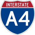
I-A4.svg

Shields for Interstates in Alaska
List of Interstate Highways in Alaska
Interstates of Alaska highlighted in red
System information
Length1,082.22 mi [1]  (1,741.66 km)
Formed1976
Highway names
Interstates Interstate A-n (A-n) (unsigned)
State Alaska Route n (AK-n)
System links

The Interstate Highways in Alaska are all owned and maintained by the US state of Alaska. [2] The Alaska Department of Transportation & Public Facilities (DOT&PF) is responsible for the maintenance and operations of the Interstate Highways. The Interstate Highway System in Alaska comprises four highways that cover 1,082.22 miles (1,741.66 km). The longest of these is Interstate A-1 (A-1), at 408.23 miles (656.98 km) long, while the shortest route is A-3, at 148.12 miles (238.38 km) long. All Interstates in Alaska are unsigned [3] [ failed verification ] and are not generally referred to by their highway numbers.

Contents

Interstates in Alaska follow the numbering system Interstate A-n, where n represents the number of the Interstate. This follows the similar numbering systems for Hawaii and Puerto Rico. [1] The Interstate Highway System was expanded to Alaska in 1976, by the Federal-Aid Highway Act of 1976, which defined the system for Interstates in Alaska and Puerto Rico under 23 U.S.C.   § 103(c)(1)(B)(ii) . [4]

Most of the lengths of the Interstates in Alaska are not constructed to Interstate Highway standards but are small, rural, two-lane undivided highways. Title 23 provides that "Highways on the Interstate System in Alaska and Puerto Rico shall be designed in accordance with such geometric and construction standards as are adequate for current and probable future traffic demands and the needs of the locality of the highway." [4] Some portions of these highways are built to Interstate standards, though. The Seward Highway, part of A-3, is built to freeway standards in Anchorage. [5] The Glenn Highway, which is part of A-1, is built to freeway standards from Anchorage to Wasilla. [6] A very small portion of the George Parks Highway, A-4, is constructed to freeway standards in Wasilla. [7] In and around Fairbanks, the Richardson Highway, part of A-2, is constructed to freeway standards. [8] In addition to these highways, the Johansen Expressway, in Fairbanks, and the Minnesota Drive Expressway, in Anchorage, are constructed to expressway standards.

Routes

NumberLength (mi) [1] Length (km)Southern or western terminusNorthern or eastern terminusFormedRemovedNotes
I-A1.svgA-1408.23 [6] 656.98 Anchorage Canadian border in Alcan Border 01976-01-011976current Glenn Highway, Richardson Highway, Tok Cut-Off, Alaska Highway [9] [10] [11] [12]
I-A2.svgA-2202.18 [8] 325.38 Tok Fairbanks 01976-01-011976current Alaska Highway, Richardson Highway [10] [11] [12]
I-A3.svgA-3148.12 [5] 238.38 Soldotna Anchorage 01976-01-011976current Seward Highway, Sterling Highway [9] [11] [12]
I-A4.svgA-4323.69 [7] 520.93 Gateway, near Palmer Fairbanks 01976-01-011976current Parks Highway [9] [10] [11] [12]

See also

Related Research Articles

<span class="mw-page-title-main">California State Route 237</span> Highway in California

State Route 237 is a state highway in the U.S. state of California that runs from El Camino Real in Mountain View to Interstate 680 in Milpitas. Known as the Southbay Freeway for most of its length, SR 237 runs south of the San Francisco Bay, connecting the East Bay to the Peninsula.

<span class="mw-page-title-main">Richardson Highway</span> Highway in Alaska

The Richardson Highway is a highway in the U.S. state of Alaska, running 368 miles (562 km) and connecting Valdez to Fairbanks. It is marked as Alaska Route 4 from Valdez to Delta Junction and as Alaska Route 2 from there to Fairbanks. It also connects segments of Alaska Route 1 between the Glenn Highway and the Tok Cut-Off. The Richardson Highway was the first major road built in Alaska.

The Glenn Highway is a highway in the U.S. state of Alaska, extending 179 miles (288 km) from Anchorage near Merrill Field to Glennallen on the Richardson Highway. The Tok Cut-Off is often considered part of the Glenn Highway, for a total length of 328 miles (528 km).

<span class="mw-page-title-main">George Parks Highway</span> Highway in Alaska

The George Parks Highway, usually called simply the Parks Highway, runs 323 miles (520 km) from the Glenn Highway 35 miles (56 km) north of Anchorage to Fairbanks in the Alaska Interior. The highway, originally known as the Anchorage-Fairbanks Highway, was completed in 1971, and given its current name in 1975.

<span class="mw-page-title-main">Seward Highway</span> State highway in Alaska, United States

The Seward Highway is a highway in the U.S. state of Alaska that extends 125 miles (201 km) from Seward to Anchorage. It was completed in 1951 and runs through the scenic Kenai Peninsula, Chugach National Forest, Turnagain Arm, and Kenai Mountains. The Seward Highway is numbered Alaska Route 9 (AK-9) for the first 37 miles (60 km) from Seward to the Sterling Highway and AK-1 for the remaining distance to Anchorage. At the junction with the Sterling Highway, AK-1 turns west towards Sterling and Homer. About eight miles (13 km) of the Seward Highway leading into Anchorage is built to freeway standards. In Anchorage, the Seward Highway terminates at an intersection with 5th Avenue, which AK-1 is routed to, and which then leads to the Glenn Highway freeway.

<span class="mw-page-title-main">California State Route 113</span> Highway in California

State Route 113 is a north–south state highway in the U.S. state of California that runs from around 10 miles (16 km) in the Sacramento Valley west of Rio Vista at State Route 12 to State Route 99 in Tudor. It serves as one of two important connecting routes between Interstate 80 and Interstate 5, bypassing Sacramento to the east; the other being Interstate 505 to the west. Past the southern terminus are Collinsville and Birds Landing around the Suisun Bay marshes. Cities along the route include Dixon, Davis, and Woodland. It also shares a stretch of Interstate 80 between just outside UC Davis and Dixon. The section running from Dixon to Woodland is a controlled-access freeway; the remainder is a standard road of two to four lanes. The freeway section spanning from the I-80 interchange in Davis to Woodland is called the Vic Fazio Highway, after the former U.S. House representative of the Davis area, who is credited with obtaining the funding for the freeway upgrade of that section.

<span class="mw-page-title-main">Interstate 180 (Wyoming)</span> Interstate Highway in Cheyenne, Wyoming, United States

Interstate 180 (I-180) is a 1.09-mile-long (1.75 km) expressway in the US state of Wyoming between I-80 and downtown Cheyenne.

<span class="mw-page-title-main">Interstate 280 (Ohio)</span> Interstate Highway in Ohio

Interstate 280 (I-280) is a 12.41-mile-long (19.97 km) auxiliary Interstate Highway in Ohio that connects I-75 in northeast Toledo with I-80/I-90 southeast of the city in northeastern Wood County. Built between 1955 and 1959, the route was originally part of the Detroit–Toledo Expressway. Although first designated in 1959, the highway originally contained several at-grade intersections and other features which left it substandard to the Interstate Highway System until 1990. Further construction in 2007 built a new crossing of the Maumee River, replacing an outdated drawbridge. The highway serves as an easterly bypass of the Toledo metropolitan area, passing through the communities of Northwood and Oregon. It is one of two auxiliary Interstate Highways serving Toledo, the other being I-475.

<span class="mw-page-title-main">Interstate 195 (Maryland)</span> Highway in Maryland

Interstate 195 (I-195) is an auxiliary Interstate Highway in the US state of Maryland. The highway runs 4.35 miles (7.00 km) from I-95 in Arbutus east to Maryland Route 170 (MD 170) near the Baltimore/Washington International Airport in Linthicum. I-195, which is also known as Metropolitan Boulevard, is the main connection between the airport terminal and highways leading to Baltimore, Washington, D.C., and Annapolis, including I-95, MD 295, and I-97. The interchange with MD 170, which forms part of the Airport Loop, provides access to various airport-related services. I-195 also links I-95 with Catonsville and the University of Maryland, Baltimore County (UMBC), via a westward continuation of Metropolitan Boulevard that is part of MD 166.

<span class="mw-page-title-main">Interstate 526</span> Highway in South Carolina

Interstate 526 (I-526) is a 19.56-mile (31.48 km) auxiliary route of I-26, providing a partial beltway around Charleston, South Carolina, in the United States. The route serves several purposes, firstly, as a bypass for through traffic on U.S. Route 17 (US 17) to avoid downtown Charleston, and, secondly, for traffic on I-26 bound for the coastal towns located north and south of Charleston. The route is not yet complete, as the western terminus it is planned for the route to be extended an additional 10 miles (16 km). After the eastern terminus, the roadway continues as a short business route, known as Interstate 526 Business.

<span class="mw-page-title-main">Interstate 490 (Ohio)</span> Highway in Ohio

Interstate 490 (I-490) is a 2.43-mile (3.91 km) auxiliary Interstate Highway in Cleveland, Ohio. The western terminus is a junction with I-90 and I-71 on Cleveland's west side. After spanning the Cuyahoga River, I-490 reaches its eastern terminus at a junction with East 55th Street, just east of I-77.

<span class="mw-page-title-main">California State Route 7</span> State highway in Imperial County, California, United States

State Route 7 is a state highway in the U.S. state of California, running from the Calexico East Port of Entry on the U.S.-Mexico border east of Calexico north to its terminus at Interstate 8 (I-8), where Orchard Road continues the route north towards Holtville. The route provides convenient access to the country of Mexico from I-8. The southern portion of the route opened in 1996, and the rest of the route connecting to I-8 opened in 2005.

<span class="mw-page-title-main">California State Route 198</span> Highway in California

State Route 198 is an east–west state highway in the U.S. state of California that runs from U.S. Route 101 south of King City to Sequoia National Park. It connects the California Central Coast to the mid–Central Valley through Hanford and Visalia, although the most developed portion is in the Central Valley itself. SR 198 intersects the major north–south routes in the Central Valley, including Interstate 5 (I-5), SR 33, and SR 99.

<span class="mw-page-title-main">Interstate 277 (North Carolina)</span> Highway in North Carolina

Interstate 277 (I-277) is an auxiliary Interstate Highway in the US state of North Carolina. It serves as a 4.41-mile (7.10 km) partial loop around Uptown Charlotte.

<span class="mw-page-title-main">Alaska Route 1</span> Highway in Alaska

Alaska Route 1 (AK-1) is a state highway in the southern part of the U.S. state of Alaska. It runs from Homer northeast and east to Tok by way of Anchorage. It is one of two routes in Alaska to contain significant portions of freeway: the Seward Highway in south Anchorage and the Glenn Highway between Anchorage and Palmer.

The Minnesota Drive Expressway is a 7.560-mile-long (12.167 km) south–north expressway located in the city of Anchorage, Alaska, United States. The expressway includes a small portion of O'Malley Road, which is also built to expressway standards. The highway travels from the southern region of Anchorage northward to North Star neighborhood area, and bisects the community of Spenard. The first section of the highway was constructed around 1950, and the entire highway was upgraded to expressway standards by the year of 1985. The entire length of the expressway is listed on the National Highway System, a network of roads important to the country's economy, defense, and mobility.

<span class="mw-page-title-main">Hope Highway</span> Highway in Alaska

The Hope Highway, also known as the Hope Road Turnoff, is a Forest Highway located in the Kenai Peninsula Borough, in the U.S. state of Alaska. The highway connects the city of Hope to the Seward Highway, and travels through 17 miles (27 km) of the Chugach National Forest. The road passes the ghost town of Sunrise City and several smaller settlements, remnants of the gold rush that occurred in that area. The highway was created circa 1928 and was designated as Forest Highway 14 by the Federal Highway Administration.

References

  1. 1 2 3 Starks, Edward (January 27, 2022). "Table 1: Main Routes of the Dwight D. Eisenhower National System of Interstate and Defense Highways". FHWA Route Log and Finder List. Federal Highway Administration . Retrieved January 24, 2023.
  2. Staff. "Interstate Frequently Asked Questions". Federal Highway Administration . Retrieved May 31, 2012.
  3. Weingroff, Richard F. (April 7, 2011). "Interstates in Hawaii: Are We Crazy???". Ask the Rambler. Federal Highway Administration. Retrieved March 15, 2011.
  4. 1 2 United States Congress. "Title 23, Chapter 1, Section §103". U.S. Government Printing Office. Retrieved May 31, 2012.
  5. 1 2 Google (May 31, 2012). "Overview Map of Interstate A-3" (Map). Google Maps. Google. Retrieved May 31, 2012.
  6. 1 2 Google (May 31, 2012). "Overview Map of Interstate A-1" (Map). Google Maps . Google. Retrieved May 31, 2012.
  7. 1 2 Google (May 31, 2012). "Overview Map of Interstate A-4" (Map). Google Maps. Google. Retrieved May 31, 2012.
  8. 1 2 Google (May 31, 2012). "Overview Map of Interstate A-2" (Map). Google Maps. Google. Retrieved May 31, 2012.
  9. 1 2 3 Witt, Jennifer W. (2010). Annual Traffic Volume Report (PDF) (Report) (2008-2009-2010 ed.). Alaska Department of Transportation & Public Facilities. Archived from the original (PDF) on March 30, 2014. Retrieved March 15, 2012.
  10. 1 2 3 Birkholz, Ethan (2010). Annual Traffic Volume Report (PDF) (Report) (2008-2009-2010 ed.). Alaska Department of Transportation & Public Facilities. Archived from the original (PDF) on April 17, 2014. Retrieved May 31, 2012.
  11. 1 2 3 4 Federal Highway Administration. "Dwight D. Eisenhower Interstate Routes Statewide" (PDF). U.S. Department of Transportation. Retrieved May 31, 2012.
  12. 1 2 3 4 Federal Highway Administration. "Alaska Department of Transportation and Public Facilities Routes by Description: CDS Route Numbers as of 28 October 2008" (PDF). U.S. Department of Transportation. Retrieved May 31, 2012.
Template:Attached KML/List of Interstate Highways in Alaska
KML is not from Wikidata