Alcan Border, Alaska

Last updated

Alcan Border, Alaska
CDP
Portalcan.jpg
The Canada–United States border crossing at Alcan Border
USA Alaska location map.svg
Red pog.svg
Alcan Border, Alaska
Location within the state of Alaska
Coordinates: 62°41′35″N141°11′56″W / 62.69306°N 141.19889°W / 62.69306; -141.19889
Country United States
State Alaska
Census Area Southeast Fairbanks
Government
   State senator Click Bishop (R)
   State rep. Mike Cronk (R)
Area
[1]
  Total152.61 sq mi (395.25 km2)
  Land151.74 sq mi (393.01 km2)
  Water0.86 sq mi (2.24 km2)
Population
 (2020)
  Total36
  Density0.24/sq mi (0.09/km2)
Time zone UTC-9 (Alaska (AKST))
  Summer (DST) UTC-8 (AKDT)
ZIP code
99780 [2]
Area code 907
FIPS code 02-01390

Alcan Border, also known as Port Alcan, is a census-designated place in the Southeast Fairbanks Census Area in the U.S. state of Alaska. Part of the Unorganized Borough, Alcan Border is the site of the Alcan - Beaver Creek Border Crossing, the main U.S. port of entry for persons arriving in Alaska by road. The population was 33 at the 2010 census, up from 21 in 2000.

Contents

Location and climate

Alcan Border is located at 62°39′42″N141°9′40″W / 62.66167°N 141.16111°W / 62.66167; -141.16111 (Sec. 04, T026N, R022E, Copper River Meridian) in the Fairbanks Recording District. It is just inside the Alaska-Canada border, southeast of Northway and northwest of Beaver Creek, Yukon, along the Alaska Highway.

Alcan Border has a dry-winter continental subarctic climate (Köppen Dwc).

According to the United States Census Bureau, the CDP has a total area of 148.6 square miles (385 km2), of which 147.9 square miles (383 km2) is land and 0.7 square miles (1.8 km2) (0.50%) is water.

Climate data for Port Alcan, Alaska, 1991–2020 normals, extremes 1985–present
MonthJanFebMarAprMayJunJulAugSepOctNovDecYear
Record high °F (°C)41
(5)
47
(8)
52
(11)
70
(21)
82
(28)
88
(31)
94
(34)
86
(30)
78
(26)
60
(16)
44
(7)
55
(13)
94
(34)
Mean maximum °F (°C)20.4
(−6.4)
26.5
(−3.1)
42.5
(5.8)
56.4
(13.6)
73.9
(23.3)
80.6
(27.0)
80.7
(27.1)
78.3
(25.7)
67.1
(19.5)
50.9
(10.5)
25.7
(−3.5)
20.7
(−6.3)
82.9
(28.3)
Mean daily maximum °F (°C)−5.3
(−20.7)
6.1
(−14.4)
22.9
(−5.1)
42.8
(6.0)
57.9
(14.4)
67.0
(19.4)
69.3
(20.7)
65.0
(18.3)
52.9
(11.6)
31.0
(−0.6)
7.5
(−13.6)
−2.4
(−19.1)
34.6
(1.4)
Daily mean °F (°C)−12.1
(−24.5)
−3.4
(−19.7)
8.4
(−13.1)
29.7
(−1.3)
45.6
(7.6)
55.3
(12.9)
57.9
(14.4)
53.0
(11.7)
41.5
(5.3)
22.6
(−5.2)
0.3
(−17.6)
−9.3
(−22.9)
24.1
(−4.4)
Mean daily minimum °F (°C)−19.0
(−28.3)
−12.9
(−24.9)
−6.0
(−21.1)
16.7
(−8.5)
33.2
(0.7)
43.6
(6.4)
46.6
(8.1)
41.0
(5.0)
30.2
(−1.0)
14.3
(−9.8)
−7.0
(−21.7)
−16.1
(−26.7)
13.7
(−10.1)
Mean minimum °F (°C)−41.7
(−40.9)
−37.5
(−38.6)
−28.5
(−33.6)
−1.8
(−18.8)
22.1
(−5.5)
33.0
(0.6)
37.7
(3.2)
31.1
(−0.5)
19.1
(−7.2)
−1.9
(−18.8)
−27.9
(−33.3)
−34.4
(−36.9)
−46.9
(−43.8)
Record low °F (°C)−55
(−48)
−56
(−49)
−49
(−45)
−29
(−34)
10
(−12)
27
(−3)
32
(0)
24
(−4)
0
(−18)
−26
(−32)
−47
(−44)
−51
(−46)
−56
(−49)
Average precipitation inches (mm)0.26
(6.6)
0.26
(6.6)
0.14
(3.6)
0.21
(5.3)
0.88
(22)
2.23
(57)
2.71
(69)
1.73
(44)
1.02
(26)
0.51
(13)
0.65
(17)
0.39
(9.9)
10.99
(280)
Average snowfall inches (cm)3.5
(8.9)
2.9
(7.4)
3.0
(7.6)
0.9
(2.3)
0.7
(1.8)
0.0
(0.0)
0.0
(0.0)
0.0
(0.0)
0.5
(1.3)
4.1
(10)
7.1
(18)
4.7
(12)
27.4
(69.3)
Average precipitation days (≥ 0.01 in)3.73.12.32.45.712.513.011.08.05.45.64.677.3
Average snowy days (≥ 0.1 in)3.93.12.41.10.50.00.00.00.64.15.34.425.4
Source 1: NOAA [3]
Source 2: National Weather Service (mean maxima/minima 20062020) [4]

History, culture and demographics

Historical population
CensusPop.Note
1990 27
2000 21−22.2%
2010 3357.1%
2020 369.1%
U.S. Decennial Census [5]

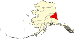
Alcan Border first appeared on the 1990 U.S. Census as the census-designated place (CDP) of "Alcan." [6] The name was changed to Alcan Border with the 2000 census. [7]

The name is derived from the Alaska-Canadian (Alcan) highway, now the Alaska Highway, and the fact that its eastern boundary (as defined by the Census Bureau) is the Yukon Territory, Canada border.

The Alcan community consists of families employed by federal customs at the entry point into the U.S. and Alaska from Canada. Students attend school in Northway or are home-schooled through correspondence study. During the 2000 U.S. Census, total housing units numbered 13, and vacant housing units numbered 4. Vacant housing units used only seasonally numbered 2. Census data showed 11 residents as employed. The unemployment rate at that time was 0 percent, although 35.29 percent of all adults were not in the work force. The median household income was $65,000, per capita income was $21,938, and 0 percent of residents were living below the poverty level.

As of the census [8] of 2000, there were 21 people, 9 households, and 6 families residing in the CDP. The population density was 0.1 inhabitants per square mile (0.039/km2). There were 13 housing units at an average density of 0.1 per square mile (0.039/km2). The racial makeup of the CDP was 66.67% White, 23.81% Native American, 4.76% Asian, 4.76% from other races. 9.52% of the population were Hispanic or Latino of any race.

There were 9 households, out of which 33.3% had children under the age of 18 living with them, 66.7% were married couples living together, and 33.3% were non-families. 33.3% of all households were made up of individuals, and none had someone living alone who was 65 years of age or older. The average household size was 2.33 and the average family size was 3.00.

In the CDP, the population was spread out, with 28.6% under the age of 18, 33.3% from 25 to 44, and 38.1% from 45 to 64. The median age was 35 years.

The median income for a household in the CDP was $65,000, and the median income for a family was $87,041. Males had a median income of $77,036 versus $0 for females. The per capita income for the CDP was $21,938. None of the population and none of the families were below the poverty line.

Facilities and infrastructure

Alcan residents derive water from a piped community well system and individual wells. Approximately 60% of the homes have complete plumbing. A piped community sewage system serves the majority of households, and outhouses or individual septic tanks are also used. A central generator distributes electrical power. Electricity is provided by Alaska Power & Telephone. There are no state operated schools in the community. The nearest healthcare facilities are in Northway or Tok. Alcan is classified as an isolated village, it is found in EMS Region 1C in the Interior Region. Emergency services have highway and air access. Emergency service is provided by volunteers.

Alcan Border is part of the Alaska Gateway School District. Walter Northway School, a K-12 campus, serves community students.

Alaska does not have a state sales tax and Alcan Border is in the Unorganized Borough and therefore has no local tax authority.

Related Research Articles

<span class="mw-page-title-main">Southeast Fairbanks Census Area, Alaska</span> Census area in Alaska, United States

Southeast Fairbanks Census Area is a census area located in the U.S. state of Alaska. As of the 2020 census, the population was 6,808, down from 7,029 in 2010. It is part of the unorganized borough and therefore has no borough seat. Its largest communities are Deltana and Tok, both unincorporated CDPs.

<span class="mw-page-title-main">Healy, Alaska</span> Census-designated place in Alaska

Healy is a census-designated place (CDP) and the borough seat of Denali Borough in the U.S. state of Alaska. The population was 966 at the time of the 2020 census, down from 1,021 in 2010.

<span class="mw-page-title-main">Fox, Alaska</span> Census-designated place in Alaska, United States

Fox is a census-designated place (CDP) in Fairbanks North Star Borough, Alaska, United States. It is part of the Fairbanks, Alaska Metropolitan Statistical Area. At the 2010 census the population was 417, up from 300 in 2000.

<span class="mw-page-title-main">Harding-Birch Lakes, Alaska</span> Census-designated place in Alaska, United States

Harding-Birch Lakes is a census-designated place (CDP) in Fairbanks North Star Borough, Alaska, United States. It is part of the Fairbanks, Alaska Metropolitan Statistical Area. At the 2010 census the population was 299, up from 216 in 2000.

<span class="mw-page-title-main">Moose Creek, Alaska</span> CDP in Alaska, United States

Moose Creek is a census-designated place (CDP) in Fairbanks North Star Borough in the U.S. state of Alaska. As of the 2010 census, the population of the CDP was 747, up from 542 in 2000. It is part of the Fairbanks, Alaska Metropolitan Statistical Area. Moose Creek is located south of Fairbanks, Alaska along the Richardson Highway. Moose Creek is bordered by Eielson Air Force Base to the south, the Tanana River to the west, and the Chena River Flood Control Project to the north.

<span class="mw-page-title-main">Salcha, Alaska</span> Census-designated place in Alaska, United States

Salcha is a census-designated place (CDP) in Fairbanks North Star Borough in the U.S. state of Alaska. It is part of the Fairbanks, Alaska Metropolitan Statistical Area. The population was 1,095 at the 2010 census, up from 854 in 2000.

<span class="mw-page-title-main">Mosquito Lake, Alaska</span> Census-designated place in Alaska, United States

Mosquito Lake is a census-designated place (CDP) in Haines Borough, Alaska, United States. At the 2010 census the population was 309, up from 221 at the 2000 census.

<span class="mw-page-title-main">Kalifornsky, Alaska</span> Census-designated place in Alaska, United States

Kalifornsky is a census-designated place (CDP) in Kenai Peninsula Borough, Alaska, United States. The population was 8,487 at the 2020 census, up from 7,850 in 2010. It is the most populated locality in the borough.

<span class="mw-page-title-main">Primrose, Alaska</span> Census-designated place in Alaska, United States

Primrose is a census-designated place (CDP) in Kenai Peninsula Borough, Alaska, United States. The population was 78 at the 2010 census, down from 93 at the 2000 census. Primrose is one of a number of small communities located north of Seward along the Seward Highway.

<span class="mw-page-title-main">Willow, Alaska</span> CDP in Alaska, United States

Willow is a census-designated place (CDP) in the Matanuska-Susitna Borough in the U.S. state of Alaska. Located 26 miles northwest from Wasilla along the George Parks Highway, it is part of the Anchorage, Alaska Metropolitan Statistical Area. At the 2020 census the population was 2,196, up from 2,102 in 2010.

<span class="mw-page-title-main">Dot Lake, Alaska</span> CDP in Alaska, United States

Dot Lake is a census-designated place (CDP) in Southeast Fairbanks Census Area, Alaska, United States. It is located on the Alaska Highway between Delta Junction and Tok. The population was 13 at the 2010 census, down from 19 in 2000.

<span class="mw-page-title-main">Eagle Village, Alaska</span> CDP in Alaska, United States

Eagle Village is a census-designated place (CDP) in Southeast Fairbanks Census Area, Alaska, United States. The population was 67 at the 2010 census.

<span class="mw-page-title-main">Northway Junction, Alaska</span> CDP in Alaska, United States

Northway Junction was a census-designated place (CDP) in Southeast Fairbanks Census Area, Alaska, United States. It was merged with Northway CDP prior to the 2020 Census. The population was 54 at the 2010 census, down from 72 in 2000.

<span class="mw-page-title-main">Northway Village, Alaska</span> CDP in Alaska, United States

Northway Village was a census-designated place (CDP) in Southeast Fairbanks Census Area, Alaska, United States. It was merged with Northway CDP prior to the 2020 Census. The population was 98 at the 2010 census, down from 107 in 2000.

<span class="mw-page-title-main">Tok, Alaska</span> Census-designated place in Alaska

Tok is a census-designated place (CDP) in Southeast Fairbanks Census Area, Alaska, United States. The population was 1,243 at the 2020 census, slightly down from 1,258 in 2010.

<span class="mw-page-title-main">Glennallen, Alaska</span> Town in Alaska

Glennallen is a census-designated place (CDP) in the Copper River Census Area in the Unorganized Borough of the U.S. state of Alaska. As of the 2020 census, the population of the CDP was 439, down from 483 in 2010. It is the most populated community in the census area.

<span class="mw-page-title-main">Alatna, Alaska</span> CDP in Alaska, United States

Alatna is a census-designated place (CDP) in the Yukon-Koyukuk Census Area of the Unorganized Borough in the U.S. state of Alaska. The population was 35 at the 2020 census.

<span class="mw-page-title-main">Evansville, Alaska</span> CDP in Alaska, United States

Evansville is a census-designated place (CDP) in Yukon-Koyukuk Census Area, Alaska, United States. The population was 15 at the 2010 census, down from 28 in 2000. The community is adjacent to Bettles. The community is named after Wilford Evans, Sr, who took part in the founding of Bettles Lodge.

Minto is a census-designated place (CDP) in Yukon-Koyukuk Census Area, Alaska, United States. As of the 2020 census, the population of the CDP is 150, down from 210 in 2010. The name is an anglicized version of the Lower Tanana Athabaskan name Menhti, meaning 'among the lakes'. After repeated flooding the village was relocated to its present location in 1969. The former village site is now known as Old Minto.

<span class="mw-page-title-main">Lake Carmel, New York</span> Census-designated place in New York, United States

Lake Carmel is a hamlet and census-designated place in the town of Kent in Putnam County, New York, United States. The home of over half of the town of Kent's population of 8,282, the hamlet is centered around Lake Carmel, a 1.6 mile long manmade lake in the southeastern corner of the township and just north of hamlet of Carmel within the town of Carmel.

References

  1. "2020 U.S. Gazetteer Files". United States Census Bureau. Retrieved October 29, 2021.
  2. "Alcan Border AK ZIP Code". zipdatamaps.com. 2023. Retrieved June 16, 2023.
  3. "U.S. Climate Normals Quick Access – Station: Port Alcan, AK". National Oceanic and Atmospheric Administration. Retrieved February 21, 2023.
  4. "NOAA Online Weather Data – NWS Fairbanks". National Weather Service. Retrieved February 21, 2023.
  5. "U.S. Decennial Census". Census.gov. Retrieved June 6, 2013.
  6. Census data census.gov
  7. U.S. Census Bureau. "2000 Census of Population and Housing - Alaska" (PDF). Archived from the original (PDF) on March 18, 2021. Retrieved October 13, 2019.
  8. "U.S. Census website". United States Census Bureau . Retrieved January 31, 2008.