Big Delta, Alaska

Last updated

Big Delta, Alaska
CDP
Aerial shot of fall colors near Big Delta, interior Alaska.jpg
Aerial view of Big Delta region
AKMap-doton-BigDelta.PNG
Location of Big Delta, Alaska
Coordinates: 64°8′50″N145°48′6″W / 64.14722°N 145.80167°W / 64.14722; -145.80167
Country United States
State Alaska
Census Area Southeast Fairbanks
Government
   State senator Click Bishop (R)
   State rep. Mike Cronk (R)
Area
[1]
  Total53.84 sq mi (139.44 km2)
  Land46.95 sq mi (121.59 km2)
  Water6.89 sq mi (17.86 km2)
Elevation
994 ft (303 m)
Population
 (2020)
  Total444
  Density9.46/sq mi (3.65/km2)
Time zone UTC-9 (Alaska (AKST))
  Summer (DST) UTC-8 (AKDT)
ZIP code
99737 [2]
Area code 907
FIPS code 02-06850
GNIS feature ID1398949

Big Delta is a census-designated place (CDP) in Southeast Fairbanks Census Area, Alaska, United States. The population was 591 at the 2010 census, down from 749 in 2000. Big Delta is at the confluence of the Delta River and the Tanana River and gets its name from the huge river delta formed by the confluence.

Contents

History

Big Delta in 1941 Alaska - Big Delta through Chilkat Inlet - NARA - 23937525 (cropped).jpg
Big Delta in 1941

From at least 10,000 years ago to the present, Athabascan Indians have inhabited portions of the interior of Alaska. They survived by hunting the abundant game and fishing in the rivers of the interior of Alaska.

Beginning in 1899, the United States Army built a pack trail from Valdez, on the south coast of Alaska, to Eagle, northeast of Big Delta, a distance of about 660 km (410 mi). The trail crossed the Tanana River near the confluence of the Delta and Tanana Rivers.

Gold was discovered in 1902 in Fairbanks, about 150 km (93 mi) north of the crossing of the Tanana River. Roadhouses were built along the pack trail that connected the south coast of Alaska with Fairbanks. One such roadhouse was Bates Landing, which was built at the confluence of the Delta and Tanana Rivers, about 12 km (7.5 mi) north of the current Delta Junction, in the area known now as Big Delta. The U. S. government collected a toll on the south side of the Tanana River from all passengers crossing north. In 1904 work began on the Richardson Highway, which mostly followed the route of the pack trail.

In 1906, John Hajdukovich bought the roadhouse and enlarged it. In addition to running the lodge there, he took hunting parties into the nearby Granite Mountains and traded with the Athabaskans in the surrounding area. An 18-year-old Swedish girl named Rika Wallen came to the roadhouse to work for John. After several years, John deeded the roadhouse to Rika in lieu of back wages he owed her. Rika also homesteaded an adjoining piece of land. Rika's Roadhouse and the adjacent property are now the Big Delta State Historical Park.

In 1928 a herd of bison were brought from the U. S. state of Montana to Big Delta, because they were thought to be threatened with extinction in the continental United States. The herd still roams in the Delta Junction area, about 12 km (7.5 mi) south of Big Delta.

The construction of the Alaska Highway during World War II shifted much of the economic activity of the area south to Delta Junction. Later history of the area can be found in the entry for Delta Junction.

Geography

Big Delta is located at 64°8′50″N145°48′6″W / 64.14722°N 145.80167°W / 64.14722; -145.80167 (64.147324, -145.801545). [3]

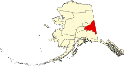
According to the United States Census Bureau, the CDP has a total area of 61.1 square miles (158 km2), of which, 55.2 square miles (143 km2) of it is land and 5.9 square miles (15 km2) of it (9.70%) is water.

Climate

Big Delta has a dry-winter humid continental climate (Köppen Dwc) with short, mild summers and long, severely cold winters.

Climate data for Big Delta
MonthJanFebMarAprMayJunJulAugSepOctNovDecYear
Record high °F (°C)54
(12)
51
(11)
58
(14)
72
(22)
90
(32)
92
(33)
91
(33)
90
(32)
79
(26)
74
(23)
52
(11)
55
(13)
92
(33)
Mean daily maximum °F (°C)3.6
(−15.8)
12.9
(−10.6)
23.4
(−4.8)
41.2
(5.1)
57.1
(13.9)
67.1
(19.5)
69.3
(20.7)
64.5
(18.1)
52.7
(11.5)
31.9
(−0.1)
13.7
(−10.2)
5.7
(−14.6)
36.9
(2.7)
Mean daily minimum °F (°C)−10.8
(−23.8)
−4.2
(−20.1)
1.7
(−16.8)
20.9
(−6.2)
37.2
(2.9)
47.5
(8.6)
50.7
(10.4)
45.8
(7.7)
35.7
(2.1)
18.6
(−7.4)
−0.1
(−17.8)
−8.5
(−22.5)
19.5
(−6.9)
Record low °F (°C)−63
(−53)
−60
(−51)
−49
(−45)
−37
(−38)
−1
(−18)
26
(−3)
32
(0)
22
(−6)
−2
(−19)
−39
(−39)
−47
(−44)
−62
(−52)
−63
(−53)
Average precipitation inches (mm)0.31
(7.9)
0.3
(7.6)
0.23
(5.8)
0.25
(6.4)
0.89
(23)
2.31
(59)
2.62
(67)
1.92
(49)
1.05
(27)
0.61
(15)
0.45
(11)
0.35
(8.9)
11.3
(290)
Average snowfall inches (cm)5.6
(14)
5.2
(13)
4.3
(11)
2.8
(7.1)
0.6
(1.5)
0
(0)
0
(0)
0
(0)
1.6
(4.1)
9.2
(23)
8.5
(22)
5.8
(15)
43.8
(111)
Average precipitation days65447111312997693
Source: [4]

Demographics

Historical population
CensusPop.Note
1950 155
1980 285
1990 40040.4%
2000 74987.3%
2010 591−21.1%
2020 444−24.9%
U.S. Decennial Census [5]

Big Delta first appeared on the 1950 U.S. Census as an unincorporated village. [6] It did not appear again until 1980 when it was made a census-designated place (CDP). [7]

As of the census [8] of 2000, there were 749 people, 165 households, and 117 families residing in the CDP. The population density was 13.6 inhabitants per square mile (5.3/km2). There were 232 housing units at an average density of 4.2 per square mile (1.6/km2). The racial makeup of the CDP was 95.46% White, 0.13% Black or African American, 1.47% Native American, 0.53% Asian, and 2.40% from two or more races. 2.54% of the population were Hispanic or Latino of any race.

There were 165 households, out of which 39.4% had children under the age of 18 living with them, 61.2% were married couples living together, 6.7% had a female householder with no husband present, and 28.5% were non-families. 21.8% of all households were made up of individuals, and 7.3% had someone living alone who was 65 years of age or older. The average household size was 3.18 and the average family size was 3.90.

In the CDP, the population was spread out, with 36.3% under the age of 18, 10.1% from 18 to 24, 23.5% from 25 to 44, 24.0% from 45 to 64, and 6.0% who were 65 years of age or older. The median age was 29 years. For every 100 females, there were 92.5 males. For every 100 females age 18 and over, there were 96.3 males.

The median income for a household in the CDP was $49,000, and the median income for a family was $53,125. Males had a median income of $32,250 versus $37,708 for females. The per capita income for the CDP was $14,803. About 7.9% of families and 30.0% of the population were below the poverty line, including 18.9% of those under age 18 and 16.0% of those age 65 or over.

Related Research Articles

<span class="mw-page-title-main">Southeast Fairbanks Census Area, Alaska</span> Census area in Alaska, United States

Southeast Fairbanks Census Area is a census area located in the U.S. state of Alaska. As of the 2020 census, the population was 6,808, down from 7,029 in 2010. It is part of the unorganized borough and therefore has no borough seat. Its largest communities are Deltana and Tok, both unincorporated CDPs.

<span class="mw-page-title-main">College, Alaska</span> Census-designated place in Alaska, United States

College is a census-designated place (CDP) in Fairbanks North Star Borough, Alaska, United States. It is part of the Fairbanks, Alaska Metropolitan Statistical Area. As of the 2020 census, the population was 11,332, down from 12,964 in 2010. College is the third-most populated CDP in Alaska.

<span class="mw-page-title-main">Moose Creek, Alaska</span> CDP in Alaska, United States

Moose Creek is a census-designated place (CDP) in Fairbanks North Star Borough in the U.S. state of Alaska. As of the 2010 census, the population of the CDP was 747, up from 542 in 2000. It is part of the Fairbanks, Alaska Metropolitan Statistical Area. Moose Creek is located south of Fairbanks, Alaska along the Richardson Highway. Moose Creek is bordered by Eielson Air Force Base to the south, the Tanana River to the west, and the Chena River Flood Control Project to the north.

<span class="mw-page-title-main">Salcha, Alaska</span> Census-designated place in Alaska, United States

Salcha is a census-designated place (CDP) in Fairbanks North Star Borough in the U.S. state of Alaska. It is part of the Fairbanks, Alaska Metropolitan Statistical Area. The population was 1,095 at the 2010 census, up from 854 in 2000.

<span class="mw-page-title-main">Delta Junction, Alaska</span> City in Alaska, United States

Delta Junction is a city in the Southeast Fairbanks Census Area, Alaska, United States. As of the 2010 census, the population was 958, up from 840 in 2000. The 2018 estimate was down to 931. The city is located a short distance south of the confluence of the Delta River with the Tanana River, which is at Big Delta. It is about 160 km (99 mi) south of Fairbanks. Native inhabitants are Tanana Athabaskans.

Deltana is a census-designated place (CDP) in Southeast Fairbanks Census Area, Alaska, United States. At the 2020 census the population was 2,359, up from 2,251 in 2010. Native inhabitants are Tanana Athabaskans.

<span class="mw-page-title-main">Fort Greely, Alaska</span> CDP in Alaska, United States

Fort Greely is a census-designated place (CDP) in Southeast Fairbanks Census Area, Alaska, United States. It is home to the Fort Greely military installation. At the 2010 census the population was 539, up from 461 in 2000.

<span class="mw-page-title-main">Healy Lake, Alaska</span> CDP in Alaska, United States

Healy Lake is a census-designated place (CDP) in Southeast Fairbanks Census Area, Alaska, United States. The population was 13 at the 2010 census, down from 37 in 2000.

Tanacross is a census-designated place (CDP) in Southeast Fairbanks Census Area, Alaska, United States. At the 2010 census the population was 136, down from 140 in 2000. It hosts an air tanker base.

<span class="mw-page-title-main">Tetlin, Alaska</span> CDP in Alaska, United States

Tetlin is a census-designated place (CDP) in Southeast Fairbanks Census Area, Alaska, United States. At the 2010 census the population was 127, up from 117 in 2000.

<span class="mw-page-title-main">Tok, Alaska</span> Census-designated place in Alaska

Tok is a census-designated place (CDP) in Southeast Fairbanks Census Area, Alaska, United States. The population was 1,243 at the 2020 census, slightly down from 1,258 in 2010.

<span class="mw-page-title-main">Copper Center, Alaska</span> CDP in Alaska, United States

Copper Center is a census-designated place (CDP) on the Copper River in Copper River Census Area, Alaska, United States. It is two hundred kilometers northeast of Anchorage. At the 2020 census the population was 338, up from 328 in 2000.

<span class="mw-page-title-main">Gakona, Alaska</span> CDP in Alaska, United States

Gakona is a census-designated place (CDP) in the Copper River Census Area in the U.S. state of Alaska. As of the 2020 census, the population of the CDP was 169, down from 218 in 2010.

<span class="mw-page-title-main">Glennallen, Alaska</span> CDP in Alaska, United States

Glennallen is a census-designated place (CDP) in the Copper River Census Area in the Unorganized Borough of the U.S. state of Alaska. As of the 2020 census, the population of the CDP was 439, down from 483 in 2010. It is the most populated community in the census area.

<span class="mw-page-title-main">Tonsina, Alaska</span> CDP in Alaska, United States

Tonsina is a census-designated place (CDP) in Copper River Census Area, Alaska, United States. At the 2020 census the population was 55, down from 78 in 2010.

<span class="mw-page-title-main">Manley Hot Springs, Alaska</span> CDP in Alaska, United States

Manley Hot Springs is a census-designated place (CDP) in Yukon-Koyukuk Census Area, Alaska, United States. At the 2020 census the population was 169, up from 89 in 2010.

Minto is a census-designated place (CDP) in Yukon-Koyukuk Census Area, Alaska, United States. As of the 2020 census, the population of the CDP is 150, down from 210 in 2010. The name is an anglicized version of the Lower Tanana Athabaskan name Menhti, meaning 'among the lakes'. After repeated flooding the village was relocated to its present location in 1969. The former village site is now known as Old Minto.

<span class="mw-page-title-main">Nenana, Alaska</span> City in Alaska, United States

Nenana (Lower Tanana: Toghotili; is a home rule city in the Yukon-Koyukuk Census Area of the Unorganized Borough in the Interior of the U.S. state of Alaska. Nenana developed as a Lower Tanana community at the confluence where the tributary Nenana River enters the Tanana. The population was 378 at the 2010 census, down from 402 in 2000.

<span class="mw-page-title-main">Tanana, Alaska</span> City in the Yukon-Koyukuk Census Area in Alaska, United States

Tanana is a city in the Yukon-Koyukuk Census Area in the U.S. state of Alaska. At the 2010 census the population was 246, down from 308 in 2000. It was formerly known as Clachotin, adopted by Canadian French.

<span class="mw-page-title-main">Rika's Landing Roadhouse</span> United States historic place

Rika's Landing Roadhouse, also known as Rika's Landing Site or the McCarty Roadhouse, is a roadhouse located at a historically important crossing of the Tanana River, in the Southeast Fairbanks Area, Alaska, United States. It is off mile 274.5 of the Richardson Highway in Big Delta.

References

  1. "2020 U.S. Gazetteer Files". United States Census Bureau. Retrieved October 29, 2021.
  2. "Big Delta AK ZIP Code". zipdatamaps.com. 2023. Retrieved February 17, 2023.
  3. "US Gazetteer files: 2010, 2000, and 1990". United States Census Bureau. February 12, 2011. Retrieved April 23, 2011.
  4. "BIG DELTA AP, AK (500770)". Western Regional Climate Center. Retrieved November 18, 2015.
  5. "U.S. Decennial Census". Census.gov. Retrieved June 6, 2013.
  6. "Number of Inhabitants - Alaska" (PDF). United States Census Bureau. 1950.
  7. "Characteristics of the Populations - Number of Inhabitants - Alaska" (PDF). United States Census Bureau. May 1982.
  8. "U.S. Census website". United States Census Bureau . Retrieved January 31, 2008.