Normangee, Texas

Last updated


Normangee, Texas
Normangee, Texas sign.jpg
Normangee welcome sign, March 2016
Motto: 
"The Deerest Place in Texas"
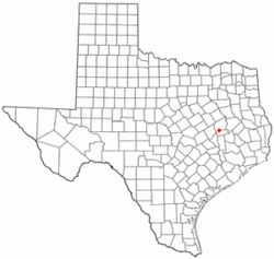
TXMap-doton-Normangee.PNG
Location of Normangee, Texas
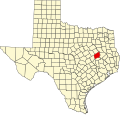
Leon County Normangee.svg
Coordinates: 31°1′45″N96°7′4″W / 31.02917°N 96.11778°W / 31.02917; -96.11778
Country United States
State Texas
Counties Leon, Madison
Area
[1]
  Total1.12 sq mi (2.89 km2)
  Land1.12 sq mi (2.89 km2)
  Water0.00 sq mi (0.00 km2)
Elevation
377 ft (115 m)
Population
 (2020) [2]
  Total495
  Density632.62/sq mi (244.36/km2)
Time zone UTC-6 (Central (CST))
  Summer (DST) UTC-5 (CDT)
ZIP code
77871
Area code 936
FIPS code 48-51840 [3]
GNIS feature ID1381022 [4]

Normangee is a town in Leon and Madison counties in Texas, United States. Its population is 495 as of 2020. [2]

Contents

History

The railroads were pushing the frontier westward and the Trinity and Brazos Valley Railway (T&BV) and the Houston and Texas Central Railway (H&TC) were built between Houston and Dallas in 1904–1905, but the railways passed through Robert Rogers' land, approximately two miles west of Rogers Prairie. So on January 26, 1907, S.B. Phillips filed for record a plat of the new town, Normangee, located in the southwestern corner of the Robert Rogers land grant at the junction of the Old San Antonio Road and the two new railroads. When the H&TC was being built through this region, railroad officials placed a town every eight miles. A small community, known as Rogers Prairie, existed two miles east of where the railroad line was built. Norman G. Kittrell was the county judge of Leon County at the time. The railroad named the new town after Judge Kittrell. [5] Since there was already a Norman, Oklahoma, the town renamed itself Normangee. [6]

Geography

Normangee is located at 31°1′45″N96°7′4″W / 31.02917°N 96.11778°W / 31.02917; -96.11778 (31.029054, –96.117712). [7]

According to the United States Census Bureau, the town has a total area of 1.1 square miles (2.9 km2), all land. Normangee is incorporated in Leon County, where most of it lies; only a small part extends into Madison County.

Demographics

Historical population
CensusPop.Note
1920 662
1930 86931.3%
1940 535−38.4%
1950 65722.8%
1960 7189.3%
1970 657−8.5%
1980 636−3.2%
1990 6898.3%
2000 7194.4%
2010 685−4.7%
2020 495−27.7%
U.S. Decennial Census [8]
Normangee racial composition as of 2020 [9]
(NH = Non-Hispanic) [lower-alpha 1]
RaceNumberPercentage
White (NH)31363.23%
Black or African American (NH)5711.52%
Native American or Alaska Native (NH)10.2%
Asian (NH)20.4%
Some Other Race (NH)20.4%
Mixed/Multi-Racial (NH)234.65%
Hispanic or Latino 9719.6%
Total495

As of the 2020 United States census, there were 495 people, 315 households, and 249 families residing in the town.

As of the census [3] of 2000, 719 people, 277 households, and 185 families were residing in the town. The population density was 648.0 inhabitants per square mile (250.2/km2). The 358 housing units averaged 322.6 per mi2 (124.5/km2). The racial makeup of the town was 73.71% White, 20.45% African American, 0.42% Native American, 0.14% Pacific Islander, 3.48% from other races, and 1.81% from two or more races. Hispanics or Latinos of any race were 8.07% of the population.

Of the 277 households, 35.0% had children under the age of 18 living with them, 43.3% were married couples living together, 19.1% had a female householder with no husband present, and 33.2% were not families. About 28.9% of all households were made up of individuals, and 16.2% had someone living alone who was 65 years of age or older. The average household size was 2.60, and the average family size was 3.22.

In the town, the age distribution was 30.7% under 18, 6.5% from 18 to 24, 28.7% from 25 to 44, 17.9% from 45 to 64, and 16.1% who were 65 or older. The median age was 36 years. For every 100 females, there were 88.2 males. For every 100 females age 18 and over, there were 81.1 males.

The median income for a household in the town was $28,594, and for a family was $34,444. Males had a median income of $29,375 versus $16,042 for females. The per capita income for the town was $18,336. About 16.1% of families and 17.6% of the population were below the poverty line, including 22.2% of those under age 18 and 17.6% of those age 65 or over.

Education

The Town of Normangee is served by the Normangee Independent School District and is home to the Normangee High School Panthers.

Economy

The local economy consists of over 100 small businesses, including banking, groceries and staple goods, antique and thrift stores, health care, and agricultural suppliers.

Notable people

See also

Notes

  1. Note: the US Census treats Hispanic/Latino as an ethnic category. This table excludes Latinos from the racial categories and assigns them to a separate category. Hispanics/Latinos can be of any race. [10] [11]

Related Research Articles

<span class="mw-page-title-main">Leon County, Texas</span> County in Texas, United States

Leon County is a county in the U.S. state of Texas. As of the 2020 census, its population was 15,719. Its county seat is Centerville.

<span class="mw-page-title-main">Little River-Academy, Texas</span> City in Texas, United States

Little River-Academy is a city in Bell County, Texas, United States. The population was 1,992 at the 2020 census. It is part of the Killeen–Temple–Fort Cavazos Metropolitan Statistical Area.

<span class="mw-page-title-main">Nash, Texas</span> City in Texas, United States

Nash is a city in Bowie County, Texas, United States, and a suburb of Texarkana. It is part of the Texarkana metropolitan area. The population was 2,960 at the 2010 census, up from 2,169 at the 2000 census. In 2020, its population was 3,814, representing continued population growth as a suburban community.

<span class="mw-page-title-main">Whiteface, Texas</span> Community in Texas, United States

Whiteface is a town in Cochran County, Texas, United States. The population was 449 at the 2010 census.

<span class="mw-page-title-main">Weston, Texas</span> Town in Texas, United States

Weston is a town in Collin County, Texas, United States. The population was 563 at the 2010 census, and 283 at the 2020 census. As of 2023, Collin County estimates Weston's population at 1,050.

<span class="mw-page-title-main">Trenton, Texas</span> City in Texas, United States

Trenton is a city in Fannin and Grayson counties, Texas, United States. The population is currently 854.

<span class="mw-page-title-main">Wortham, Texas</span> Town in Texas, United States

Wortham is a town in Freestone County, Texas, United States. The population was 980 at the 2020 census.

<span class="mw-page-title-main">Kountze, Texas</span> City in Texas, United States

Kountze is a city in and the county seat of Hardin County, Texas, United States. The population was 1,981 at the 2020 census. The city is part of the Beaumont–Port Arthur Metropolitan Statistical Area.

<span class="mw-page-title-main">Silsbee, Texas</span> Town in Texas, United States

Silsbee is a town in Hardin County, Texas, United States. This town is 21 miles (34 km) north of Beaumont. The population was 6,935 at the 2020 census. It is part of the Beaumont–Port Arthur metropolitan area.

<span class="mw-page-title-main">Rule, Texas</span> Town in Texas, United States

Rule is a town in Haskell County, Texas, United States. The population was 561 at the 2020 census, down from 636 at the 2010 census.

<span class="mw-page-title-main">Brownsboro, Texas</span> City in Texas, United States

Brownsboro is a city in Henderson County, Texas, United States. The population was 1,212 at the 2020 census, up from 1,039 at the 2010 census. The city is on Texas State Highway 31.

<span class="mw-page-title-main">Trinidad, Texas</span> City in Texas, United States

Trinidad is a city in Henderson County, Texas, United States, near the Trinity River from which the town's name was derived. The population was 860 at the 2020 census, down from 886 at the 2010 census.

<span class="mw-page-title-main">Hubbard, Texas</span> City in Texas, United States

Hubbard is a city in Hill County, Texas, United States. It was named for Texas Governor Richard B. Hubbard. The city is 42 miles (68 km) northeast of Waco.The population was 1,394 at the 2020 census, down from 1,423 at the 2010 census.

<span class="mw-page-title-main">Madisonville, Texas</span> City in and county seat of Madison County, Texas, United States

Madisonville is a city in Madison County, Texas, United States. The population was 4,420 at the 2020 census. It is the county seat of Madison County. Both the City of Madisonville and the County of Madison were named for U.S. President James Madison, the fourth chief executive.

<span class="mw-page-title-main">Riesel, Texas</span> City in Texas, United States

Riesel is a city in McLennan County, Texas, United States. The population was 1,062 at the 2020 census, a slight increase from the 1,007 people who lived in Riesel at the 2010 census. It is part of the Waco Metropolitan Statistical Area.

<span class="mw-page-title-main">Milano, Texas</span> Town in Texas, United States

Milano is a city in Milam County, Texas, United States, located at the intersection of U.S. Route 79 and State Highway 36, twelve miles southeast of Cameron, the county seat. Its population was 390 at the 2020 census.

<span class="mw-page-title-main">Emhouse, Texas</span> Town in Texas, United States

Emhouse is a town in Navarro County, Texas, United States. The population was 187 at the 2020 census.

<span class="mw-page-title-main">Inez, Texas</span> CDP in Texas, United States

Inez is a census-designated place (CDP), on Interstate 69/U.S. Highway 59, fifteen miles northeast of Victoria, near the Jackson County, Texas line in Victoria County, Texas, United States. The population was 2,098 at the 2010 census. It is included in the Victoria, Texas, Metropolitan Statistical Area. The name is that of a daughter of a railroad developer.

<span class="mw-page-title-main">Hungerford, Texas</span> CDP in Texas, United States

Hungerford is a census-designated place (CDP) in northeastern Wharton County, Texas, United States. U.S. Route 59, Texas State Highway 60, and Farm to Market Road 1161 intersect in the community. The Kansas City Southern Railway Co. passes through Hungerford. The population was 390 at the 2020 census. It is located on what in the 1820s was part of colonist Alexander Jackson's land grant north of George E. Quinan's home. By the 1870s, the Quinan settlement grew up a short distance away, but its residents moved to the new town when the railroad came through Hungerford.

<span class="mw-page-title-main">Oakwood, Texas</span> Town in Texas, United States

Oakwood is a town in Leon and Freestone counties in the U.S. state of Texas. The population was 389 at the 2020 census. It was founded in 1872 as a stop on the International Railroad.

References

  1. "2019 U.S. Gazetteer Files". United States Census Bureau. Retrieved August 7, 2020.
  2. 1 2 "Total Population: 2010 Census DEC Summary File 1 (P1), Normangee town, Texas". data.census.gov. U.S. Census Bureau. Retrieved January 20, 2021.
  3. 1 2 "U.S. Census website". United States Census Bureau . Retrieved January 31, 2008.
  4. "US Board on Geographic Names". United States Geological Survey. October 25, 2007. Retrieved January 31, 2008.
  5. "TSHA | Normangee, TX".
  6. Temple, Robert D. Edge Effects: The Border-Name Places, (2nd edition, 2009), iUniverse, ISBN   978-0-595-47758-6, page 324.
  7. "US Gazetteer files: 2010, 2000, and 1990". United States Census Bureau. February 12, 2011. Retrieved April 23, 2011.
  8. "Census of Population and Housing". Census.gov. Retrieved June 4, 2015.
  9. "Explore Census Data". data.census.gov. Retrieved May 25, 2022.
  10. https://www.census.gov/ [ not specific enough to verify ]
  11. "About the Hispanic Population and its Origin". www.census.gov. Retrieved May 18, 2022.
  12. Patents, Justia (September 27, 2022). "Patents By Inventor Billy Charles Covington". Justia Patents. Retrieved September 27, 2022.

Commons-logo.svg Media related to Normangee, Texas at Wikimedia Commons