Sanderson, Texas

Last updated

Sanderson, Texas
CDP
2019 Terrell County Courthouse.jpg
Terrell County Courthouse in Sanderson
Terrell County Sanderson.svg
USA Texas location map.svg
Red pog.svg
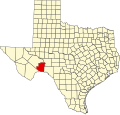
Sanderson, Texas
Location in the state of Texas
Usa edcp location map.svg
Red pog.svg
Sanderson, Texas
Sanderson, Texas (the United States)
Coordinates: 30°09′03″N102°24′29″W / 30.15083°N 102.40806°W / 30.15083; -102.40806 [1]
Country United States
State Texas
County Terrell
Area
  Total4.2 sq mi (10.8 km2)
  Land4.2 sq mi (10.8 km2)
  Water0.0 sq mi (0.0 km2)
Elevation
[1]
2,868 ft (874 m)
Population
 (2010)
  Total837
  Density200/sq mi (78/km2)
Time zone UTC-6 (Central (CST))
  Summer (DST) UTC-5 (CDT)
ZIP code
79848
Area code 432
FIPS code 48-65084 [2]
GNIS feature ID1346563 [1]

Sanderson is a census-designated place (CDP) in and the county seat of Terrell County, Texas, United States. [3] The population was 837 at the 2010 census. Sanderson was created in 1882 as a part of neighboring Pecos County. It became the seat of Terrell County in 1905.

Contents

History

Sanderson was founded in 1882. It was a division point for the Southern Pacific Railroad, where refueling and crew changes on its main transcontinental route took place. Mohair and wool production on surrounding ranches formed a significant part of the economy. The community entered in an economic decline when the operations involving sheep and goats decreased.

A devastating flood in June 1965 killed 26 people and washed away homes and businesses near the usually dry Sanderson Creek. Since then, many flood-control dams have been erected across the arroyos upstream from the town. [4]

An illustrated tour brochure guides visitors past 50 historic sites, [5] including several notable buildings remaining from the town's more prosperous era. The 1906 Courthouse was built to designs by Henry Phelps, but the still-graceful building was much modified in 1932, in 1950, and again in 1983. Facing the courthouse square is the little-changed 1931 Art Deco-style Sanderson High School, designed by Ralph W. Cameron, one of San Antonio's leading architects of the period. A handsome Deco frieze above the entranceway illustrates TRUTH CULTURE PROGRESS SUCCESS. Nearby is a Classical Revival structure built as a Masonic Lodge, but used for many years now as a private residence. Kerrs Mercantile on U.S. Route 90 was the leading retailer in these parts for decades; now under new ownership, the establishment is called the Z bar trading company known for hardware, household goods and gift items.

After regulations changed in 1995, the Southern Pacific ended the practice of changing train crews (and overnighting them) in Sanderson. By 2013, the community had lost most of the businesses it had during its peak, and the population was half of what it had been at its peak. [6]

Geography

According to the United States Census Bureau, the CDP has a total area of 4.2 square miles (10.9 km2), all land.

Sanderson is located on U.S. Route 90, 120 miles (190 km) west of Del Rio. [6]

Climate

Sanderson has a hot semiarid climate (Köppen BSh) bordering both on a cool semiarid climate (BSk) and a hot desert climate (BWh). [7] Winters feature mild, sunny days and cold or freezing nights, while summers are hot with occasional thunderstorms providing the only significant source of precipitation apart from occasional remnant hurricanes moving inland from the Gulf of Mexico.

Climate data for Sanderson, Texas (Jan 1, 1897–Mar 31, 2013)
MonthJanFebMarAprMayJunJulAugSepOctNovDecYear
Record high °F (°C)87
(31)
94
(34)
96
(36)
101
(38)
109
(43)
110
(43)
107
(42)
106
(41)
106
(41)
102
(39)
94
(34)
85
(29)
110
(43)
Mean daily maximum °F (°C)60.8
(16.0)
64.5
(18.1)
72.9
(22.7)
81.5
(27.5)
87.3
(30.7)
92.0
(33.3)
92.6
(33.7)
92.4
(33.6)
86.9
(30.5)
78.8
(26.0)
69.2
(20.7)
61.3
(16.3)
78.4
(25.8)
Daily mean °F (°C)46.1
(7.8)
49.6
(9.8)
57.6
(14.2)
66.6
(19.2)
73.7
(23.2)
79.6
(26.4)
81.0
(27.2)
80.4
(26.9)
74.6
(23.7)
65.1
(18.4)
54.7
(12.6)
46.8
(8.2)
64.7
(18.2)
Mean daily minimum °F (°C)31.4
(−0.3)
34.8
(1.6)
42.3
(5.7)
51.7
(10.9)
60.2
(15.7)
67.3
(19.6)
69.4
(20.8)
68.4
(20.2)
62.3
(16.8)
51.4
(10.8)
40.2
(4.6)
32.3
(0.2)
51.0
(10.6)
Record low °F (°C)7
(−14)
4
(−16)
12
(−11)
22
(−6)
37
(3)
40
(4)
49
(9)
54
(12)
40
(4)
21
(−6)
12
(−11)
3
(−16)
3
(−16)
Average rainfall inches (mm)0.46
(12)
0.54
(14)
0.42
(11)
0.79
(20)
1.62
(41)
1.73
(44)
1.42
(36)
1.50
(38)
2.14
(54)
1.49
(38)
0.59
(15)
0.42
(11)
13.12
(334)
Average snowfall inches (cm)0.2
(0.51)
0.0
(0.0)
0.1
(0.25)
0.0
(0.0)
0.0
(0.0)
0.0
(0.0)
0.0
(0.0)
0.0
(0.0)
0.0
(0.0)
0.0
(0.0)
0.0
(0.0)
0.1
(0.25)
0.4
(1.01)
Average rainy days (≥ 0.01 in)33224434542238
Source: Western Regional Climate Center, Desert Research Institute [8]

Demographics

2020 census

Note: the US Census treats Hispanic/Latino as an ethnic category. This table excludes Latinos from the racial categories and assigns them to a separate category. Hispanics/Latinos can be of any race. [9] [10]

Sanderson racial composition [11]
(NH = Non-Hispanic)
RaceNumberPercentage
White (NH)27441.27%
Black or African American (NH)81.2%
Asian (NH)50.75%
Some Other Race (NH)20.3%
Mixed/Multi-Racial (NH)172.56%
Hispanic or Latino 35853.92%
Total664

As of the 2020 United States census, there were 664 people, 312 households, and 199 families residing in the CDP.

2000 census

As of the census [2] of 2000, 861 people, 356 households, and 237 families resided in the CDP. The population density was 206 inhabitants per square mile (80/km2). The 635 housing units averaged 151.7/sq mi (58.5/km2). The racial makeup of the CDP was 86.88% White, 2.09% Native American, 0.70% Asian, 9.18% from other races, and 1.16% from two or more races. Hispanics or Latinos of any race were 51.45% of the population.

Of the 356 households, 29.2% had children under the age of 18 living with them, 53.4% were married couples living together, 8.4% had a female householder with no husband present, and 33.4% were not families. About 32.0% of all households were made up of individuals, and 18.5% had someone living alone who was 65 years of age or older. The average household size was 2.42 and the average family size was 3.08.

In the CDP, the population was distributed as 25.9% under the age of 18, 5.6% from 18 to 24, 22.1% from 25 to 44, 26.4% from 45 to 64, and 20.1% who were 65 years of age or older. The median age was 43 years. For every 100 females, there were 97.0 males. For every 100 females age 18 and over, there were 92.2 males.

The median income for a household in the CDP was $23,594, and for a family was $29,500. Males had a median income of $22,946 versus $14,453 for females. The per capita income for the CDP was $13,714. About 21.8% of families and 26.9% of the population were below the poverty line, including 33.5% of those under age 18 and 31.4% of those age 65 or over.

Education

Sanderson is served by the Terrell County Independent School District and is home to the Sanderson High School Eagles.

The high school and junior high school each have a six-man football team. [6]

Media

The Terrell County Sun's first issue was published in late November 2013. It was established to replace the previous paper, the Terrell County News-Leader , which closed in July 2013. Between the closing of the News-Leader and the opening of the Sun, the only source of local news was a bulletin board. Kenn Norris, the county commissioner, stated that the San Angelo Standard-Times was previously distributed in the community. [6]

Norris stated in 2013 that no radio reception exists in Sanderson. He stated that the television in the community as of 1989 came from Colorado. [6]

Infrastructure

Transportation

Sanderson is the location of the trailer park where Llewellyn Moss lives in the 2005 Cormac McCarthy novel and 2007 Coen Brothers film No Country for Old Men . [12] It is also the destination of the truckload of down-on-their-luck Mexicans looking for work in McCarthy's third Border Trilogy book Cities of the Plain (1998). [13]

See also

Related Research Articles

<span class="mw-page-title-main">Terrell County, Texas</span> County in Texas, United States

Terrell County is a county in the U.S. state of Texas. As of the 2020 census, its population was 760, making it the seventh-least populous county in Texas, and the 37th-least populous county in the nation. Its county seat is the census-designated place of Sanderson; no incorporated municipalities are in the county. The county was named for Alexander W. Terrell, a Texas state senator. Terrell County is one of the nine counties in the Trans-Pecos region of West Texas. It is the setting for Cormac McCarthy's novel No Country for Old Men, and the Academy Award-winning film adaptation of the same name.

<span class="mw-page-title-main">Schurz, Nevada</span> CDP in Nevada, United States

Schurz is a census-designated place (CDP) in Mineral County, Nevada, United States. The population was 658 at the 2010 census. It is located on the Walker River Indian Reservation. It is the burial place of Wovoka, the Paiute messiah who originated the Ghost Dance movement.

<span class="mw-page-title-main">Normanna, Texas</span> Census-designated place in Texas, United States

Normanna is a census-designated place in Bee County, Texas, United States. The population was 113 at the 2010 census.

<span class="mw-page-title-main">Marathon, Texas</span> CDP in Texas, United States

Marathon is a census-designated place (CDP) in Brewster County, Texas, United States. The population was 470 in 2007, after growing from 455 in 2000, but had decreased to 430 by 2010.

<span class="mw-page-title-main">Study Butte-Terlingua, Texas</span> Former CDP in Texas, United States

Study Butte-Terlingua was a census-designated place (CDP) in Brewster County, Texas, United States. The population was 267 at the 2000 census. For the 2010 census it was split into two CDPs, Study Butte and Terlingua.

<span class="mw-page-title-main">Ozona, Texas</span> Census-designated place in Texas, United States

Ozona is an unincorporated community and census-designated place (CDP) that serves as the county seat of Crockett County, Texas, United States. The population was 3,225 at the time of the 2010 census. Ozona is the only Census Bureau–recognized community in Crockett County, which is named for Colonel Davy Crockett, a hero of the Alamo.

<span class="mw-page-title-main">Lorenzo, Texas</span> City in Texas, United States

Lorenzo is a city in Crosby County, Texas, United States. As of the 2010 census, the city population was 1,147, down from 1,372 in 2000. It is part of the Lubbock Metropolitan Statistical Area.

<span class="mw-page-title-main">Tornillo, Texas</span> Census-designated place in Texas, United States

Tornillo is a census-designated place (CDP) and border town in El Paso County, Texas, United States. The population was 1,568 at the 2010 census. It is part of the El Paso Metropolitan Statistical Area. The Tornillo and Guadalupe, Chihuahua, area is connected by the Tornillo-Guadalupe Bridge.

<span class="mw-page-title-main">Rotan, Texas</span> City in Texas, United States

Rotan is a city in Fisher County, Texas, United States. The population was 1,508 at the 2010 census, down from 1,611 at the 2000 census.

<span class="mw-page-title-main">Redwood, Texas</span> Unincorporated community in Texas, United States

Redwood is an unincorporated community and census-designated place (CDP) in Guadalupe County, Texas, United States. The population was 4,003 at the 2020 census, down from 4,338 at the 2010 census. It is part of the San Antonio Metropolitan Statistical Area.

<span class="mw-page-title-main">Gruver, Texas</span> City in Texas, United States

Gruver is a city in Hansford County, Texas, United States. The population was 1,162 at the 2010 census. Farwell, in the center of Hansford County, approximately three miles east of what became Gruver, was established in 1880 by the Canott family of Illinois, and was the first town in the county. Gruver was established shortly after, and Farwell rapidly fell into oblivion after 1889, when it lost a county seat election to Hansford.

<span class="mw-page-title-main">Morse, Texas</span> Census-designated place in Texas, United States

Morse is an unincorporated community and census-designated place (CDP) in Hansford County, Texas, United States. The population was 147 at the 2010 census, down from 172 at the 2000 census.

<span class="mw-page-title-main">Evadale, Texas</span> Census-designated place in Texas, United States

Evadale is an unincorporated community and census-designated place (CDP) in Jasper County, Texas, United States. The population was 1,246 at the 2020 census.

<span class="mw-page-title-main">Fort Davis, Texas</span> Census-designated place in Texas, United States

Fort Davis is an unincorporated community and census-designated place (CDP) in Jeff Davis County, Texas, United States. The population was 1,201 at the 2010 census, up from 1,050 at the 2000 census. It is the county seat of Jeff Davis County.

<span class="mw-page-title-main">Central Gardens, Texas</span> Census-designated place in Texas, United States

Central Gardens is an unincorporated community and census-designated place (CDP) in Jefferson County, Texas, United States. The population was 4,373 at the 2020 census. It is part of the Beaumont–Port Arthur metropolitan area.

<span class="mw-page-title-main">Lipscomb, Texas</span> Census-designated place in Texas, United States

Lipscomb is an unincorporated community and census-designated place (CDP) in Lipscomb County, Texas, United States. It is the Lipscomb county seat. The population was 37 at the 2010 census.

<span class="mw-page-title-main">Buchanan Dam, Texas</span> Census-designated place in Texas, United States

Buchanan Dam is a census-designated place (CDP) in Llano County, Texas, United States. The population was 1,519 at the 2010 census, down from 1,688 at the 2000 census.

<span class="mw-page-title-main">Potosi, Texas</span> CDP in Texas, United States

Potosi is a census-designated place (CDP) in Taylor County, Texas, United States. Its population was 2,991 at the 2010 census. It is part of the Abilene, Texas metropolitan statistical area.

<span class="mw-page-title-main">Rushmere, Virginia</span> Census-designated place in Virginia, United States

Rushmere is a census-designated place (CDP) in Isle of Wight County, Virginia, United States. The population was 1,018 at the 2010 census.

<span class="mw-page-title-main">Hamlin, Texas</span> City in Texas, United States

Hamlin is a city in Jones and Fisher Counties in the U.S. state of Texas. The population was 2,124 at the 2010 census, and in 2018, the estimated population was 1,997. The Jones County portion of Hamlin is part of the Abilene, Texas metropolitan area.

References

  1. 1 2 3 U.S. Geological Survey Geographic Names Information System: Sanderson, Texas
  2. 1 2 "U.S. Census website". United States Census Bureau . Retrieved January 31, 2008.
  3. "Find a County". National Association of Counties. Retrieved June 7, 2011.
  4. Swanya Howell Pitts, "SANDERSON, TX," Handbook of Texas Online
  5. Terrell County~Cactus Capital of Texas
  6. 1 2 3 4 5 MacCormack, John. "In fading town, the news is back." Houston Chronicle . December 27, 2013. Retrieved on December 27, 2013. - Also available from the San Antonio Express-News . "In fading town, the news is back", December 25, 2013.
  7. "US COOP Station Map". Western Regional Climate Center, Desert Research Institute . Retrieved March 27, 2016.
  8. "SANDERSON, TEXAS (418022), Period of Record Monthly Climate Summary". Western Regional Climate Center, Desert Research Institute. Retrieved March 27, 2016.
  9. https://www.census.gov/ [ not specific enough to verify ]
  10. "About the Hispanic Population and its Origin". www.census.gov. Retrieved May 18, 2022.
  11. "Explore Census Data". data.census.gov. Retrieved May 18, 2022.
  12. "Reviews". Uncut.
  13. Chapter I, pp. 35-37