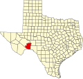
Dryden, Texas

Last updated

Dryden
Dryden PO. Texas (cropped).jpg
Dryden Post Office
USA Texas location map.svg
Red pog.svg
Dryden
Location in the state of Texas
Coordinates: 30°02′41″N102°06′52″W / 30.04472°N 102.11444°W / 30.04472; -102.11444
Country United States
State Texas
County Terrell
Elevation
[1]
2,110 ft (640 m)
Time zone UTC-6 (Central (CST))
  Summer (DST) UTC-5 (CDT)
ZIP codes
78851
Area code 432
GNIS feature ID1334709 [1]

Dryden is an unincorporated community in south central Terrell County, Texas, United States.

Contents

History

The community was founded in 1882 and named for Eugene E. Dryden. He was the chief engineer of the Galveston, Harrisburg and San Antonio Railway, which established a section house at Dryden when building its tracks through Terrell County. Over the next several decades Dryden became a small center for ranching-based businesses. The headquarters for the Pecos Land and Cattle Company were established in Dryden in 1884. The company drilled a well that supplied the area with water.

By 1912 the Dryden Hotel had been established, along with a combined schoolhouse, community center, and church. Dryden had a population of nearly 100 by 1929.

Two units of U.S. Army troops were stationed in Dryden during the 191317 Mexican border unrest. During the Great Depression of the 1930s, the railway closed the Dryden depot and relocated its crews, and the area’s ranches were eventually broken up. The population had dwindled to approximately fifty by 1970. The population continued to decline, to thirteen by 1988, although a general store was still operating in 1995. [2] [3]

The post office dated from 1888; however, the United States Postal Service no longer maintains a post office in Dryden.

Wayne Sutton, a local sheep farmer and director of Dryden Water Supply Company, [4] has been[ when? ] appointed mayor by the other residents.

Amtrak's Sunset Limited passes through the town on Union Pacific tracks, but makes no stop. A stop is located 20 miles to the west in the nearby town of Sanderson.

Geography

Dryden is located on U.S. Route 90 at the south termination of State Highway 349, 20 miles east of Terrell County's county seat Sanderson and 100 miles (162 km) west of Del Rio. [2] [3] [5]

Climate

Elevation: 2,110 feet (643 m). [6] [7]

Climate data for Dryden, Texas (Jun 1, 1966–Oct 31, 1994)
MonthJanFebMarAprMayJunJulAugSepOctNovDecYear
Record high °F (°C)87
(31)
95
(35)
98
(37)
103
(39)
110
(43)
112
(44)
111
(44)
110
(43)
106
(41)
103
(39)
90
(32)
87
(31)
112
(44)
Average high °F (°C)60.2
(15.7)
65.0
(18.3)
74.3
(23.5)
82.7
(28.2)
88.8
(31.6)
94.5
(34.7)
95.5
(35.3)
94.8
(34.9)
88.8
(31.6)
79.9
(26.6)
69.2
(20.7)
61.8
(16.6)
79.6
(26.4)
Daily mean °F (°C)46.5
(8.1)
50.5
(10.3)
59.2
(15.1)
68.1
(20.1)
75.2
(24.0)
81.5
(27.5)
83.1
(28.4)
82.1
(27.8)
76.3
(24.6)
66.3
(19.1)
55.3
(12.9)
47.8
(8.8)
66.0
(18.9)
Average low °F (°C)32.7
(0.4)
36.0
(2.2)
44.0
(6.7)
53.4
(11.9)
61.6
(16.4)
68.6
(20.3)
70.6
(21.4)
69.4
(20.8)
63.8
(17.7)
52.6
(11.4)
41.7
(5.4)
33.8
(1.0)
52.3
(11.3)
Record low °F (°C)10
(−12)
1
(−17)
12
(−11)
24
(−4)
40
(4)
49
(9)
60
(16)
59
(15)
38
(3)
27
(−3)
17
(−8)
1
(−17)
1
(−17)
Average precipitation inches (mm)0.53
(13)
1.03
(26)
0.57
(14)
0.99
(25)
1.75
(44)
1.02
(26)
1.27
(32)
1.85
(47)
2.64
(67)
1.40
(36)
0.74
(19)
0.45
(11)
14.24
(362)
Average snowfall inches (cm)0.6
(1.5)
0.2
(0.51)
0.0
(0.0)
0.0
(0.0)
0.0
(0.0)
0.0
(0.0)
0.0
(0.0)
0.0
(0.0)
0.0
(0.0)
0.0
(0.0)
0.1
(0.25)
0.0
(0.0)
0.9
(2.3)
Average precipitation days (≥ 0.01 in)33224333532235
Source: Western Regional Climate Center, Desert Research Institute [8]

See also

Related Research Articles

<span class="mw-page-title-main">Terrell County, Texas</span> County in Texas, United States

Terrell County is a county in the U.S. state of Texas. As of the 2020 census, its population was 760, making it the seventh-least populous county in Texas, and the 37th-least populous county in the nation. Its county seat is the census-designated place of Sanderson; no incorporated municipalities are in the county. The county was named for Alexander W. Terrell, a Texas state senator. Terrell County is one of the nine counties in the Trans-Pecos region of West Texas. It is the setting for Cormac McCarthy's novel No Country for Old Men, and the Academy Award-winning film adaptation of the same name.

<span class="mw-page-title-main">Presidio County, Texas</span> County in Texas, United States

Presidio County is a county located in the U.S. state of Texas. As of the 2020 census, its population was 6,131. Its county seat is Marfa. The county was created in 1850 and later organized in 1875. Presidio County is in the Trans-Pecos region of West Texas and is named for the border settlement of Presidio del Norte. It is on the Rio Grande, which forms the Mexican border.

<span class="mw-page-title-main">Pecos County, Texas</span> County in Texas, United States

Pecos County is a county located in the U.S. state of Texas. As of the 2020 census, its population was 15,193. The county seat is Fort Stockton. The county was created in 1871 and organized in 1875. It is named for the Pecos River. It is one of the nine counties that comprise the Trans-Pecos region of West Texas.

<span class="mw-page-title-main">Brewster County, Texas</span> County in Texas, United States

Brewster County is a county located in the U.S. state of Texas. It is in West Texas and its county seat is Alpine. It is one of the nine counties that comprise the Trans-Pecos region, and borders Mexico. Brewster County is the largest county by area in the state - at 6,192 square miles (16,040 km2) it is over three times the size of the state of Delaware, and more than 500 square miles (1,300 km2) bigger than Connecticut.

<span class="mw-page-title-main">Fernley, Nevada</span> City in Nevada, United States

Fernley is a city in Lyon County, Nevada, United States, and part of the Reno–Tahoe-Sparks metropolitan area CSA. The city was incorporated in 2001. The population of the city was 22,895 at the 2020 census, making it the 7th most populous city in Nevada.

<span class="mw-page-title-main">Muleshoe, Texas</span> City in Texas, United States

Muleshoe is a city in Bailey County, Texas, United States. It was founded in 1913, when the Pecos and Northern Texas Railway built an 88-mile (142 km) line from Farwell, Texas, to Lubbock through northern Bailey County. In 1926, Muleshoe was incorporated. Its population was 5,158 at the 2010 census. The county seat of Bailey County, it is home to the National Mule Memorial.

<span class="mw-page-title-main">White Deer, Texas</span> Town in Texas, United States

White Deer is a town in Carson County, Texas, United States. The population was 1,000 at the 2010 census. It is part of the Amarillo metropolitan statistical area.

<span class="mw-page-title-main">Hereford, Texas</span> City in Texas, United States of America

Hereford is a city in and county seat of Deaf Smith County, Texas, United States. It is 48 miles southwest of Amarillo. Its population was 15,370 at the 2010 census. It is the only incorporated locality named "Hereford" in the country.

<span class="mw-page-title-main">Kingsville, Texas</span> City in Texas, United States

Kingsville is a city in the southern region of the U.S. state of Texas and the county seat of Kleberg County. Located on the U.S. Route 77 corridor between Corpus Christi and Harlingen, Kingsville is the principal city of the Kingsville Micropolitan Statistical Area, which is part of the larger Corpus Christi-Kingsville Combined Statistical Area. The population was 25,402 at the 2020 census, and in 2022 the U.S. Census Bureau estimated the population at 24,833.

<span class="mw-page-title-main">Fort Stockton, Texas</span> City in Texas, United States

Fort Stockton is a city in and the county seat of Pecos County, Texas, United States. It is located on Interstate 10, future Interstate 14, U.S. Highways 67, 285, and 385, and the Santa Fe Railroad, 329 mi (529 km) northwest of San Antonio and 240 mi (390 km) southeast of El Paso. Its population was 8,466 at the 2020 census.

<span class="mw-page-title-main">Big Lake, Texas</span> City in Texas, United States

Big Lake is a small rural city in Reagan County, Texas, United States. As of the 2010 Census, the city population was 2,936. It is the county seat of Reagan County.

<span class="mw-page-title-main">Sanderson, Texas</span> CDP in Texas, United States

Sanderson is a census-designated place (CDP) in and the county seat of Terrell County, Texas, United States. The population was 837 at the 2010 census. Sanderson was created in 1882 as a part of neighboring Pecos County. It became the seat of Terrell County in 1905.

<span class="mw-page-title-main">Mobeetie, Texas</span> City in Texas, United States

Mobeetie is a city in northwestern Wheeler County, Texas, United States, located on Sweetwater Creek and State Highway 152. Its population was 101 at the 2010 census, six below the 2000 figure.

<span class="mw-page-title-main">Floresville, Texas</span> City in Texas, United States

Floresville is a city in Wilson County, Texas, United States. According to the U.S. Census Bureau, its population was at 7,203 at the 2020 Census. It is the county seat of Wilson County. The city is also part of the San Antonio metropolitan statistical area.

<span class="mw-page-title-main">Newberry Springs, California</span> Unincorporated community in California, United States

Newberry Springs is an unincorporated community in the western Mojave Desert of Southern California, located at the foot of the Newberry Mountains in San Bernardino County, California, United States. Newberry Spring is a spring that in the 19th century supplied water to the local Santa Fe Railway and originally was a camping place. The population at the 2000 census was 2,895.

<span class="mw-page-title-main">Palo Pinto, Texas</span> CDP in Texas, United States

Palo Pinto is a census-designated place (CDP) and unincorporated community and county seat in Palo Pinto County, Texas, United States. This was a new CDP for the 2010 census with a population of 333.

Sheffield is an unincorporated community in Pecos County, Texas, United States. According to the 2020 Census, the community had an estimated population of 174 in 2020. Named for pioneer rancher Will Sheffield, it has a post office with ZIP code of 79781.

<span class="mw-page-title-main">Lake George, Colorado</span> Unincorporated community in Park County, Colorado, United States

Lake George is an unincorporated community and a U.S. Post Office in Park County, Colorado, United States. The Lake George Post Office has the ZIP Code 80827. It lies along U.S. Highway 24 northwest of Colorado Springs, and several miles north of Florissant Fossil Beds National Monument.

Dryden is a small unincorporated community in Chelan County, Washington, United States. It is situated along the Wenatchee River in the fertile Wenatchee Valley between the towns of Cashmere and Leavenworth. The community serves as a supply and shipping point for local farms and orchards.

Dundee is an unincorporated community located in Archer County, Texas, United States. According to the Handbook of Texas, the community had a population of 12 in 2010. Dundee is located within the Wichita Falls Metropolitan Statistical Area.

References

  1. 1 2 U.S. Geological Survey Geographic Names Information System: Dryden, Texas
  2. 1 2 "Dryden, Texas". TexasEscapes.com. June 4, 2007. Retrieved June 30, 2007.
  3. 1 2 "Dryden, Texas". Handbook of Texas Online. April 12, 2006. Retrieved June 30, 2007.
  4. "Wayne Sutton in Sanderson, TX". Bizapedia. Retrieved November 20, 2013.
  5. "Dryden, Texas Community Profile". Home Town Locator. 2007. Archived from the original on September 30, 2007. Retrieved June 30, 2007.
  6. U.S. Geological Survey Geographic Names Information System: Dryden, Texas
  7. "US COOP Station Map". Western Regional Climate Center, Desert Research Institute . Retrieved March 27, 2016.
  8. "DRYDEN, TEXAS (412590), Period of Record Monthly Climate Summary". Western Regional Climate Center, Desert Research Institute. Retrieved March 27, 2016.