Hermleigh, Texas

Last updated

Hermleigh, Texas
CDP
Hermleigh post office.JPG
The Hermleigh post office.
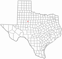
TXMap-doton-Hermleigh.PNG
Location of Hermleigh, Texas
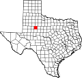
Scurry County Hermleigh.svg
Coordinates: 32°38′5″N100°45′34″W / 32.63472°N 100.75944°W / 32.63472; -100.75944
Country United States
State Texas
County Scurry
Area
  Total9.1 sq mi (23.5 km2)
  Land9.1 sq mi (23.5 km2)
  Water0.0 sq mi (0.0 km2)
Elevation
2,441 ft (744 m)
Population
 (2010)
  Total345
  Density38/sq mi (15/km2)
Time zone UTC-6 (Central (CST))
  Summer (DST) UTC-5 (CDT)
ZIP code
79526
Area code 325
FIPS code 48-33356 [1]
GNIS feature ID1337647 [2]

Hermleigh is a census-designated place (CDP) in Scurry County, Texas, United States.

Contents

Hermleigh lies on U.S. Route 84, ninety-six miles southeast of Lubbock, and has population of 345 people at the 2010 census.

A destructive low-end EF2 tornado struck the northwestern side of town on May 1, 2022, damaging or destroying mobile homes while also damaging a home, a garage, trailers, and vehicles. [3]

Geography

Hermleigh is located at 32°38′5″N100°45′34″W / 32.63472°N 100.75944°W / 32.63472; -100.75944 (32.634619, -100.759336). [4]

According to the United States Census Bureau, the CDP has a total area of 9.1 square miles (23.5 km2), all land.

Demographics

As of the census [1] of 2000, there were 393 people, 151 households, and 104 families residing in the CDP. The population density was 43.4 inhabitants per square mile (16.8/km2). There were 183 housing units at an average density of 20.2/sq mi (7.8/km2). The racial makeup of the CDP was 90.08% White, 2.29% African American, 0.25% Asian, 5.34% from other races, and 2.04% from two or more races. Hispanic or Latino of any race were 23.66% of the population.

There were 151 households, out of which 33.1% had children under the age of 18 living with them, 58.3% were married couples living together, 8.6% had a female householder with no husband present, and 31.1% were non-families. 28.5% of all households were made up of individuals, and 15.2% had someone living alone who was 65 years of age or older. The average household size was 2.60 and the average family size was 3.24.

In the CDP, the population was spread out, with 28.2% under the age of 18, 12.2% from 18 to 24, 23.4% from 25 to 44, 20.9% from 45 to 64, and 15.3% who were 65 years of age or older. The median age was 36 years. For every 100 females, there were 99.5 males. For every 100 females age 18 and over, there were 95.8 males.

The median income for a household in the CDP was $26,111, and the median income for a family was $30,417. Males had a median income of $27,222 versus $21,000 for females. The per capita income for the CDP was $11,843. About 13.1% of families and 23.4% of the population were below the poverty line, including 34.7% of those under age 18 and 25.3% of those age 65 or over.

History

Hermleigh's history begins in 1907 when a townsite was surveyed on land donated by two men named R. C. Herm and Harry W. Harlin near the small community of Wheat. Citizens chose to name their new community "Hermlin" (an amalgam of the surnames of the two landowners) but this name was rejected by postal officials as being too close to the nearby town of Hamlin, potentially causing confusion between the two communities. The compromise of "Hermleigh" was settled upon, and the post office opened shortly thereafter. The Roscoe, Snyder and Pacific Railway was built through the new community, and residents of Wheat began to relocate to Hermleigh.

In 1911 the Santa Fe Railroad reached the community, and Hermleigh developed into a shipping point and trading center for local ranchers and cotton farmers. A school opened to serve area students in 1913, and by the late 1910s the community had its own newspaper (the Hermleigh Herald). Hermleigh briefly changed its name in the late 1910s to Foch to honor the French field marshal and World War I hero Ferdinand Foch, but reverted to the original name shortly thereafter and continued to flourish until the early 1930s, when the effects of the Great Depression brought an end to Hermleigh's growth.

Though adversely effected by the Depression, Hermleigh remained stable throughout most of the twentieth century and by 1980 was home to over 700 residents. By 1990, however, the population had fallen dramatically to approximately 200 and some of the remaining businesses closed down. The community inexplicably rebounded during the 1990s, with the population reaching 393 by the 2000 Census.

Hermleigh is the hometown of former head coach of the Baylor Bears football program, Grant Teaff.

The most expensive pig ever sold was owned by a Hermleigh resident. Jefferey Roemisch of Hermleigh sold his cross-breed barrow named "Bud" for a record-breaking $56,000 in 1983 to a man named Bud Olson and his partner, Phil Bonzio. [5]

Education

The community of Hermleigh is served by the Hermleigh Independent School District.

Related Research Articles

<span class="mw-page-title-main">Clay, Alabama</span> City in Alabama, United States

Clay is a city in northeastern Jefferson County, Alabama, United States. It is part of the Birmingham–Hoover–Cullman Combined Statistical Area in the north-central part of the state. Local government is run by a mayor and city council.

<span class="mw-page-title-main">Smiths Station, Alabama</span> City in Alabama, United States

Smiths Station is a city in Lee County, Alabama. It is part of the Columbus metropolitan area, Georgia. At the time of the 2000 census, it was still a census-designated place (CDP), and its population was 6,756. The area that incorporated as Smiths Station in 2001 was much smaller than the CDP, and contained a population of 4,926 by the 2010 census. Smiths Station, known to locals as "Smiths", is a bedroom community of Columbus, Georgia and Phenix City, Alabama. Smiths Station High School has an enrollment of over 1,800 students and is the 11th-largest high school in the state.

<span class="mw-page-title-main">Johannesburg, California</span> Census-designated place in California, United States

Johannesburg is a census-designated place (CDP) in Kern County, California, in a mining district of the Rand Mountains. Johannesburg is located 1 mile (1.6 km) east-northeast of Randsburg, at an elevation of 3,517 feet (1,072 m). The terminus of the Randsburg Railway was here from 1897 to 1933. The population was 172 at the 2010 census, down from 176 at the 2000 census. Johannesburg is divided from the neighboring community of Randsburg by a ridge. The town is frequently referred to as "Jo-burg" by locals and frequent visitors to the northwest Mojave.

<span class="mw-page-title-main">C-Road, California</span> Census-designated place in California, United States

C-Road is a census-designated place (CDP) in Plumas County, California, United States. The population was 150 at the 2010 census, down from 152 at the 2000 census.

<span class="mw-page-title-main">Lake Mack-Forest Hills, Florida</span> Census-designated place in Florida

Lake Mack-Forest Hills is a census-designated place (CDP) in Lake County, Florida, United States. It contains the unincorporated communities of Forest Hills and Lake Mack Park. The population was 1,010 at the 2010 census, up from 989 at the 2000 census. It is part of the Orlando–Kissimmee–Sanford Metropolitan Statistical Area.

<span class="mw-page-title-main">Paisley, Florida</span> Census-designated place in Florida

Paisley is an unincorporated community and census-designated place (CDP) in Lake County, Florida, United States. The population was 818 at the 2010 census, up from 734 at the 2000 census. It is part of the Orlando–Kissimmee Metropolitan Statistical Area.

<span class="mw-page-title-main">Buckingham, Florida</span> Census-designated place in Florida, United States

Buckingham is an unincorporated community and census-designated place (CDP) in Lee County, Florida, United States. The population was 4,443 at the 2020 census, up from 4,036 at the 2010 census. It is part of the Cape Coral-Fort Myers, Florida Metropolitan Statistical Area.

<span class="mw-page-title-main">East Bernstadt, Kentucky</span> Census-designated place in Kentucky, United States

East Bernstadt is a census-designated place (CDP) and coal town in Laurel County, Kentucky, United States. The population was 716 at the 2010 census, down from 774 at the 2000 census.

<span class="mw-page-title-main">Rancho San Diego, California</span> Census designated place in California, United States

Rancho San Diego is a census-designated place (CDP) in the East County region of San Diego County, California. The population was 21,858 at the 2020 census, up from 21,208 at the 2010 census. The area was developed as subdivisions beginning in the 1970s.

<span class="mw-page-title-main">Presidential Lakes Estates, New Jersey</span> Populated place in Burlington County, New Jersey, US

Presidential Lakes Estates is an unincorporated community and census-designated place (CDP) located within Pemberton Township, in Burlington County, in the U.S. state of New Jersey. As of the 2010 United States Census, the CDP's population was 2,365.

<span class="mw-page-title-main">Clarence Center, New York</span> Census-designated place in New York, United States

Clarence Center is a affluent hamlet and census-designated place (CDP) in the town of Clarence in Erie County, New York, United States. The population was 2,257 at the 2010 census. It is part of the Buffalo–Niagara Falls Metropolitan Statistical Area.

<span class="mw-page-title-main">Park Layne, Ohio</span> Census-designated place in Ohio, United States

Park Layne is a census-designated place (CDP) in Clark County, Ohio, United States. The area is also referred to as Park Layne Manor. The population of the CDP was 4,248 at the 2020 census. It is part of the Springfield, Ohio Metropolitan Statistical Area.

<span class="mw-page-title-main">Northridge, Montgomery County, Ohio</span> Unincorporated community in Ohio, United States

Northridge is an unincorporated community in Harrison Township in Montgomery County, Ohio, United States. It was delineated as a census-designated place (CDP) for the 2000 census, at which time its population was 8,487. It was not delineated as a CDP for the 2010 census. It is located directly north of the city of Dayton and is part of the Dayton Metropolitan Statistical Area.

<span class="mw-page-title-main">Masury, Ohio</span> Census-designated place in Ohio, United States

Masury is an unincorporated community and census-designated place in eastern Trumbull County, Ohio, United States. The population was 2,001 at the 2020 census. It is part of the Youngstown–Warren metropolitan area.

<span class="mw-page-title-main">Leach, Oklahoma</span> Census-designated place in Oklahoma, United States

Leach is an unincorporated community and census-designated place (CDP) in southwestern Delaware County, Oklahoma, United States, along U.S. Route 412 and 412 Alternate. The population was 237 at the 2010 census.

<span class="mw-page-title-main">Pine Ridge, South Dakota</span> CDP in South Dakota, United States

Pine Ridge is a census-designated place (CDP) and the most populous community in Oglala Lakota County, South Dakota, United States. The population was 3,138 at the 2020 census. It is the tribal headquarters of the Oglala Sioux Tribe on the Pine Ridge Indian Reservation.

<span class="mw-page-title-main">Encantada-Ranchito-El Calaboz, Texas</span> Census-designated place in Texas, United States

Encantada-Ranchito-El Calaboz, also known as El Calaboz Rancheria in the San Pedro de Carricitos Land Grant, is a census-designated place (CDP) in Cameron County, Texas, United States. The population was 2,255 at the 2010 census. It is part of the Brownsville–Harlingen Metropolitan Statistical Area.

<span class="mw-page-title-main">El Refugio, Texas</span> CDP in Texas, United States

El Refugio is a census-designated place (CDP) in Starr County, Texas, United States. The population was 331 at the 2010 census. El Refugio gained area in the 2010 census.

<span class="mw-page-title-main">Cheektowaga (CDP), New York</span> Census-designated place in New York, United States

Cheektowaga is a suburban community and census-designated place (CDP) in Erie County, New York, United States. The population was 75,178 at the 2010 census, making it the most populous census-designated place in New York. It is within the town of Cheektowaga. The CDP includes Buffalo Niagara International Airport.

Argyle is an unincorporated community and census-designated place in Boone and Winnebago counties in the U.S. state of Illinois, northeast of Rockford. It is part of the Rockford, Illinois Metropolitan Statistical Area.

References

  1. 1 2 "U.S. Census website". United States Census Bureau . Retrieved January 31, 2008.
  2. "US Board on Geographic Names". United States Geological Survey. October 25, 2007. Retrieved January 31, 2008.
  3. "NWS Damage Survey for 05/01/2022 Tornado Event". Iowa Environmental Mesonet. National Weather Service in Midland/Odessa, Texas. May 2, 2022. Retrieved May 3, 2022.
  4. "US Gazetteer files: 2010, 2000, and 1990". United States Census Bureau. February 12, 2011. Retrieved April 23, 2011.
  5. Glenday, Craig (2011). Guinness world records 2011 (2011 Bantam mass market ed.). New York: Bantam Books. p.  288. ISBN   978-0440423102 . Retrieved February 27, 2016. ★Pig: E.A. Bud Olson and Phil Bonzio paid $56,000 to Jeffrey Roemisch of Texaas, U.S.A., for Bud, a crossbred barrow on March 5, 1983.

Handbook of Texas Online entry for Hermleigh