| History of Texas | ||||||||||||||||||
|---|---|---|---|---|---|---|---|---|---|---|---|---|---|---|---|---|---|---|
 | ||||||||||||||||||
| Timeline | ||||||||||||||||||
| ||||||||||||||||||
Kicaster is an unincorporated community in northwestern Wilson County, Texas, United States. [1]
| History of Texas | ||||||||||||||||||
|---|---|---|---|---|---|---|---|---|---|---|---|---|---|---|---|---|---|---|
| | ||||||||||||||||||
| Timeline | ||||||||||||||||||
| ||||||||||||||||||
Kicaster is an unincorporated community in northwestern Wilson County, Texas, United States. [1]
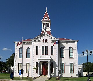
Wilson County is a county located in the U.S. state of Texas. As of the 2020 census, its population was 49,753. Its county seat is Floresville. The county is named after James Charles Wilson. Wilson County is part of the San Antonio–New Braunfels, Texas, metropolitan statistical area.

Cherry Grove Township is a civil township of Wexford County in the U.S. state of Michigan. The population was 2,421 at the 2020 census.

Arlington Heights is a census-designated place (CDP) in Snohomish County, Washington, United States. As of the 2020 census, the population was 2,477, up from 2,284 at the 2010 census.

Neosho is a village in Dodge County, Wisconsin, United States. The population was 574 at the 2010 census.

Belmez is a village and municipality with 2964 (2018) inhabitants in Córdoba, Andalucia, Spain.

The Diocese of Lake Charles, is a Latin Church diocese of the Catholic Church in southwestern Louisiana in the United States. It is a suffragan see of the metropolitan Archdiocese of New Orleans.
Scraggane is a fishing port located on the Maharees peninsula near Castlegregory in County Kerry, Ireland.

Iowa's 2nd congressional district is a congressional district in the U.S. state of Iowa that covers most of its northeastern part. It includes Cedar Rapids, Dubuque, Waterloo, and Grinnell.
Bellhouse Provincial Park is a provincial park in the southern Gulf Islands of British Columbia, Canada. It is located in the Sturdies Bay area of southeastern Galiano Island. It is on land donated by Thorney Bellhouse in 1964, and is noted for its spring wildflowers, notably fawn lilies and chocolate lilies, as well as views of snow-capped mountains and abundant marine life.
Kicaster Creek is a short stream in Wilson County, Texas. The creek begins in the recharge zone for the Carrizo-Wilcox Aquifer, near Kicaster, six miles southwest of the town of La Vernia. It flows through the Sand Hills Region of Wilson County for eleven miles southeastward to its mouth three miles northwest of the town of Floresville on the San Antonio River.
CFLN-FM is a Canadian radio station in Happy Valley-Goose Bay, Newfoundland & Labrador broadcasting at 97.9 FM. Owned by Stingray Group, CFLN first went on the air on September 28, 1974 at 1230 AM before converting to its current frequency in 2009. The station's format primarily consists of country music with some News/Talk programming. The station was formerly branded Radio Labrador but is now branded Big Land – Labrador's FM.
Acatlán de Osorio is a city in the Mexican state of Puebla. The shortened name Acatlán, is commonly used to refer to the municipality of which it is the seat, and to the city itself. It is at an elevation of 1,213 m (3,981 ft). In the 2000 census the population of the city was 34,765.

Fall River Township is located in LaSalle County, Illinois. As of the 2010 census, its population was 763 and it contained 339 housing units. Fall River Township was formed from Grand Rapids Township on an unknown date.

Walbrook is a neighborhood in West Baltimore, located along West North Avenue. Coppin State University is located in Walbrook, and the neighborhood was also the namesake of the former Walbrook High School.
Aruküla is a village in Alutaguse Parish, Ida-Viru County in northeastern Estonia.

Veliševac is a village situated in Ljig municipality in Serbia.

Castelo de Longroiva is a castle in Portugal. It is classified as a National Monument.

Conashaugh Lakes is a census-designated place located in Dingman Township, Pike County in the state of Pennsylvania. The community is located off Pennsylvania Route 739 to the south of Interstate 84. As of the 2020 census the population was 1,425 residents.
Pueblo Nuevo is a census-designated place (CDP) in Webb County, Texas, United States.This was a new CDP formed from parts of the Laredo Ranchettes CDP and additional area prior to the 2010 census, with a population of 521.
Cottage was an unincorporated community in Hardin County, in the U.S. state of Iowa.
29°18′37″N98°12′31″W / 29.31028°N 98.20861°W
Municipalities and communities of Wilson County, Texas, United States | ||
|---|---|---|
| Cities | 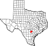 | |
| Town | ||
| Unincorporated communities | ||
| Ghost towns | ||
| Footnotes | ‡This populated place also has portions in an adjacent county or counties | |