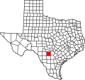
Dunlay, Texas

Last updated

Dunlay is an unincorporated community in Medina County, Texas. It lies about six miles west of Castroville and eight miles east of Hondo on U.S. Highway 90. The town was named after Jerry Dunlay, a local train conductor. Dunlay, originally called Enterprise, was established in 1881 along the Galveston, Harrisburg and San Antonio Railway. A post office was established in 1890 with Norval Seymour Murray as postmaster. After May 10, 1895, the town was called Dunlay.

Dunlay is part of the San Antonio metropolitan area.

Related Research Articles

Medina County, Texas County in Texas, United States

Medina County is a county located in the U.S. state of Texas. As of the 2010 census, its population was 46,006. Its county seat is Hondo. The county is named for the Medina River. The extreme northern part of the county lies within the Edwards Plateau, which elevates into the Texas Hill Country. The Medina Dam, the fourth largest in the nation when completed in 1913, is listed on the National Register of Historic Places. The irrigation project, creating Medina Lake, was built by 1500 skilled workers who worked in shifts operating 24 hours a day to complete the dam in two years. Medina County is part of the San Antonio, TX Metropolitan Statistical Area.

Christine, Texas Town in Texas, United States

Christine is a town in Atascosa County, Texas, United States. The population was 390 at the 2010 census. It is part of the San Antonio Metropolitan Statistical Area.

Pleasanton, Texas City in Texas, United States

Pleasanton is a city in Atascosa County, Texas, United States. The population was 8,934 at the 2010 census. Pleasanton's official motto is "The City of Live Oaks and Friendly Folks." It is part of the San Antonio-New Braunfels Metropolitan Statistical Area.

Poteet, Texas City in Texas, United States

Poteet is a city in Atascosa County, Texas, United States. The population was 3,260 as of the 2010 census. It is part of the San Antonio Metropolitan Statistical Area. It was named for its first postmaster, Francis Marion Poteet. It is best known as the birthplace of country music legend, George Strait.

Lakehills, Texas CDP in Texas, United States

Lakehills is a census-designated place (CDP) in Bandera County, Texas, United States. The population was 5,150 at the 2010 census, making it the most populous place in Bandera county. It is part of the San Antonio Metropolitan Statistical Area.

Elmendorf, Texas City in Texas, United States

Elmendorf is a city in Bexar County, Texas, United States. It is part of the San Antonio—New Braunfels metropolitan statistical area. Its population was 1,488 at the 2010 census. It was founded in 1885, and named after Henry Elmendorf, a former mayor of San Antonio, and a German-Texan. For a long time, the biggest employer was Star Clay Products.

Universal City, Texas City in Texas, United States

Universal City is a city in Bexar County, Texas, United States. It borders San Antonio to the northeast, and is adjacent to Randolph Air Force Base. The population was 18,530 at the 2010 census. It is part of the San Antonio Metropolitan Statistical Area.

Brackettville, Texas City in Texas, United States

Brackettville is a city in Kinney County, Texas, United States. The population was 1,688 at the 2010 census, down from 1,876 at the 2000 census. It is the county seat of Kinney County.

Castroville, Texas City in Texas, United States

Castroville is a city in Medina County, Texas, United States. The population was 2,680 at the 2010 census. Prior to 1893, Castroville was the first county seat of Medina County. Castroville is known for its influential Alsatian-Texan architecture, people, and culture. Most Alsatians that came to Castroville spoke Alsatian. To say Castroville's ancestral influences are broadly French would not be true, as they are more strictly Alsatian, a culture and language still kept alive by its residents.

Floresville, Texas City in Texas, United States

Floresville is a city in Wilson County, Texas, United States. According to the U.S. Census Bureau, the population was at 6,448 at the 2010 Census. It is the county seat of Wilson County. The city is also part of the San Antonio Metropolitan Statistical Area.

Selma, Texas City in Texas, United States

Selma is a city in Bexar, Comal, and Guadalupe counties in the U.S. state of Texas. It is part of the San Antonio Metropolitan Statistical Area. The population was 5,540 at the 2010 census, up from 788 at the 2000 census. The estimated population in 2018 was 11,075.

Mico is an unincorporated community in northeastern Medina County, Texas, United States, approximately 40 miles (64 km) west of Downtown San Antonio off Farm to Market Road 1283. The community is part of the San Antonio Metropolitan Statistical Area (MSA). Its zip code is 78056.

Pearson, named for Dr. Frederick Stark Pearson, is an unincorporated community in Medina County, Texas, United States. It is part of the San Antonio Metropolitan Statistical Area. Pearson was established in 1912 by the Medina Valley Irrigation Company as a stop on the Southern Pacific Railroad. The community lies approximately seven miles west of LaCoste on FM 471 South and before the Noonan Switch and Natalia. It was formerly the site of a shop, a machinery and material yard, and a house for a caretaker. The proposed townsite was never developed.

San Saba River

The San Saba River is a river in the U.S. state of Texas. It is an undeveloped and scenic waterway located on the northern boundary of the Edwards Plateau.

San Pedro Springs

San Pedro Springs is the name of a cluster of springs in Bexar County, Texas, U.S.A. These springs provide water for San Pedro Creek, which flows into the San Antonio River. The San Antonio Springs also feed into the San Antonio River.

Rio Medina, is an unincorporated community in Medina County, Texas, United States. It is located approximately five miles north of Castroville and is part of the San Antonio Metropolitan Statistical Area. According to the 2006-07 Texas Almanac, it had a population of 60 people in 2000. According to an online community profile, Rio Medina has a population of 541 people.

Greater San Antonio Metropolitan area in Texas, United States

Greater San Antonio, officially designated San Antonio–New Braunfels, is an eight-county metropolitan area in the U.S. state of Texas defined by the Office of Management and Budget (OMB). The metropolitan area straddles South Texas and Central Texas and is on the southwestern corner of the Texas Triangle. The official 2020 U.S. Census showed the metropolitan area's population at 2,558,143—up from a reported 1,711,103 in 2000—making it the 24th largest metropolitan area in the United States. Austin–Round Rock lies about 80 miles northeast of Greater San Antonio.

Macdona is an unincorporated community and census-designated place in Bexar County, Texas, United States. As of the 2010 census it had a population of 559. Macdona lies along the Union Pacific rail line near Loop 1604 in southwest Bexar County. It is part of the San Antonio Metropolitan Statistical Area.

Alamo Heights, Texas City in Texas, United States

Alamo Heights is an incorporated city that is surrounded by the city of San Antonio in Bexar County in the U.S. state of Texas. At the time of the 2010 census, the population of Alamo Heights was 7,031. It is part of the Greater San Antonio metropolitan area. A portion of the University of the Incarnate Word is in Alamo Heights.

Giant was an unincorporated community, now within Point Pinole Regional Shoreline, and annexed to Richmond in Contra Costa County, California. It lies at an elevation of 23 feet.

References

Coordinates: 29°20′55″N98°59′26″W / 29.34861°N 98.99056°W / 29.34861; -98.99056