Santa Clara, Texas

Last updated

Santa Clara, Texas
TXMap-doton-SantaClara.PNG
Location of Santa Clara, Texas
Guadalupe County SantaClara.svg
Coordinates: 29°35′3″N98°10′0″W / 29.58417°N 98.16667°W / 29.58417; -98.16667
Country United States
State Texas
County Guadalupe
Area
[1]
  Total2.15 sq mi (5.58 km2)
  Land2.15 sq mi (5.58 km2)
  Water0.00 sq mi (0.00 km2)
Elevation
594 ft (181 m)
Population
 (2010)
  Total725
  Estimate 
(2019) [2]
751
  Density348.65/sq mi (134.61/km2)
Time zone UTC-6 (Central (CST))
  Summer (DST) UTC-5 (CDT)
FIPS code 48-65690 [3]
GNIS feature ID1379028 [4]
Website www.santaclaratx.gov

Santa Clara is a city in Guadalupe County, Texas, United States. The population was 725 at the 2010 census, [5] down from 889 at the 2000 census. It is part of the San Antonio Metropolitan Statistical Area.

Contents

Santa Clara was incorporated as a city in May 1999. [6]

Geography

Santa Clara is located in western Guadalupe County at 29°35′3″N98°10′0″W / 29.58417°N 98.16667°W / 29.58417; -98.16667 (29.584036, –98.166763). [7] It is west and north of Marion and east of Cibolo. Seguin, the county seat, is 13 miles (21 km) to the east, and downtown San Antonio is 25 miles (40 km) to the southwest.

According to the United States Census Bureau, Santa Clara has a total area of 2.4 square miles (6.3 km2), all land. [5]

Demographics

Historical population
CensusPop.Note
2000 889
2010 725−18.4%
2019 (est.)751 [2] 3.6%
U.S. Decennial Census [8]

As of the census [3] of 2000, there were 889 people, 297 households, and 247 families residing in the city. The population density was 428.0 inhabitants per square mile (165.3/km2). There were 310 housing units at an average density of 149.2 per square mile (57.6/km2). The racial makeup of the city was 90.21% White, 1.35% African American, 0.67% Native American, 0.11% Asian, 0.11% Pacific Islander, 5.62% from other races, and 1.91% from two or more races. Hispanic or Latino of any race were 13.16% of the population.

There were 297 households, out of which 43.4% had children under the age of 18 living with them, 74.7% were married couples living together, 5.7% had a female householder with no husband present, and 16.5% were non-families. 12.1% of all households were made up of individuals, and 4.0% had someone living alone who was 65 years of age or older. The average household size was 2.99 and the average family size was 3.27.

In the city, the population was spread out, with 28.6% under the age of 18, 8.2% from 18 to 24, 28.1% from 25 to 44, 26.3% from 45 to 64, and 8.8% who were 65 years of age or older. The median age was 37 years. For every 100 females, there were 102.0 males. For every 100 females age 18 and over, there were 95.4 males.

The median income for a household in the city was $51,250, and the median income for a family was $54,500. Males had a median income of $36,447 versus $27,313 for females. The per capita income for the city was $31,971. About 1.8% of families and 7.9% of the population were below the poverty line, including 15.0% of those under age 18 and none of those age 65 or over.

Education

Santa Clara is served by the Marion Independent School District.

Related Research Articles

<span class="mw-page-title-main">Guadalupe County, New Mexico</span> County in New Mexico, United States

Guadalupe County is a county in the U.S. state of New Mexico. As of the 2020 census, the population was 4,452. Its county seat is Santa Rosa.

<span class="mw-page-title-main">Santa Clara, New Mexico</span> Village in New Mexico, United States

Santa Clara is a village in Grant County, New Mexico, United States. The population was 1,686 at the 2010 census, down from 1,944 in 2000. Today it is a bedroom community for nearby Silver City.
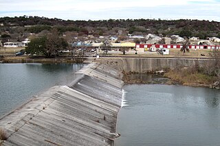
<span class="mw-page-title-main">Goshen Township, Clearfield County, Pennsylvania</span> Township in Pennsylvania, United States

Goshen Township is a township in Clearfield County, Pennsylvania, United States. The population was 393 at the 2020 census.

<span class="mw-page-title-main">Washington Township, Jefferson County, Pennsylvania</span> Township in Pennsylvania, United States

Washington Township is a township in Jefferson County, Pennsylvania, United States. The population was 1,892 at the 2020 census. It was named for President George Washington.

<span class="mw-page-title-main">Shenango Township, Mercer County, Pennsylvania</span> Township in Pennsylvania, United States

Shenango Township is a township in Mercer County, Pennsylvania, United States. The population was 3,519 at the 2020 census, down from 3,929 in 2010.

<span class="mw-page-title-main">Brandonville, Pennsylvania</span> CDP in Pennsylvania, United States

Brandonville is a census-designated place (CDP) in East Union Township in Schuylkill County, Pennsylvania. The population was 180 at the 2020 census.

<span class="mw-page-title-main">Port Carbon, Pennsylvania</span> Borough in Pennsylvania, United States

Port Carbon is a borough of Schuylkill County, Pennsylvania, United States, located two miles (3 km) northeast of Pottsville. It is in a coal-mining area. In the past, ironworks had been a feature of the borough. In 1900, 2,168 people lived here and, in 1910, 2,678. The population was 1,815 at the 2020 census.

<span class="mw-page-title-main">Charlotte, Texas</span> City in Texas, United States

Charlotte is a city in Atascosa County, Texas, United States. The population was 1,715 at the 2010 census. It is part of the San Antonio Metropolitan Statistical Area. The town is named for Charlotte Simmons, the daughter of Dr. Charles Simmons, who aided in the development of Atascosa County.

<span class="mw-page-title-main">Iredell, Texas</span> City in Texas, United States

Iredell is a city located in Bosque County in central Texas, United States. The population was 339 at the 2010 census.

<span class="mw-page-title-main">McQueeney, Texas</span> Census-designated place in Texas, United States

McQueeney is an unincorporated community and census-designated place (CDP) in Guadalupe County, Texas, United States. The population was 2,545 at the 2010 census. It is part of the San Antonio Metropolitan Statistical Area.

<span class="mw-page-title-main">New Berlin, Texas</span> City in Texas, United States

New Berlin is a city in Guadalupe County, Texas, United States. The population was 511 at the 2010 census. New Berlin is a German-Texan town settled by German emigrants in the 1800s as a farming community. New Berlin is named after Berlin, Germany and boasts many residents being descendants of the original German founders.

Northcliffe is a former census-designated place (CDP) in Guadalupe County, Texas, United States. The population was 1,819 at the 2000 census. The area is now part of the city of Schertz and did not have its population recorded separately at the 2010 census. It is part of the San Antonio Metropolitan Statistical Area.

<span class="mw-page-title-main">Zuehl, Texas</span> Census-designated place in Texas, United States

Zuehl is an unincorporated area and census-designated place in western Guadalupe County, Texas, United States. It is part of the San Antonio Metropolitan Statistical Area. Located on Cibolo Creek, it lies 13 miles (21 km) southwest of Seguin. The population was 362 at the 2010 census.

<span class="mw-page-title-main">Haskell, Texas</span> City in Texas, United States

Haskell is a city in central Haskell County, Texas, United States. As of the 2010 census, the city population was 3,322. It is the Haskell county seat.

<span class="mw-page-title-main">Smyer, Texas</span> Town in Texas, United States

Smyer is a town in Hockley County, Texas, United States. The nickname it is known for is "The Pit Stop Town", since the town is between two major urban areas. The population was 474 at the 2010 census. in 2023, the population declined to 433.

<span class="mw-page-title-main">Ingram, Texas</span> City in Texas, United States

Ingram is a city in Kerr County, Texas, United States. The population was 1,804 at the 2010 census.

<span class="mw-page-title-main">Stanton, Texas</span> City in Texas, United States

Stanton is a city in and the county seat of Martin County, Texas, United States. Stanton was founded as Marienfeld by German immigrants that were some of the first settlers in this region of Texas. The population was 2,492 at the 2010 census.

<span class="mw-page-title-main">Sanctuary, Texas</span> Town in Texas, United States

Sanctuary is a town in Parker County, Texas, United States. The population was 329 at the 2010 census, and the community was incorporated in the early 1980s.

<span class="mw-page-title-main">Scott, Ohio</span> Village in Ohio, United States

Scott is a village in Paulding and Van Wert counties in the U.S. state of Ohio. The population was 242 at the 2020 census. The Van Wert County portion of Scott is part of the Van Wert Micropolitan Statistical Area.

<span class="mw-page-title-main">Selma, Texas</span> City in Texas, United States

Selma is a city in Bexar, Comal, and Guadalupe counties in the U.S. state of Texas. It is part of the San Antonio metropolitan statistical area. Its population was 10,952 at the 2020 census, up from 5,540 at the 2010 census. Selma was settled by German and Polish immigrants in the mid 1800s.

References

  1. "2019 U.S. Gazetteer Files". United States Census Bureau. Retrieved August 7, 2020.
  2. 1 2 "Population and Housing Unit Estimates". United States Census Bureau. May 24, 2020. Retrieved May 27, 2020.
  3. 1 2 "U.S. Census website". United States Census Bureau . Retrieved January 31, 2008.
  4. "US Board on Geographic Names". United States Geological Survey. October 25, 2007. Retrieved January 31, 2008.
  5. 1 2 "Geographic Identifiers: 2010 Demographic Profile Data (G001): Santa Clara city, Texas". U.S. Census Bureau, American Factfinder. Retrieved March 24, 2017.[ dead link ]
  6. "Boundary Changes". Geographic Change Notes: Texas. Population Division, United States Census Bureau. May 19, 2006. Archived from the original on February 6, 2006. Retrieved May 27, 2008.
  7. "US Gazetteer files: 2010, 2000, and 1990". United States Census Bureau. February 12, 2011. Retrieved April 23, 2011.
  8. "Census of Population and Housing". Census.gov. Retrieved June 4, 2015.