
Kendall County is a county located on the Edwards Plateau in the U.S. state of Texas. In 2020 census, its population was 44,279. Its county seat is Boerne. The county is named for George Wilkins Kendall, a journalist and Mexican–American War correspondent.

Guadalupe County is a county located in the U.S. state of Texas. As of the 2020 census, its population was 172,706. The county seat is Seguin. The county was founded in 1846 and is named after the Guadalupe River.
Geronimo is an unincorporated community and census-designated place (CDP) in Guadalupe County, Texas, United States. The population was 1,097 at the 2020 census, up from 1,032 at the 2010 census. It is part of the San Antonio Metropolitan Statistical Area.

McQueeney is an unincorporated community and census-designated place (CDP) in Guadalupe County, Texas, United States. The population was 2,397 at the 2020 census. It is part of the San Antonio Metropolitan Statistical Area.
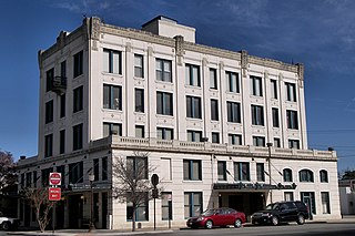
Seguin is a city in and the county seat of Guadalupe County, Texas, United States. The population was 29,433 at the 2020 census, and according to 2023 census estimates, the city is estimated to have a population of 36,013.

José Antonio Navarro was a Texas statesman, revolutionary, rancher, and merchant. The son of Ángel Navarro and Josefa María Ruiz y Peña, he was born into a distinguished noble family at San Antonio de Béxar in the Viceroyalty of New Spain. His uncle was José Francisco Ruiz and his brother-in-law was Juan Martín de Veramendi.
Thomas Hinds Duggan was an early Texas settler and two-time Texas State Senator from Guadalupe County, Texas.
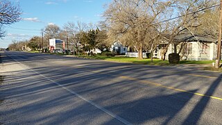
Zorn is an unincorporated community in northern Guadalupe County, Texas, United States. Zorn is located on Texas State Highway 123, approximately 13 miles (21 km) north of the town of Seguin.
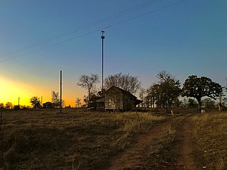
Belmont, officially known as the "Belmont Site," is an unincorporated area of approximately 40 square miles in extreme western Gonzales County, Texas, United States, adjacent to Greater Austin, north of the "Belmont intersection" at the “Leesville Quad” water-testing site, electorally known as local Precinct 5. The population of Belmont-proper has been rated at 36 employees, with the greater area rated at 1,169 residents. The area is defined by the limits of the northern and western county line, bordered by the significant 1800s land grants of Eliza Dewitt, Ira Nash, Samuel Robbins and Thomas Decrew. It is served by the Belmont Volunteer Fire Department.
Grapetown is an unincorporated farming and ranching community 9.5 miles (15.3 km) south of Fredericksburg, situated on South Grape Creek in Gillespie County, in the U.S. state of Texas. It is located on the old Pinta Trail. Grapetown is noted for being the site of the first annual Gillespie County Bundes Schützenfest. The school was designated a Recorded Texas Historic Landmark in 1984, Marker number 10048.

Ferdinand C. Weinert was a merchant and politician from Seguin, Texas, who served in the Texas Legislature, four years in the Senate and four terms in the House, and well as serving as Secretary of State.
Arthur Swift was a 19th-century Texas merchant, surveyor, political and military figure. He, along with Rangers Mathew Caldwell, and James Campbell, were founders of Seguin, Texas. He participated in the Texas–Indian wars. He served as a member of the Texas House of Representatives from the Gonzales district in the First Texas Legislature. After Guadalupe County was established with his hometown of Seguin as the county seat, Swift used his influence with the county commissioners to move the route of a planned road from Seguin to San Antonio.
Andrew Jackson Sowell was a lifelong soldier and farmer in the 19th century. He was a participant in the Texas Revolution and a survivor of the siege of the Alamo. He continued his service during the years of the Republic of Texas, in the Mexican–American War, and the Civil War. He was a frontier defender, early Texas Ranger, and a friend and scout with Kit Carson.

Los Nogales is a historic 1800s home, among the oldest structures still standing in Seguin, Texas and is the last remaining adobe constructed home in the city. It serves the community as a museum.
Cottonwood Creek is a stream in South Central Texas, United States that runs approximately 9 miles from its source five miles east of New Berlin, Texas, to its confluence with the Guadalupe River in Guadalupe County, Texas, four miles southeast of Seguin. The creek serves as a tributary of the Guadalupe River and forms its watershed near Seguin, Texas. There is a separate Cottonwood Creek that flows through northern Guadalupe County before discharging into the San Marcos River above Kingsbury.
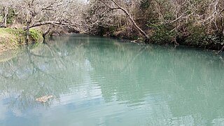
Geronimo Creek is a stream in South Central Texas, U.S., that runs approximately 17 miles, from its source one mile east of Clear Springs, Texas, to its confluence with the Guadalupe River in Guadalupe County, Texas, three miles southeast of Seguin.
Clear Springs is a historic settlement and former unincorporated community that is now a neighborhood in New Braunfels, Texas, United States. As part of New Braunfels, it is part of the San Antonio Metropolitan Statistical Area. It shares its name with the nearby Clear Springs Air Force Base.
Elm Creek is the name of two separate streams that rise in Guadalupe County southwest of Seguin in South Central Texas, United States. The western Elm Creek runs approximately 14 miles from its source about 8.6 miles southwest of Seguin in southwestern Guadalupe County, to its confluence with Cibolo Creek, two miles east of La Vernia in Wilson County. The eastern Elm Creek originates 9.4 miles southwest of Seguin, and proceeds southeast through Guadalupe County, where it discharges into Cottonwood Creek, which itself flows into the Guadalupe River.
Jenks Branch, also known as the Miller Community, was a freedmens colony located between the modern towns of Leander and Liberty Hill in Williamson County, Texas. The community began when Milas Miller, a formerly enslaved man, purchased land in 1870 near the Jenks Branch Creek on the south side of the San Gabriel River. By 1880 he owned over 1000 acres of land.


