Lake Medina Shores, Texas | |
|---|---|
 Lake Medina Shores | |
| Coordinates: 29°38′17″N98°59′29″W / 29.63806°N 98.99139°W | |
| Country | United States |
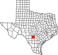
| State | Texas |
| Counties | Bandera, Medina |
| Area | |
• Total | 3.4 sq mi (8.8 km2) |
| • Land | 3.1 sq mi (8.0 km2) |
| • Water | 0.3 sq mi (0.78 km2) |
| Elevation | 1,168 ft (356 m) |
| Population | |
• Total | 1,235 |
| • Density | 400/sq mi (150/km2) |
| Time zone | UTC-6 (Central (CST)) |
| • Summer (DST) | UTC-5 (CDT) |
| Zip Code | 78003 |
| Area code | 830 |
| FIPS code | 48-40674 |
| GNIS feature ID | 2586947 [1] |
Lake Medina Shores is a census-designated place in Bandera and Medina counties, Texas, United States. Its population was 1,235 as of the 2010 census. [2] This was a new CDP for the 2010 census. [3]