Related Research Articles

Wood County is a county located in the U.S. state of Texas. As of the 2020 census, its population was 44,843. Its county seat is Quitman. The county was named for George T. Wood, governor of Texas from 1847 to 1849.
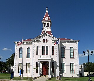
Wilson County is a county located in the U.S. state of Texas. As of the 2020 census, its population was 49,753. Its county seat is Floresville. The county is named after James Charles Wilson. Wilson County is part of the San Antonio–New Braunfels, Texas, metropolitan statistical area.
Washington County is a county in Texas. As of the 2020 census, the population was 35,805. Its county seat is Brenham, which is located along U.S. Highway 290, 72 miles northwest of Houston. The county was created in 1835 as a municipality of Mexico and organized as a county in 1837. It is named for George Washington, the first president of the United States.

Upshur County is a county located in the eastern part of the U.S. state of Texas. As of the 2020 census, the population was 40,892. The county seat is Gilmer. The county is named for Abel P. Upshur, who was U.S. Secretary of State during President John Tyler's administration.

Bosque County is a county located in the greater Waco area. The county sits just northwest of Waco in the U.S. state of Texas. As of the 2020 census, the population was 18,235. Its county seat is Meridian, while Clifton is the largest city and the cultural/financial center of the county. The county is named for the Bosque River, which runs through the center of the county north to south. The Brazos River makes up the eastern border, along with the Lake Whitney reservoir it feeds.

Bexar County is a county in the U.S. state of Texas. It is in South Texas and its county seat is San Antonio.
The Fulton County School System is a school district headquartered in Sandy Springs, Georgia, United States. The system serves the area of Fulton County outside the Atlanta city limits. Fulton County Schools serve the cities of Alpharetta, Johns Creek, Milton, Mountain Park, Roswell, and Sandy Springs north of Atlanta, and Chattahoochee Hills, College Park, East Point, Fairburn, Hapeville, Palmetto, Union City, South Fulton, and Fulton's remaining unincorporated areas in the south. Fulton County is the fourth-largest school system in Georgia.
The term Cross Timbers, also known as Ecoregion 29, Central Oklahoma/Texas Plains, is used to describe a strip of land in the United States that runs from southeastern Kansas across Central Oklahoma to Central Texas. Made up of a mix of prairie, savanna, and woodland, it forms part of the boundary between the more heavily forested eastern country and the almost treeless Great Plains, and also marks the western habitat limit of many mammals and insects.

Georgia Carroll was an American singer, fashion model, and actress, best known for her work with Kay Kyser's big band orchestra in the mid-1940s. She and Kyser were married in 1944 until he died in 1985.
Kicaster is an unincorporated community in northwestern Wilson County, Texas, United States.
Grass Pond Colony was located at the site of several large natural ponds which remain filled by water year-round due to natural springs. It is located in the northern part of Wilson County, Texas, United States, approximately five miles south of Sutherland Springs.

Sutherland Springs is an unincorporated community located on the old Spanish land grant of Manuel Tarin in northern Wilson County, Texas, United States. It is located on U.S. Highway 87 at the intersection of Farm to Market Road 539.
Fort Bend was a blockhouse built in a large bend of the Brazos River in what is now Fort Bend County, Texas, to provide protection against Indian raids. It was erected in November 1822 by several members of Stephen F. Austin's Old Three Hundred, including William W. Little, Joseph Polley, William Smithers [Smeathers], Charles Beard, Henry Holster and is described as a "little log shanty". The location was reportedly selected by Austin, and a settlement soon grew up around the post. As the site provided one of the more favorable fords of the Brazos River, it became important during the Texas Revolution. The Fort Bend crossing was briefly defended in April 1836 by a rear guard detachment led by Wiley Martin. Where Mexican pickets forced the company of 46 men to retreat across the Ford after a short skirmish. After Martin was maneuvered out of the position, Gen. Antonio López de Santa Anna transported a portion of his Mexican army across the Brazos at the crossing. After Santa Anna's defeat at the battle of San Jacinto the site was used briefly by the Texas army. Troops under Thomas Jefferson Green, who were in pursuit of retreating Mexican forces led by Gen. Vicente Filisola, halted for a short time in mid-May 1836 at Fort Bend. Because Fort Bend had been the center of activity in the area its name was given to the county when it was established in 1837. The next year nearby Richmond, Texas was selected as the county seat and soon absorbed the smaller Fort Bend settlement. In 1936 the Texas Centennial Commission erected a monument to commemorate Fort Bend's role in the Texas Revolution.

Monument Hill and Kreische Brewery State Historic Sites are two state historic sites managed by the Texas Historical Commission. They are located at 29.888° -96.876°, just off U.S. Route 77, south of La Grange, Texas. The sites sit on a sandstone bluff 200 feet above the Colorado River. Monument Hill is a memorial to the men who died in the Dawson Massacre and in the Black Bean Episode of the ill-fated Mier Expedition.
Doseido Colony was a small historic settlement which was located in western Wilson County, Texas, United States, one mile north of FM 775, at the intersection of county roads 321 and 361.

La Grange is a city in Fayette County, Texas, United States, near the Colorado River. La Grange is in the center of the Texas-German belt. The population was 4,391 at the 2020 census, and in 2018 the estimated population was 4,632. La Grange is the county seat of Fayette County.
Sandy Point is a city on Farm to Market Road 521 (FM 521) in north central Brazoria County, Texas, United States. The small community is located near a state prison. In the 19th century, the settlement served nearby sugar cane and cotton plantations. Sandy Point's post office, school and railroad have disappeared, but there were two churches in the community in December 2013. The population was 207 at the 2020 census.

Quihi is a settlement in Medina County, in the U.S. state of Texas. Located 9 miles (14 km) north of Hondo, it sits at the intersection of Farm to Market Road 2676 and Quihi Creek. In 1936, Quihi received centennial marker Number 5537, a gray granite marker placed to commemorate the Texas Centennial.
Sandy Hill may refer to:

The 1920 presidential election in Texas was part of the 1920 United States presidential election in which all contemporary forty-eight states voted on November 2, 1920. State voters chose 20 electors, or representatives to the Electoral College, who voted for president and vice president.
References
Municipalities and communities of Wilson County, Texas, United States | ||
|---|---|---|
| Cities | 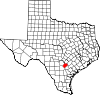 | |
| Town | ||
| Unincorporated communities | ||
| Ghost towns | ||
| Footnotes | ‡This populated place also has portions in an adjacent county or counties | |