Rocky Creek, Texas | |
|---|---|
 Rocky Creek  Rocky Creek | |
| Coordinates: 30°15′13″N98°31′37″W / 30.25361°N 98.52694°W | |
| Country | United States |
| State | Texas |
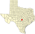
| County | Blanco |
| Elevation | 1,355 ft (413 m) |
| Time zone | UTC-6 (Central (CST)) |
| • Summer (DST) | UTC-5 (CDT) |
| Area code | 830 |
| GNIS feature ID | 1378976 [1] |
Rocky Creek is an unincorporated community in Blanco County, in the U.S. state of Texas. [1] According to the Handbook of Texas, the community had a population of 20 in 2000.[ citation needed ] It is sometimes simply called "Rocky". [2]