Hye, Texas

Last updated
Hye, Texas
Hye General Store & Post Office.JPG
Hye General Store & Post Office (c. 1886)
USA Texas location map.svg
Red pog.svg
Hye, Texas
Location within the state of Texas
Usa edcp location map.svg
Red pog.svg
Hye, Texas
Hye, Texas (the United States)
Coordinates: 30°14′33″N98°34′12″W / 30.24250°N 98.57000°W / 30.24250; -98.57000 Coordinates: 30°14′33″N98°34′12″W / 30.24250°N 98.57000°W / 30.24250; -98.57000
Country United States
State Texas
County Blanco
Elevation
1,453 ft (443 m)
Time zone UTC-6 (Central (CST))
  Summer (DST) UTC-5 (CDT)
ZIP codes
78635
Area code(s) 830
FIPS code 48-35648 [1]
GNIS feature ID1378475 [2]

Hye is an unincorporated community in western Blanco County, Texas, United States. According to the Handbook of Texas, the community had a population of 105 in 2000. Hye is part of the Texas-German belt and in very conservative rural Texas.

Contents

History

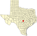
The first settlers came to the area in 1860 when several farmers and ranchers moved to Rocky Creek, located three miles east of the community. It continued to grow when German and Anglo settlers came to the area throughout the 1860s and 70s. Hiram ("Hye") G. Brown and his parents settled in the Rocky Creek area of Blanco County, circa 1872. He constructed a small store and house near the Pedernales River on the Austin-Fredericksburg road. Brown was appointed postmaster upon getting a post office established in his store on April 17, 1886. The post office was named Hye for him. The establishment of the post office drew other businesses to the area, eventually bringing in a grist mill, a blacksmith shop, and a cotton gin. In 1904, Brown erected a new building for the store and post office. In 1965, on the porch of the Hye post office, Lyndon B. Johnson swore in Lawrence F. O'Brien as United States Postmaster General. Johnson's boyhood home is located nearby and is reported to be where he mailed his first letter at the post office when he was just four years old. The community's population was 200 during the 1920s and 30s, dropped to 50 during World War II, grew to 90 in 1947, its zenith of 140 in 1968, and settled at 105 from 1970 through 2000. [3]

In 1966, the Hye General Store and Post Office was designated a Recorded Texas Historic Landmark, marker number 2607. [4]

The Garrison Brothers Distillery also operates in the community.

Geography

Hye lies along U.S. Route 290 near the Gillespie County line, 10 mi (16 km) west of Johnson City, the county seat of Blanco County. [3] It is also located 60 mi (97 km) west of Austin and 20 mi (32 km) east of Fredericksburg. [5]

Climate

The climate in this area is characterized by hot, humid summers and generally mild to cool winters. According to the Köppen Climate Classification system, Hye has a humid subtropical climate, abbreviated "Cfa" on climate maps. [6]

Education

Hye is served by the Johnson City Independent School District.

Garrison Brothers Stillhouse in Hye Garrison Brothers Stillhouse.jpg
Garrison Brothers Stillhouse in Hye

See also

Flag of Texas.svg  Texasportal

Related Research Articles

Blanco County, Texas County in Texas, United States

Blanco County is a United States county located in the U.S. state of Texas. It is located in Central Texas and its county seat is Johnson City.

Johnson City, Texas City in Texas, United States

Johnson City is a city and the county seat of Blanco County, Texas, United States. The population was 1,656 at the 2010 census. Founded in 1879 by James P. Johnson, it was named for early settler Sam E. Johnson, Sr. Johnson City is part of the Texas-German belt region.

Harper, Texas Census-designated place in Texas, United States

Harper is an unincorporated community and census-designated place (CDP), located 23 miles (37 km) west of Fredericksburg on U.S. Highway 290, in Gillespie County, in the U.S. state of Texas. The population was 1,192 at the 2010 census.

Stonewall, Texas Census-designated place in Texas, United States

Stonewall is an unincorporated community and census-designated place (CDP) in Gillespie County, Texas, United States. The population was 525 at the 2010 census. It was named for Confederate General Thomas J. (Stonewall) Jackson, by Israel P.Nunez who established a stage station near the site in 1870.

Mason, Texas City in Texas, United States

Mason is a city in, and the county seat of, Mason County, Texas, United States. The city is an agricultural community on Comanche Creek southwest of Mason Mountain, on the Edwards Plateau and part of the Llano Uplift. The population was 2,114 at the 2010 census.

West, Texas City in Texas, United States

West is a city in McLennan County, Texas, United States. As of the 2020 census, the city population was 2,531. It is named after K. West, the first postmaster of the city. The city is located in the north-central part of Texas, approximately 70 miles (110 km) south of the Dallas-Fort Worth Metroplex, 20 miles north of Waco and 120 miles north of Austin, the state's capital.

May is an unincorporated community in Brown County, Texas, United States. According to the Handbook of Texas, the community had an estimated population of 285 in 2000. May was designated a Recorded Texas Historic Landmark in 1981, with marker number 5377. In 2001, historical marker 12532 was added for May United Methodist Church, commemorating the church's presence in the community for over 100 years. The May Cemetery was designated an Historic Texas Cemetery in 2016.

Castell is a small unincorporated, rural town in Llano County, Texas, United States. It is part of the Texas German belt region, and most residents are still ethnic German-Texan. Its population was 104 at the 2010 census. Located in the heart of the Texas Hill Country, its northern border is formed by the Llano River. It was designated a Recorded Texas Historic Landmark in 1964, marker number 9440.

Doss is an unincorporated farming and ranching community at the crossroads juncture of FM 783 and FM 648 in northwestern Gillespie County, Texas, United States. It is 19 miles NW of Fredericksburg and 14 miles NE of Harper. Postal zip code is 78618. Elevation is 1729 feet.

Telegraph is a ghost town on State Highway 377, 13 miles (20 km) southwest of Junction, in Kimble County, Texas, United States.

Albert, Texas Ghost town in Texas, United States

Albert, originally Martinsburg, is a ghost town 16 miles (25.7 km) southeast of Fredericksburg and one mile (1.6 km) west of the Blanco County line in southeastern Gillespie County, Texas, United States. The town was a stop on the Fredericksburg-Blanco stage route and in 1967 became a stop on the President's Ranch Trail.

Spicewood, Texas

Spicewood is an unincorporated community in Travis County and partially in Burnet County, Texas, United States. According to the Texas Almanac, the community had an estimated population of 2,000 in 2000. But in the 2011 census, the community had a population of 7,666. The community also extends towards Travis County off of Highway 71.

Kenney, Texas Unincorporated community in Texas, United States

Kenney is an unincorporated community in northern Austin County, Texas, United States. According to the Handbook of Texas, the community had a population of 200 in 2000. It is located within the Greater Houston metropolitan area.

Crabapple, Texas Unincorporated community in Texas, United States

Crabapple, Texas is an unincorporated farming and ranching community 10.5 miles (16.9 km) north of Fredericksburg in Gillespie County, Texas located on Crabapple Creek, about halfway between Fredericksburg and Enchanted Rock State Park at an elevation of 1,775 feet. The school was designated a Recorded Texas Historic Landmark number 10022 in 1994. The school was added to the National Register of Historic Places in Texas on May 6, 2005, NRHP Reference #:05000390.

Lytton Springs is an unincorporated community in northeastern Caldwell County, Texas, United States. According to the Handbook of Texas, the community had a population of 500 in 2000. It is located within the Greater Austin metropolitan area.

Rock is an unincorporated community in Delta County, Michigan, United States. Rock is located in Maple Ridge Township along M-35 and the Canadian National Railway, 16.5 miles (26.6 km) north-northwest of Gladstone. Rock has a post office with ZIP code 49880.

Hedwigs Hill, Texas is an unincorporated farming and ranching community, established in 1853 just off U.S. Highway 87, located 5 miles (8.0 km) south of Art in southern Mason County, Texas.

Morris Ranch, Texas Ghost town in Texas, United States

Morris Ranch is a ghost town, located 8.5 miles (13.7 km) southwest of Fredericksburg in Gillespie County, in the U.S. state of Texas. The area was begun as a thoroughbred horse ranch by New Yorker Francis Morris in 1856, and the town grew up around it. In 1962, the school district was merged with Fredericksburg Independent School District, and the Morris Ranch school ceased operations. The Morris Ranch school was designated a Recorded Texas Historic Landmark in 1980, Marker number 10086. The school was added to the National Register of Historic Places listings in Texas, on March 29, 1983, NRHP Reference #:83003142.

Blowout is an unincorporated community in Blanco County, Texas, United States.

Twin Sisters is an unincorporated community in western Blanco County, Texas, United States. According to the Handbook of Texas, the community had a population of 78 in 2000.

References

  1. "U.S. Census website". United States Census Bureau . Retrieved 2008-01-31.
  2. "US Board on Geographic Names". United States Geological Survey. 2007-10-25. Retrieved 2008-01-31.
  3. 1 2 Bruhn, Richard. "Hye, Texas". Handbook of Texas Online. Texas State Historical Association. Retrieved 25 February 2011.
  4. "THC-Hye General Store and Post Office". Recorded Texas Historic Marker. Texas Historical Commission. Retrieved 25 February 2011.
  5. "Hye, Texas". Texas Escapes Online Magazine. Retrieved 2022-08-15.
  6. Climate Summary for Hye, Texas

Commons-logo.svg Media related to Hye, Texas at Wikimedia Commons