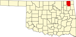
Craig County is a county in the U.S. state of Oklahoma. As of the 2020 census, the population was 14,107.[1] Its county seat is Vinita.[2] The county was organized in 1907, shortly before statehood, and named for Granville Craig, a prominent Cherokee farmer who lived in the Bluejacket area.[3]
In the early 1800s, this area was part of the hunting grounds of the Osage nation and other Plains tribes, some of whom had migrated west from other areas. Members of the Cherokee Nation began moving into the area during the 1830s, particularly after Indian Removal by the US government, which forced them on the "Trail of Tears" to west of the Mississippi River, when they were given land by the United States in exchange for their territory in the Southeast. The area was sparsely populated until after the Civil War. The Texas Road and the East Shawnee Cattle Trail, used for cattle drives from Texas, ran through the eastern part of the present-day Craig County.[3]
Between 1867 and 1870, the U. S. government moved the Shawnee and Delaware tribes into this area from Kansas, another section of Indian Territory. Then the area was assigned as part of the Delaware and Cooweescoowee districts of the Cherokee Nation, Indian Territory, after the US government had made new treaties with the tribes that had allied with the Confederacy during the Civil War.
In 1871, the federal government took Cherokee land for the Missouri, Kansas and Texas Railroad to construct a north–south railroad through this area, while the Atlantic and Pacific Railroad (later acquired by the St. Louis and San Francisco Railway) was allowed to build an east–west line that ran through Vinita in the same year. This line was extended through Tulsa, Oklahoma in 1881–2.[3]
Coal mining began in this area after the Civil War. Mine companies used both tunnel and strip mines, but they did not begin major production until about 1900. Production has continued into the 21st century.
Other resource exploitation was based on oil, and the first oil refinery began operations by 1911; it was operated by Sinclair Oil until the 1920s. Otherwise, farming and ranching were the mainstays of the county economy.[3]
The county was organized in 1907, at the Oklahoma Statehood Convention. It was named for Granville Craig, a prominent Cherokee farmer of mixed race who had property near Bluejacket.
Geography
According to the U.S. Census Bureau, the county has a total area of 763 square miles (1,980km2), of which 761 square miles (1,970km2) is land and 1.4 square miles (3.6km2) (0.2%) is water.[4] The county lies in the Osage Plains, on the western edge of the Ozark Plateau, and drains into several tributaries of the Neosho River.[3]
U.S. Decennial Census[6] 1790-1960[7] 1900-1990[8] 1990-2000[9] 2010[10]
Age pyramid for Craig County, Oklahoma, based on census 2000 data.
2020 census
As of the 2020 United States census, the county had a population of 14,107. Of the residents, 21.5% were under the age of 18 and 20.3% were 65 years of age or older; the median age was 43.2 years. For every 100 females there were 106.7 males, and for every 100 females age 18 and over there were 106.8 males.[11][12]
There were 5,424 households in the county, of which 28.5% had children under the age of 18 living with them and 26.7% had a female householder with no spouse or partner present. About 29.1% of all households were made up of individuals and 14.5% had someone living alone who was 65 years of age or older.[11]
There were 6,369 housing units, of which 14.8% were vacant. Among occupied housing units, 70.1% were owner-occupied and 29.9% were renter-occupied. The homeowner vacancy rate was 2.0% and the rental vacancy rate was 10.4%.[11]
Politics
Voter Registration and Party Enrollment as of June 30, 2023[13]
The Heritage of Craig County and Cooweescoowee and Delaware Districts, Indian Territory, Vol. 3 (Vinita, Okla.: Craig County Genealogical Society, 2000).
The Story of Craig County: Its People and Places, 2 vols. (Vinita, Okla.: Craig County Heritage Association, 1984–1991).
This page is based on this Wikipedia article Text is available under the CC BY-SA 4.0 license; additional terms may apply. Images, videos and audio are available under their respective licenses.