Cimarron County, Oklahoma

Last updated

Cimarron County
Cimarron County Courthouse.jpg
Map of Oklahoma highlighting Cimarron County.svg
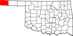
Location within the U.S. state of Oklahoma
Oklahoma in United States.svg
Oklahoma's location within the U.S.
Coordinates: 36°44′N102°31′W / 36.74°N 102.52°W / 36.74; -102.52
CountryFlag of the United States.svg United States
StateFlag of Oklahoma.svg  Oklahoma
Founded1907
Seat Boise City
Largest cityBoise City
Area
  Total1,841 sq mi (4,770 km2)
  Land1,835 sq mi (4,750 km2)
  Water6.1 sq mi (16 km2)  0.3%
Population
 (2020)
  Total2,296
  Density1.2/sq mi (0.5/km2)
Time zones
entire county (legally) UTC−6 (Central)
  Summer (DST) UTC−5 (CDT)
Kenton (unofficially) UTC−7 (Mountain)
  Summer (DST) UTC−6 (MDT)

Cimarron County is the westernmost county in the U.S. state of Oklahoma. Its county seat is Boise City. [1] As of the 2020 census, its population was 2,296, [2] making it the least-populous county in Oklahoma; and indeed, throughout most of its history, it has had both the smallest population and the lowest population density of any county in Oklahoma. Located in the Oklahoma Panhandle, Cimarron County contains the only community in the state (Kenton) that observes the Mountain Time Zone. Black Mesa, the highest point in the state, is in the northwest corner of the county. The Cimarron County community of Regnier has the distinction of being the driest spot in Oklahoma ranked by lowest annual average precipitation, at just 15.62 inches; at the same time, Boise City is the snowiest location in Oklahoma ranked by highest annual average snowfall, at 31.6 inches. [3]

Contents

History

Cimarron County was created at statehood in 1907. Before the Oklahoma Organic Act was passed in 1890, the area had belonged to what was known as "No-Man's Land", also referred to as the "Public Land Strip". This was a relatively lawless area, with no organized government, and several outlaws sought refuge within its borders. In 1890, the strip became known as Beaver County, Oklahoma Territory. Informally, it was known as the "Oklahoma Panhandle". Only two communities were in the strip. One, Carrizo (near present-day Kenton), [4] had 83 residents in 1890, while the other, Mineral City, had 93 residents. Otherwise, the land was used primarily by sheepherders from New Mexico. [5]

Several communities vied to become county seat after statehood: Boise City, Cimarron, Doby, Hurley, Willowbar, and Centerview. A county election in 1908 selected Boise City. [5]

Railroads came late to this part of Oklahoma. The Elkhart and Santa Fe Railway built a line from Elkhart, Kansas, through Cimarron County in 1925. It completed the link into New Mexico in 1932. Service ended in 1942. The same company built a line from Colorado to Boise City in 1931 and extended it into Texas in 1937. This line still operates and in 2000 was part of the BNSF system. [5]

Cimarron County was affected by the Dust Bowl and was the site of the iconic 1936 photo entitled Dust Bowl Cimarron County, Oklahoma.

Geography

Dust Bowl Cimarron County, Oklahoma, by Arthur Rothstein (1936) Farmer walking in dust storm Cimarron County Oklahoma2.jpg
Dust Bowl Cimarron County, Oklahoma , by Arthur Rothstein (1936)

Farmer walking in dust storm Cimarron County Oklahoma

Farmer and two sons during a dust storm in Cimarron County, 1936. Iconic photo entitled "Dust Bowl Cimarron County, Oklahoma" taken by Arthur Rothstein.

According to the U.S. Census Bureau, the county has a total area of 1,841 square miles (4,770 km2), of which 1,835 square miles (4,750 km2) are land and 6.1 square miles (16 km2) (0.3%) are covered by water. [6] It is the fourth-largest county in Oklahoma by area. It also has Oklahoma's highest point at 4,973 feet (1,516 m) above mean sea level on the Black Mesa.

The northern part of the county is drained by the Cimarron River, which flows eastward, then turns north into Kansas. The southern part is drained by the Beaver River (sometimes also called the North Canadian River). The human-made Lake Carl Etling lies inside Black Mesa Park. [5]

The Boise City Airport (FAA ID: 17K) is about 3 miles north of town. [7]

Major highways

Adjacent states and counties

Cimarron County is the only county in the United States that borders four states: Colorado, Kansas, New Mexico, and Texas. [5] As a result, Cimarron County is the only county in the United States to border at least five counties from five different states (one from each of the four aforementioned states, plus one in Oklahoma and a second county in Texas).

A location 300 yards (270 m) east of US 287-385 and 1.75 miles (2.82 km) south of the Cimarron River is the only place in the US less than 27 miles (43 km) from five different states: 26.99 miles (43.44 km) from Kansas, New Mexico, and Texas and 7 miles (11 km) from Colorado. [8]

National protected area

Images

Demographics

Historical population
CensusPop.Note
1910 4,553
1920 3,436−24.5%
1930 5,40857.4%
1940 3,054−43.5%
1950 4,58950.3%
1960 4,496−2.0%
1970 4,145−7.8%
1980 3,648−12.0%
1990 3,301−9.5%
2000 3,148−4.6%
2010 2,475−21.4%
2020 2,296−7.2%
U.S. Decennial Census [9]
1790-1960 [10] 1900-1990 [11]
1990-2000 [12] 2010-2019 [2]

As of the 2010 census, 2,475 people, 1,047 households, and 705 families were residing in the county. The population density was 2 people per square mile (0.77 people/km2). The 1,587 housing units averaged 1 units per square mile (0.39/km2). The racial makeup of the county was 84.7% White, 0.2% African American, 0.8% Native American, 0.3% Asian, 12.1% from other races, and 1.8% from two or more races. Hispanics or Latinos of any race made up 20.8% (16.4% Mexican, 1.4% Spanish, 0.2% Salvadoran). [13] [14]

Of the 1,257 households, 31.30% had children under the age of 18 living with them, 60.40% were married couples living together, 6.00% had a female householder with no husband present, and 30.90% were not families. About 29.30% of all households were made up of individuals, and 15.50% had someone living alone who was 65 years of age or older. The average household size was 2.47, and the average family size was 3.07.

In the county, the age distribution was 27.60% under 18, 6.40% from 18 to 24, 23.40% from 25 to 44, 24.00% from 45 to 64, and 18.60% who were 65 years of age or older. The median age was 39 years. For every 100 females there were 97.40 males. For every 100 females age 18 and over, there were 95.30 males.

The median income for a household in the county was $30,625, and for a family was $36,250. Males had a median income of $24,327 versus $18,110 for females. The per capita income for the county was $15,744. About 13.90% of families and 17.60% of the population were below the poverty line, including 22.20% of those under age 18 and 10.10% of those age 65 or over.

Politics

Cimarron County is a solidly Republican county in presidential elections. It cast 92% of its votes for Donald Trump in the 2020 election, the highest percentage of any Oklahoma county. [15] The last Democrat to carry the county was Jimmy Carter in 1976. A section of U.S. Route 287 in Oklahoma within the county was renamed President Donald Trump Highway after Trump left office. The Oklahoman newspaper reported in December 2021: "After altering rules and overcoming opposition to pass the state's highway naming bill in May, Oklahoma GOP legislators have yet to provide promised funding for signage along a 20-mile stretch of Panhandle highway designated 'President Donald J. Trump Highway.'" [16]

United States presidential election results for Cimarron County, Oklahoma [17]
Year Republican Democratic Third party
No.%No.%No.%
2020 97092.03%706.64%141.33%
2016 96389.25%716.58%454.17%
2012 1,08290.39%1159.61%00.00%
2008 1,11988.04%15211.96%00.00%
2004 1,24287.10%18412.90%00.00%
2000 1,23082.88%22715.30%271.82%
1996 98667.77%36124.81%1087.42%
1992 96559.42%39524.32%26416.26%
1988 1,15370.01%47028.54%241.46%
1984 1,42079.15%35920.01%150.84%
1980 1,40477.10%37320.48%442.42%
1976 87246.41%96251.20%452.39%
1972 1,35071.62%32317.14%21211.25%
1968 1,12253.81%43620.91%52725.28%
1964 1,22558.25%87841.75%00.00%
1960 1,31665.41%69634.59%00.00%
1956 1,05356.46%81243.54%00.00%
1952 1,43867.10%70532.90%00.00%
1948 65042.10%89457.90%00.00%
1944 82252.06%74647.25%110.70%
1940 84145.39%98953.37%231.24%
1936 55529.06%1,34270.26%130.68%
1932 57123.15%1,89576.85%00.00%
1928 1,13966.03%56632.81%201.16%
1924 58641.21%67247.26%16411.53%
1920 63053.48%46539.47%837.05%
1916 23830.87%38750.19%14618.94%
1912 26337.04%34248.17%10514.79%
1908 37143.24%44952.33%384.43%
Voter Registration and Party Enrollment as of May 31, 2023 [18]
PartyNumber of VotersPercentage
Democratic 18313.30%
Republican 1,05776.82%
Others1369.88%
Total1,376100%

Economy

The county economy has been largely based on cattle ranching and agriculture throughout its history. Wheat and grain sorghum are the most important crops. The Dust Bowl devastated the county during the 1930s, and the deluges of 1942-1945 destroyed what was left; the economy had to be completely rebuilt. Oil and natural gas production became important in the 1960s, and a gas plant near Keyes began producing helium in 1959. In 2000, Cimarron County had the ninth-highest per capita income of all Oklahoma counties. [5]

Communities

City

Towns

Census-designated place

Other unincorporated places

See also

Related Research Articles

<span class="mw-page-title-main">Sherman County, Texas</span> County in Texas, United States

Sherman County is a county located in the U.S. state of Texas. As of the 2020 census, its population was 2,782. Its county seat is Stratford. The county was created in 1876 and organized in 1889. It is named for Sidney Sherman, who fought in the Texas Revolution. Though both Sherman County and Sherman, Texas, are named for the same person, the city of Sherman is located in Grayson County, about 430 miles to the southeast.

<span class="mw-page-title-main">Dallam County, Texas</span> County in Texas, United States

Dallam County is the north-westernmost county in the U.S. state of Texas. As of the 2020 Census, its population was 7,115. Its county seat is Dalhart. The county was founded in 1876 and later organized in 1891. It is named for James Wilmer Dallam, a lawyer and newspaper publisher.

<span class="mw-page-title-main">Texas County, Oklahoma</span> County in Oklahoma, United States

Texas County is a county located in the panhandle of the U.S. state of Oklahoma. Its county seat is Guymon. As of the 2020 census, the population was 21,384. It is the second largest county in Oklahoma, based on land area, and is named for Texas, the state that adjoins the county to its south. Texas County comprises the Guymon, OK Micropolitan Statistical Area. The county economy is largely based on farming and cattle production. It is one of the top-producing counties in the U.S. for wheat, cattle, and hogs. It also lies within the noted Hugoton-Panhandle natural gas field.

<span class="mw-page-title-main">Beaver County, Oklahoma</span> County in Oklahoma, United States

Beaver County is a county located in the U.S. state of Oklahoma. As of the 2020 census, the population was 5,049. The county seat is Beaver. The name was given because of the presence of many beaver dams on the Beaver River, which runs through the area. It is located in the Oklahoma Panhandle.

<span class="mw-page-title-main">Seward County, Kansas</span> County in Kansas, United States

Seward County is a county of the U.S. state of Kansas. Its county seat and largest city is Liberal. As of the 2020 census, the county population was 21,964. The county was formed on March 20, 1873, and named after William Seward, a politician and Secretary of State under Abraham Lincoln and Andrew Johnson.

<span class="mw-page-title-main">Morton County, Kansas</span> County in Kansas, United States

Morton County is a county in the southwestern corner of the U.S. state of Kansas. Its county seat and largest city is Elkhart. As of the 2020 census, the county population was 2,701. The county was named after Oliver Morton, the 14th governor of the state of Indiana.

<span class="mw-page-title-main">Baca County, Colorado</span> County in Colorado, United States

Baca County is a county located in the U.S. state of Colorado. As of the 2020 census, the population was 3,506. The county seat is Springfield. Located at the southeast corner of Colorado, the county shares state borders with Kansas, New Mexico, and Oklahoma.

<span class="mw-page-title-main">Clayton, New Mexico</span> Town in New Mexico, United States

Clayton is a town and county seat of Union County, New Mexico, United States. As of the 2010 census, the city population was 2,980.

<span class="mw-page-title-main">Beaver, Oklahoma</span> Town in Oklahoma, United States

Beaver is a town and county seat in Beaver County, Oklahoma, United States. The community is in the Oklahoma Panhandle. As of the 2020 census, the town’s population was 1,280. The city is host to the annual World Cow Chip Throwing Championship. Held in April, "Cow Chip" brings attention from nearby cities with a parade, carnival, and cowchip throwing.

<span class="mw-page-title-main">Boise City, Oklahoma</span> City in Oklahoma, United States

Boise City is a city in and the county seat of Cimarron County, in the Panhandle of Oklahoma, United States. The population was 1,166 at the 2020 census, a decline of 7.9 percent from 1,266 in 2010.

<span class="mw-page-title-main">Keyes, Oklahoma</span> Town in Oklahoma, United States

Keyes is a town in Cimarron County, Oklahoma, United States. As of the 2020 census, the town’s population was 276.

<span class="mw-page-title-main">Guymon, Oklahoma</span> City in Oklahoma, United States

Guymon is a city and county seat of Texas County, in the panhandle of Oklahoma, United States. As of the 2020 census, the city population was 12,965, an increase of 13.3% from 11,442 in 2010, and represents more than half of the population of the county, along with being the largest city in the Oklahoma Panhandle. Cattle feedlots, corporate pork farms, and natural gas production dominate its economy, with wind energy production and transmission recently diversifying landowners' farms. Guymon was the only town or city in Oklahoma in 2010 and 2020 in which the majority of the population was Hispanic.

<span class="mw-page-title-main">Black Mesa (Oklahoma, Colorado, New Mexico)</span> Mesa in the U.S. States of Colorado, New Mexico, and Oklahoma

Black Mesa is a mesa located in an area covering parts of the U.S. states of Colorado, New Mexico, and Oklahoma. It extends from Mesa de Maya, Colorado southeasterly 28 miles (45 km) crossing into the northeast corner of New Mexico, and ending in the Oklahoma panhandle along the north bank of the Cimarron River at its confluence with the North Carrizo Creek near Kenton. Its highest elevation is 5,705 feet (1,739 m) in Colorado. The highest point of Black Mesa within New Mexico is 5,239 feet (1,597 m). In northwestern Cimarron County, Oklahoma, Black Mesa reaches 4,973 feet (1,516 m), the highest point in the state of Oklahoma. The plateau that formed at the top of the mesa has been known as a "geological wonder" of North America. There is abundant wildlife in this shortgrass prairie environment, including mountain lions, butterflies, and the Texas horned lizard.

<span class="mw-page-title-main">Oklahoma panhandle</span> Panhandle in north-western Oklahoma and former unorganized territory

The Oklahoma Panhandle is a salient in the extreme northwestern region of the U.S. state of Oklahoma, consisting of Cimarron County, Texas County and Beaver County, from west to east. As with other salients in the United States, its name comes from the similarity of its shape to the handle of a pan. Its largest city is Guymon in Texas County. Black Mesa State Park, located in Cimarron County, is the highest point in the state. Other points of interest include Beaver Dunes Park, Optima Lake, and the Optima National Wildlife Refuge. Oklahoma Panhandle State University is ten miles away from Guymon.

<span class="mw-page-title-main">Cimarron River (Arkansas River tributary)</span> River in the United States

The Cimarron River extends 698 miles (1,123 km) across New Mexico, Oklahoma, Colorado, and Kansas. The headwaters flow from Johnson Mesa west of Folsom in northeastern New Mexico. Much of the river's length lies in Oklahoma, where it either borders or passes through eleven counties. There are no major cities along its route. The river enters the Oklahoma Panhandle near Kenton, Oklahoma, crosses the corner of southeastern Colorado into Kansas, reenters the Oklahoma Panhandle, reenters Kansas, and finally returns to Oklahoma where it joins the Arkansas River at Keystone Reservoir west of Tulsa, Oklahoma, its only impoundment. The Cimarron drains a basin that encompasses about 18,927 square miles (49,020 km2).

<span class="mw-page-title-main">Felt, Oklahoma</span> Census-designated place in Oklahoma, United States

Felt is a small unincorporated community and census-designated place (CDP) in Cimarron County, Oklahoma, United States. As of the 2020 census, the town’s population was 77. It was named for C.F.W. Felt of the Santa Fe Railroad. Nearby is the Cedar Breaks Archeological District, included on the National Register of Historic Places listings in Cimarron County, Oklahoma. The community is served by a post office and a school. During the Great Depression in 1936 a farm in Felt was the site of the iconic Dust Bowl photograph known as Dust Bowl Cimarron County, Oklahoma.

<span class="mw-page-title-main">Kenton, Oklahoma</span> Town in Oklahoma, United States

Kenton is a town in Cimarron County, Oklahoma, United States. As of the 2020 census, the community had 31 residents.

<span class="mw-page-title-main">Oklahoma State Highway 325</span> State highway in Cimarron County, Oklahoma, United States

State Highway 325, officially, SH-325, is a 38.08-mile (61.28 km)state highway Cimarron County, Oklahoma, United States, that connects New Mexico State Road 456 to the traffic circle in Boise City that includes U.S. Route 56, U.S. Route 64, U.S. Route 287, U.S. Route 287, U.S. Route 412 and Oklahoma State Highway 3. Along the way it provides access to Black Mesa State Park, near Black Mesa, the highest point in the state of Oklahoma.

<span class="mw-page-title-main">Northwestern Oklahoma</span>

Northwestern Oklahoma is the geographical region of the state of Oklahoma which includes the Oklahoma Panhandle and a majority of the Cherokee Outlet, stretching to an eastern extent along Interstate 35, and its southern extent along the Canadian River to Noble County. Northwest Oklahoma is also known by its Oklahoma Department of Tourism designation, Red Carpet Country, which is named after the region's red soil and alludes to the metaphor that the panhandle is a "red carpet" into Oklahoma. The region consists of Cimarron, Texas, Beaver, Harper, Woods, Alfalfa, Grant, Kay, Ellis, Woodward, Major, Garfield, Noble, Dewey, Blaine, and Kingfisher counties.

<span class="mw-page-title-main">Black Mesa State Park</span> State park in Oklahoma, United States

Black Mesa State Park is an Oklahoma state park in Cimarron County, near the western border of the Oklahoma panhandle and New Mexico. The park is located about 15 miles (24 km) away from its namesake, Black Mesa, the highest point in Oklahoma. The mesa was named for the layer of black lava rock that coats it.

References

  1. "Find a County". National Association of Counties. Archived from the original on May 31, 2011. Retrieved June 7, 2011.
  2. 1 2 "State & County QuickFacts". United States Census Bureau. Archived from the original on June 6, 2011. Retrieved November 8, 2013.
  3. "Oklahoma Annual Rainfall and Climate Data". Coolweather.net. Retrieved November 29, 2020.
  4. "Oklahoma Panhandle: Badmen in No Man's Land". HistoryNet.com. June 12, 2006. Retrieved January 18, 2021.
  5. 1 2 3 4 5 6 Young, Norma Gene. "Cimarron County," Encyclopedia of Oklahoma History and Culture, 2009. Accessed March 28, 2015.
  6. "2010 Census Gazetteer Files". United States Census Bureau. August 22, 2012. Retrieved February 18, 2015.
  7. "Boise City Airport". AirNav.com. Retrieved December 17, 2020.
  8. From United States Geological Survey sources, an area one mile southwest of Goshen, Massachusetts, is 27.3 miles (43.9 km) from five different states, second to this location.
  9. "U.S. Decennial Census". United States Census Bureau. Retrieved February 18, 2015.
  10. "Historical Census Browser". University of Virginia Library. Archived from the original on May 30, 2019. Retrieved February 18, 2015.
  11. Forstall, Richard L., ed. (March 27, 1995). "Population of Counties by Decennial Census: 1900 to 1990". United States Census Bureau. Retrieved February 18, 2015.
  12. "Census 2000 PHC-T-4. Ranking Tables for Counties: 1990 and 2000" (PDF). United States Census Bureau. April 2, 2001. Archived (PDF) from the original on March 27, 2010. Retrieved February 18, 2015.
  13. "American FactFinder - Results". Archived from the original on March 5, 2014. Retrieved May 15, 2016.
  14. "American FactFinder - Results". Archived from the original on December 18, 2014. Retrieved May 7, 2016.
  15. "Election Results: President: Oklahoma". CNN Politics. CNN.
  16. Gore, Hogan. "Roadwork ahead: Signage for Trump highway in Oklahoma remains unfunded" https://www.oklahoman.com/story/news/2021/12/15/donald-j-trump-highway-oklahoma-road-signs-transportation-department-funding/6463485001/
  17. Leip, David. "Dave Leip's Atlas of U.S. Presidential Elections". uselectionatlas.org. Retrieved March 28, 2018.
  18. "Voter Registration Totals". OK Elections Interactive Statistics Beta. May 31, 2023. Retrieved June 25, 2023.

Further reading

36°44′N102°31′W / 36.74°N 102.52°W / 36.74; -102.52