Kingfisher County, Oklahoma

Last updated

Kingfisher County
Kingfisher, OK USA - U.S. Land Office 1889 - panoramio (4).jpg
Map of Oklahoma highlighting Kingfisher County.svg
Location within the U.S. state of Oklahoma
Oklahoma in United States.svg
Oklahoma's location within the U.S.
Coordinates: 35°56′N97°56′W / 35.94°N 97.94°W / 35.94; -97.94
CountryFlag of the United States.svg United States
StateFlag of Oklahoma.svg  Oklahoma
FoundedMay 2, 1890
Seat Kingfisher
Largest cityKingfisher
Area
  Total906 sq mi (2,350 km2)
  Land898 sq mi (2,330 km2)
  Water7.9 sq mi (20 km2)  0.9%
Population
 (2020)
  Total15,184
  Density17/sq mi (6.5/km2)
Time zone UTC−6 (Central)
  Summer (DST) UTC−5 (CDT)
Congressional district 3rd

Kingfisher County is a county located in the U.S. state of Oklahoma. As of the 2020 census, the population was 15,184. [1] Its county seat is Kingfisher. [2] The county was formed in 1890 and named Kingfisher by a vote of residents.

Contents

The land was given to the Creek Nation by the federal government, but was taken back after the American Civil War.

History

Limited archaeological surveys may have discovered evidence of pre-contact peoples, including Paleo-Indian and Archaic (6000 BC - 1 AD) groups that used the area for hunting and foraging. The historic Osage, Cheyenne, and Comanche tribes traversed the prairie grasslands of this area.

Before the county's creation, The Chisholm Trail's many routes crossed the area. A stage road which paralleled the trail had important stops at Dover Station, King Fisher Station and Baker Station.

The area was given to the Creek Nation by the federal government after their forced removal from Georgia. At the end of the American Civil War, the Creeks were forced to cede the land back to the federal government for siding with the Confederacy. It became part of the Unassigned Lands, and the area was opened to non-Indian settlement in the land run on April 22, 1889. [3] Several towns, including Kingfisher, Oklahoma developed soon after the land run. [3]

Originally this area was called County 5, when the Organic Act of May 2, 1890 created Oklahoma Territory. [4] At an August 5, 1890 election, the voters of County 5 overwhelmingly voted for the name "Kingfisher" over "Hennessey" and "Harrison". The origin of the name is unclear. The Encyclopedia of Oklahoma History and Culture mentions three different possibilities. The first is that the name memorialized a local rancher, David King Fisher. The second version is that King and Fisher were two different settlers, whose names were combined for the county and town. The third explanation was that the name was for a rancher named John Fisher and for whom Uncle Johns Creek was named. [4]

In November, 2022, the county gained national attention when four Chinese nationals were murdered, execution-style, at a Chinese-run marijuana farm at the crossroads hamlet of Lacey, near Hennessey. Prior to that, the farm had drawn some attention to itself by having armed guards visible at its perimeters, who hasselled anyone stopping nearby, including postal delivery personnel.
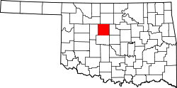
Geography

According to the U.S. Census Bureau, the county has a total area of 906 square miles (2,350 km2), of which 898 square miles (2,330 km2) is land and 7.9 square miles (20 km2) (0.9%) is water. [5] The principal waterway is the Cimarron River, which runs from northwest to east through the county. [4]

Major highways

Adjacent counties

Demographics

Historical population
CensusPop.Note
1910 18,825
1920 15,671−16.8%
1930 15,9601.8%
1940 15,617−2.1%
1950 12,860−17.7%
1960 10,635−17.3%
1970 12,85720.9%
1980 14,18710.3%
1990 13,212−6.9%
2000 13,9265.4%
2010 15,0348.0%
2020 15,1841.0%
U.S. Decennial Census [6]
1790-1960 [7] 1900-1990 [8]
1990-2000 [9] 2010 [10]
Age pyramid for Kingfisher County, Oklahoma, based on census 2000 data. USA Kingfisher County, Oklahoma age pyramid.svg
Age pyramid for Kingfisher County, Oklahoma, based on census 2000 data.

As of the census [11] of 2000, there were 13,926 people, 5,247 households, and 3,893 families residing in the county. The population density was 15 people per square mile (5.8 people/km2). There were 5,879 housing units at an average density of 6 units per square mile (2.3/km2). The racial makeup of the county was 88.09% White, 1.59% Black or African American, 3.02% Native American, 0.22% Asian, 0.01% Pacific Islander, 4.34% from other races, and 2.74% from two or more races. 6.90% of the population were Hispanic or Latino of any race. By 2020, its population was 15,184. [1]

In 2000, there were 5,247 households, out of which 35.40% had children under the age of 18 living with them, 62.20% were married couples living together, 8.00% had a female householder with no husband present, and 25.80% were non-families. 23.50% of all households were made up of individuals, and 12.00% had someone living alone who was 65 years of age or older. The average household size was 2.60 and the average family size was 3.08.

In the county, the population was spread out, with 27.20% under the age of 18, 8.20% from 18 to 24, 26.80% from 25 to 44, 22.40% from 45 to 64, and 15.40% who were 65 years of age or older. The median age was 38 years. For every 100 females there were 95.10 males. For every 100 females age 18 and over, there were 92.90 males.

The median income for a household in the county was $36,676, and the median income for a family was $43,242. Males had a median income of $30,918 versus $19,819 for females. The per capita income for the county was $18,167. About 8.50% of families and 10.80% of the population were below the poverty line, including 14.30% of those under age 18 and 6.50% of those age 65 or over.

Communities

Cities and towns

Unincorporated communities

Politics

At the presidential level, Kingfisher County has voted predominantly Republican; the last Democratic presidential nominee to carry the county was Franklin D. Roosevelt in 1936.

Voter Registration and Party Enrollment as of June 30, 2023 [12]
PartyNumber of VotersPercentage
Democratic 1,31915.17%
Republican 6,42273.88%
Others95110.94%
Total8,692100%
United States presidential election results for Kingfisher County, Oklahoma [13]
Year Republican Democratic Third party
No.%No.%No.%
2020 5,52185.40%85413.21%901.39%
2016 5,15684.10%78612.82%1893.08%
2012 4,87084.43%89815.57%00.00%
2008 5,37284.19%1,00915.81%00.00%
2004 5,63084.64%1,02215.36%00.00%
2000 4,69377.49%1,30421.53%590.97%
1996 3,42360.27%1,62628.63%63011.09%
1992 3,47954.27%1,37921.51%1,55324.22%
1988 4,01168.54%1,77730.37%641.09%
1984 5,52882.68%1,12516.83%330.49%
1980 4,96277.31%1,28219.98%1742.71%
1976 3,44358.39%2,37240.22%821.39%
1972 4,86181.90%91215.37%1622.73%
1968 3,55864.64%1,22622.27%72013.08%
1964 3,11755.37%2,51244.63%00.00%
1960 3,50165.78%1,82134.22%00.00%
1956 3,93570.23%1,66829.77%00.00%
1952 4,87376.96%1,45923.04%00.00%
1948 2,93154.09%2,48845.91%00.00%
1944 3,41760.92%2,17538.78%170.30%
1940 3,71856.27%2,86543.36%250.38%
1936 2,53938.17%4,08161.35%320.48%
1932 2,10334.54%3,98665.46%00.00%
1928 4,06369.08%1,78030.26%390.66%
1924 2,83455.62%1,64432.27%61712.11%
1920 3,22061.77%1,74433.45%2494.78%
1916 1,72848.90%1,36438.60%44212.51%
1912 1,52748.90%1,23539.55%36111.56%

Economy

Agriculture has been the mainstay of the county since the area was opened for settlement in 1899. Wheat and rye have been the most important crops. Oil and gas exploration became important to the county economy during the 1920s, especially in that part of the county around Hennessey, Cashion and Dover. Roxana was a boomtown during that period, but quickly declined its population peaked at one thousand people. It is now considered a ghost town.

Education

Kingfisher Academy, affiliated with the Congregational Church, was established in Kingfisher well before statehood. It remained open between 1890 and 1894. In 1895, the Association of Congregational Churches of Oklahoma Territory chartered Kingfisher College, and opened it for instruction on September 2, 1895. [14]

NRHP sites

The following sites in Kingfisher County are listed on the National Register of Historic Places:

Related Research Articles

<span class="mw-page-title-main">Pottawatomie County, Oklahoma</span> County in Oklahoma, United States

Pottawatomie County is a county located in the U.S. state of Oklahoma. As of the 2020 census, the population was 72,454. Its county seat is Shawnee.

<span class="mw-page-title-main">Payne County, Oklahoma</span> County in Oklahoma, United States

Payne County is located in the U.S. state of Oklahoma. As of the 2020 census, its population was 81,646. Its county seat is Stillwater. The county was created in 1890 as part of Oklahoma Territory and is named for Capt. David L. Payne, a leader of the "Boomers".

<span class="mw-page-title-main">Love County, Oklahoma</span> County in Oklahoma, United States

Love County is a county on the southern border of the U.S. state of Oklahoma. As of the 2020 census, the population was 10,146. Its county seat is Marietta. The county was created at statehood in 1907 and named for Overton Love, a prominent Chickasaw farmer, entrepreneur and politician.

<span class="mw-page-title-main">Logan County, Oklahoma</span> County in Oklahoma, United States

Logan County is a county located in the U.S. state of Oklahoma. As of the 2020 census, the population was 49,555. Its county seat is Guthrie.

<span class="mw-page-title-main">Lincoln County, Oklahoma</span> County in Oklahoma, United States

Lincoln County is a county in eastern Central Oklahoma. As of the 2020 census, the population was 33,458. Its county seat is Chandler.

<span class="mw-page-title-main">Kiowa County, Oklahoma</span> County in Oklahoma, United States

Kiowa County is a county located in the southwestern part of the U.S. state of Oklahoma. As of the 2020 census, the population was 8,509. Its county seat is Hobart. The county was created in 1901 as part of Oklahoma Territory. It was named for the Kiowa people.

<span class="mw-page-title-main">Garfield County, Oklahoma</span> County in Oklahoma, United States

Garfield County is a county located in the U.S. state of Oklahoma. As of the 2020 census, the population was 62,846. Enid is the county seat and largest city within Garfield County. The county is named after President James A. Garfield.

<span class="mw-page-title-main">Creek County, Oklahoma</span> County in Oklahoma, United States

Creek County is a county located in the U.S. state of Oklahoma. As of the 2020 census, the population was 71,754. Its county seat is Sapulpa.

<span class="mw-page-title-main">Canadian County, Oklahoma</span> County in Oklahoma, United States

Canadian County is a county located in the U.S. state of Oklahoma. As of the 2020 census, the population was 154,405, making it the fourth most populous county in Oklahoma. Its county seat is El Reno.

<span class="mw-page-title-main">Caddo County, Oklahoma</span> County in Oklahoma, United States

Caddo County is a county located in the U.S. state of Oklahoma. As of the 2020 census, the population was 26,945. Its county seat is Anadarko. Created in 1901 as part of Oklahoma Territory, the county is named for the Caddo tribe who were settled here on a reservation in the 1870s. Caddo County is immediately west of the seven-county Greater Oklahoma City metro area, and although is not officially in the metro area, it has many economic ties in this region.

<span class="mw-page-title-main">Beckham County, Oklahoma</span> County in Oklahoma, United States

Beckham County is a county located on the western border of the U.S. state of Oklahoma. As of the 2020 census, the population was 22,410. Its county seat is Sayre. Founded upon statehood in 1907, Beckham County was named for J. C. W. Beckham, who was Governor of Kentucky and the first popularly elected member of the United States Senate from Kentucky. Beckham County comprises the Elk City, OK Micropolitan Statistical Area.

<span class="mw-page-title-main">Okeene, Oklahoma</span> Town in Oklahoma, United States

Okeene is a town in Blaine County, Oklahoma, United States. The population was 1,090 as of the 2020 United States census. The name was created by combining the last letters of Cherokee and Cheyenne.

<span class="mw-page-title-main">Calumet, Oklahoma</span> Town in Oklahoma, United States

Calumet is a town in Canadian County, Oklahoma, United States. It is part of the Oklahoma City Metropolitan Area. The population was 507 at the 2010 census, a 5.23 percent decrease since 2000.

<span class="mw-page-title-main">Union City, Oklahoma</span> Town in Oklahoma, United States

Union City is a town in Canadian County, Oklahoma, United States. The population was 1,645 at the 2010 census, a 19.6 percent increase from 1,375 in 2000. It is part of the Oklahoma City metropolitan statistical area.

Flint Creek is an unincorporated area and census-designated place (CDP) in Delaware County, Oklahoma, United States. The population was 732 at the 2010 census, up from 580 in 2000.

Dover is a town in Kingfisher County, Oklahoma, United States. The population was 464 at the 2010 census. a 26.4 percent gain over the figure of 367 in 2000.

<span class="mw-page-title-main">Hennessey, Oklahoma</span> Town in Oklahoma, United States

Hennessey is a town in Kingfisher County, Oklahoma, United States. The population was 2,131 at the 2010 census, up from 2,058 in 2000.

<span class="mw-page-title-main">Kingfisher, Oklahoma</span> City in Oklahoma, United States

Kingfisher is a city in and the county seat of Kingfisher County, Oklahoma,. The population was 4,903 at the time of the 2020 census. It is the former home and namesake of Kingfisher College. According to the Encyclopedia of Oklahoma History and Culture, Kingfisher is now primarily a bedroom community for people employed in Enid and Oklahoma City.

<span class="mw-page-title-main">Loyal, Oklahoma</span> Town in Oklahoma, United States

Loyal is a town in Kingfisher County, Oklahoma, United States. The population was 79 at the 2010 census.

<span class="mw-page-title-main">Okarche, Oklahoma</span> Town in Oklahoma, United States

Okarche is a town in Canadian and Kingfisher counties in Oklahoma, United States, that is part of the Oklahoma City Metropolitan Area. The population was 1,141 as of the 2020 United States census.

References

  1. 1 2 "Kingfisher County, Oklahoma". United States Census Bureau . Retrieved May 13, 2023.
  2. "Find a County". National Association of Counties. Archived from the original on May 31, 2011. Retrieved June 7, 2011.
  3. 1 2 Oklahoma Territory's First Land Run (accessed May 15, 2013)
  4. 1 2 3 Everett, Dianna. "Kingfisher County," Encyclopedia of Oklahoma History and Culture, Oklahoma Historical Society, 2009. Accessed April 4, 2015.
  5. "2010 Census Gazetteer Files". United States Census Bureau. August 22, 2012. Retrieved February 21, 2015.
  6. "U.S. Decennial Census". United States Census Bureau. Retrieved February 21, 2015.
  7. "Historical Census Browser". University of Virginia Library. Retrieved February 21, 2015.
  8. Forstall, Richard L., ed. (March 27, 1995). "Population of Counties by Decennial Census: 1900 to 1990". United States Census Bureau. Retrieved February 21, 2015.
  9. "Census 2000 PHC-T-4. Ranking Tables for Counties: 1990 and 2000" (PDF). United States Census Bureau. April 2, 2001. Archived (PDF) from the original on October 9, 2022. Retrieved February 21, 2015.
  10. "State & County QuickFacts". United States Census Bureau. Archived from the original on June 6, 2011. Retrieved March 26, 2015.
  11. "U.S. Census website". United States Census Bureau . Retrieved January 31, 2008.
  12. "Oklahoma Registration Statistics by County" (PDF). OK.gov. January 15, 2019. Archived from the original (PDF) on July 17, 2020. Retrieved February 27, 2019.
  13. Leip, David. "Dave Leip's Atlas of U.S. Presidential Elections". uselectionatlas.org. Retrieved September 19, 2017.
  14. Carolyn G. Hanneman, "Kingfisher College." Encyclopedia of Oklahoma History and Culture. Retrieved March 7, 2015.

Further reading

35°56′N97°56′W / 35.94°N 97.94°W / 35.94; -97.94