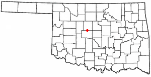
Kingfisher County is a county located in the U.S. state of Oklahoma. As of the 2010 census, the population was 15,034. Its county seat is Kingfisher. The county was formed in 1890 and named Kingfisher by a vote of residents.

Stilwell is a city and county seat of Adair County, Oklahoma, United States. The population was 3,949 at the 2010 census, an increase of 20.5 percent over the figure of 3,276 recorded in 2000. In 1949, the Oklahoma governor and legislature proclaimed Stilwell as the "Strawberry Capital of the World." Stilwell also serves as a gateway to Lake Tenkiller and Adair Park, formerly Adair State Park

Asher is a town in Pottawatomie County, Oklahoma. The population was 393 at the 2010 census, a decline of 6.2 percent from the figure of 419 in 2000.

Okarche is a town in Canadian and Kingfisher counties in Oklahoma, United States, that is part of the Oklahoma City Metropolitan Area. The population was 1,215 at the 2010 census, a 9.5 percent increase from 1,110 at the 2000 census.

Owasso is a city in Rogers and Tulsa Counties in the U.S. state of Oklahoma, and a northern suburb of Tulsa. The population was 28,915 at the 2010 census. Originally settled in 1881 in Indian Territory, the town incorporated in 1904 just prior to Oklahoma statehood and was chartered as a city in 1972.
Four Corners is a region in the southwestern United States where the corners of Colorado, Utah, New Mexico, and Arizona meet.

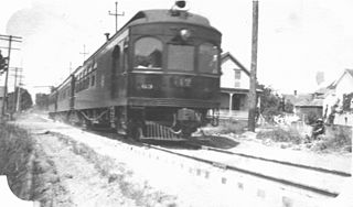
The Oregon Electric Railway (OE) was an interurban railroad line in the U.S. state of Oregon that linked Portland to Eugene. Service from Portland to Salem began in January 1908. The Spokane, Portland and Seattle Railway purchased the system in 1910, and extended service to Eugene in 1912. Regular passenger service in the Willamette Valley ended in May 1933. Freight operations continued and the railway survived into the 1990s, ultimately as a Burlington Northern feeder. Operation as an electric railroad ended July 10, 1945.

Boggy Depot is a ghost town and Oklahoma State Park that was formerly a significant city in the Indian Territory. It grew as a vibrant and thriving town in present-day Atoka County, Oklahoma, United States, and became a major trading center on the Texas Road and the Butterfield Overland Mail route between Missouri and San Francisco. After the Civil War, when the MKT Railroad came through the area, it bypassed Boggy Depot and the town began a steady decline. It was soon replaced by Atoka as the chief city in the area. By the early 20th century, all that remained of the community was a sort of ghost town.

The Oklahoma City metropolitan area is an urban region in Central Oklahoma. It is the largest metropolitan area in the state of Oklahoma and contains the state capital and principal city, Oklahoma City. It is often known as the Oklahoma City Metro, Oklahoma City Metroplex, or Greater Oklahoma City in addition to the nicknames Oklahoma City itself is known for, such as OKC or 'the 405'.

Abira is a town located in Iburi Subprefecture, Hokkaido, Japan. As of 30 September 2016, the town has an estimated population of 8,323.

The Brisbane tramway network served the city of Brisbane, Australia, between 1885 and 1969. It ran on standard gauge track. The electric system was originally energised to 500 volts, and subsequently increased to 600 volts. All tramcars built in Brisbane up to 1938 had an open design. This proved so popular, especially on hot summer nights, that the trams were used as fundraisers and often chartered right up until the last service by social groups.

Pine Ridge is an unincorporated community in Hale Township, Caddo County, Oklahoma, United States. It is located 6 miles (10 km) south of Fort Cobb at the junction of County Road 1380 and County Street 2550.

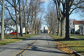
Ridgeville Corners is an unincorporated community and census-designated place (CDP) in southern Ridgeville Township, Henry County, Ohio, United States. It has a post office with the ZIP code 43555. The population was 435 at the 2010 census.

Tonquin is an unincorporated locale in Washington County, Oregon, United States.

Goerke's Corners is a former unincorporated community in the Town of Brookfield, in Waukesha County, Wisconsin, United States, at latitude 43°02'11" N and longitude 088°09'58" W. It is now the location of a major highway intersection, and the site of a park-and-ride lot.

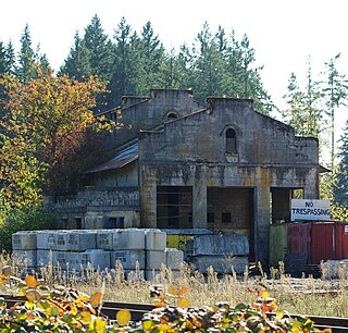
Windsor Town Quarry Park and Tramways Substation No. 6 is a heritage-listed former quarry with electrical substation at 356 Lutwyche Road, Windsor in the City of Brisbane, Queensland, Australia. It was built from c. 1926 to c. 1928. The park and substation were added to the Queensland Heritage Register on 31 May 2005. There is another, larger substation building, Tramways Substation No. 13 which was designed by Frank Gibson Costello and became operational in June 1949.

Brisbane City Council Tramways Substation No. 9 is a heritage-listed electrical substation at 97 Wynnum Road, Norman Park, Queensland, Australia. It was built in 1935. It was added to the Queensland Heritage Register on 5 August 2003.

Brisbane City Council Tramways Substation No. 8 is a heritage-listed electrical substation at 134 Kedron Park Road, Wooloowin, City of Brisbane, Queensland, Australia. It was built from 1934 to 1937. It was added to the Queensland Heritage Register on 5 August 2003.

Paddington Tramways Substation is a heritage-listed former electrical substation at 150 Enoggera Terrace, Paddington, City of Brisbane, Queensland, Australia. It was designed by Roy Rusden Ogg and built from 1929 to 1930. It was added to the Queensland Heritage Register on 22 March 1993.

Gilmore is an unincorporated community in Le Flore County, Oklahoma, United States. The town, formerly incorporated, boasted a small post office, city hall, and Mayor Pratt McMillin, a rancher and oil distributor who died in April 2001, aged 84.


