Britton, Oklahoma

Last updated
Britton, Oklahoma
USA Oklahoma location map.svg
Red pog.svg
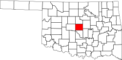
Britton, Oklahoma
Location within the state of Oklahoma
Coordinates: 35°33′56″N97°31′52″W / 35.56556°N 97.53111°W / 35.56556; -97.53111
Country United States
State Oklahoma
County Oklahoma
Elevation
[1]
1,221 ft (372 m)
Time zone UTC-6 (Central (CST))
  Summer (DST) UTC-5 (CDT)
GNIS feature ID1090504 [1]

Britton is a former town in Oklahoma County, Oklahoma, United States, annexed by Oklahoma City in 1950. The GNIS classifies it as a populated place. [1]

Britton, founded in 1889, bears the name of Washington D.C. railroad attorney, Alexander Britton, who worked for the Atchison, Topeka and Santa Fe Railway. As part of its charter allowing a railroad to be built through Oklahoma, the United States required the construction of railway stations every seven miles. The first site north of Oklahoma City became the town of Britton. Britton's altitude is 1,220 feet above sea level and is the highest point on the Santa Fe Railroad between Kansas City, Missouri and Galveston, Texas.[ citation needed ]

Through the efforts of Oklahoma City developers Anton H. Classen and John Shartel, Britton was connected in 1910 to Oklahoma City through the Oklahoma Railway Company's Interurban, which ran on north to Guthrie. During its early years, the town thrived and was home to two movie theaters, gas stations, a drug store, a lumberyard, medical clinics and retail businesses. Before its annexation by Oklahoma City in 1950, Britton's main street offered a shopping point for its 6,000 residents.[ citation needed ]

Between March 3, 1936 and March 2, 1953, Route 66 passed directly through downtown Britton and was the major conduit through which Route 66 travelers made their way through Oklahoma City en route to Illinois and California. The Owl Courts motel, one of Oklahoma City's oldest surviving 1930s era Route 66 motels, was built in the former town of Britton.[ citation needed ]

Related Research Articles

<span class="mw-page-title-main">U.S. Route 66</span> Former US Highway between Chicago and Santa Monica

U.S. Route 66 or U.S. Highway 66 was one of the original highways in the United States Numbered Highway System. It was established on November 11, 1926, with road signs erected the following year. The highway, which became one of the most famous roads in the United States, ran from Chicago, Illinois, through Missouri, Kansas, Oklahoma, Texas, New Mexico, and Arizona before terminating in Santa Monica in Los Angeles County, California, covering a total of 2,448 miles (3,940 km).

<span class="mw-page-title-main">Marion County, Kansas</span> County in Kansas, United States

Marion County is a county located in the U.S. state of Kansas. Its county seat is Marion and its most populous city is Hillsboro. As of the 2020 census, the county population was 11,823. The county was named in honor of Francis Marion, a brigadier general of the American Revolutionary War, known as the "Swamp Fox".

<span class="mw-page-title-main">Ash Fork, Arizona</span> CDP in Yavapai County, Arizona

Ash Fork is a census-designated place in Yavapai County, Arizona, United States. Its population was 396 at the 2010 U.S. Census, down from 457 in 2000.

<span class="mw-page-title-main">Seligman, Arizona</span> CDP in Yavapai County, Arizona

Seligman is a census-designated place (CDP) on the northern border of Yavapai County, in northwestern Arizona, United States. The population was 456 at the 2020 census. It is one of the stops on historic U.S. Route 66.

<span class="mw-page-title-main">Afton, Oklahoma</span> Town in Oklahoma, United States

Afton is a town in northeast Oklahoma in Ottawa County, Oklahoma, United States. The population was 734 at the time of the 2020 United States census.

<span class="mw-page-title-main">Waynoka, Oklahoma</span> City in Oklahoma, United States

Waynoka is a city in Woods County, Oklahoma, United States. It is located on U.S. Highway 281 and State Highway 14, seventy miles west of Enid. The population, which peaked at 2,018 in 1950, was 708 at the time of the 2020 Census.

<span class="mw-page-title-main">BNSF Railway</span> American freight railroad

BNSF Railway is the largest freight railroad in the United States. One of six North American Class I railroads, BNSF has 36,000 employees, 33,400 miles (53,800 km) of track in 28 states, and over 8,000 locomotives. It has three transcontinental routes that provide rail connections between the western and eastern United States. BNSF trains traveled over 169 million miles in 2010, more than any other North American railroad.

<span class="mw-page-title-main">Atchison, Topeka and Santa Fe Railway</span> Former railroad company in the United States

The Atchison, Topeka and Santa Fe Railway, often referred to as the Santa Fe or AT&SF, was one of the largest Class 1 railroads in the United States.

<span class="mw-page-title-main">Winona, Arizona</span> Populated place in Coconino County, Arizona, US

Winona is a small populated place in Coconino County in the northern part of the U.S. state of Arizona. At one time it was also called Walnut, and Winona's railroad station was renamed Darling in honor of an engineer.

<span class="mw-page-title-main">Railroad Wars</span> Historical rivalries between railroad companies in the United States

Railroad Wars were business rivalries between railroad companies, which occurred frequently in American history. Although they were usually little more than legal disputes inside a courtroom, they sometimes turned into armed conflicts. There has been competition between railroad companies since the beginning of railroading in the United States, but violent confrontations were most common in the final quarter of the 19th century, particularly in the Old West.

<span class="mw-page-title-main">U.S. Route 66 in Arizona</span> Former designated US highway in Arizona

U.S. Route 66 also known as the Will Rogers Highway, was a major United States Numbered Highway in the state of Arizona from November 11, 1926, to June 26, 1985. US 66 covered a total of 385.20 miles (619.92 km) through Arizona. The highway ran from west to east, starting in Needles, California, through Kingman and Seligman to the New Mexico state line. Nationally, US 66 ran from Santa Monica, California, to Chicago, Illinois. In its height of popularity, US 66 was one of the most popular highways in the state of Arizona, sometimes carrying over one million cars a year.

<span class="mw-page-title-main">U.S. Route 66 in New Mexico</span> Historic highway in the United States

The historic U.S. Route 66 ran east–west across the central part of the state of New Mexico, along the path now taken by Interstate 40 (I-40). However, until 1937, it took a longer route via Los Lunas, Albuquerque, and Santa Fe, now roughly New Mexico State Road 6 (NM 6), I-25, and US 84. Large portions of the old road parallel to I-40 have been designated NM 117, NM 118, NM 122, NM 124, NM 333, three separate loops of I-40 Business, and state-maintained frontage roads.

<span class="mw-page-title-main">Santa Fe Depot (San Diego)</span> Main railroad station for San Diego

Santa Fe Depot in San Diego, California, is a union station built by the Atchison, Topeka and Santa Fe Railway to replace the small Victorian-style structure erected in 1887 for the California Southern Railroad Company. The Spanish Colonial Revival style station is listed on the National Register of Historic Places and is a San Diego Historic Landmark. Its architecture, particularly the signature twin domes, is often echoed in the design of modern buildings in Downtown San Diego.

<span class="mw-page-title-main">California Southern Railroad</span> Former railroad in California

The California Southern Railroad was a subsidiary railroad of the Atchison, Topeka and Santa Fe Railway in Southern California. It was organized July 10, 1880, and chartered on October 23, 1880, to build a rail connection between what has become the city of Barstow and San Diego, California.

<span class="mw-page-title-main">Gulf, Colorado and Santa Fe Railway</span> Former railway company

The Gulf, Colorado and Santa Fe Railway was a subsidiary of the Atchison, Topeka & Santa Fe Railway. From its starting point in Galveston, Texas, the railroad eventually extended northwestwards across the state to Sweetwater and northwards via Fort Worth to Purcell, Oklahoma.

<span class="mw-page-title-main">Fullerton Transportation Center</span> Passenger train and bus station in Fullerton, California, United States

The Fullerton Transportation Center is a passenger rail and bus station located in Fullerton, California, United States.

<span class="mw-page-title-main">Yucca, Arizona</span> Community in Mohave County, Arizona

Yucca is an unincorporated community and census-designated place (CDP) in Mohave County, Arizona, United States. As of the 2020 census it had a population of 96, down from 126 at the 2010 census.

<span class="mw-page-title-main">Galesburg station (Atchison, Topeka and Santa Fe Railway)</span>

Galesburg Santa Fe Station was a railway station in the west central Illinois town of Galesburg. The station was along the Atchison, Topeka and Santa Fe Railway's main line and served trains such as the Super Chief and El Captain. After Amtrak took over intercity rail in the United States, it was served by trains such as the Lone Star (1971–1979) and the Southwest Chief (1971–1996).

References