Nicoma Park, Oklahoma

Last updated

Nicoma Park, Oklahoma
City Hall, Nicoma Park, Oklahoma.jpg
Nicoma Park City Hall
Oklahoma County Oklahoma Incorporated and Unincorporated areas Nicoma Park highlighted.svg
Location in Oklahoma County and the state of Oklahoma.
Coordinates: 35°29′29″N97°19′32″W / 35.49139°N 97.32556°W / 35.49139; -97.32556
Country United States
State Oklahoma
County Oklahoma
Area
[1]
  Total3.36 sq mi (8.70 km2)
  Land3.36 sq mi (8.70 km2)
  Water0.00 sq mi (0.00 km2)
Elevation
[2]
1,194 ft (364 m)
Population
 (2020)
  Total2,313
  Density688.39/sq mi (265.76/km2)
Time zone UTC-6 (Central (CST))
  Summer (DST) UTC-5 (CDT)
ZIP code
73066
Area code 405
FIPS code 40-51850 [3]
GNIS feature ID2411255 [2]

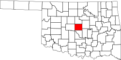
Nicoma Park is a city in Oklahoma County, Oklahoma, United States, and a part of the Oklahoma City metropolitan area. The name Nicoma is a portmanteau of the first three letters of Nichols, for G.A. Nichols, and the last three letters of Oklahoma. The population was 2,313 at the 2020 census, a 3.3% decrease from 2010.

Contents

Geography

According to the United States Census Bureau, the city has a total area of 3.3 square miles (8.5 km2), all land.

Demographics

Historical population
CensusPop.Note
1960 1,263
1970 2,560102.7%
1980 2,5881.1%
1990 2,353−9.1%
2000 2,4152.6%
2010 2,393−0.9%
2020 2,313−3.3%
U.S. Decennial Census [4]

As of the census [3] of 2000, there were 2,415 people, 943 households, and 691 families residing in the city. The population density was 738.8 inhabitants per square mile (285.3/km2). There were 1,089 housing units at an average density of 333.1 per square mile (128.6/km2). The racial makeup of the city was 85.96% White, 3.40% African American, 4.43% Native American, 0.46% Asian, 0.87% from other races, and 4.89% from two or more races. Hispanic or Latino of any race were 3.56% of the population.

There were 941 households, out of which 30.2% had children under the age of 18 living with them, 57.3% were married couples living together, 11.6% had a female householder with no husband present, and 26.7% were non-families. 23.1% of all households were made up of individuals, and 9.8% had someone living alone who was 65 years of age or older. The average household size was 2.56 and the average family size was 3.02.

In the city, the population was spread out, with 25.5% under the age of 18, 7.4% from 18 to 24, 27.0% from 25 to 44, 23.5% from 45 to 64, and 16.6% who were 65 years of age or older. The median age was 38 years. For every 100 females, there were 100.9 males. For every 100 females age 18 and over, there were 95.0 males.

The median income for a household in the city was $36,190, and the median income for a family was $40,345. Males had a median income of $30,339 versus $20,417 for females. The per capita income for the city was $17,801. About 7.0% of families and 10.6% of the population were below the poverty line, including 14.3% of those under age 18 and 6.1% of those age 65 or over.

City government

Nicoma Park has a Mayor-Council form of government. The mayor is elected like other city officials but fulfills both the role of overseeing the city council meetings and running the day-to-day affairs of the city's administration. The city council consists of six ward council members. [ citation needed ]

Education

Most of Nicoma Park is in Choctaw/Nicoma Park Schools. A portion of Nicoma Park is in Oklahoma City Public Schools (OKCPS). [5]

Schools in Nicoma Park, all in Choctaw/Nicoma Park Schools, include: Nicoma Park Elementary School, Nicoma Park Intermediate School, and Nicoma Park Middle School. The zoned high school of the Choctaw/Nicoma Park part is Choctaw High School. [6]

Zoned schools of the OKCPS portion include Willow Brook Elementary School (PreKindergarten-Grade 1), Spencer Elementary School (grades 2-4), Rogers Intermediate School (grades 5-6), [7] and Star Spencer Mid-High School. [8] [9]

Related Research Articles

<span class="mw-page-title-main">Effingham, Kansas</span> City in Kansas, United States

Effingham is a city in Atchison County, Kansas, United States. As of the 2020 census, the population of the city was 495.

<span class="mw-page-title-main">Kiowa, Kansas</span> City in Kiowa County, Kansas

Kiowa is a city in Barber County, Kansas, United States. As of the 2020 census, the population of the city was 902. It is located 1 mile north of the Kansas / Oklahoma state border.

<span class="mw-page-title-main">Haysville, Kansas</span> City in Sedgwick County, Kansas

Haysville is a city in Sedgwick County, Kansas, United States, and a suburb of Wichita. As of the 2020 census, the population of the city was 11,262. Haysville is known as the "Peach Capital of Kansas".

<span class="mw-page-title-main">Park City, Kansas</span> City in Sedgwick County, Kansas

Park City is a city in Sedgwick County, Kansas, United States and a suburb of Wichita. As of the 2020 census, the population of the city was 8,333.

<span class="mw-page-title-main">Hunnewell, Kansas</span> City in Sumner County, Kansas

Hunnewell is a city in Sumner County, Kansas, United States. As of the 2020 census, the population of the city was 44.

<span class="mw-page-title-main">Gladstone, Missouri</span> City in Missouri, United States

Gladstone is a city in Clay County, Missouri, United States and a suburb of Kansas City. The City of Gladstone is located about 10–20 minutes from downtown Kansas City, and about 10–20 minutes from Kansas City International Airport. As of the 2020 census, the city population was 27,063. It is part of the Kansas City metropolitan area.

<span class="mw-page-title-main">Hazelwood, Missouri</span> City in Missouri, United States

Hazelwood is a city in St. Louis County, Missouri, within Greater St. Louis. It is a second-ring northern suburb of St. Louis. Based on the 2020 United States census, the city had a total population of 25,485. It is located north of St. Louis-Lambert International Airport and is situated on Interstates 270 and 170, as well as the much-traveled Lindbergh Boulevard and Highway 370.

<span class="mw-page-title-main">Hall Park, Oklahoma</span> Town in Oklahoma, United States

Hall Park is a neighborhood in Norman, Oklahoma. It was originally a town in Cleveland County, Oklahoma, United States and part of the Oklahoma City Metropolitan Area. It began in the 1960s and is named after the founder Ike Hall. At the time of the 2000 census, the town population was 1,088 prior to becoming part of the City of Norman.

<span class="mw-page-title-main">Amber, Oklahoma</span> Town in Oklahoma, United States

Amber is a town in Grady County, Oklahoma, United States. The population was 413 at the 2020 census, a 1.4% decrease from 2010.

<span class="mw-page-title-main">Davenport, Oklahoma</span> Town in Oklahoma, United States

Davenport is a town in Lincoln County, Oklahoma, United States. The population was 814 at the 2010 census.

<span class="mw-page-title-main">Kendrick, Oklahoma</span> Town in Oklahoma, United States

Kendrick is a town in Lincoln County, Oklahoma, United States. The population was 139 at the 2010 census.

<span class="mw-page-title-main">Ringwood, Oklahoma</span> Town in Oklahoma, United States

Ringwood is a town in Major County, Oklahoma, United States. The population was 497 at the 2010 census, a 17.2 percent increase from the 2000 census. The population is now estimated to be 510. The town was given its name because it was ringed by woods from northwest to southeast, though the town is no longer accurate to its name.

<span class="mw-page-title-main">Forest Park, Oklahoma</span> Town in Oklahoma, United States

Forest Park is a town in Oklahoma County, Oklahoma, United States, and a part of the Oklahoma City metropolitan area. The population was 998 at the 2010 census.

<span class="mw-page-title-main">The Village, Oklahoma</span> City in Oklahoma, United States

The Village is a city in Oklahoma County, Oklahoma, United States, and a part of the Oklahoma City metropolitan area. The population was 9,538 at the 2020 Census.

<span class="mw-page-title-main">Woodlawn Park, Oklahoma</span> Town in Oklahoma, United States

Woodlawn Park is a town in Oklahoma County, Oklahoma, United States, and a part of the Oklahoma City Metropolitan Area. The population was 161 at the 2000 census.

<span class="mw-page-title-main">Cleveland, Oklahoma</span> City in Oklahoma, United States

Cleveland is a city in Pawnee County, Oklahoma, United States. The 2010 census population was 3,251, a decrease of 0.9 percent from the figure of 3,282 recorded in 2000.

<span class="mw-page-title-main">Valley Park, Oklahoma</span> Town in Oklahoma, United States

Valley Park is a town in Rogers County, Oklahoma, United States. The population was 77 at the 2010 census, up 221 percent from the figure of 24 recorded in 2000.

<span class="mw-page-title-main">Brushy, Oklahoma</span> CDP in Oklahoma, United States

Brushy is a census-designated place (CDP) in Sequoyah County, Oklahoma, United States, along U.S. Route 59 in the foothills of the Brushy Mountains. It is part of the Fort Smith, Arkansas-Oklahoma Metropolitan Statistical Area. The population was 900 at the 2010 census, an increase of 14.4 percent over the figure of 787 recorded in 2000.

Marble City Community is a census-designated place (CDP) in Sequoyah County, Oklahoma, United States. It is part of the Fort Smith, Arkansas-Oklahoma Metropolitan Statistical Area. The population was 420 at the 2000 census.

<span class="mw-page-title-main">Ridgefield, Washington</span> City in Washington, United States

Ridgefield is a city in northern Clark County, Washington, United States. The population was 10,319 at the time of the 2020 census, up from 4,763 in 2010, making it the fastest growing city in the state of Washington.

References

  1. "ArcGIS REST Services Directory". United States Census Bureau. Retrieved September 20, 2022.
  2. 1 2 U.S. Geological Survey Geographic Names Information System: Nicoma Park, Oklahoma
  3. 1 2 "U.S. Census website". United States Census Bureau . Retrieved October 31, 2008.
  4. "Census of Population and Housing". Census.gov. Retrieved June 4, 2015.
  5. "2020 CENSUS - SCHOOL DISTRICT REFERENCE MAP: Oklahoma County, OK" (PDF). U.S. Census Bureau . Retrieved January 28, 2024.
  6. "Schools". Choctaw/Nicoma Park Schools . Retrieved January 28, 2024.
  7. "ALL_Elementary%2020190422.pdf" (PDF). Oklahoma City Public Schools . Retrieved January 28, 2024.
  8. "ALL_Middle%2020190422.pdf" (PDF). Oklahoma City Public Schools . Retrieved January 28, 2024.
  9. "ALL_High%2020190422.pdf" (PDF). Oklahoma City Public Schools . Retrieved January 28, 2024.