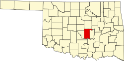
Maud, Oklahoma | |
---|---|
Coordinates: 35°7′55″N96°46′42″W / 35.13194°N 96.77833°W | |
Country | United States |
State | Oklahoma |
Counties | Pottawatomie, Seminole |
Government | |
• Type | Aldermanic |
• Mayor | Jimmy Porterfield |
• Councilmembers | Kurtis Dustman, Lee Davis, Chad Votaw and Bobby Shatto |
Area | |
• Total | 1.05 sq mi (2.72 km2) |
• Land | 1.05 sq mi (2.72 km2) |
• Water | 0.00 sq mi (0.00 km2) |
Elevation | 978 ft (298 m) |
Population (2020) | |
• Total | 867 |
• Density | 826.50/sq mi (318.97/km2) |
Time zone | UTC-6 (Central (CST)) |
• Summer (DST) | UTC-5 (CDT) |
ZIP code | 74854 |
Area code | 405 |
FIPS code | 40-46900 [3] |
GNIS feature ID | 2411050 [2] |
Maud is a city on the boundary between Pottawatomie and Seminole counties in the U.S. state of Oklahoma. The population was 867 by the 2020 United States census. [4] The locale was named for Maud Stearns, a sister to the wives of two men who owned the first general store. [5]
This community was established by 1890 on the dividing line between Oklahoma Territory and Indian Territory. In 1890, a barbed-wire fence was built along the street now called Broadway from the North Canadian River to the Canadian River to keep the Native Americans out of Oklahoma Territory. However, the fence failed to prevent the illegal sale of alcohol to residents of Indian Territory. [5]
A post office was established on April 16, 1896.
In January 1898, a mob lynched two Seminole teenagers, Lincoln McGeisey and Palmer Sampson, by burning them alive near this same post office, in retaliation for their alleged murder of a white woman. [6] Newspapers reported that the charred bodies remained chained to an oak tree for several days after the mob murdered them. [7] Unlike in most lynchings, some members of the mob were actually convicted of participating in the violence. When one of these men was released from the federal penitentiary in Leavenworth in 1906, a celebratory crowd welcomed him home to Maud. [8]
A railroad station was built by the Missouri, Kansas and Texas Railway in 1903. [5] The first newspaper, the Maud Monitor, appeared in 1904, and lasted until about 1919. [9] The city was formally incorporated on July 21, 1905. [5] The 1910 census showed a population of 503. [5]
Maud became a boom town in the early 1920s because oil was discovered nearby. The peak population was estimated at ten thousand. The boom was short-lived and the population was only 4,326 at the 1930 census. [5]
According to the United States Census Bureau, the city has a total area of 1.0 square mile (2.6 km2), all land.
Census | Pop. | Note | %± |
---|---|---|---|
1910 | 503 | — | |
1920 | 637 | 26.6% | |
1930 | 4,326 | 579.1% | |
1940 | 2,036 | −52.9% | |
1950 | 1,389 | −31.8% | |
1960 | 1,137 | −18.1% | |
1970 | 1,143 | 0.5% | |
1980 | 1,444 | 26.3% | |
1990 | 1,204 | −16.6% | |
2000 | 1,136 | −5.6% | |
2010 | 1,048 | −7.7% | |
2020 | 867 | −17.3% | |
U.S. Decennial Census [10] |
As of the census [3] of 2000, there were 1,136 people, 435 households, and 301 families residing in the city. The population density was 1,174.3 inhabitants per square mile (453.4/km2). There were 523 housing units at an average density of 540.6 units per square mile (208.7 units/km2). The racial makeup of the city was 78.52% White, 0.18% Native American, 13.73% Native American, 0.26% Asian, 0.18% Pacific Islander, 0.26% from other races, and 6.87% from two or more races. Hispanic or Latino of any race were 2.55% of the population.
There were 435 households, out of which 36.6% had children under the age of 18 living with them, 51.3% were married couples living together, 14.7% had a female householder with no husband present, and 30.8% were non-families. 27.4% of all households were made up of individuals, and 15.4% had someone living alone who was 65 years of age or older. The average household size was 2.52 and the average family size was 3.07.
In the city, the population was spread out, with 28.1% under the age of 18, 9.0% from 18 to 24, 26.1% from 25 to 44, 19.8% from 45 to 64, and 17.0% who were 65 years of age or older. The median age was 36 years. For every 100 females, there were 85.3 males. For every 100 females age 18 and over, there were 80.4 males.
The median income for a household in the city was $22,604, and the median income for a family was $27,847. Males had a median income of $26,944 versus $15,625 for females. The per capita income for the city was $12,719. About 19.2% of families and 22.7% of the population were below the poverty line, including 25.0% of those under age 18 and 21.3% of those age 65 or over.
Seminole County is a county located in the U.S. state of Oklahoma. As of the 2020 census, the population was 23,556. Its county seat is Wewoka. Most of the county was a reservation for the Seminole Nation of Oklahoma which still retains jurisdiction over some land in the county. A small portion of land at the eastern end of the county belonged to the Muscogee (Creek) Nation.
Pottawatomie County is a county located in the U.S. state of Oklahoma. As of the 2020 census, the population was 72,454. Its county seat is Shawnee.
Oklahoma County is a county located in the central part of the U.S. state of Oklahoma. As of the 2020 census, the population was 796,292, making it the most populous county in Oklahoma. The county seat is Oklahoma City, the state capital and largest city. Oklahoma County is at the heart of the Oklahoma City metropolitan statistical area.
Logan County is a county located in the U.S. state of Oklahoma. As of the 2020 census, the population was 49,555. Its county seat is Guthrie.
Lincoln County is a county in eastern Central Oklahoma. As of the 2020 census, the population was 33,458. Its county seat is Chandler.
Jackson County is a county located in the southwestern corner of the U.S. state of Oklahoma. As of the 2020 census, the population was 24,785. Its county seat is Altus. According to the Encyclopedia of Oklahoma History and Culture, the county was named for two historical figures: President Andrew Jackson and Confederate General Stonewall Jackson. One source states that the county was named only for the former president, while an earlier source states it was named only for General Stonewall Jackson.
Greer County is a county located along the southwest border of the U.S. state of Oklahoma. As of the 2020 census, the population was 5,491. Its county seat is Mangum. From 1860 to 1896, the state of Texas claimed an area known as Greer County, Texas, which included present-day Greer County along with neighboring areas. In 1896 it was designated as a county in Oklahoma Territory under a ruling by the US Supreme Court. The rural Greer County is home to Quartz Mountain State Park, near the community of Lone Wolf, Oklahoma. It is also home to the Oklahoma State Reformatory, located in Granite. Its population has declined since 1930 due to changes in agriculture and migration to cities for work.
Blountstown is a city and the county seat of Calhoun County, Florida, United States. As of the 2020 census, the city had a population of 2,266.
Centrahoma is a rural small town in Coal County, Oklahoma, United States. The population was 97 at the 2010 census.
Olustee is a town in Jackson County, Oklahoma, United States. "Olustee" is said to be a Seminole word meaning "pond" or from the Creek (Muscogee) language ue-lvste (/oy-lást-i/) meaning "black water", and being taken from the Battle of Olustee in Florida. The population was 468 as of the 2020 United States census.
Talihina is a town in LeFlore County, Oklahoma, United States, its name originating from two Choctaw words, tully and hena, meaning "iron road," a reference to the railroad around which the town was built. It is part of the Fort Smith, Arkansas–Oklahoma Metropolitan Statistical Area. The population was 925 at the time of the 2020 Census.
Beggs is a city in Okmulgee County, Oklahoma, United States. The population was 1,179 as of the 2020 census. Beggs was named for Charles Hoffman Beggs (1865–1942), vice president of the St. Louis-San Francisco (Frisco) Railway.
Ashland is a town in Pittsburg County, Oklahoma, United States. The population was 66 at the 2010 census.
Byng is a town in Pontotoc County, Oklahoma, United States. The population was 1,175 at the 2010 census.
Earlsboro is a town in Pottawatomie County, Oklahoma, United States. The population was 594 by the 2020 United States census. It was once called "...the town that whisky built and oil broke."
St. Louis is a town in Pottawatomie County, Oklahoma, United States. The population was 121 by the 2020 United States census.
Bowlegs is a town in Seminole County, Oklahoma, United States. The population was 357 at the time of the 2020 census.
Sasakwa is a town in Seminole County, Oklahoma, United States. The population was 80 as of the 2020 census.
Seminole is a city in Seminole County, Oklahoma, United States. The population was 7,488 at the 2010 census. Seminole experienced a large population growth in the 1920s due to an oil boom.
Edmond Andrew Harjo was an American Seminole Code Talker during World War II. Harjo, who served with his brothers at Normandy landings and the Battle of the Bulge, was the last surviving code talker from the Seminole Nation of Oklahoma. On November 20, 2013, a group representing thirty-three Native American tribes were awarded the Congressional Gold Medal, the highest civilian honor bestowed by the United States Congress, for their service as code talkers. Harjo was the only surviving code talker present. He was presented with a silver duplicate of the gold medal representing his tribe.