Sasakwa, Oklahoma

Last updated

Sasakwa, Oklahoma
OKMap-doton-Sasakwa.PNG
Location of Sasakwa, Oklahoma
Coordinates: 34°56′48″N96°31′31″W / 34.94667°N 96.52528°W / 34.94667; -96.52528
Country United States
State Oklahoma
County Seminole
Area
[1]
  Total0.21 sq mi (0.55 km2)
  Land0.21 sq mi (0.55 km2)
  Water0.00 sq mi (0.00 km2)
Elevation
[2]
827 ft (252 m)
Population
 (2020)
  Total80
  Density375.59/sq mi (144.69/km2)
Time zone UTC-6 (Central (CST))
  Summer (DST) UTC-5 (CDT)
ZIP code
74867
Area code 405
FIPS code 40-65500 [3]
GNIS feature ID2413261 [2]

Sasakwa is a town in Seminole County, Oklahoma, United States. The population was 80 as of the 2020 census. [4]

Contents

History

Sasakwa was originally located at a site 12 miles (19 km) west of the present townsite, where Governor John E Brown, Seminole, established a trading post, cotton gin, and 16 room mansion where he fed vagrants and poor. [5] A post office was established in 1880, and took the name from that given his trading post by Gov John E Brown, from the Seminole word meaning "wild goose". [5] Sasakwa Female Academy existed at Sasakwa from 1880 to 1892. At that time Sasakwa was part of the [not sure it was Creek, part of Seminole nation today] Nation in the Indian Territory. The site of the present town was moved to where the train station was located.

In 1917, hundreds of men gathered on a farm near Sasakwa to protest the draft in World War I, an event called the Green Corn Rebellion. [5]

Geography

Sasakwa is located 13 miles (21 km) south of Wewoka, the county seat. According to the United States Census Bureau, [5] the town has a total area of 0.2 square miles (0.52 km2), all land.

The town is on Oklahoma State Highway 56; Lake Konawa is to the west. [6]

Demographics

Historical population
CensusPop.Note
1910 241
1920 35547.3%
1930 781120.0%
1940 532−31.9%
1950 365−31.4%
1960 253−30.7%
1970 32126.9%
1980 3354.4%
1990 169−49.6%
2000 150−11.2%
2010 1500.0%
2020 80−46.7%
U.S. Decennial Census [7]

As of the census [3] of 2000, there were 150 people, 58 households, and 41 families residing in the town. The population density was 714.8 inhabitants per square mile (276.0/km2). There were 77 housing units at an average density of 367.0 per square mile (141.7/km2). The racial makeup of the town was 61.33% White, 1.33% African American, 28.67% Native American, and 8.67% from two or more races.

There were 58 households, out of which 27.6% had children under the age of 18 living with them, 48.3% were married couples living together, 19.0% had a female householder with no husband present, and 27.6% were non-families. 25.9% of all households were made up of individuals, and 15.5% had someone living alone who was 65 years of age or older. The average household size was 2.59 and the average family size was 3.02.

In the town, the population was spread out, with 30.7% under the age of 18, 9.3% from 18 to 24, 22.7% from 25 to 44, 20.7% from 45 to 64, and 16.7% who were 65 years of age or older. The median age was 35 years. For every 100 females, there were 74.4 males. For every 100 females age 18 and over, there were 79.3 males.

The median income for a household in the town was $20,750, and the median income for a family was $24,286. Males had a median income of $23,750 versus $13,542 for females. The per capita income for the town was $9,353. There were 19.6% of families and 24.3% of the population living below the poverty line, including 33.3% of under eighteens and 32.1% of those over 64.

Notable people

Sasakwa was home to Seminole Chiefs John Jumper and John F. Brown. [5]

Related Research Articles

<span class="mw-page-title-main">Seminole County, Oklahoma</span> County in Oklahoma, United States

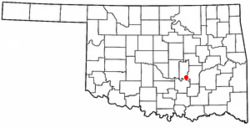
Seminole County is a county located in the U.S. state of Oklahoma. As of the 2020 census, the population was 23,556. Its county seat is Wewoka. Most of the county was a reservation for the Seminole Nation of Oklahoma which still retains jurisdiction over some land in the county. A small portion of land at the eastern end of the county belonged to the Muscogee (Creek) Nation.

<span class="mw-page-title-main">Upton, Maine</span> Town in the state of Maine, United States

Upton is a town in Oxford County, Maine, United States. The population was 69 at the 2020 census.

<span class="mw-page-title-main">Knowles, Oklahoma</span> Town in Oklahoma, United States

Knowles is a town in Beaver County, Oklahoma, United States. The population was 6 at the time of the 2020 census.

<span class="mw-page-title-main">Kenefic, Oklahoma</span> Town in Oklahoma, United States

Kenefic is a town in Bryan County, Oklahoma, United States. The population was 196 at the 2010 census, a 2 percent increase from the total of 192 recorded in 2000. The town was named for William Kenefick, president of the Missouri, Oklahoma and Gulf Railroad (MO&G), which had constructed a rail line through the region. The town name has been spelled both Kenefic and Kenefick throughout its history.

<span class="mw-page-title-main">Norge, Oklahoma</span> Town in Oklahoma, United States

Norge is a town in Grady County, Oklahoma, United States. The population was 129 at the 2020 census, a 11% decrease from 2010.

<span class="mw-page-title-main">Olustee, Oklahoma</span> Town in Oklahoma, United States

Olustee is a town in Jackson County, Oklahoma, United States. "Olustee" is said to be a Seminole word meaning "pond" or from the Creek (Muscogee) language ue-lvste (/oy-lást-i/) meaning "black water", and being taken from the Battle of Olustee in Florida. The population was 468 as of the 2020 United States census.

<span class="mw-page-title-main">Tryon, Oklahoma</span> Town in Oklahoma, United States

Tryon is a town in Lincoln County, Oklahoma, United States. The population was 491 at the 2010 census. The community is named after early land owner Fred S. Tryon.

<span class="mw-page-title-main">Forest Park, Oklahoma</span> Town in Oklahoma, United States

Forest Park is a town in Oklahoma County, Oklahoma, United States, and a part of the Oklahoma City metropolitan area. The population was 998 at the 2010 census.

<span class="mw-page-title-main">Lake Aluma, Oklahoma</span> Town in Oklahoma, United States

Lake Aluma is a town in Oklahoma County, Oklahoma, United States, and a part of the Oklahoma City Metropolitan Area. The population was 88 at the 2010 census.

<span class="mw-page-title-main">Smith Village, Oklahoma</span> Town in Oklahoma, United States

Smith Village is a town in Oklahoma County, Oklahoma, United States, and a part of the Oklahoma City Metropolitan Area. The population was 66 at the 2010 census.

<span class="mw-page-title-main">Byng, Oklahoma</span> Town in Oklahoma, United States

Byng is a town in Pontotoc County, Oklahoma, United States. The population was 1,175 at the 2010 census.

St. Louis is a town in Pottawatomie County, Oklahoma, United States. The population was 121 by the 2020 United States census.

<span class="mw-page-title-main">Tribbey, Oklahoma</span> Town in Oklahoma, United States

Tribbey is a town in Pottawatomie County, Oklahoma, United States.The community was named for Alpheus M. Tribbey, landowner. The population was 337 by the 2020 United States census.

<span class="mw-page-title-main">Foyil, Oklahoma</span> Town in Oklahoma, United States

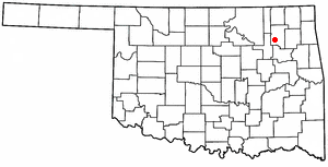
Foyil is a town in Rogers County, Oklahoma, United States. It was named for Alfred Foyil, a local landowner and the first postmaster of the town. The population was 344 at the 2010 census, a 47.0 percent increase over the figure of 234 recorded in 2000.

<span class="mw-page-title-main">Valley Park, Oklahoma</span> Town in Oklahoma, United States

Valley Park is a town in Rogers County, Oklahoma, United States. The population was 77 at the 2010 census, up 221 percent from the figure of 24 recorded in 2000.

<span class="mw-page-title-main">Bowlegs, Oklahoma</span> Town in Oklahoma, United States

Bowlegs is a town in Seminole County, Oklahoma, United States. The population was 357 at the time of the 2020 census.

<span class="mw-page-title-main">Seminole, Oklahoma</span> City in Oklahoma, United States

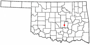
Seminole is a city in Seminole County, Oklahoma, United States. The population was 7,488 at the 2010 census. Seminole experienced a large population growth in the 1920s due to an oil boom.

<span class="mw-page-title-main">Loveland, Oklahoma</span> Town in Oklahoma, United States

Loveland is a town in Tillman County, Oklahoma, United States. It is located about 38 miles southwest of Lawton, Oklahoma. The population was 13 at the 2020 Census. Loveland once had a post office that has since closed. The post office was popular around Valentine's Day, when people often drove many miles to have their valentines postmarked "Loveland".

Allen is a town in Hughes and Pontotoc counties in the U.S. state of Oklahoma. The population was 805 at the 2020 census.

<span class="mw-page-title-main">Maud, Oklahoma</span> Town in Oklahoma, United States

Maud is a city on the boundary between Pottawatomie and Seminole counties in the U.S. state of Oklahoma. The population was 867 by the 2020 United States census. The locale was named for Maud Stearns, a sister to the wives of two men who owned the first general store.

References

  1. "ArcGIS REST Services Directory". United States Census Bureau. Retrieved September 20, 2022.
  2. 1 2 U.S. Geological Survey Geographic Names Information System: Sasakwa, Oklahoma
  3. 1 2 "U.S. Census website". United States Census Bureau . Retrieved January 31, 2008.
  4. CensusViewer" Sasakawa, Oklahoma Population. Retrieved May 25, 2015.
  5. 1 2 3 4 5 Wilson, Linda D. "Sasakwa - Encyclopedia of Oklahoma History & Culture". Oklahoma Historical Society. Retrieved May 9, 2011.
  6. "Sasakwa, Oklahoma". Google Maps. Retrieved July 11, 2020.
  7. "Census of Population and Housing". Census.gov. Retrieved June 4, 2015.