Related Research Articles

Seminole County is a county located in the U.S. state of Oklahoma. As of the 2020 census, the population was 23,556. Its county seat is Wewoka. Most of the county was a reservation for the Seminole Nation of Oklahoma which still retains jurisdiction over some land in the county. A small portion of land at the eastern end of the county belonged to the Muscogee (Creek) Nation.

Pottawatomie County is a county located in the U.S. state of Oklahoma. As of the 2020 census, the population was 72,454. Its county seat is Shawnee.

Byng is a town in Pontotoc County, Oklahoma, United States. The population was 1,175 at the 2010 census.
Asher is a town in Pottawatomie County, Oklahoma. The population was 393 at the 2010 census, a decline of 6.2 percent from the figure of 419 in 2000.
St. Louis is a town in Pottawatomie County, Oklahoma, United States. The population was 158 at the 2010 census, a 23.3 percent decline from the figure of 206 in 2000.

Cromwell is a town in Seminole County, Oklahoma, United States. It is within the jurisdiction of the Muscogee (Creek) Nation. The population was 286 at the 2010 census, an 8 percent increase from the figure of 265 recorded in 2000. It was named for oilman Joe I. Cromwell, who platted the original town in 1923. The population soared to several thousand people in a few weeks, and lawlessness was rampant in the community. Retired legendary Old West lawman Bill Tilghman was hired as Town Marshal to restore order. Tilghman was shot to death the following year, the most notable event in Cromwell's history.

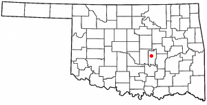
Konawa is a city in Seminole County, Oklahoma, United States. The population was 1,298 at the 2010 census. Konawa is a Seminole word meaning, "string of beads."

Sasakwa is a town in Seminole County, Oklahoma, United States. The population was documented as 150 in both the 2010 and 2000 census.
Seminole is a city in Seminole County, Oklahoma, United States. The population was 7,488 at the 2010 census. Seminole experienced a large population growth in the 1920s due to an oil boom.
Wewoka is a city in Seminole County, Oklahoma, United States. The population was 3,271 at the 2020 census. It is the county seat of Seminole County.

State Highway 99 (SH-99) is a north–south state highway through central Oklahoma. It runs from the Texas state line at Lake Texoma to the Kansas state line near Lake Hulah. It is 241.5 miles (388.7 km) long. The highway overlaps U.S. Highway 377 (US-377) for over half its length.

State Highway 39, abbreviated as SH-39, is a state highway in the U.S. state of Oklahoma. It is 68.4 miles (110.1 km) in length. It runs east–west through the central part of the state, beginning at unincorporated Tabler, east of Chickasha, and ending east of Konawa. Along the way, SH-39 serves the counties of Grady, McClain, Cleveland, Pottawatomie, and Seminole. It currently has no lettered spurs.

State Highway 56 is a state highway in the U.S. state of Oklahoma. The road serves Seminole County, Okfuskee County, and Okmulgee Counties in central and east-central Oklahoma. In Seminole County, it is also designated as the Seminole Nation Highway in honor of the contributions the Seminole Nation has made to the state of Oklahoma.
Avoca was a small town in Avoca Township, located in southeastern Pottawatomie County, Oklahoma Territory. The post office was established in 1894 and closed permanently in 1906.
Avoca Township was located in Pottawatomie County, Oklahoma. It should not be confused with Avoca, which was a smaller community inside the township.
Spelter City is a populated place within the city of Henryetta, Oklahoma. It is located northeast of Henryetta’s town center, and west of Dewar, Oklahoma.
Dixon is a populated place in Seminole County, Oklahoma, at an elevation of 863 feet. It is less than two miles west of Wewoka, Oklahoma, the county seat. It is located on Business 270, being an offshoot of US Route 270 which bypasses Dixon to the west and south.
Nobletown is a populated place in Seminole County, Oklahoma at an elevation of 840 feet. It is about five miles northwest of Wewoka, Oklahoma, the county seat.
Little is a populated place in Seminole County, Oklahoma at an elevation of 968 feet. It is north of the City of Seminole and east of Shawnee, Oklahoma, located at the intersection of US Route 377 and Oklahoma State Highway 99A, just south of Interstate 40. It had a post office from August 14, 1902 to November 30, 1916. It was named for Thomas Little, a prominent Seminole and second chief of the tribe.
Butner is a populated place in Seminole County, Oklahoma at an elevation of 925 feet. It is about 6 miles south of Cromwell, Oklahoma on Oklahoma State Highway 56. It had a post office from June 1, 1903, to November 30, 1906. It was named for one Thomas Butner, an early settler.
References
- ↑ "Vamoosa". Geographic Names Information System . United States Geological Survey, United States Department of the Interior . Retrieved July 10, 2021.
- ↑ "Vamoosa (in Seminole County, OK) Populated Place Profile". HomeTownLocator.com. Retrieved June 25, 2021.
- 1 2 "Konowa, Oklahoma to Vamoosa, Oklahoma". Google Maps. Retrieved June 25, 2021.
- ↑ "Ghost Towns". The Seminole Nation. Retrieved June 28, 2021.
- ↑ "vamoose". Merriam-Webster. Retrieved June 25, 2021.
- ↑ "Vamoosa". The Oklahoman, October 14, 2000. Retrieved June 25, 2021.
- ↑ Jones, David (February 25, 2019). "No place like home" . Retrieved June 25, 2021.
Municipalities and communities of Seminole County, Oklahoma, United States | ||
|---|---|---|
| Cities |  | |
| Towns | ||
| CDP | ||
| Other communities | ||
| Indian reservations | ||
| Footnotes | ‡This populated place also has portions in an adjacent county or counties | |