References
- ↑ "Trousdale". Geographic Names Information System . United States Geological Survey, United States Department of the Interior . Retrieved July 10, 2021.
- ↑ "Trousdale, Oklahoma". RoadsideThoughts. Retrieved June 30, 2021.
- ↑ "Tribbey, Oklahoma to Trousdale, Oklahoma". Google Maps. Retrieved June 30, 2021.
- 1 2 3 4 "Trousdale". Rootsweb.com. Retrieved June 30, 2021.
Municipalities and communities of Pottawatomie County, Oklahoma, United States | ||
|---|---|---|
| Cities | 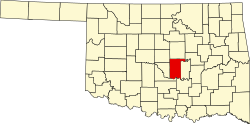 | |
| Towns | ||
| CDP | ||
| Other communities | ||
| Ghost towns | ||
| Footnotes | ‡This populated place also has portions in an adjacent county or counties | |
35°02′28″N97°02′34″W / 35.04111°N 97.04278°W
| | This Pottawatomie County, Oklahoma location article is a stub. You can help Wikipedia by expanding it. |