2020 census
As of the 2020 census, McLoud had a population of 4,351. The median age was 37.6 years. 19.4% of residents were under the age of 18 and 13.6% of residents were 65 years of age or older. For every 100 females there were 53.5 males, and for every 100 females age 18 and over there were 45.1 males age 18 and over. [11]
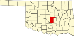
0% of residents lived in urban areas, while 100.0% lived in rural areas. [12]
There were 1,153 households in McLoud, of which 35.3% had children under the age of 18 living in them. Of all households, 50.3% were married-couple households, 15.6% were households with a male householder and no spouse or partner present, and 27.1% were households with a female householder and no spouse or partner present. About 22.4% of all households were made up of individuals and 8.6% had someone living alone who was 65 years of age or older. [11]
There were 1,269 housing units, of which 9.1% were vacant. Among occupied housing units, 65.0% were owner-occupied and 35.0% were renter-occupied. The homeowner vacancy rate was 1.8% and the rental vacancy rate was 8.1%. [11]
2010 census
As of the 2010 census [3] , there were 4,044 people and 1,102 households in the town. The racial makeup of the town was 2,910 White, 241 African American, 569 Native American, 10 Asian, 46 from some other race, and 276 from two or more races. [3]
There were 1,102 households, out of which 356 had children under the age of 18 living with them. [3]
In the town, the population was spread out, with 21.5% under the age of 18, 9.5% from 18 to 24, 38.7% from 25 to 44, 19.9% from 45 to 64, and 10.4% who were 65 years of age or older. The median age was 35 years. For every 100 females, there were 58.8 males. For every 100 females age 18 and over, there were 49.0 males. [3]
The median income for a household in the town was $32,475, and the median income for a family was $37,138. Males had a median income of $30,431 versus $20,667 for females. The per capita income for the town was $12,774. About 11.6% of families and 13.4% of the population were below the poverty line, including 15.5% of those under age 18 and 16.3% of those age 65 or over. [3]