Verden, Oklahoma | |
---|---|
Location of Verden, Oklahoma | |
Coordinates: 35°05′00″N98°05′10″W / 35.08333°N 98.08611°W | |
Country | United States |
State | Oklahoma |
County | Grady |
Area | |
• Total | 0.39 sq mi (1.01 km2) |
• Land | 0.39 sq mi (1.01 km2) |
• Water | 0.00 sq mi (0.00 km2) |
Elevation | 1,135 ft (346 m) |
Population (2020) | |
• Total | 508 |
• Density | 1,305.91/sq mi (504.86/km2) |
Time zone | UTC-6 (Central (CST)) |
• Summer (DST) | UTC-5 (CDT) |
ZIP code | 73092 |
Area code | 405 |
FIPS code | 40-77000 [3] |
GNIS feature ID | 2413428 [2] |
Verden is a town in western Grady County, Oklahoma, United States. It abuts the Caddo County line, and is probably best known as the site of the 1865 Camp Napoleon Council. The population was 580 at the 2020 census, [4] an increase from 530 in 2010. [5]
A rural community called "Cottonwood Grove" began to emerge near the present site of Verden before the Civil War. It was on the eastern edge of the Kiowa and Comanche reservation that was established by the Medicine Lodge Treaty, that was made with the U.S. government in 1867. A stage stop was established at Cottonwood Grove for travelers en route from Boggy Depot to the Kiowa Agency, Fort Sill, and Fort Cobb. The land around the community, outside the reservation, belonged to the Half Moon Ranch, owned by W. G. "Caddo" Williams. His son-in-law, Charles Campbell, owner of the 7BC Ranch, and E. B. Johnson bought the Half Moon around 1900. [5]
The Chicago, Rock Island and Pacific Railroad (a.k.a. CRI&P or Rock Island Railroad) built tracks through this area, between Chickasha and Mangum in 1900. James N. Jones and his family claimed the land around Cottonwood Grove when the tribes living near the Kiowa Agency were allowed to claim their land allotments. A post office was established at Cottonwood Grove, in 1899, but was discontinued in 1900. Another post office was established in 1902, which was named "Verden", because there was another Cottonwood Grove post office elsewhere in the Oklahoma Territory. The town was platted in 1904, and A. A. Hiatt sold the lots for the CRI&P townsite division. In 1907, Verden became a town incorporated in Oklahoma Territory by the commissioners of Caddo County, and had a population of 312. [5]
Agriculture has been the main economic activity in Verden since its founding, and the railroad made Verden an important shipping point for products of the farms and ranches. The town's public school began in 1905 and absorbed a Caddo County district in 1917. By 1910, the population had climbed to 524 and the town had two banks, a newspaper, the Verden News, a telephone connection, an electric company, a grain elevator, a cotton yard, a cotton gin, a milling company, a lumberyard, and several retail outlets. The business district had survived a major fire in 1908. It also survived several floods that plagued the Washita River valley. [5]
Verden is located in western Grady County. It is on U.S. Route 62 and State Highway 9, 9 miles (14 km) west of Chickasha, the county seat, and 18 miles (29 km) east of Anadarko.
The town's western border follows the Caddo County line, and the Washita River flows to the east just outside the northern border of the town.
According to the United States Census Bureau, the town has a total area of 0.33 square miles (0.85 km2), all land. [4]
Census | Pop. | Note | %± |
---|---|---|---|
1910 | 524 | — | |
1920 | 496 | −5.3% | |
1930 | 587 | 18.3% | |
1940 | 575 | −2.0% | |
1950 | 508 | −11.7% | |
1960 | 405 | −20.3% | |
1970 | 439 | 8.4% | |
1980 | 625 | 42.4% | |
1990 | 546 | −12.6% | |
2000 | 659 | 20.7% | |
2010 | 530 | −19.6% | |
2020 | 508 | −4.2% | |
U.S. Decennial Census [6] |
As of the census [3] of 2000, there were 659 people, 246 households, and 182 families residing in the town. The population density was 2,047.5 inhabitants per square mile (790.5/km2). There were 280 housing units at an average density of 870.0 per square mile (335.9/km2). The racial makeup of the town was 90.44% White, 6.07% Native American, 0.15% Asian, 0.15% from other races, and 3.19% from two or more races. Hispanic or Latino of any race were 0.61% of the population.
There were 246 households, out of which 38.6% had children under the age of 18 living with them, 59.3% were married couples living together, 9.3% had a female householder with no husband present, and 26.0% were non-families. 24.0% of all households were made up of individuals, and 9.3% had someone living alone who was 65 years of age or older. The average household size was 2.68 and the average family size was 3.14.
In the town, the population was spread out, with 32.0% under the age of 18, 6.4% from 18 to 24, 29.7% from 25 to 44, 19.3% from 45 to 64, and 12.6% who were 65 years of age or older. The median age was 34 years. For every 100 females, there were 83.1 males. For every 100 females age 18 and over, there were 88.2 males.
The median income for a household in the town was $23,667, and the median income for a family was $26,833. Males had a median income of $24,063 versus $20,469 for females. The per capita income for the town was $11,617. About 11.6% of families and 13.4% of the population were below the poverty line, including 11.3% of those under age 18 and 10.3% of those age 65 or over.
Verden resident Allen Toles was an African American farmer who had become a landowner through the Homestead Act of 1862. [7] He built the Verden Separate School on his own property in 1910 as a school for black children. [7] The school operated until 1935. [8] The school building was rediscovered by historians in 2004 and restored and relocated to nearby Chickasha. [8] It was placed on the National Register of Historic Places in 2005. [8]
Washita County is a county located in the U.S. state of Oklahoma. As of the 2020 census, the population was 10,924. Its county seat is New Cordell. The county seat was formerly located in Cloud Chief. The county was created in 1891.
Kiowa County is a county located in the southwestern part of the U.S. state of Oklahoma. As of the 2020 census, the population was 8,509. Its county seat is Hobart. The county was created in 1901 as part of Oklahoma Territory. It was named for the Kiowa people.
Grady County is a county located in the U.S. state of Oklahoma. As of the 2020 census, the population was 54,795. Its county seat is Chickasha. It was named for Henry W. Grady, an editor of the Atlanta Constitution and southern orator.
Caddo County is a county located in the U.S. state of Oklahoma. As of the 2020 census, the population was 26,945. Its county seat is Anadarko. Created in 1901 as part of Oklahoma Territory, the county is named for the Caddo tribe who were settled here on a reservation in the 1870s. Caddo County is immediately west of the seven-county Greater Oklahoma City metro area, and although is not officially in the metro area, it has many economic ties in this region.
Anadarko is a city and county seat of Caddo County, Oklahoma, United States. The city is 50 miles (80.5 km) southwest of Oklahoma City. The population was 5,745 at the 2020 census.
Binger is a town in Caddo County, Oklahoma, United States. The population was 672 at the 2010 census. It is the headquarters of the Caddo Nation of Oklahoma, who were settled in the area during the 1870s.
Carnegie is a town in Caddo County, Oklahoma, United States. The population was 1,430 as of the 2020 United States census.
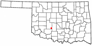
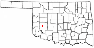
Cement is a town in Caddo County, Oklahoma, United States. The population was 436 as of the 2020 United States census.
Fort Cobb is a town in Caddo County, Oklahoma, United States. The population was 518 at the 2020 census.
Gracemont is a town in Caddo County, Oklahoma, United States. The population was 279 as of the 2020 United States census. The town moniker is a portmanteau of 'Grace' and 'Montgomery,' the names of two friends of the first postmaster, Alice L. Bailey.
Lindsay is a city in Garvin County, Oklahoma, United States. The population was 2,840 at the 2010 census. It once promoted itself as "The Broomcorn Capital of the World" but no longer uses that slogan, as broomcorn is no longer raised in the area.
Maysville is a town in Garvin and McClain counties, Oklahoma, United States. The population was 1,232 at the 2010 census, down from 1,313 in 2000.
Chickasha is a city in and the county seat of Grady County, Oklahoma, United States. The population was 16,051 at the 2020 census, a 0.1% increase from 2010. The city is named for and strongly connected to Native American heritage, as "Chickasha" (Chikashsha) is the Choctaw word for Chickasaw. Chickasha is home to the University of Science and Arts of Oklahoma.
Minco is a city in Grady County, Oklahoma, United States. The population was 1,500 at the 2020 census, a 8.1% decrease from 2010.
Rush Springs is a town in Grady County, Oklahoma, United States. The population was 997 at the 2020 census, a 19% decrease from 2010. The town promotes itself as the "Watermelon Capital of the World."
Gotebo is a town in Kiowa County, Oklahoma, United States. The population was 174 at the 2020 Census.
Mountain View is a town in Kiowa County, Oklahoma, United States. Its population was 740 as of the 2020 United States census. It is situated about 23 miles east of the county seat of Hobart, at the intersection of Oklahoma State Highway 9 and Oklahoma State Highway 115.
Corn is a town in Washita County, Oklahoma, United States. The population was 503 at the 2010 census.
Rocky is a town in Washita County, Oklahoma, United States. The population was 162 at the 2010 United States Census, a 6.9 percent decline from the figure of 174 in 2000. The town lies along U.S. Route 183.
Hydro is a town in Caddo and Blaine counties in the U.S. state of Oklahoma. The population was 927 as of the 2020 United States census.