Cedar Lake, Oklahoma | |
|---|---|
 Cedar Lake  Cedar Lake | |
| Coordinates: 35°25′39″N98°11′35″W / 35.42750°N 98.19306°W | |
| Country | United States |
| State | Oklahoma |
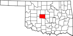
| County | Canadian |
| Area | |
• Total | 0.94 sq mi (2.45 km2) |
| • Land | 0.87 sq mi (2.24 km2) |
| • Water | 0.08 sq mi (0.21 km2) |
| Elevation | 1,447 ft (441 m) |
| Population (2020) | |
• Total | 404 |
| • Density | 466.51/sq mi (180.09/km2) |
| Time zone | UTC-6 (Central (CST)) |
| • Summer (DST) | UTC-5 (CDT) |
| ZIP Code | 73047 (Hinton) |
| Area codes | 405/572 |
| FIPS code | 40-12937 |
| GNIS feature ID | 2806999 [2] |
Cedar Lake is an unincorporated community and census-designated place (CDP) in Canadian County, Oklahoma, United States. It was first listed as a CDP prior to the 2020 census. [2]
The CDP is in southwestern Canadian County, built around Cedar Lake, a reservoir. It is 12 miles (19 km) southeast of Hinton, 21 miles (34 km) southwest of El Reno, and 45 miles (72 km) west of Oklahoma City.