Wheeless, Oklahoma | |
|---|---|
 Wheeless in April 2024 | |
 Wheeless Location within the state of Oklahoma  Wheeless Wheeless (the United States) | |
| Coordinates: 36°43′9″N102°53′40″W / 36.71917°N 102.89444°W | |
| Country | United States |
| State | Oklahoma |
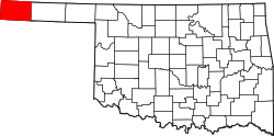
| County | Cimarron |
| Elevation | 4,675 ft (1,425 m) |
| Time zone | UTC-6 (Central (CST)) |
| • Summer (DST) | UTC-5 (CDT) |
| GNIS feature ID | 1100935 [1] |
Wheeless is an unincorporated community in Cimarron County, Oklahoma, United States. [2] The post office was established February 12, 1907, and discontinued September 27, 1963. Nearby are the ruins of Camp Nichols, a military encampment on the Santa Fe Trail, which is a National Historic Landmark. [3]
Wheeless is on E0200 Road; [4] the New Mexico border is about 6 miles west. [5] The closest highway access points are east and then north to Oklahoma State Highway 325 at the curve where that road turns north after running west from Boise City, [4] or west and then south to the very short New Mexico State Road 410, which links to New Mexico State Road 406, [5] about two miles to the west. [6] The Texhomex benchmark, being the meeting point of Texas, Oklahoma, and New Mexico, is south-southwest of town. [7] [8]