Jamestown, Oklahoma

Last updated

Jamestown, Oklahoma
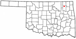
OKMap-doton-Jamestown.PNG
Location of Jamestown, Oklahoma
Coordinates: 36°34′12″N95°37′46″W / 36.57000°N 95.62944°W / 36.57000; -95.62944
Country United States
State Oklahoma
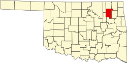
County Rogers
Area
  Total0.1 sq mi (0.4 km2)
  Land0.1 sq mi (0.4 km2)
  Water0.0 sq mi (0.0 km2)
Elevation
[1]
696 ft (212 m)
Population
 (2000)
  Total10
  Density68.5/sq mi (26.4/km2)
Time zone UTC-6 (Central (CST))
  Summer (DST) UTC-5 (CDT)
FIPS code 40-37550 [2]
GNIS feature ID1102941 [1]

Jamestown is an unincorporated community in Rogers County, Oklahoma, United States. The population was 10 at the 2000 census, at which time it was a town; the community disincorporated in 1998, but the change was not reported to the Census Bureau until 2006. [3]

Contents

Geography

Jamestown is located at 36°34′12″N95°37′46″W / 36.57000°N 95.62944°W / 36.57000; -95.62944 (36.570063, -95.629318). [4]

According to the United States Census Bureau, the town had a total area of 0.2 square miles (0.52 km2), all land.

Demographics

As of the census [2] of 2000, there were 10 people, 4 households, and 3 families residing in the town. The population density was 68.5 inhabitants per square mile (26.4/km2). There were 4 housing units at an average density of 27.4 per square mile (10.6/km2). The racial makeup of the town was 60.00% White, and 40.00% from two or more races.

There were 4 households, out of which 25.0% had children under the age of 18 living with them, 75.0% were married couples living together, and 25.0% were non-families. 25.0% of all households were made up of individuals, and 25.0% had someone living alone who was 65 years of age or older. The average household size was 2.50 and the average family size was 3.00.

In the town the population was spread out, with 20.0% under the age of 18, 10.0% from 18 to 24, 20.0% from 25 to 44, 40.0% from 45 to 64, and 10.0% who were 65 years of age or older. The median age was 52 years. For every 100 females, there were 150.0 males. For every 100 females age 18 and over, there were 166.7 males.

The median income for a household in the town was $54,583, and the median income for a family was $54,583. Males had a median income of $0 versus $0 for females. The per capita income for the town was $33,007. None of the population and none of the families were below the poverty line.

Related Research Articles

<span class="mw-page-title-main">Jamestown, Indiana</span> Town in Indiana, United States

Jamestown is a town in Jackson Township, Boone County and Eel River Township, Hendricks County, Indiana, United States. The population was 958 at the 2010 census.

West Ferriday is an Unincorporated Community in Concordia Parish, Louisiana, United States. The population was 1,541 at the 2000 census. The area was not delineated as a CDP for the 2010 census.

Webster Plantation is a plantation in Penobscot County, Maine, United States. The population was 68 at the 2020 census.

<span class="mw-page-title-main">Jamestown, Missouri</span> Town in Missouri, United States

Jamestown is a village in northeastern Moniteau County, Missouri, United States. The population was 386 at the 2010 census. It is part of the Jefferson City, Missouri Metropolitan Statistical Area.

<span class="mw-page-title-main">Stratton, Ohio</span> Village in Ohio, United States

Stratton is a village in northern Jefferson County, Ohio, United States, along the Ohio River. The population was 267 at the 2020 census. It is part of the Weirton–Steubenville metropolitan area.

<span class="mw-page-title-main">Knowles, Oklahoma</span> Town in Oklahoma, United States

Knowles is a town in Beaver County, Oklahoma, United States. The population was 11 at the 2010 census.

<span class="mw-page-title-main">Lawrence Creek, Oklahoma</span> Town in Oklahoma, United States

Lawrence Creek is a town in Creek County, Oklahoma, United States. Incorporated March 15, 1983, it is primarily a bedroom community whose employed residents work in Sapulpa and Tulsa. The population was 149 at the 2010 census, a gain of 25.2 percent over the figure of 119 recorded in 2000.

<span class="mw-page-title-main">Kremlin, Oklahoma</span> Town in Oklahoma, United States

Kremlin is a town in Garfield County, Oklahoma, United States. The population was 255 at the 2010 census, a 6.25 percent increase from the figure of 240 in 2000.

<span class="mw-page-title-main">Renfrow, Oklahoma</span> Town in Oklahoma, United States

Renfrow is a town in Grant County, Oklahoma, United States. The population was 12 at the 2010 census, a decline of 33.3 percent from the figure of 16 at the 2000 census.

<span class="mw-page-title-main">Wellston, Oklahoma</span> Town in Oklahoma, United States

Wellston is a town in Lincoln County, Oklahoma, United States. The population was 788 at the 2010 census.

<span class="mw-page-title-main">Pensacola, Oklahoma</span> Town in Oklahoma, United States

Pensacola is a town in Mayes County, Oklahoma, United States. The population was 125 at the 2010 census, which represented a 76 percent increase from the figure of 71 recorded in 2000.

<span class="mw-page-title-main">Strang, Oklahoma</span> Town in Oklahoma, United States

Strang is a town in Mayes County, Oklahoma, United States. The population was 100 at the 2000 census.

<span class="mw-page-title-main">Webb City, Oklahoma</span> Town in Oklahoma, United States

Webb City is an unincorporated town in northwestern Osage County, Oklahoma, United States. The population was 62 at the 2010 census, a 34.7 percent decline from the figure of 95 recorded in 2000. It was named for its founder, Horace Webb, on whose land the town was founded. The Webb City post office opened December 16, 1922.

<span class="mw-page-title-main">Reydon, Oklahoma</span> Town in Oklahoma, United States

Reydon is a town in Roger Mills County, Oklahoma, United States.

<span class="mw-page-title-main">Foyil, Oklahoma</span> Town in Oklahoma, United States

Foyil is a town in Rogers County, Oklahoma, United States. It was named for Alfred Foyil, a local landowner and the first postmaster of the town. The population was 344 at the 2010 census, a 47.0 percent increase over the figure of 234 recorded in 2000.

<span class="mw-page-title-main">Valley Park, Oklahoma</span> Town in Oklahoma, United States

Valley Park is a town in Rogers County, Oklahoma, United States. The population was 77 at the 2010 census, up 221 percent from the figure of 24 recorded in 2000.

<span class="mw-page-title-main">Paradise Hill, Oklahoma</span> Town in Oklahoma, United States

Paradise Hill is a town in the northwest corner of Sequoyah County, Oklahoma, United States. It is part of the Fort Smith, Arkansas-Oklahoma Metropolitan Statistical Area. The population was 85 at the 2010 census, a decline from the figure of 100 recorded in 2000.

<span class="mw-page-title-main">Man, West Virginia</span> Town in West Virginia, United States

Man is a town in Logan County, West Virginia, United States. The population was 759 at the 2010 census. The town is located along the Guyandotte River at the mouth of Buffalo Creek, which was the site of the 1972 Buffalo Creek Flood following a dam collapse. The name of the town reportedly derives from the last syllable of the surname of Ulysses Hinchman, who was a member of the House of Delegates from Logan County between 1866 and 1869.

<span class="mw-page-title-main">Peru, Wisconsin</span> Town in Wisconsin, United States

The Town of Peru is a Town located in Dunn County, Wisconsin, United States. The population was 247 at the 2000 census. The unincorporated communities of Meridean and Red Cedar and the ghost towns of Old Tyrone and Old Meridean are located in the town.

<span class="mw-page-title-main">Geary, Oklahoma</span> City in Oklahoma, United States

Geary is a city in Blaine and Canadian counties in the U.S. state of Oklahoma. The population was 994 at the 2020 census. The town was named for Edmund Guerrier, a scout and an interpreter for the U.S. Army.

References

  1. 1 2 U.S. Geological Survey Geographic Names Information System: Jamestown, Oklahoma
  2. 1 2 "U.S. Census website". United States Census Bureau . Retrieved January 31, 2008.
  3. Population Estimates Boundary Changes Archived 2006-02-06 at the Wayback Machine , United States Census Bureau, 2007-07-01. Accessed 2008-11-06.
  4. "US Gazetteer files: 2010, 2000, and 1990". United States Census Bureau. February 12, 2011. Retrieved April 23, 2011.